| Tornadoes of December 5, 2005 |
Moist, unstable air in advance of a strong cold front produced a couple of damaging tornadoes across south central Georgia and the Florida Big Bend on Monday, December 5th. The first tornado, rated an F-1 on the Fujita tornado intensity scale, damaged numerous buildings, including the Worth County Courthouse, in Sylvester, Georgia. The figure below shows the damage track through the central business district. Click on the images below for larger high resolution versions. A local storm report is available.
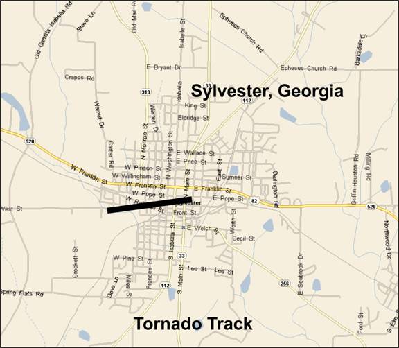
Figure 1. Damage path of the tornado that tracked across Sylvester, GA, on December 5, 2005.
The second F-1 tornado hopscotched its way across Wakulla County, passing just north of Crawfordville, Florida. The tornado developed from a long-lived convective storm, which moved ashore near Port St. Joe around 11:00 am EST. The thunderstorm developed supercell characteristics over Liberty County and probably became tornadic over western Wakulla County. The most intense damage occurred off of U.S. Hwy 319 around 1:15 pm EST in the vicinity of Ivan Church Road. See our Public Information Statement describing the storm survey conducted in Wakulla County.
The following image shows the track of this tornado. Later images show reflectivity and storm-relative velocity as the supercell moved across western and central Wakulla County.
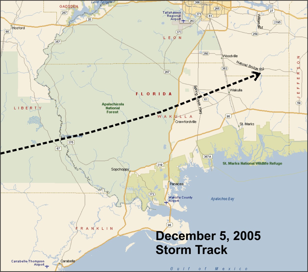
Figure 2. Track of the tornado that crossed Wakulla County, FL, on December 5, 2005.
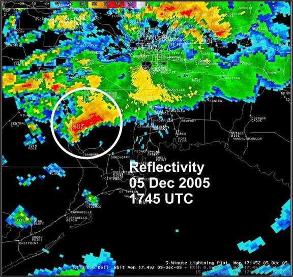
Figure 3. Base reflectivity from the Tallahassee, FL, radar (KTLH) at 1745 UTC, 05 December 2005.
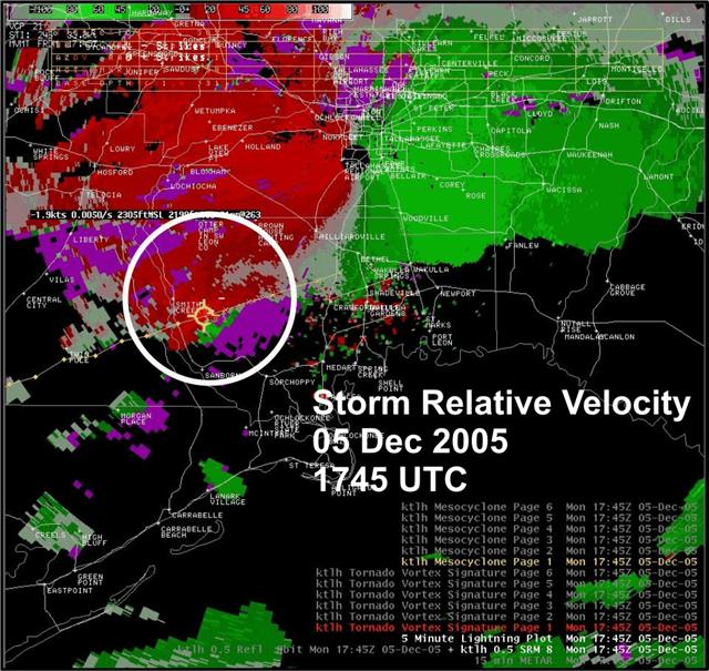
Figure 4. Storm Relative Velocity from the Tallahassee, FL, radar (KTLH) at 1745 UTC, 05 December 2005.
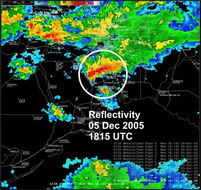
Figure 5. Base reflectivity from the Tallahassee, FL, radar (KTLH) at 1815 UTC, 05 December 2005.
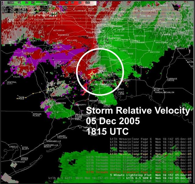
Figure 6. Storm Relative Velocity from the Tallahassee, FL, radar (KTLH) at 1815 UTC, 05 December 2005.
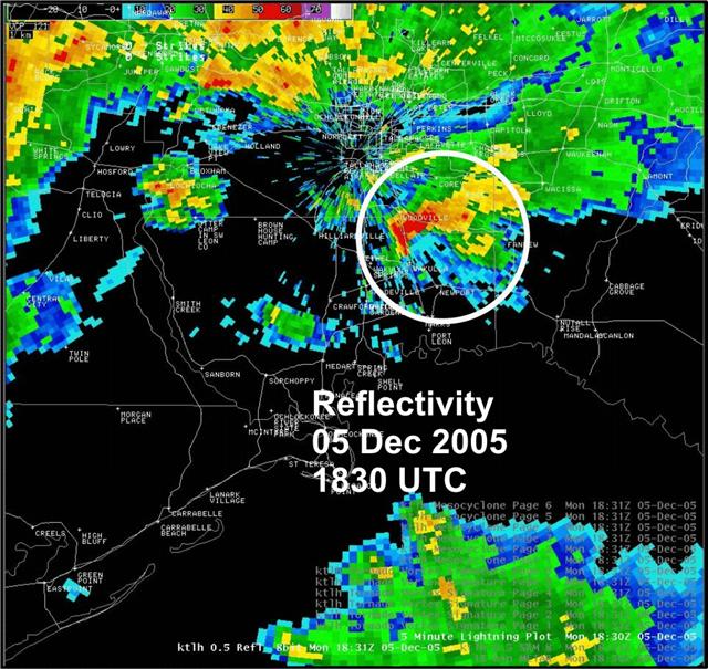
Figure 7. Base reflectivity from the Tallahassee, FL, radar (KTLH) at 1830 UTC, 05 December 2005.
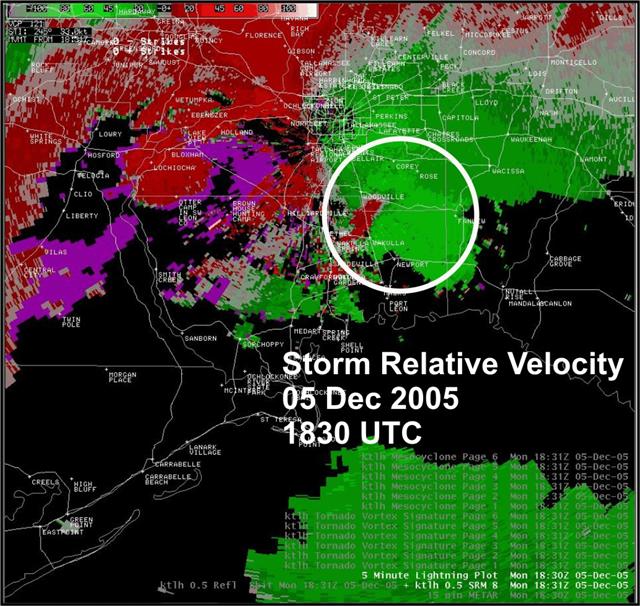
Figure 8. Storm Relative Velocity from the Tallahassee, FL, radar (KTLH) at 1830 UTC, 05 December 2005.
The tornado continued to hopscotch its way to the northeast and was last sighted south of Woodville where it finally dissipated. The storm cell continued across northeast Wakulla County, extreme southeast Leon County, and into Jefferson County. One storm spotter sighted the storm near Interstate 10 in Jefferson County still showing cloud rotation…but no tornado. The storm cell finally merged into the frontal squall line near Valdosta, Georgia after a 140 mile trek across the Florida Big Bend.

