| Severe Weather Outbreak of August 8, 2006 |
Showers and thunderstorms began during mid afternoon on Tuesday mainly in the sea breeze zone in the Florida Panhandle and Big Bend. Two additional areas of convective activity began at approximately the same time, one in central Georgia, and the other in southeast Georgia.
Intense thunderstorms began in Florida around 1 to 1:30 pm CDT in the Panama City area. These storms continued to develop and spread eastward across much of, if not all of the Florida Panhandle and Big Bend. Additionally, strong and severe thunderstorms moved across the south central Georgia and Interstate-75 corridor around 5 to 5:30 pm EDT. Several thunderstorm outflow boundaries collided in southern Leon and northern Wakulla Counties producing a series of strong and severe thunderstorms in that area.
The central Georgia storms developed into nearly a solid east-west squall line around 6 pm EDT extending from Fitzgerald in the east through Ashburn and Leesburg westward to Georgetown, and even extended into southeast Alabama near Clayton and Eufaula. Figure 1 shows the line about an hour later. Convective outflow boundaries moving northward from the Florida storms intersected the east-west squall line over southwest Georgia and produced numerous severe weather reports including several tornado reports, power outages, property damage, and countless trees being reported down.
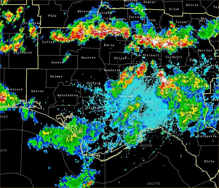
Figure 1. Base reflectivity image from the Tallahassee, FL, (KTLH) doppler radar showing a squall line over southeast Alabama and southwest Georgia at 2300 UTC Tuesday, August 8, 2006.
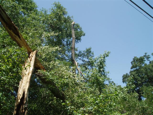
Figure 2. Trees with their tops snapped off due to a downburst that occurred around the time of the above radar image on the evening of Tuesday, August 8, 2006, just east of Thomasville, GA.
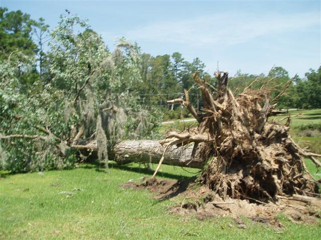
Figure 3. A large tree uprooted due to a downburst that occurred around the time of the above radar image on the evening of Tuesday, August 8, 2006, just east of Thomasville, GA.
However, the most significant damage was reported in southeast Alabama, particularly in the Napier Field, Midland City, and Pinckard area where estimated 70-mph thunderstorm wind gusts occurred. Base velocity data from just after the thunderstorm gust front pushed through the heavily damaged area is shown in Figure 4. Damage from the area is shown in Figures 5 and 6.
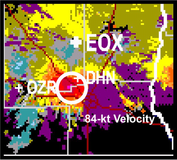
Figure 4. Base velocity image from the Fort Rucker, AL, (KEOX) doppler radar showing 84-kt outbound velocity at 2331 UTC Tuesday, August 8, 2006 at an elevation of about 640 ft AGL.
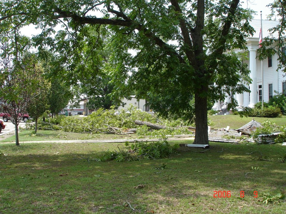
Figure 5. Large pecan trees damaged in front of the City Hall of Midland City, AL.
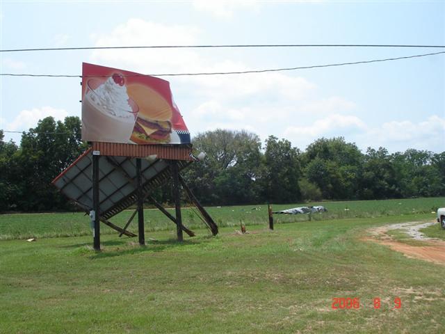
Figure 6. Damage to a billboard near Midland City, AL.
The SPC storm report details all severe weather and damage reports received during this event.

