| Severe Weather of February 18-19, 2009 |
An approaching strong cold front provided the focusing mechanism for moisture, instability, and atmospheric winds to produce a significant severe weather outbreak across the southeast U.S. from the afternoon of Wednesday, February 18th, through the predawn hours of Thursday morning, February 19th. The major weather maker in the Tallahassee Forecast area was a long-lived supercell thunderstorm that developed in southwest Alabama east of Mobile and traversed the Florida Panhandle and much of South Georgia, crossing the entire NWS Tallahassee forecast area (see Figure 1). It is estmated that the supercell averaged 60 mph as it moved across the region. The supercell produced baseball-sized hail and 70-80mph wind gusts in Walton and Holmes Counties. The storm began to intensify again in eastern Jackson County, FL, and eventually spawned an EF-2 tornado with a path width of 300 to 400 yards, that tracked from central Grady County across much of Thomas County, and a short-track EF-3 tornado that touched down near Boston in eastern Thomas County. Check out the spectacular radar images in Figs. 3-5 as the cell became tornadic across Grady and Thomas Counties. In Thomas County alone, there were 160 structures damaged with 9 mobile homes destroyed, and 20 single family homes destroyed. A little over two hours after the supercell left the area, thunderstorm winds felled several trees in Madison County, FL. Considering the severity of this storm, the time of night it occurred, and the amount of damage it caused, it is amazing that no one was killed or suffered serious injury.
A public information statement contains additional details from the NWS storm survey team's report.
A local storm report summarizes damage that occurred across the region.
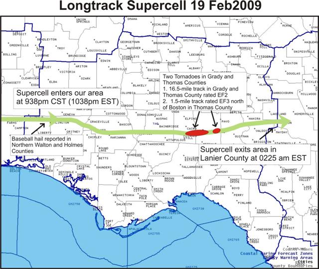
Figure 1. Path of the long-track supercell that moved across the entire NWS Tallahassee forecast area.
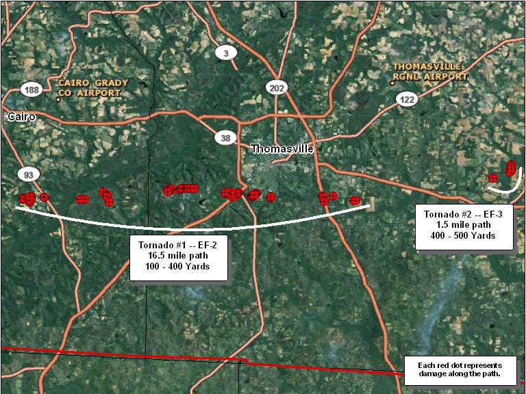
Figure 2. Damage locations along the path of the two tornadoes that affected Grady and Thomas Counties.
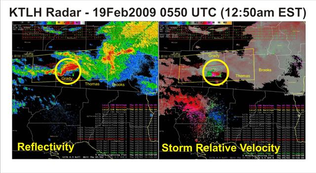
Figure 3. Base reflectivity and storm-relative velocity images from the Tallahassee Doppler radar (KTLH) at 0550 UTC (12:50 am EST) February 19, 2009, as the tornadic supercell tracked across Grady County, GA. Tornado warning polygon is overlaid in yellow. Click on the image for a larger view.
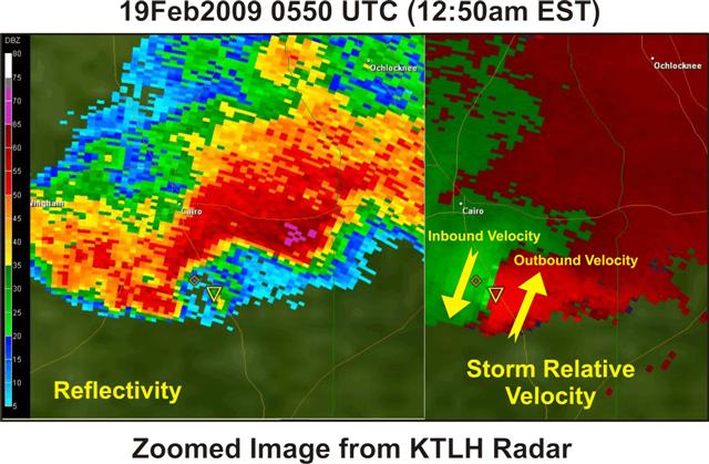
Figure 4. A zoomed in look at the base reflectivity and storm-relative velocity images from the Tallahassee Doppler radar (KTLH) at 0550 UTC (12:50 am EST) February 19, 2009, as the tornadic supercell tracked across Grady County, GA. Click on the image for a larger view.
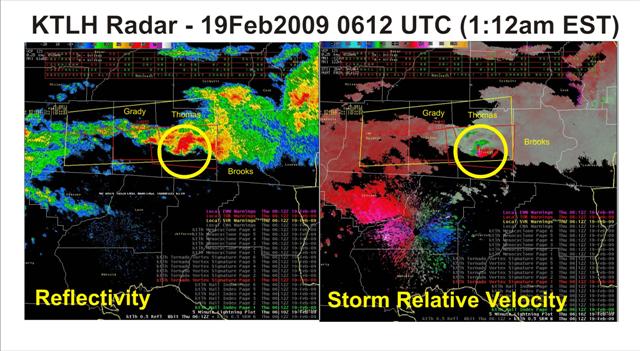
Figure 5. Base reflectivity and storm-relative velocity images from the Tallahassee Doppler radar (KTLH) at 0612 UTC (1:12 am EST) February 19, 2009, as the tornadic supercell tracked across Thomas County, GA. Tornado warning polygon is overlaid in yellow. Click on the image for a larger view.

Figure 6. Large pine trees stripped of their bark and snapped in half near Boston, GA. This damage was used to assign the EF-3 rating.

