Hermine (2016) First Hurricane to Make Landfall Along the
Apalachee Bay Coast Since 1966
Overview
Hurricane Hermine slamed into the Big Bend early Friday morning making landfall around 1:30 AM EDT just east of St. Marks, Florida near the Wakulla-Jefferson County line. Maximum sustained winds were near 80 mph with a central pressure of 982mb. Hermine brought devestating winds to the Big Bend area which resulted in extensive downed trees and power lines causing significant power outages lasting days across the Big Bend.
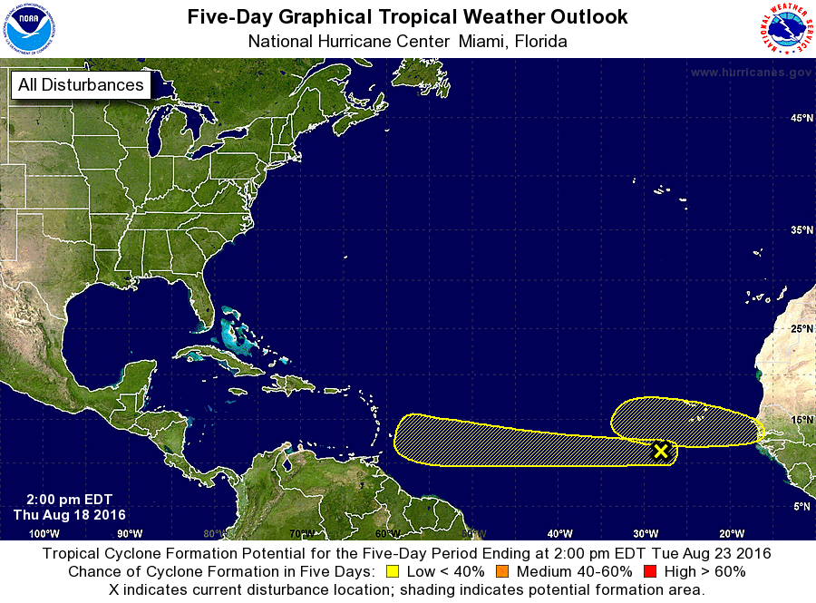
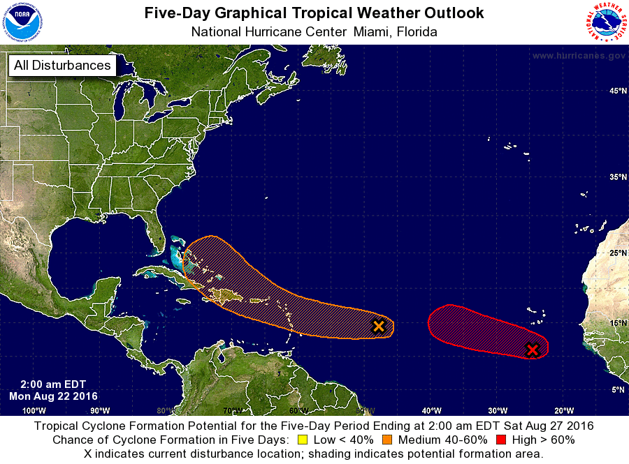
What eventually become Hermine was initially highlighted by the National Hurricane Center (NHC) well before it formed into a Tropical Cyclone in the Five Day Tropical Weather Outlook on Thursday, August 18, 2016 (2 PM EDT). NHC tracked this system across the Atlantic. While initially the system was expected to track along the east coast of Florida later model runs kept pushing it futher west and eventually the disturbance pushed into the Florida Straits and became a Tropical Depression with the 5 PM EDT NHC advisory on Sunday, August 28, 2016.
 |
 |
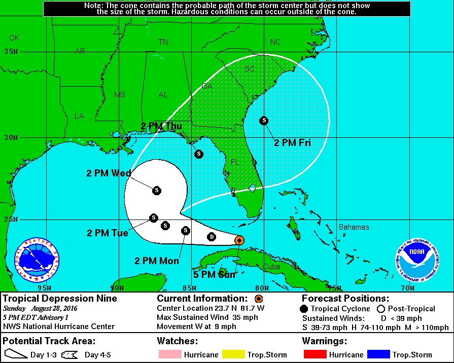 |
| First 5-day Graphical Tropical Weather Outlook (August 18, 2016 2 PM EDT) highlighting wave that eventually became Hermine (yellow lower X). | 5-day Graphical Tropical Weather Outlook August 22, 2016 2 AM EDT. What eventually became Hermine is denoted by the left, orange X. | First advisory issued on Hermine (August 28, 2016 5 PM EDT). |
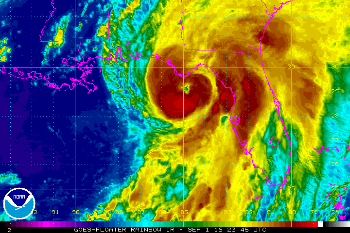
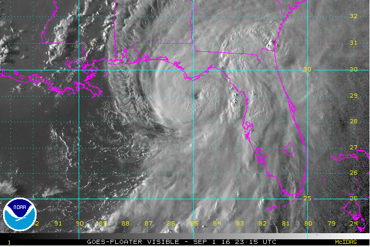
While sea surface temperatures were plenty warm for development, once a Tropical Depression, Hermine struggled to intensify due to westerly shear over the Gulf of America. During this time, there was a wide spread in the track guidance for the storm. As Hermine began to turn to the north in the Gulf of America, deep convection was able to form closer to the low pressure center, likely due to a decrease in storm-relative shear. As a result, the system strengthened into a Tropical Storm Wednesday afternoon. While initially Hermine was slow to intensify, it quickly strengthened from a Tropical Storm on Wednesday (August 31) to a Category 1 Hurricane on Thursday (September 1). During this time, the mean sea level pressure dropped from 1000 mb at 1 PM Wednesday, August 31 to 988 mb at 2:55 PM EDT Thursday, September 1. As Hurricane Hermine moved toward the coast during the evening of Thursday, September 1, the satellite presentation of the storm became increasingly symmetrical and an eye became noticible. Hurricane Hermine continued to track NNE toward the coast and made landfall early Friday morning, September 2, 2016 at 1:30 AM EDT. Landfall occurred just east of St. Marks near the Wakulla-Jefferson County line. The preliminary Post Tropical Cyclone Report (PSH) can be found here.
 |
 |
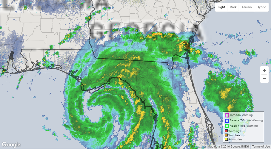 |
| IR Satellite Image of Hurricane Hermine | Visible Satellite Image of Hermine | Radar Loop of Hermine from TLH Radar (Loop Courtesy of Brian McNoldy) |
| Satellite Loop of Hermine Courtesy of NASA/NOAA |
Watches/Warnings
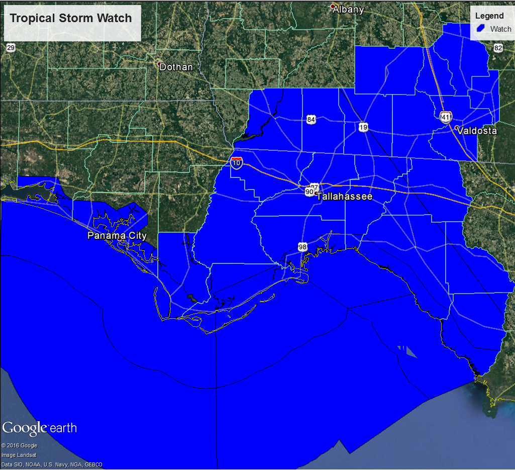
Tropical Storm and Hurricane Watches were initially issued with the 5 PM EDT advisory on Tuesday, August 30, 2016 for portions of the Florida panhandle and Big Bend with Tropical Storm Warnings issued for these areas with the 5 AM EDT advisory on Wednesday, August 31, 2016. Tropical Storm Watches were then extended into southern Georgia with the 11 AM EDT advisory with this upgraded to a warning at the 5 PM EDT advisory and extended into Alabama. At the 11 PM EDT advisory much of the Big Bend area that was under the Tropical Storm Warning and Hurricane Watch was upgraded to a Hurricane Warning.
 |
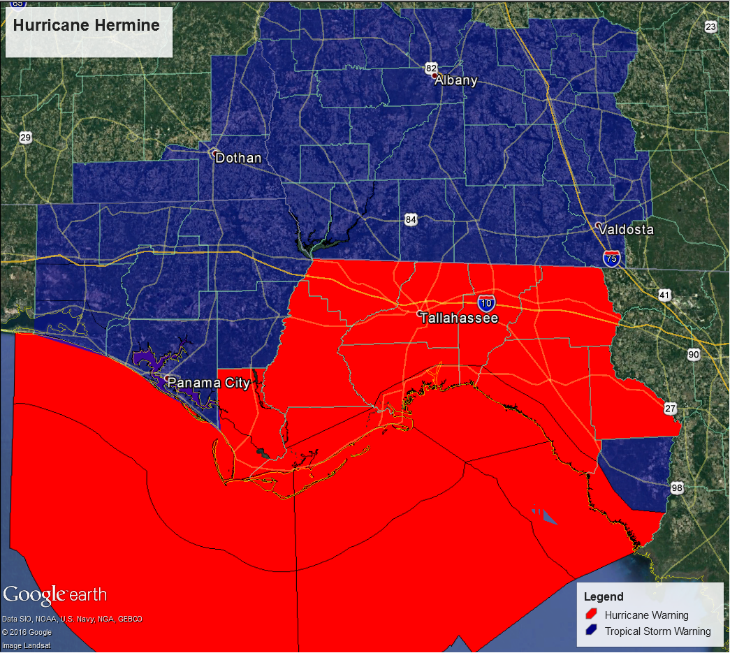 |
| Map of initial Tropical Storm Watches for the Tallahassee County Warning Area | Map of Tropical Storm/Hurricane Warnings for the Tallahassee County Warning Area |
Hazards and Impacts
Storm Surge
Initial forecasts for Apalachee Bay were for 2 to 4 feet of inundation from storm surge however these forecast amounts slowly increased to 6 to 9 feet of inundation for parts of Apalahcee Bay. This was the first event in which the experimental Storm Surge Watch/Warning was been issued. This watch/warning map highlights where more than 3 feet of inundation is expected.
While surge data is still be collected, initial estimates are of 4-6 feet of inundation in Wakulla County increasing to 8-9 feet in Dixie County. The storm surge in Dixie County was just a few inches less than the 1993 superstorm based on an established water mark in Horseshoe Beach. Note, these values will continue to be refined as additional data is collected and analyzed. Updates to the surge data is expected next week (9/12-9/16).
Wind
Winds impacts were expected to be significant and below is an excerpt from the Hurricane Local Statement.
 |
| Excerpt from Hurricane Local Statement |
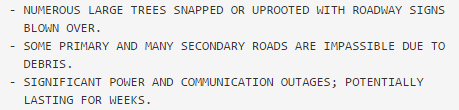
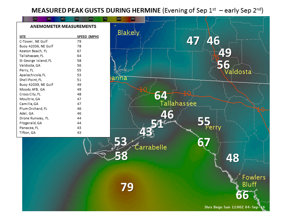
Hurricane Hermine brought wind gusts of 50-60 MPH to the Florida Big Bend and 40-50 MPH winds into southern Georgia. The FSU WeatherSTEM observation site at Doak Campbell Stadium recorded a wind gust of 64 MPH. At Keaton Beach the C-MAN station reported a gust to 67 MPH. While other significant gusts were likely observed across the Big Bend region, unfortunately, some of the observation sensors failed thus limiting available data from Hurricane Hermine.
 |
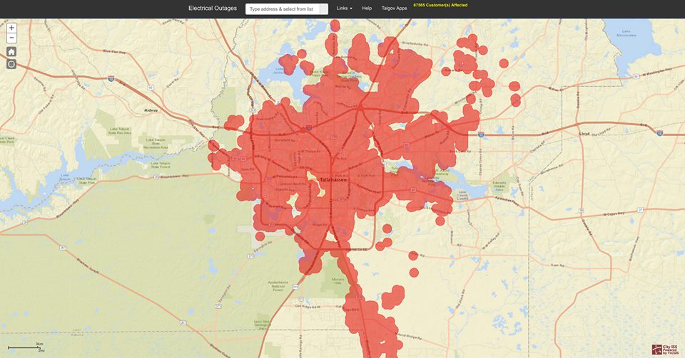 |
| Peak Wind Gusts from Hurricane Hermine | Tallahassee Power Outage Map During a Peak Outage Time Courtesy of the City of Tallahassee |
Wind impacts from Hurricane Hermine stretched across the Florida Big Bend and into southern Georgia, with the most impacts across the Big Bend. Numerous trees and power lines were downed which resulted in extensive power outages across the Big Bend area. In Tallahassee, approximately 80% of customers lost power during the hurricane.
Rainfall
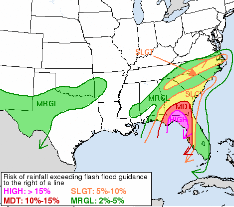
Original rainfall forecasts were calling for 5-10 inches of rain with isolated amounts of 15-20 inches. Given these higher amounts, the Weather Prediction Center issued a High Risk for exceeding flash flood guidance across the Big Bend and portions of southeast Georgia. Fortunately, these higher isolated amounts did not occur. Ultimately, widespread 4-5 inches fell across the Big Bend and portions of southwest Georgia with isolated amounts up to 10 inches. As shown in the picture below, there was a tight gradient between the widespread 4-5 inches of rain across the eastern half of the area and western half that generally received less than one inch of rain.
 |
 |
| WPC Excessive Rainfall Outlook | Rainfall Totals from Hurricane Hermine |
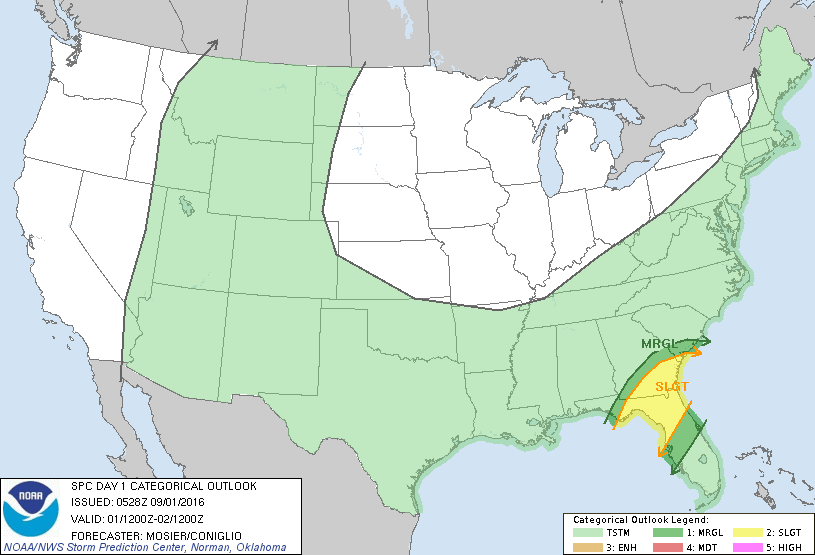
Tornadoes
The Storm Prediction Center had the Big Bend and portions of southwest Georgia in a slight risk for tornadoes during Hermine. During the event, the National Weather Service in Tallahassee issued 13 tornado warnings. Three tornadoes during Hermine have been confirmed, all of which were in Taylor County. The tornado locations are denoted by the markers on the right hand image below.
 |
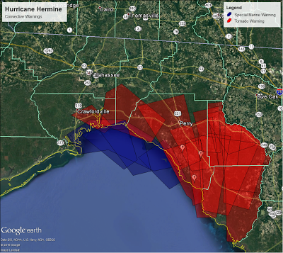 |
| SPC Day 1 Outlook (September 1, 2016) | Special Marine Warnings and Tornado Warnings Issued During Hermine. Confirmed tornadoes are denoted by the red makers. |
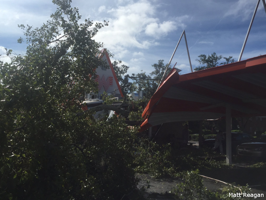
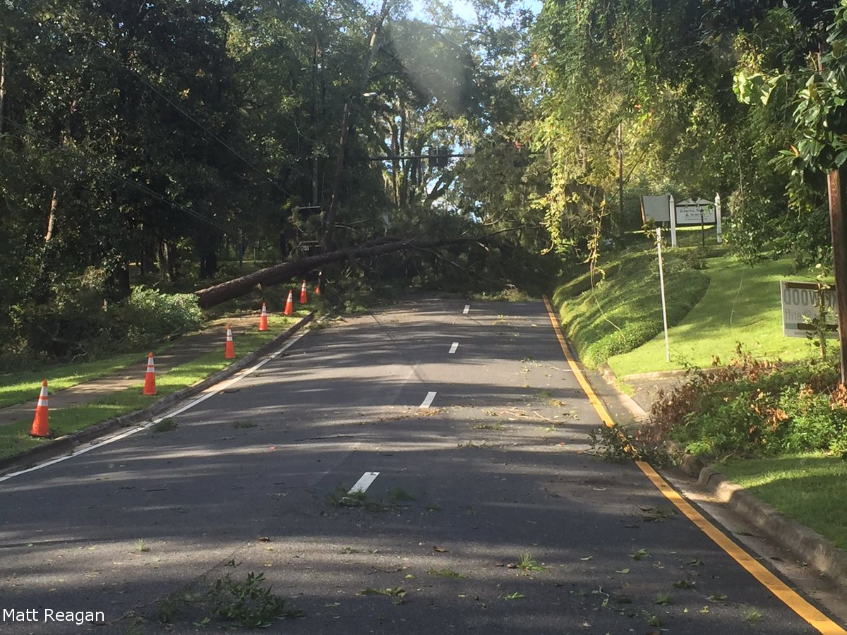
Event Pictures
 |
 |
 |
| Tree Damage to the Whataburger in Tallahassee (Photo Courtesy of Matt Reagan) |
Tree on a Home in Tallahassee (Photo Courtesy of Jack Wolfgang) |
Tree and Powerlines down near Gadsen and Ingleside in Tallahassee (Photo Courtesy of Matt Reagan) |
 |
 |
 |
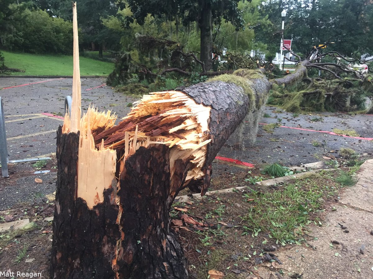
| Tree Snapped in Half on FSU Campus (Photo Courtesy of Matt Reagan) |
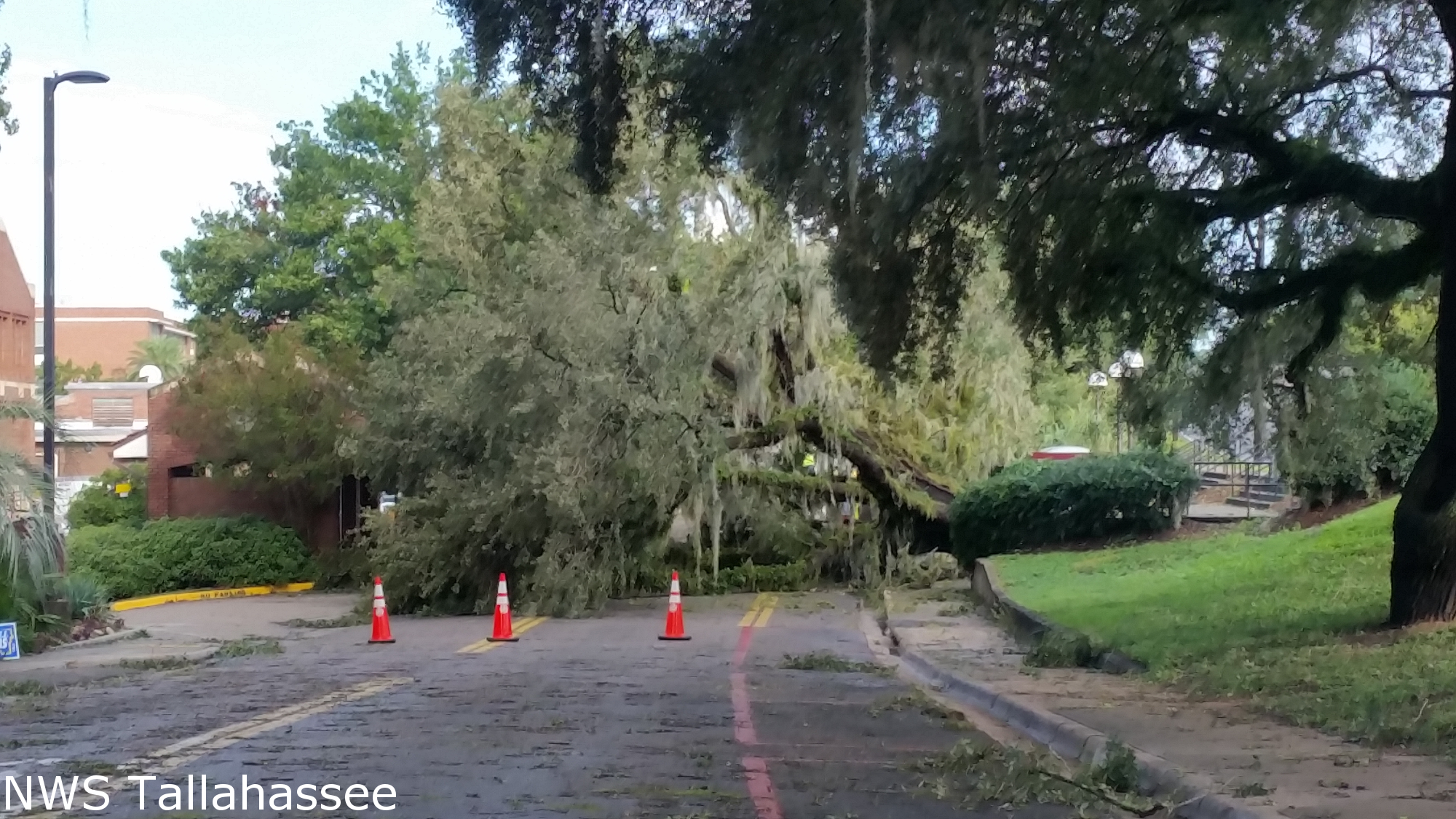
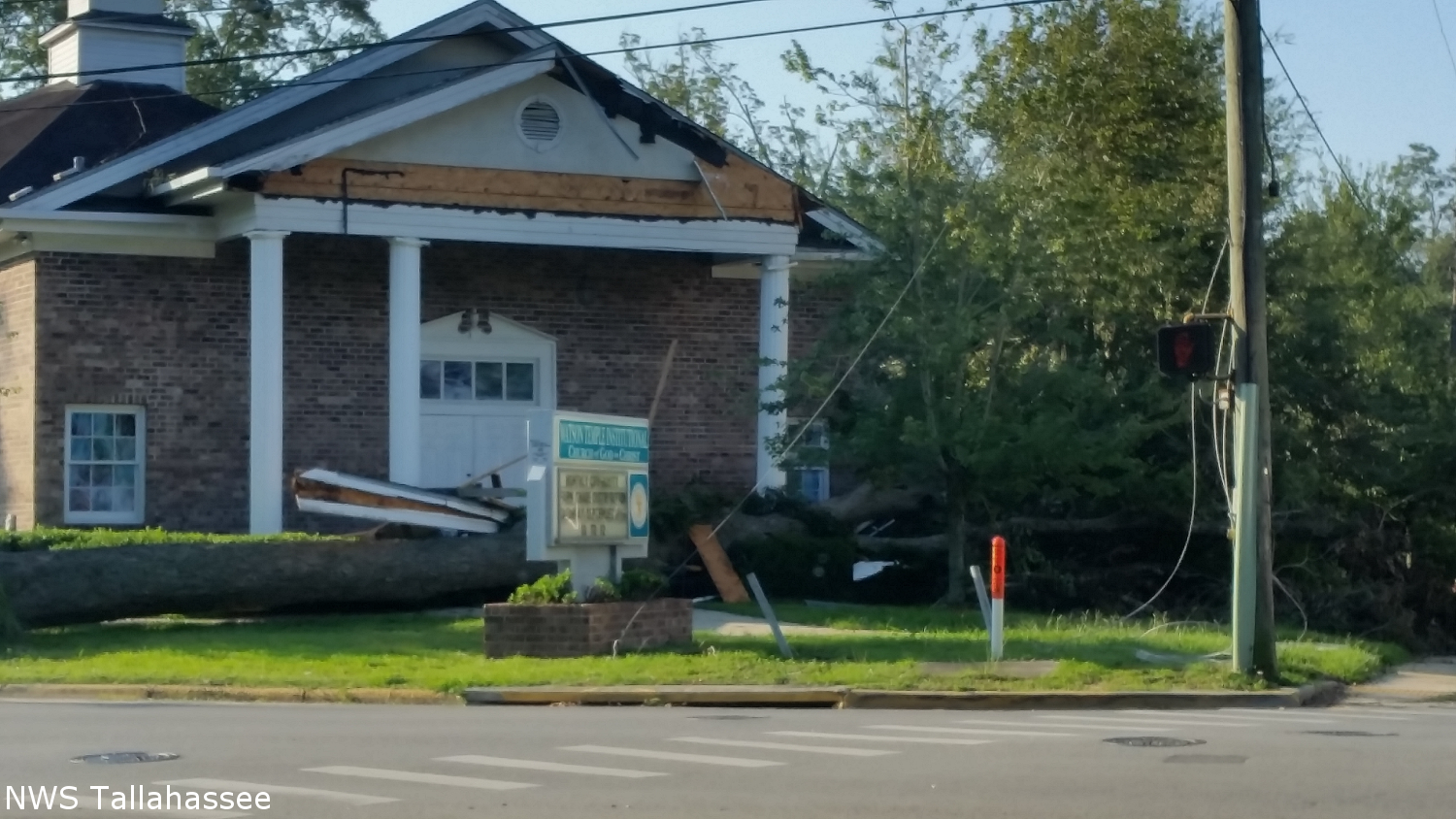
Tree Across Academic Way at FSU | Damage to Tallahassee Church |
 |
 |
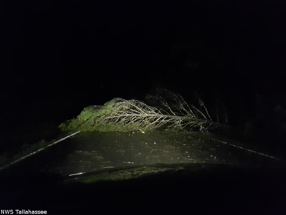 |
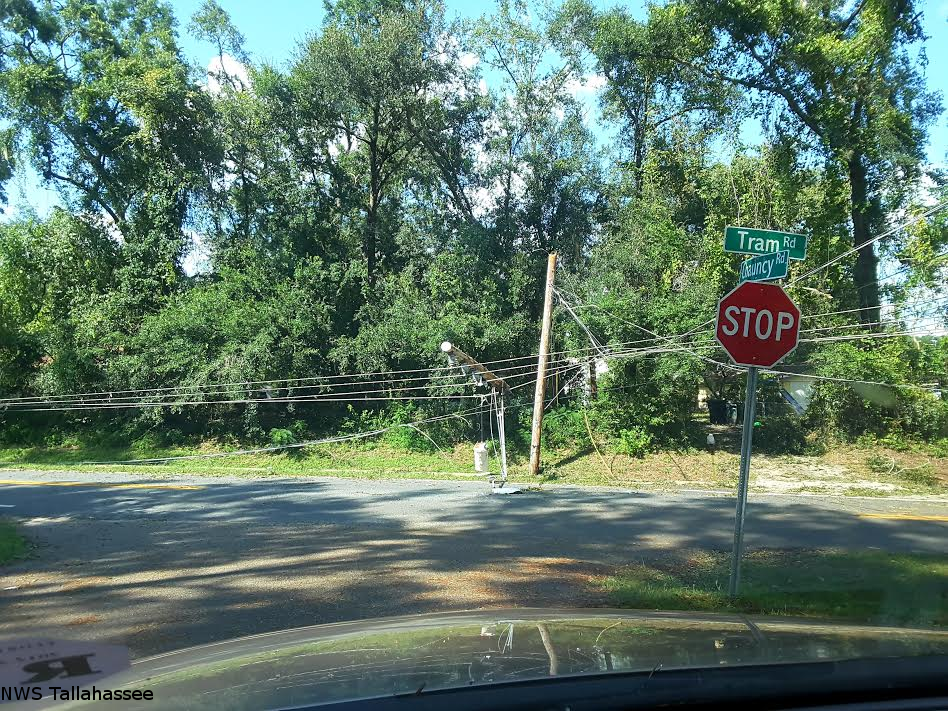
| Powerlines down near Tram Road and Chauncy | Tree Down Near Tram Road and Chauncy | Tree Across Tram Road |

