National Weather Service United States Department of Commerce

Flooding Threat Along the Gulf Coast, Southern Rockies and High Plains; Cooler Weather in the Central and Eastern U.S.

Strong thunderstorms may bring excessive rainfall and flooding over parts of the northern Gulf Coast today and over parts of the southern Rockies into the High Plains today through the weekend. A refreshingly cool and dry air mass will continue to produce below average temperatures across the central and eastern U.S. through the weekend. Read More >

Click a location below for detailed forecast.

Last Map Update: Sat, Aug 30, 2025 at 7:09:07 am CDT

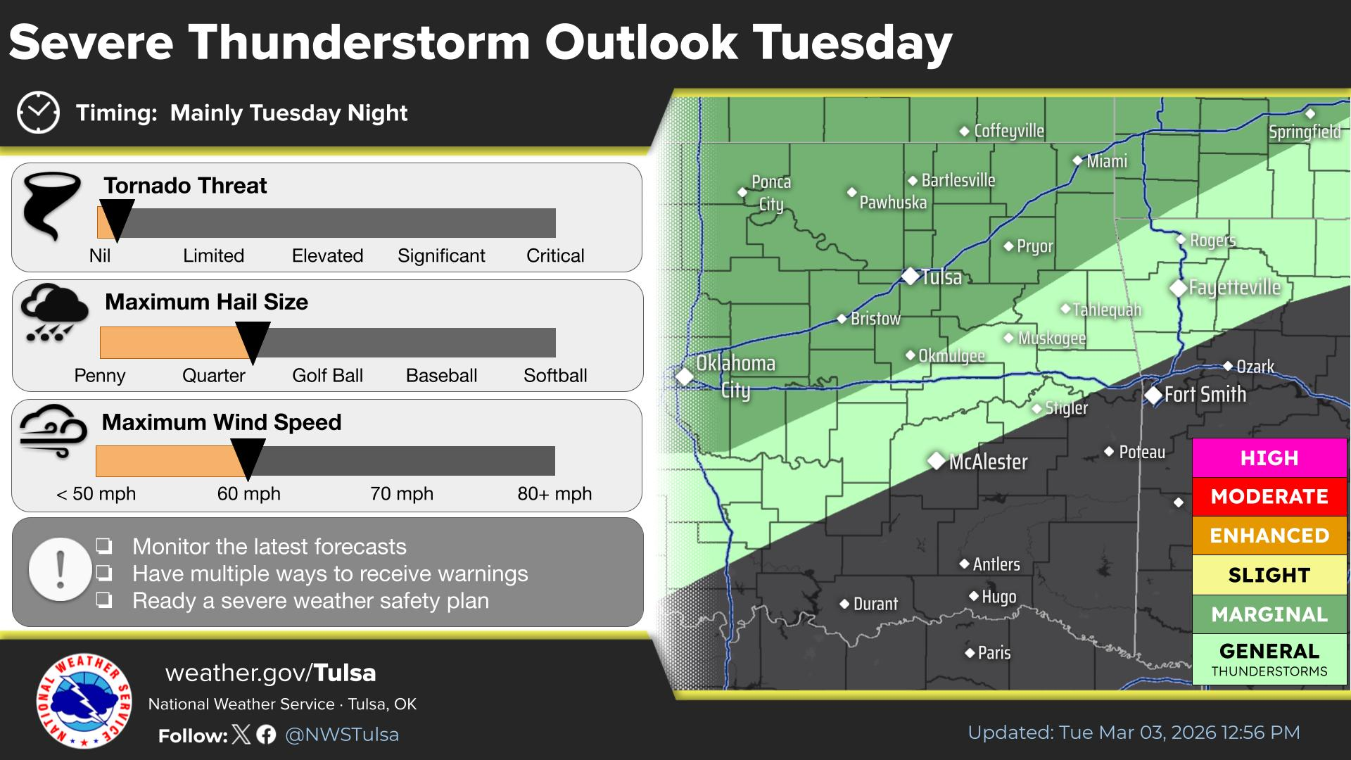
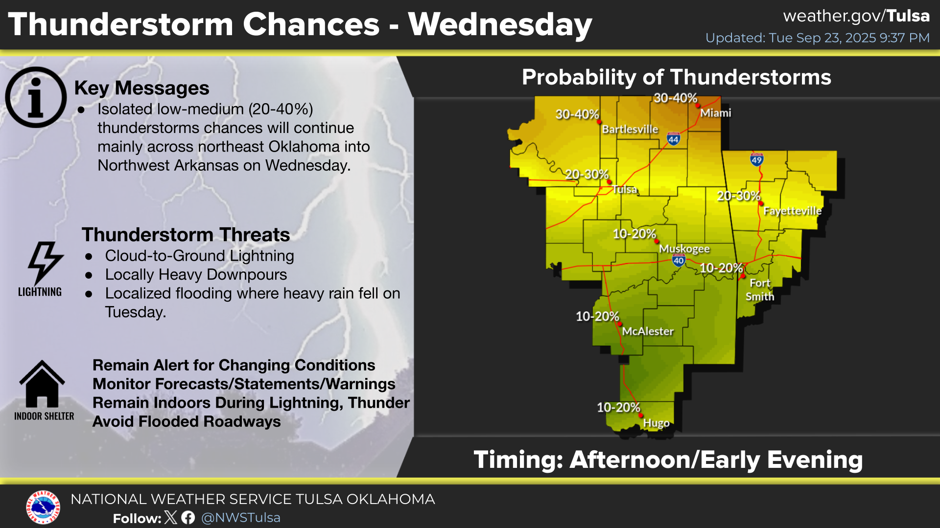
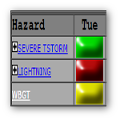
Isolated thunderstorms may spread into portions of eastern Oklahoma Saturday afternoon. Any storms which do develop will likely be short lived. Shower and thunderstorm coverage then increases after midnight, especially across NE OK, with the approach of an upper level low pressure system. Locally heavy rainfall is the main threat from these storms.
Slow-moving showers and thunderstorms will increase in coverage across NE OK after midnight tonight, with some potential to produce locally heavy rainfall. There is a slight risk of flash flooding across a portion of NE OK tonight.
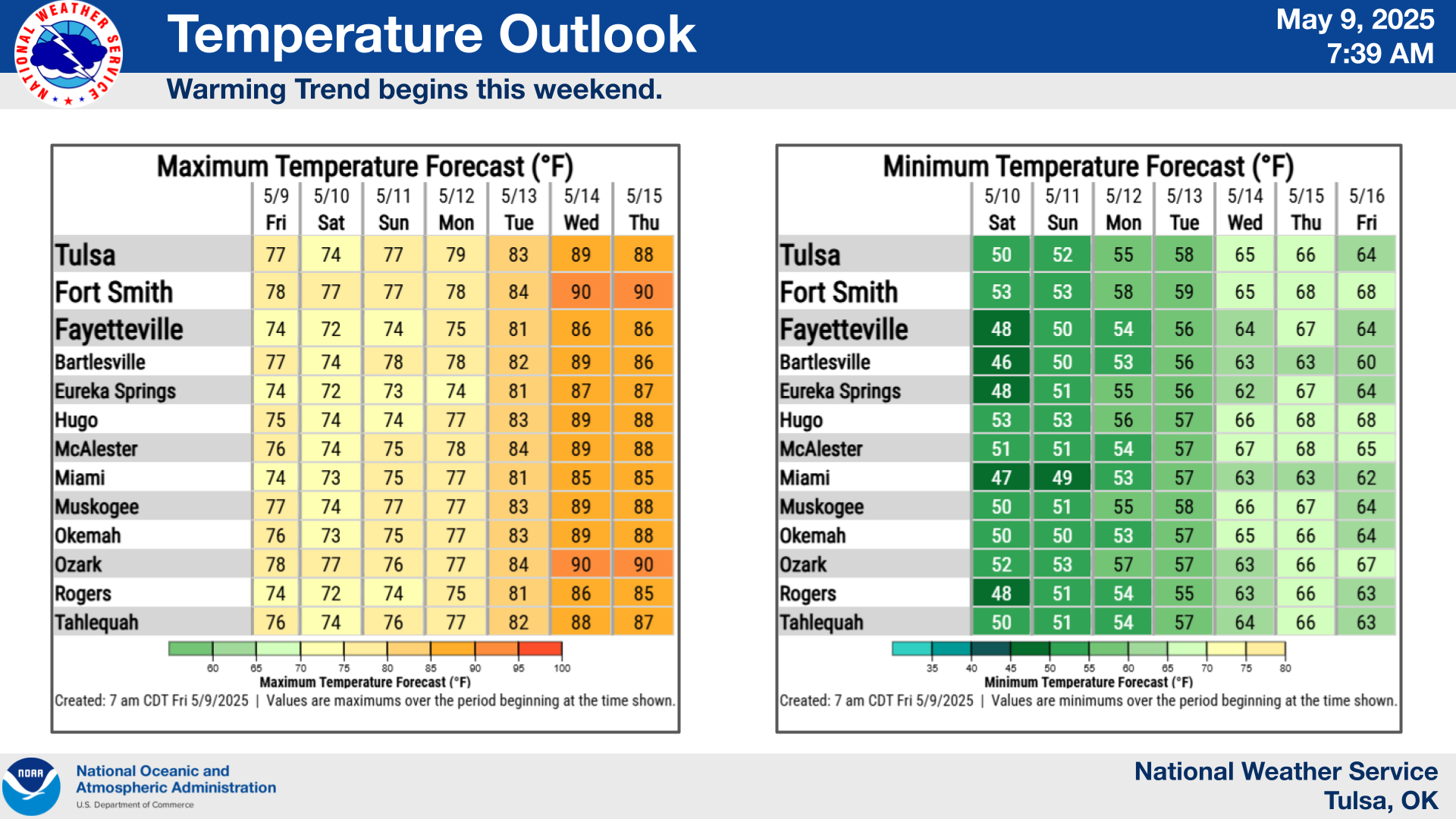
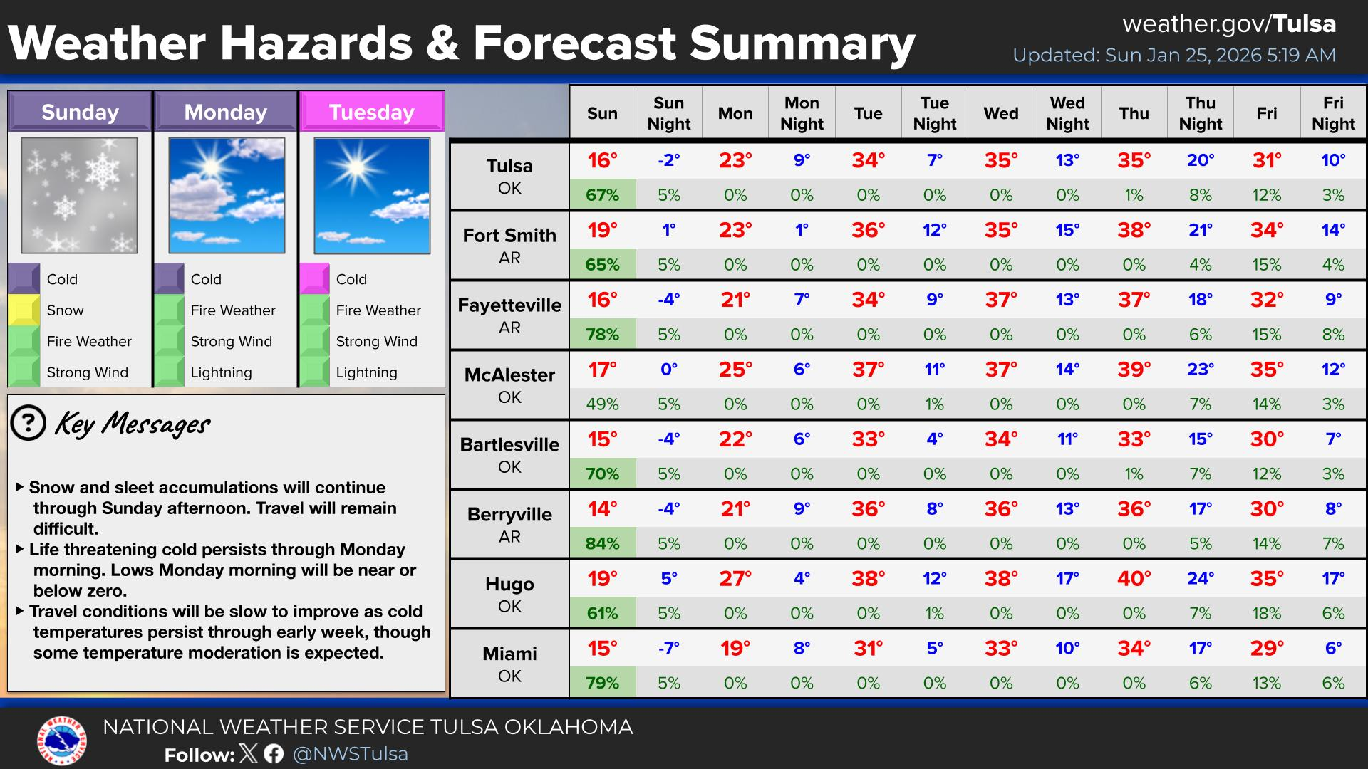
Below average temps will prevail over the upcoming week, with a real taste of fall coming late next week with the passage of a cold front. Shower and thunderstorm chances will be higher Sunday through Tuesday as an upper level low pressure system moves across, with low chances other days.
Latest Text Product Selector (Selected product opens in a new window)

Decision Support Winter Hazards Observations Climate Hydrology
 
 
Social Media Satellite Fire Weather Weather Radio Spotter Training Text Products
 
 
Models