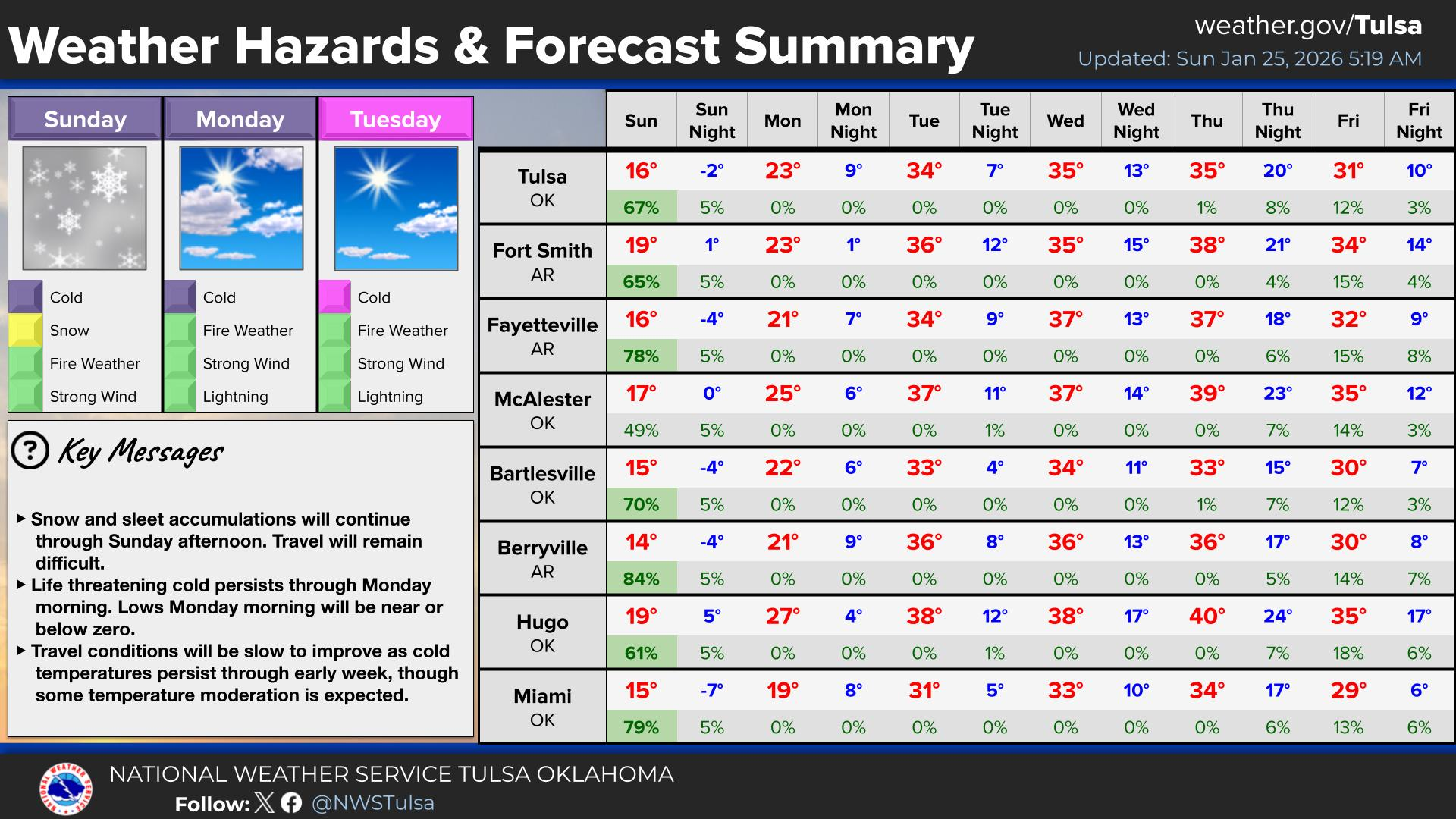
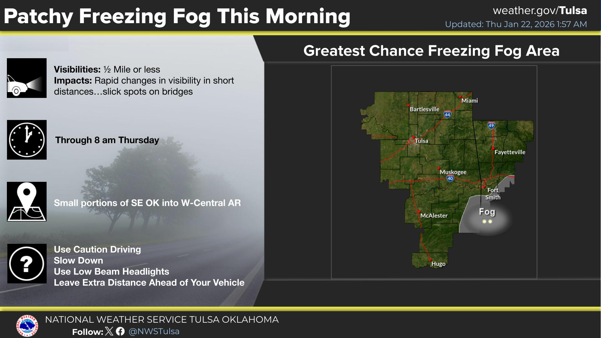
National Weather Service United States Department of Commerce
Click a location below for detailed forecast.

Last Map Update: Mon, Mar 2, 2026 at 10:56:18 am CST

Fire weather concerns will develop by late morning Tuesday as strong southerly surface winds become breezy and gusty and temperatures climb into the upper 70s and lower 80s. Afternoon relative humidity values should remain around or above 40 percent, but dry and cured fine fuels in the area will enhance the fire threat and the strong southerly winds will cause fire spread rates >100 ft/min in most places.
Shower and thunderstorm chances increase Wednesday as a cold front drops southeast into the region. Instability ahead of the front is expected to create a potential for severe storms across parts of eastern Oklahoma and northwest Arkansas. Large hail and damaging wind gusts are the primary hazards with any severe storm, but a low tornado threat will exist as well.
A Marginal Risk of excessive rainfall exists Wednesday and into Wednesday night, mainly for areas southeast of I-44. Monitor forecasts if you live in a flood prone area. Have multiple ways to receive warning information.
A Marginal Risk of excessive rainfall exists again on Friday and into Friday night for most of eastern Oklahoma and all of western Arkansas. Monitor forecasts if you live in a flood prone area. Have multiple ways to receive warning information.
Shower and thunderstorm chances increase again Friday as another cold front pushes into the region. Instability ahead of the front could create a potential for severe storms across much of eastern Oklahoma and northwest Arkansas. Continue to monitor latest forecasts.
Severe storm potential will shift into far SE OK Saturday morning, ahead of a cold front that will pushing through the area. The severe thunderstorm threat is expected to exit the forecast area by midday or early afternoon.
Latest Text Product Selector (Selected product opens in a new window)

Decision Support Winter Hazards Observations Climate Hydrology
 
 
Social Media Satellite Fire Weather Weather Radio Spotter Training Text Products
 
 
Models