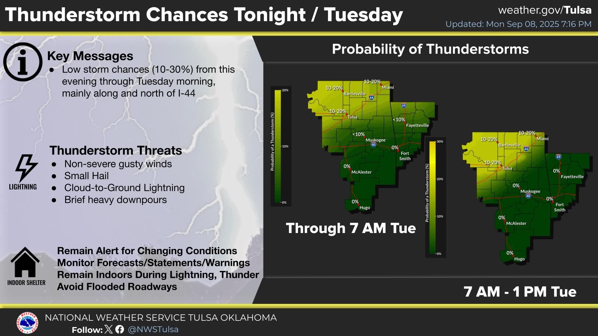
National Weather Service United States Department of Commerce

Heavy Rain and Flooding Threat in the Ohio Valley

Gulf moisture will combine with a cold front and will bring heavy rain and scattered flash flooding over parts of the Mid-South into the Ohio Valley through the morning and the Ohio Valley and Central Appalachians on Tuesday. Showers and thunderstorms, some severe, are expected over the Southern Rockies/Southern High Plains on Tuesday. Read More >

Click a location below for detailed forecast.

Last Map Update: Mon, Oct 6, 2025 at 6:44:45 pm CDT

Isolated to widely scattered storms remain forecast Monday afternoon into early evening across northwest and west central Arkansas and also far eastern Oklahoma.
Low (10-20%) storm chances will shift to far northeast Oklahoma close to the Kansas border mainly from after midnight tonight to Tuesday morning in association with a frontal boundary. Finally, isolated showers and storms may develop over northwest and west-central Arkansas into southeast Oklahoma Tuesday afternoon near the southeastward moving front.
Patchy areas of fog development are forecast across southeast and far eastern Oklahoma as well as northwest Arkansas overnight tonight into Tuesday morning ahead of a weak frontal boundary moving into the region. Visibility less than 1 mile at times is possible, which could impact the Tuesday morning commute.
Low shower and thunderstorm chances return to the forecast today and continue into Tuesday. Above normal temperatures will continue today, but we'll see a cool down Tuesday and Wednesday behind a front. A return to well above normal temps is forecast by next weekend.
Ft Smith Radar (Ft Smith, Ar - KSRX)
Latest Text Product Selector (Selected product opens in a new window)

Decision Support Winter Hazards Observations Climate Hydrology
 
 
Social Media Satellite Fire Weather Weather Radio Spotter Training Text Products
 
 
Models