
Severe weather and flooding threats will continue for portions of the central U.S. through Thursday, focused from the central High Plains to the Mid-Mississippi Valley. Hot and dry conditions will fuel fire weather concerns for the Intermountain West, and dry thunderstorms may spark additional wildfires. Dangerous heat will build across the southern U.S. Friday into the weekend. Read More >
Last Map Update: Thu, Jun 25, 2026 at 4:20:44 am CDT

| Latest Text Product Selector (Selected product opens in a new window) | |
 |
 |
 |
 |
 |
 |
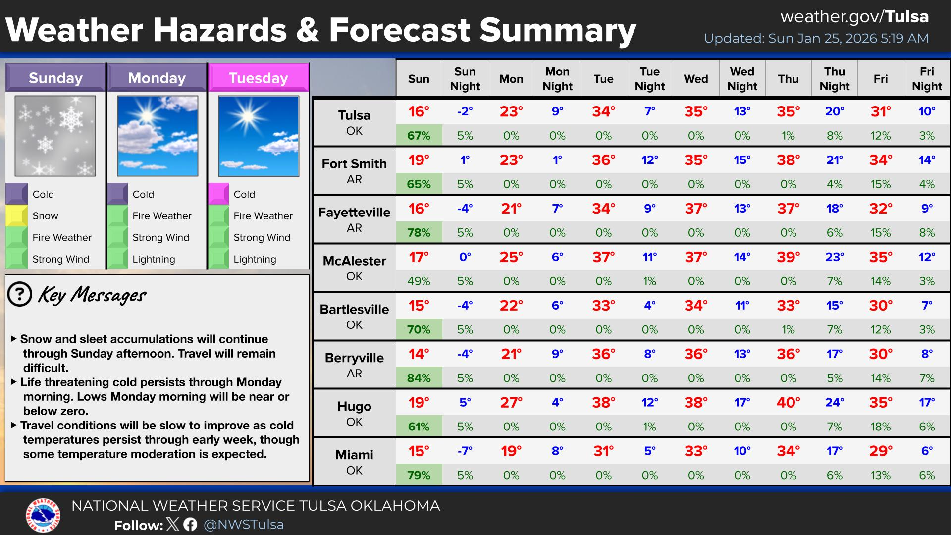
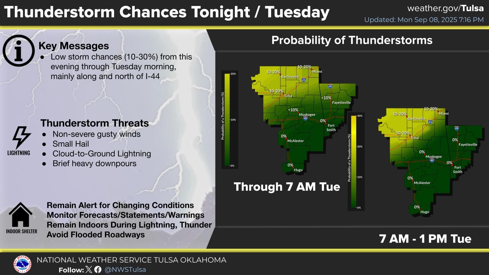
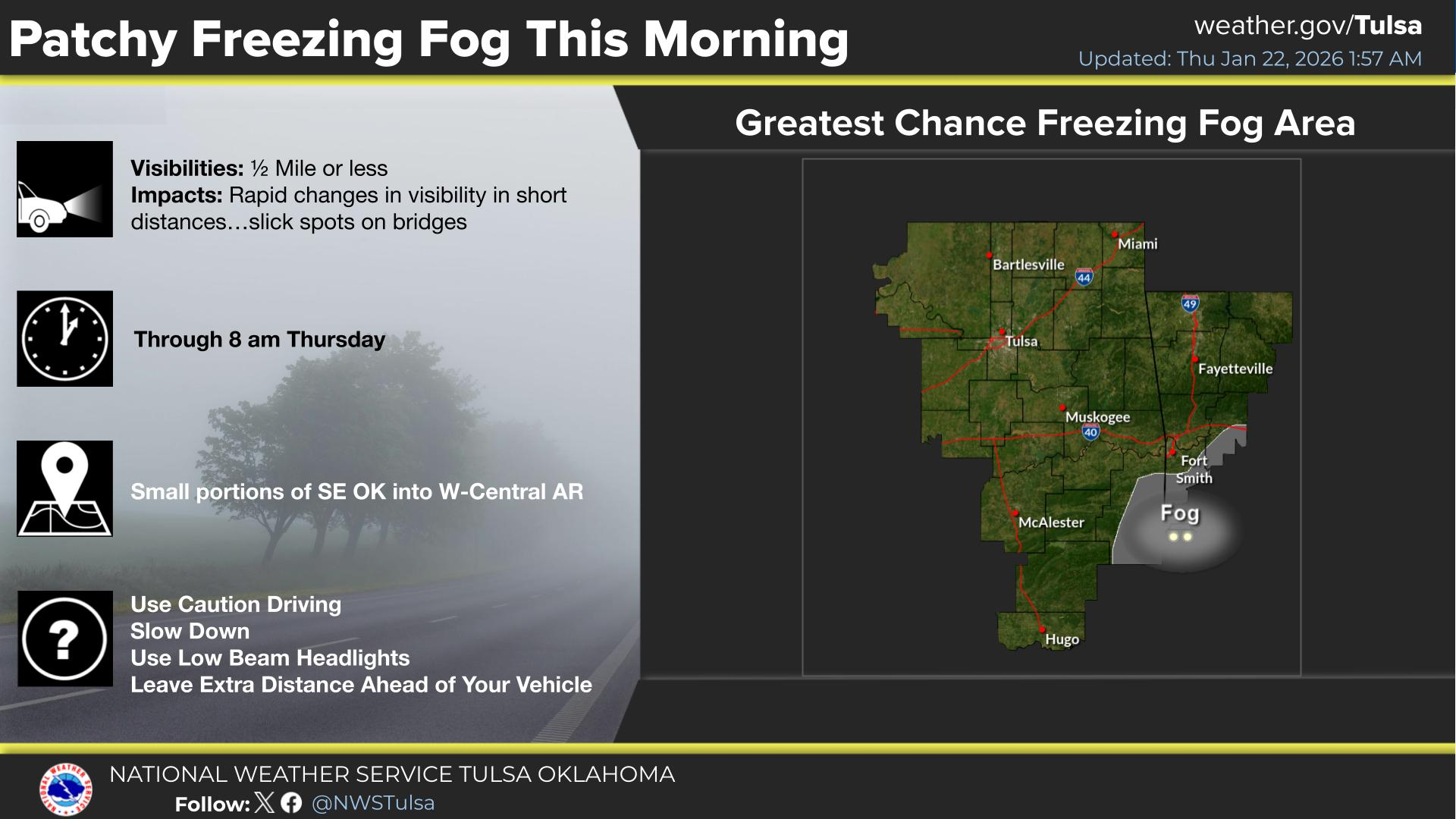
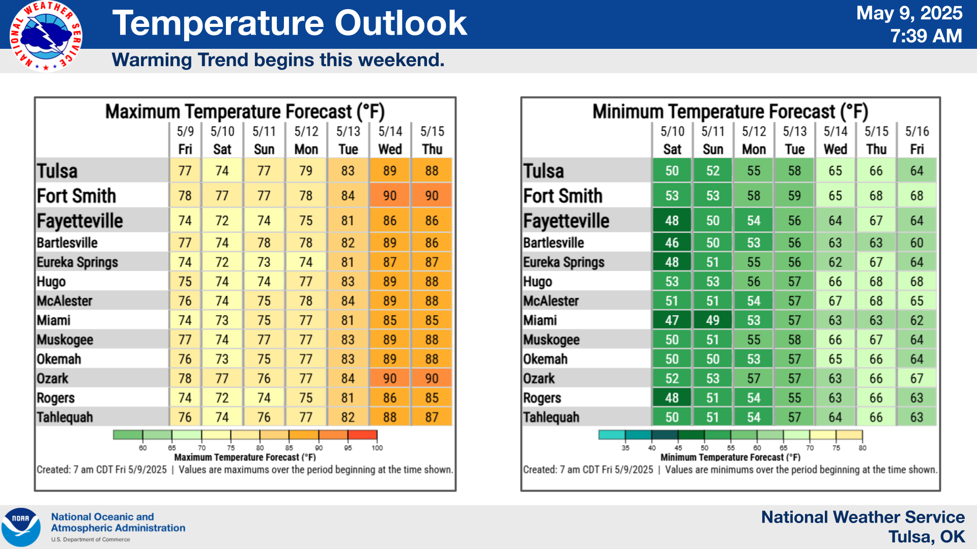
| Decision Support | Winter | Hazards | Observations | Climate | Hydrology |
 |
 |
 |
 |
 |
 |
| Social Media | Satellite | Fire Weather | Weather Radio | Spotter Training | Text Products |
 |
|||||
| Models | |||||


 Tulsa Radar
  Weather Map
 Fort Smith Radar