
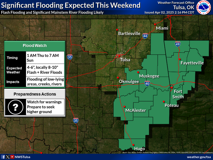
A low pressure center tracking across the Great Lakes and its associated cold front extending across the Southern Plains will focus occasional showers and thunderstorms through tonight. A few of these thunderstorms may become severe alongside heavy rainfall that may cause flash flooding; Portions of the Southern Plains would be the greatest threat for these hazards through tonight. Read More >
Last Map Update: Thu, May 1, 2025 at 2:52:35 pm CDT
| Latest Text Product Selector (Selected product opens in a new window) | |
 |
 |
 |
 |
 |
 |
| Decision Support | Winter | Hazards | Observations | Climate | Hydrology |
 |
 |
 |
 |
 |
 |
| Social Media | Satellite | Fire Weather | Weather Radio | Spotter Training | Text Products |
 |
|||||
| Models | |||||


 Tulsa Radar
  Weather Map
 Fort Smith Radar