Area Covered
This spring flood and water resource outlook is for the Rapid City Hydrologic Service Area (HSA) which covers northeastern Wyoming and western South Dakota. The main river basins include the Little Missouri, Eastern Powder, Belle Fourche, Grand, Moreau, Cheyenne, Bad, White and Keya Paha River Basins.
Current Flooding
To obtain the latest watches, warnings, statements, and advisories, go to: https://weather.gov/unr
Temperature and Precipitation
Click here for a listing of ways to obtain past precipitation.
Central PlainsPercent of Normal Precipitation since October 1 |
WyomingDeparture from Normal Precipitation |
South DakotaDeparture from Normal Precipitation |
| Precipitation Maps from the High Plains Climate Center | ||
Below is modeled snow depth and snow water equivalent from National Operation Hydrologic Remote Sensing Center and automated SNOTEL data from the Natural Resources Conservation Service.
Modeled Snow Depth |
Modeled Snow Water Equivalent |
|
|
|
| Modeled Snow Analyses from National Operational Hydrologic Remote Sensing Center | |
Cole Canyon |
North Rapid Creek |
Blind Park |
|
|
|
|
| Black Hills and Bear Lodge Mountain SNOTEL Data from the Natural Resources Conservation Service | ||
Calculated Soil Moisture Anomaly |
|
|
|
Modeled Snow Moisture from Climate Prediction Center |
Current Reservoir Data from the Bureau of Reclamation |
||
| The graphs below denote reservoir storage levels. The line labeled active is the point where the reservoir is considered "full" which is when the pool elevation is at the top of the active conservation pool. Most reservoirs have additional storage above this level for surplus or to hold flood waters. | ||
Angostura Reservoir, SD |
Belle Fourche Reservoir, SD |
Deerfield Reservoir, SD |
|
|
|
|
Keyhole Reservoir, WY |
Pactola Reservoir, SD |
Shadehill Reservoir, SD |
|
|
|
|
Climate Prediction Center Temperature and Precipitation Outlooks
8 - 14 Day Temperature Outlook |
8 - 14 day Precipitation Outlook |
|
|
|
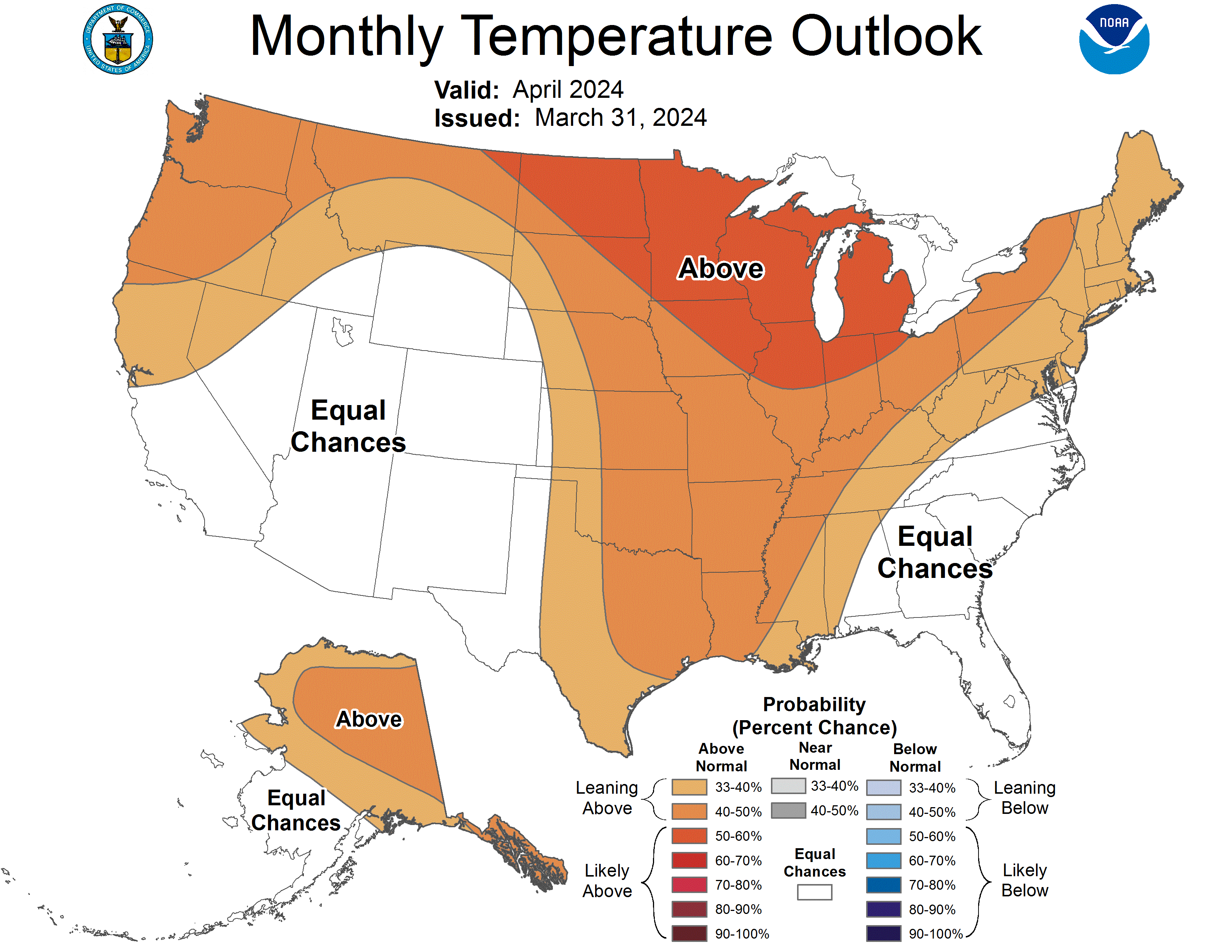
1 Month Temperature Outlook |
1 Month Precipitation Outlook |
|
|
|
Three Month Temperature Outlook |
Three Month Precipitation Outlook |
|
|
|
If you have any questions or comments about this spring flood and water resource outlook please contact:
Melissa Smith
Senior Service Hydrologist
National Weather Service
300 East Signal Drive
Rapid City, SD 57701
605-341-9271
melissa.smith@noaa.gov