| Click on the icons below to access individual briefing pages |
|
|
|
***Click Here for Experimental Probabilistic Snowfall Products***
Snowfall Accumulation Forecast (click on thumbnails to display below)
Ice Accumulation Forecast (click on thumbnails to display below)
Probability of Precipitation (PoP) (click on thumbnails to display below)
Days 1-4 Max Temperatures(click on thumbnails to display below)
Nights 1-4 Min Temperatures(click on thumbnails to display below)
Days 1-4 Min Wind Chill(click on thumbnails to display below)
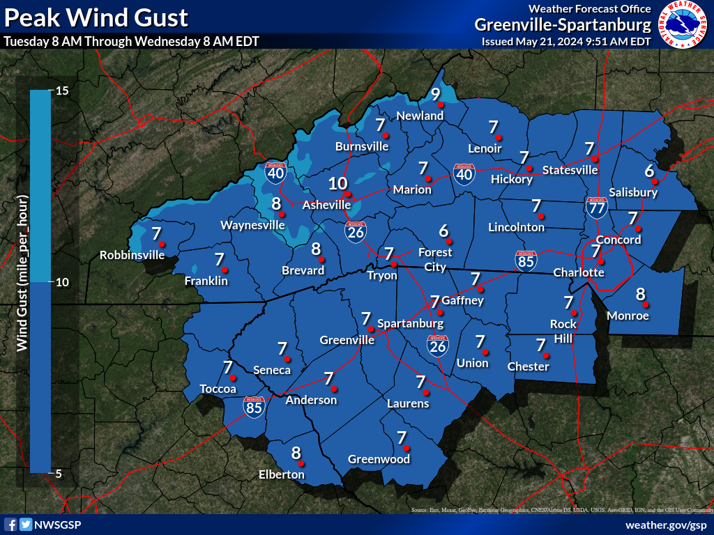
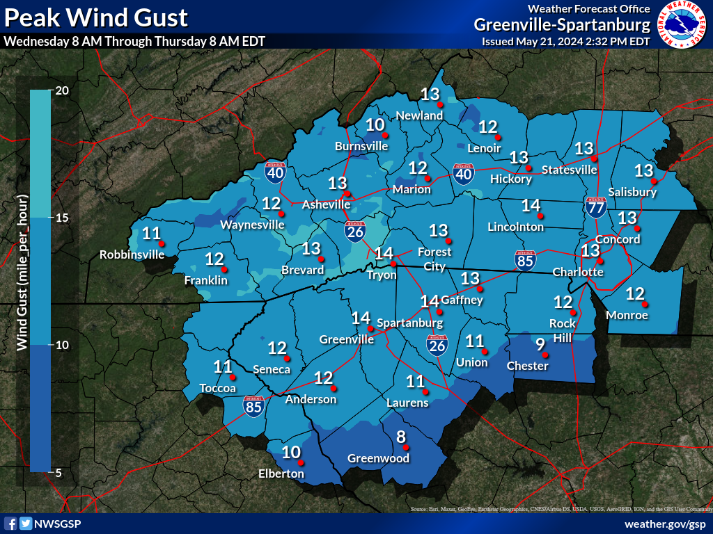
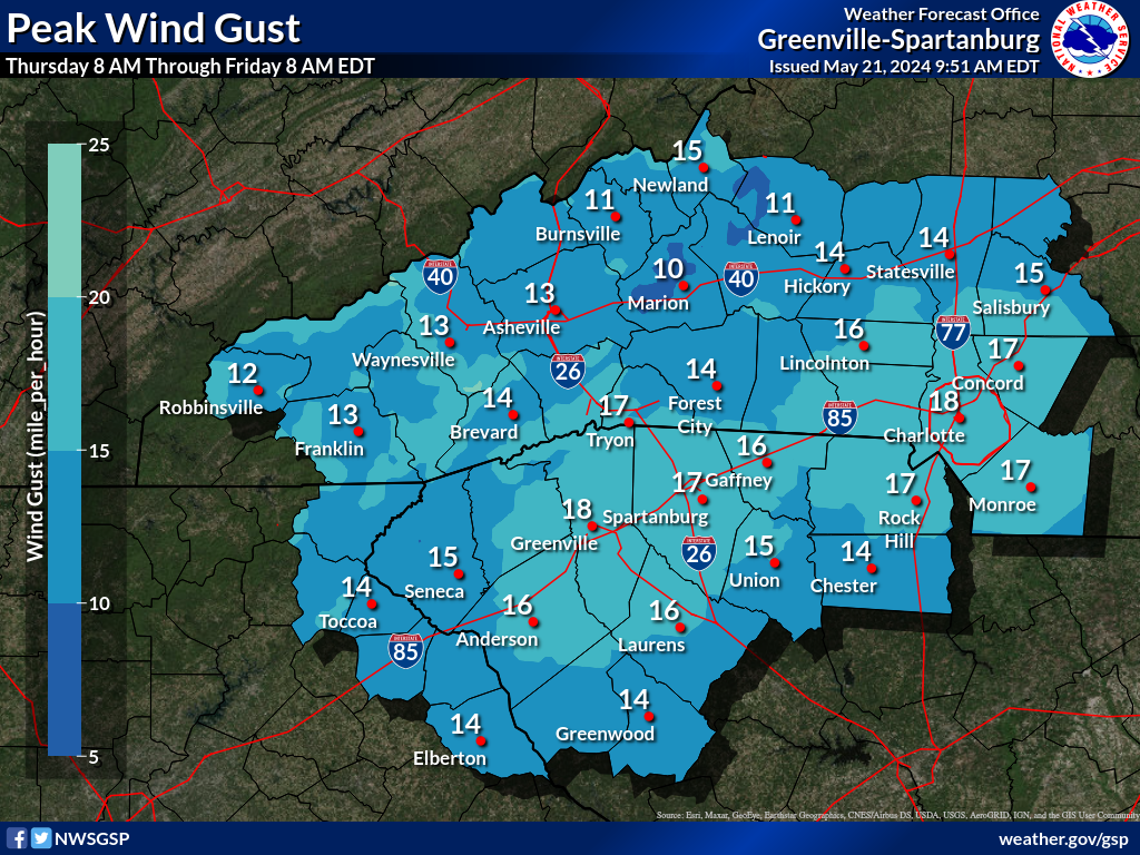
Days 1-4 Max Wind Gusts(click on thumbnails to display below)
Radar Loops: Local Radar (KGSP) | Charlotte Radar | Southeast Radar Loop NWS GSP Products: Winter Weather Warning / Watches / Advisrories (WSW) - WSW Map Criteria Explanation Non- Precipitation Warnings / Watches / Advisories (NPW) -- NPW Map Criteria Explanation Hazardous Weather Outlook | Special Weather Statement | Local Storm Reports |


 Tropical Weather


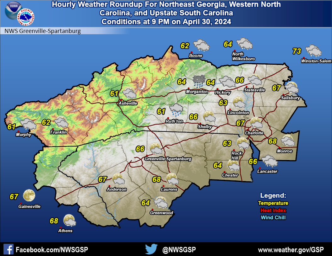 Current Conditions Map
 Follow us on YouTube