EF-2 Tornado Smithfield, NY
Summary
After considerable review of field notes, along with ground and aerial photographs, the National Weather Service in Binghamton, NY has updated the estimated maximum wind speed associated with the tornado in the town of Smithfield in Madison county New York on July 8, 2014. Beginning and ending latitude and longitude points have also been added to this report.
The survey team has determined that the damage to structures and natural objects is consistent with a strong EF-2 tornado with estimated wind speeds in the 125 to 135 mph range.
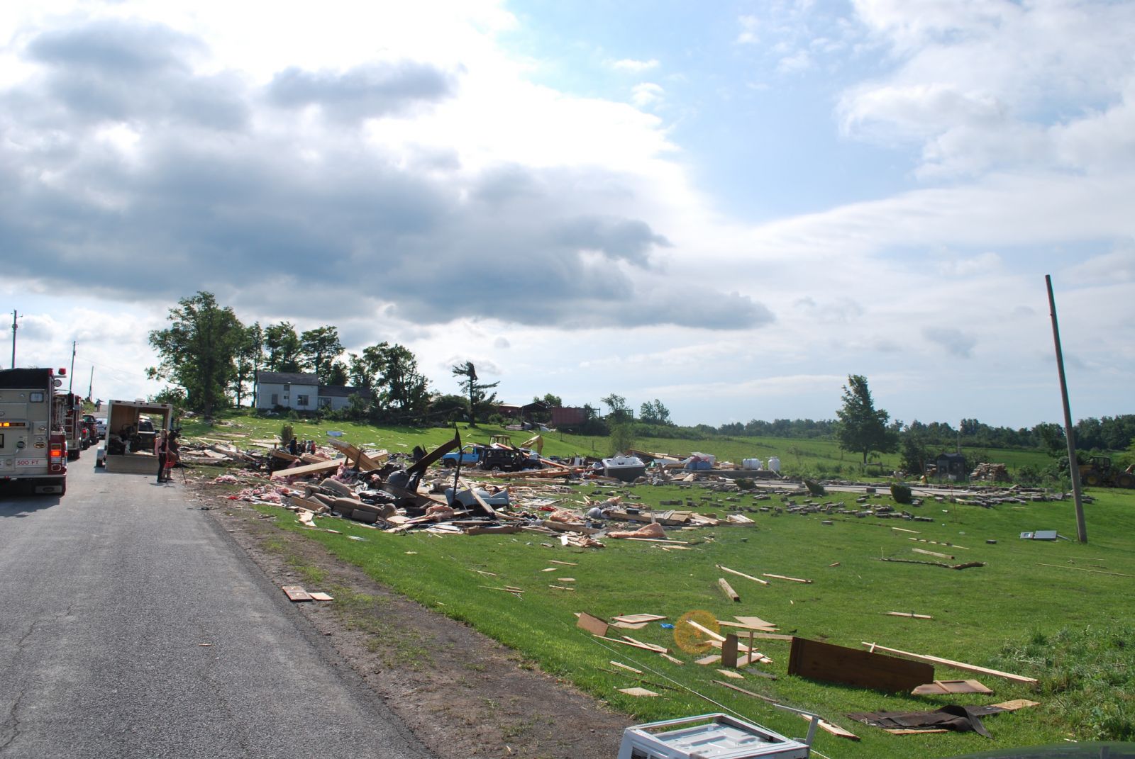
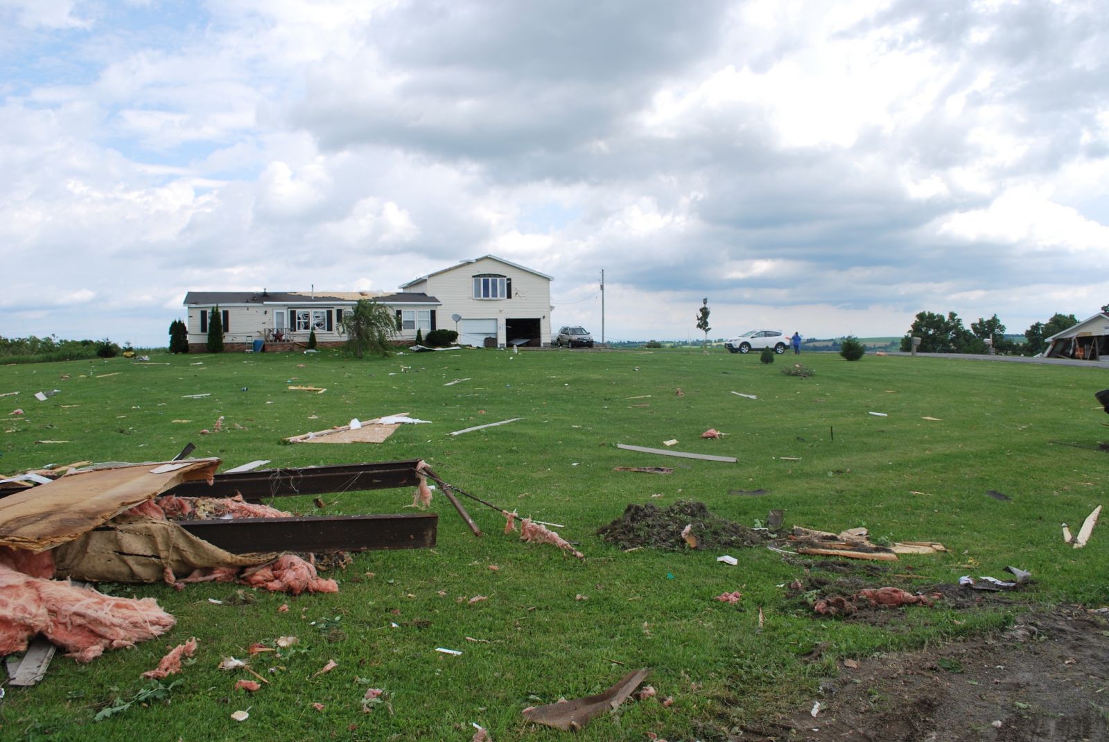
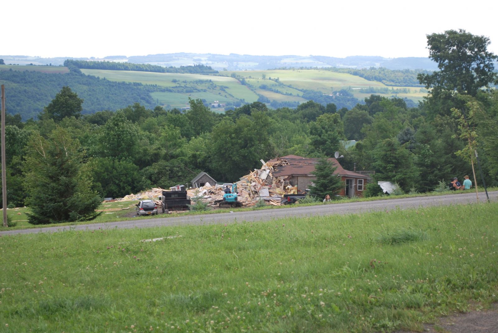
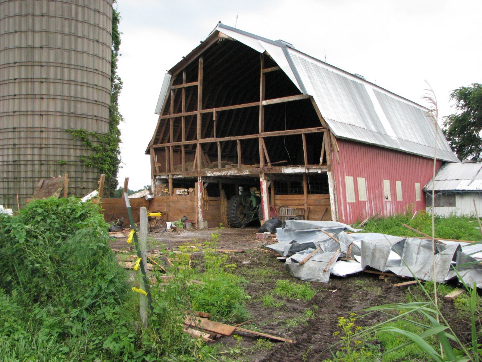
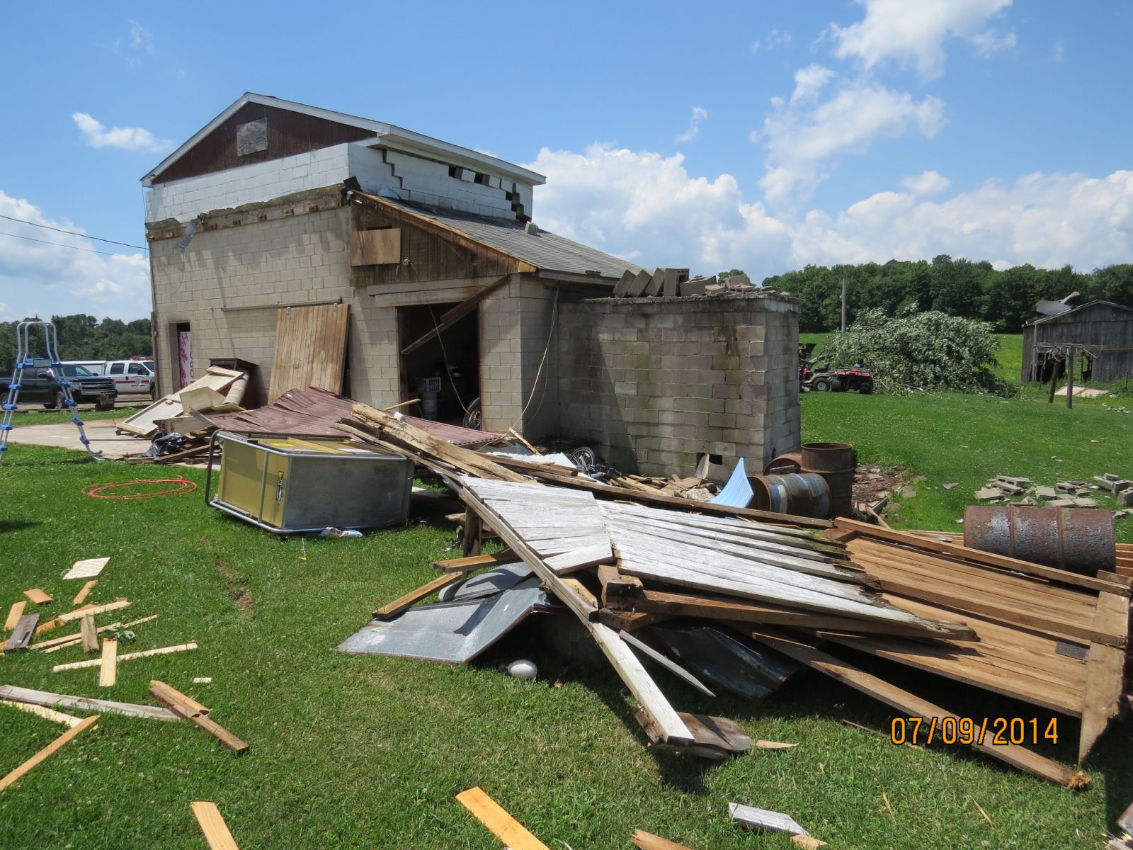
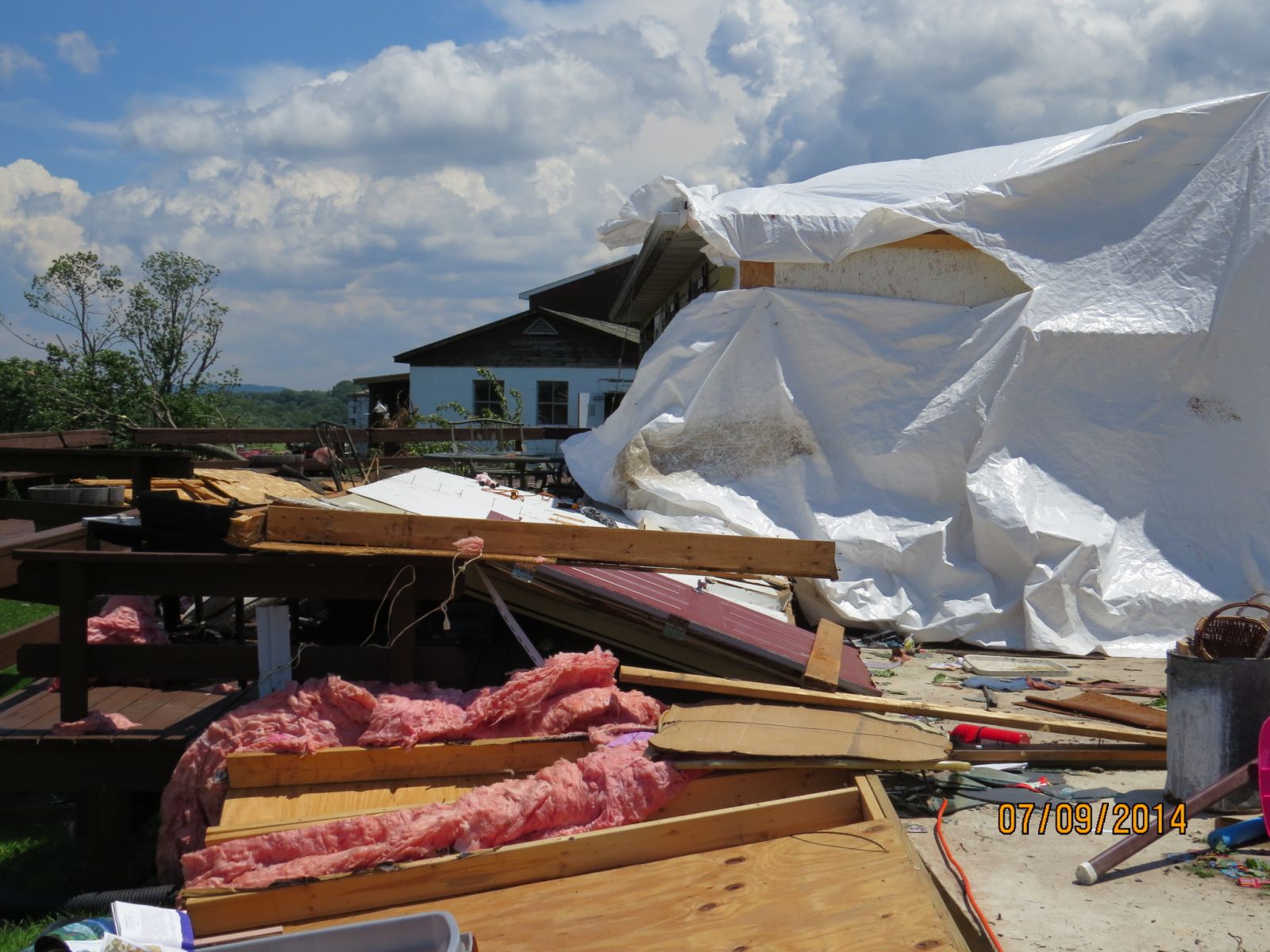
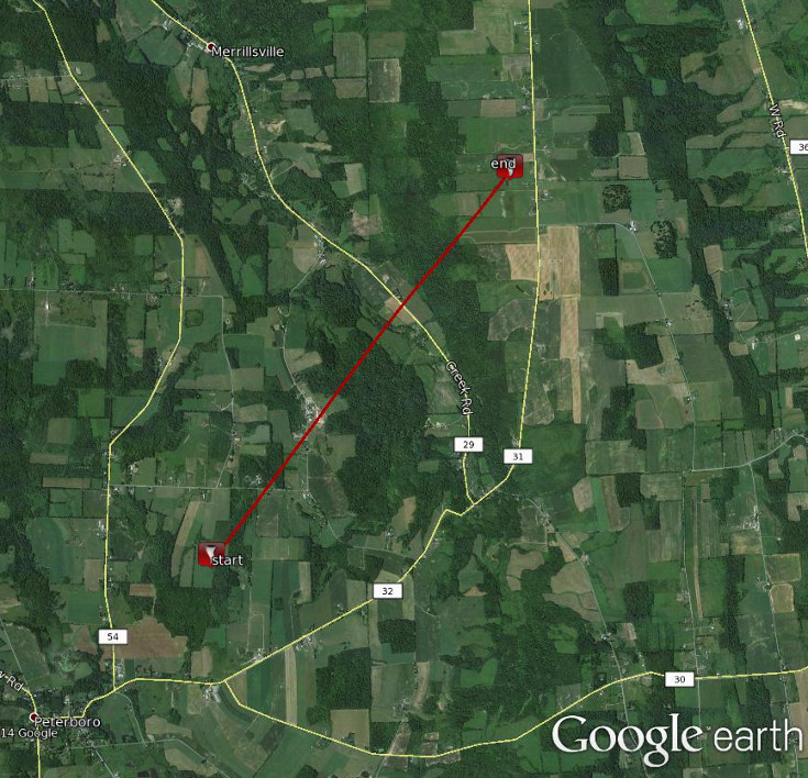
The tornado first touched down just over a hill behind a farm stead on the south side of Goff Road where it destroyed two manufactured homes and a barn. Additional barns and an unoccupied house were severely damaged at this location. The tornado passed between two houses on the north side of Goff Road with one home sustaining significant damage from flying debris. The tornado then crested a small knoll onto Northrup Road where it destroyed a three story home situated on the downhill slope. This structure was lifted off it's foundation and tossed approximately 150 yards across the road into another residence. The tornado weakened slightly, but continued across Northrup Road and tracked through fields and wooded areas before striking another farm on North Butler road. The tornado destroyed an outbuilding at this location, and also severely damaged the residence and another farm building across the street. The storm weakened further as it crossed creek road before dissipating near the intersection of bishop road and county Route 31 where only scattered light tree damage was noted.
Light debris from the destroyed structures was found up to 5 miles Away. The tornado produced three fatalities on goff road, and one on Northrup Road. A dog was also killed at the residence on Northrup.
Some pictures from the survey, click for a larger view.
|
Home destroyed. |
Structure damage. |
Trailer destroyed. |
|
Home damage. |
Part of house destroyed. |
Home lifted off foundation. |
Map shows the approximate path of the tornado.
Summary
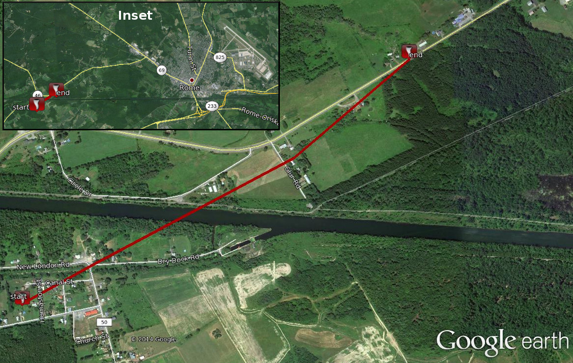
A concentrated area of damage was observed, starting just west of the New London Fire Station on Cornell Street. In this area, 6 to 8 hardwood trees were uprooted and a metal pavilion was heavily damaged. Farther north in the village of New London, numerous hardwood trees were uprooted in a chaotic fashion. Strong winds varied considerably in direction over a short distance, ranging from north northeast to west southwest. Structural damage included a metal roof that was peeled back on county Route 50.
Damage continued towards Glur Road. A metal play set was damaged and numerous hardwood trees were uprooted. Once again, the pattern of damage indicated significantly varying wind directions.
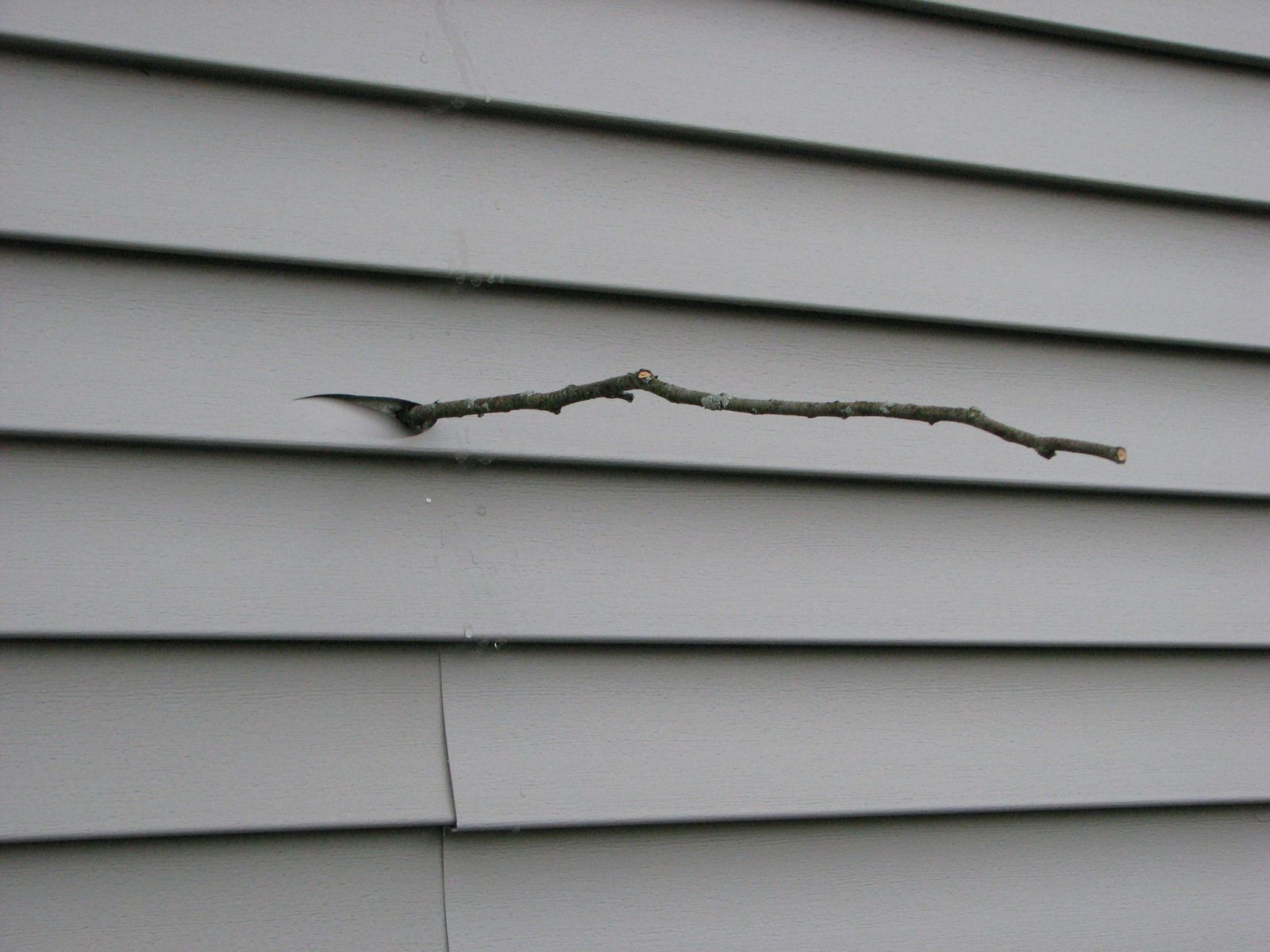
The damage path ended near Rome-New London Road. A loss of shingles was noted on the roof of a sturdy 2-story home, and a portion of the siding was blown about 50 yards down the road. Also, a small twig was found embedded in the aluminum siding.
Some pictures from the survey, click for a larger view.
|
Barn damaged. |
Roof off barn. |
Branch stuck into wall of house. |
Below is a map showing the approximate path of the tornado. Click for a large view.
More pictures from the survey can be found on our Facebook page.
Summary
At approximately 725 PM EDT, a small tornado developed in a wooded area off trenton road just to the north of the new york state thruway. The tornado tracked north-northeast through neighborhoods to the west of coventry avenue. The hardest hit area was between wells drive, beaumond place and walker road. The tornado snapped and uprooted dozens of trees, and caused some structural damage to a garage. Shingles were also peeled off several roofs in the area. After crossing walker road, the tornado lifted in the vicinity of the high voltage transmission lines just to the east of where they cross walker road.
Map shows the approximate path of the tornado.

Summary
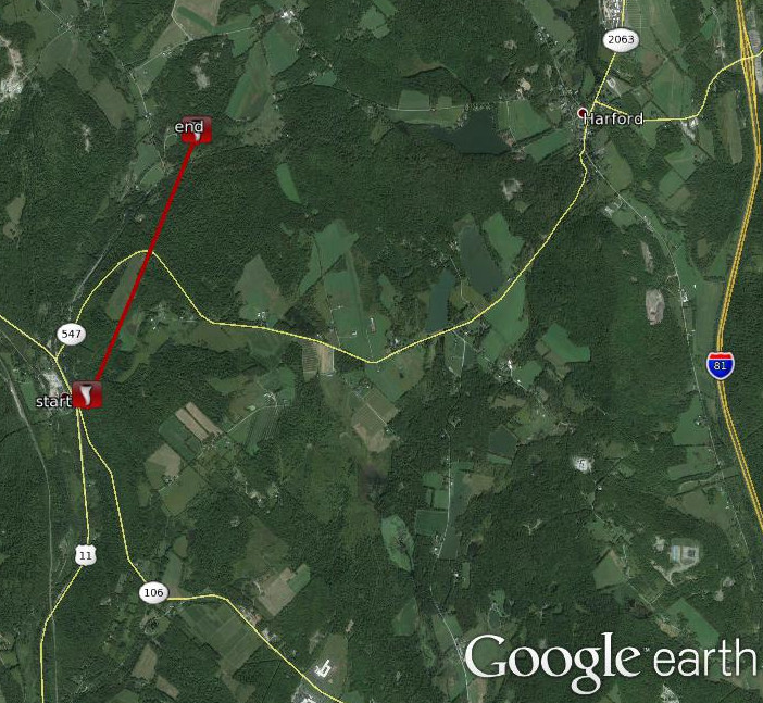
A tornado touched down just south of the Borough of Kingsley in Susquehanna county Pennsylvania at about 705 PM EDT July 8 2014. The tornado knocked down numerous large trees as it tracked up a hillside before lifting after almost a one mile and half. There were many downed trees and power lines with several homes being struck by large trees. A chimney was partially damaged on one home. The damage was consistent with the EF-1 category on the Enhanced Fujita Scale of tornado damage.
Map shows the approximate path of the tornado.
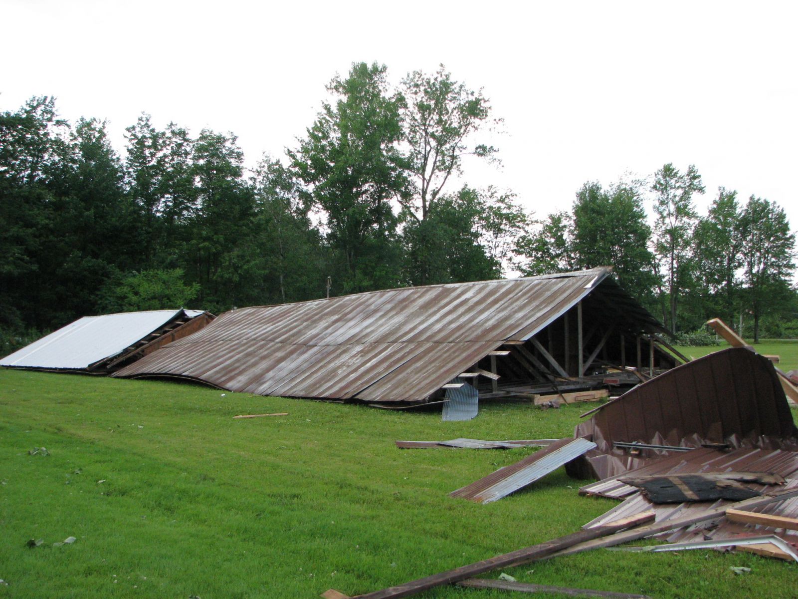
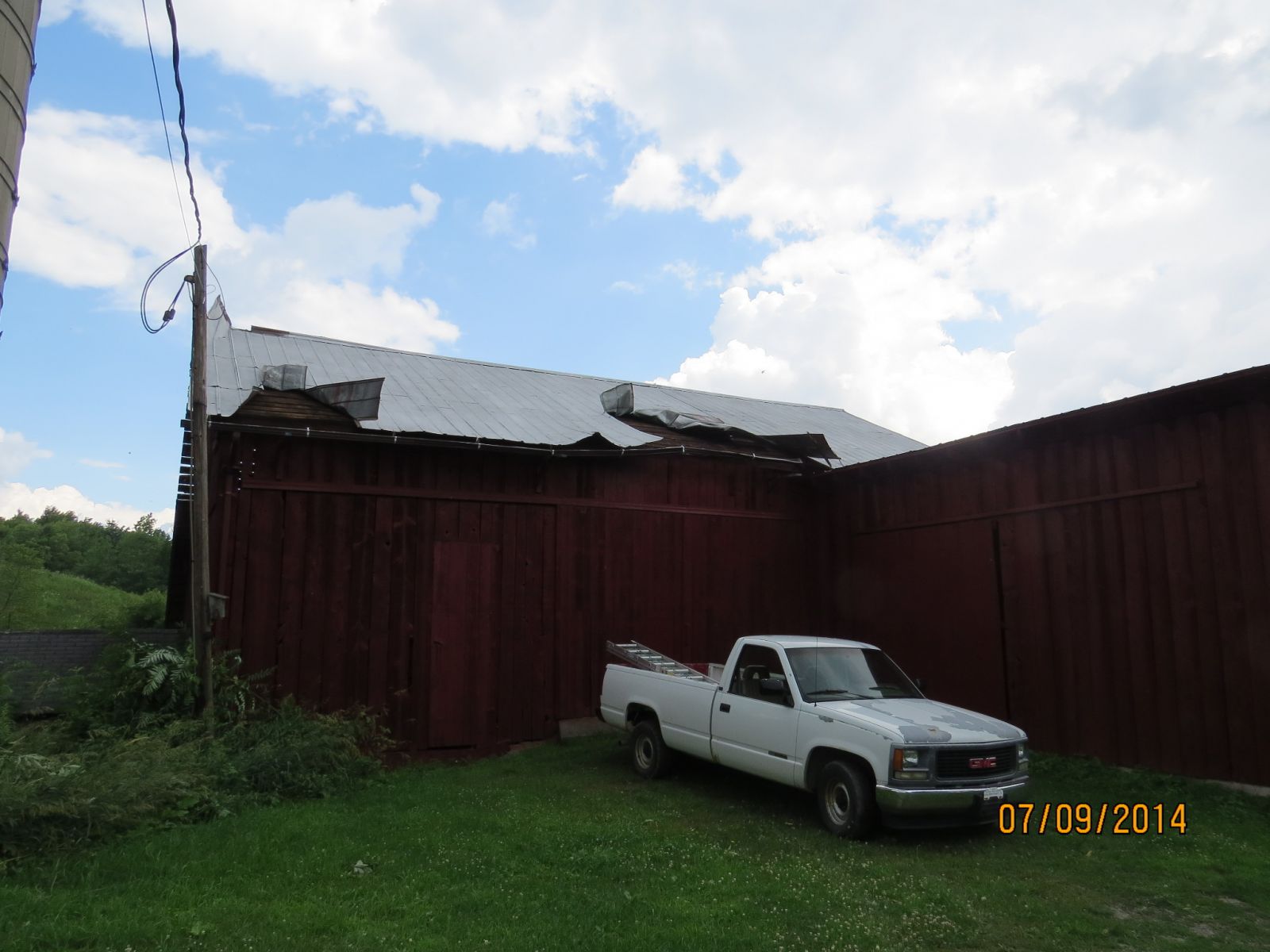
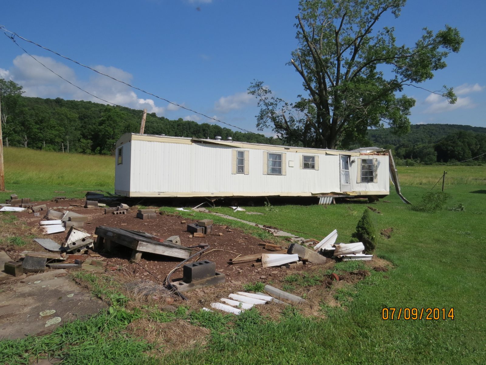
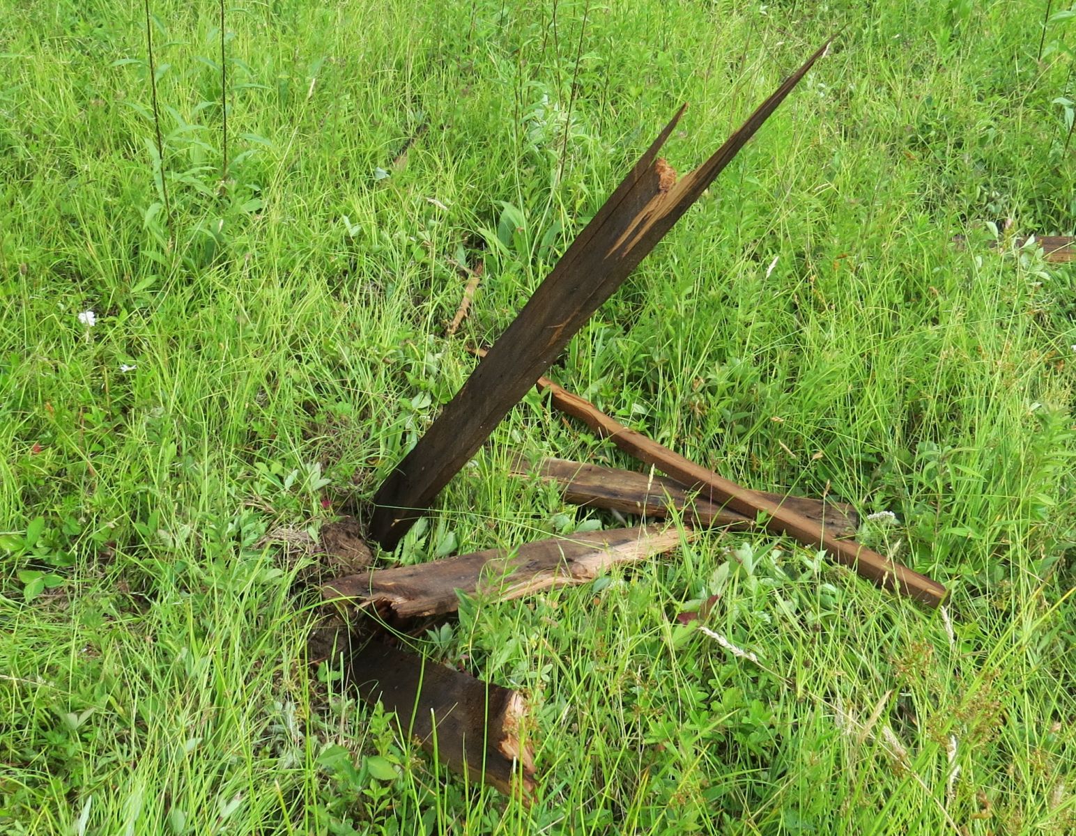
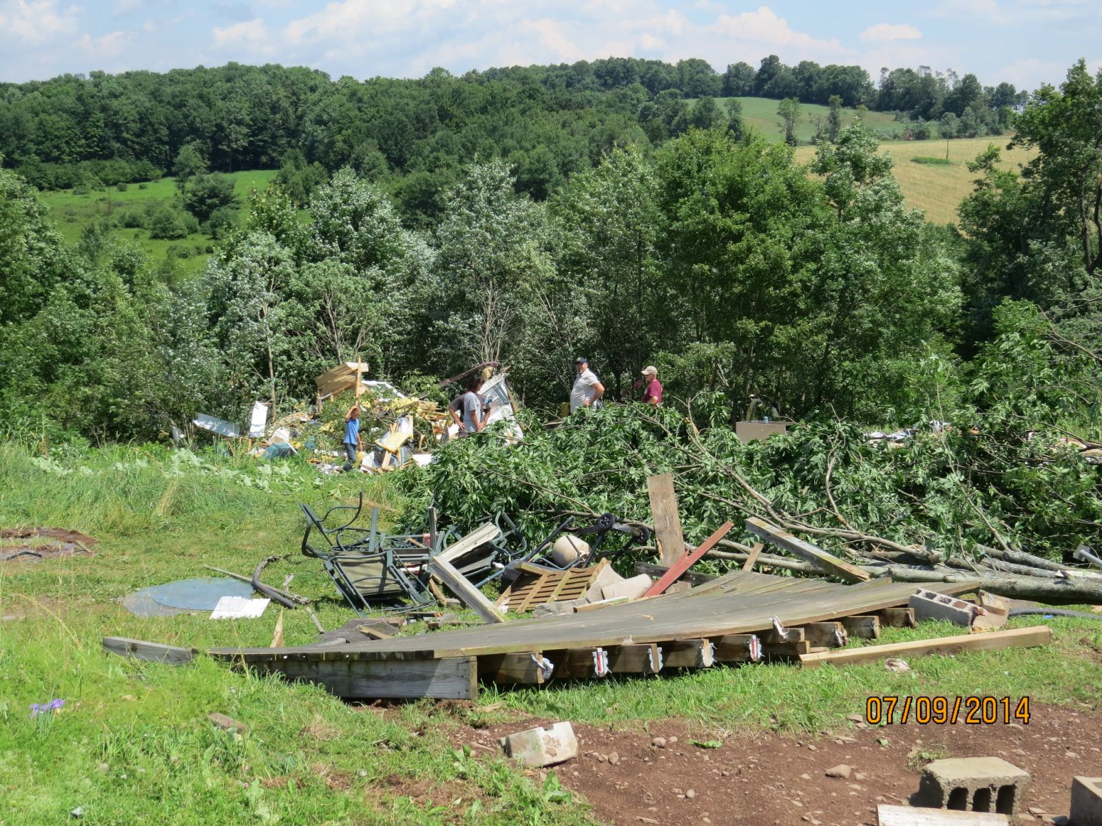
Summary
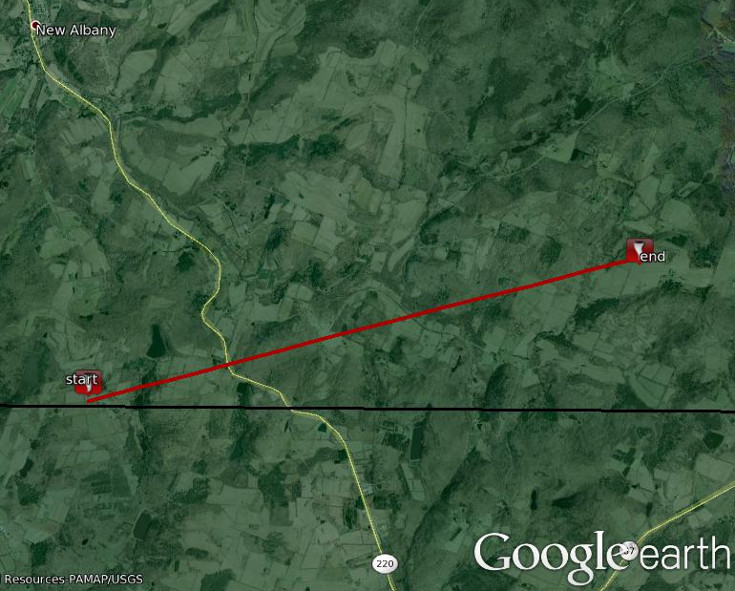
At 620 PM EDT, a tornado tracked into southern Bradford county from Cherry Township in northern Sullivan county. This tornado knocked down numerous trees as it tracked east northeast across Albany Township in Bradford county south of the borough of New Albany. The hardest hit area was on marsh road where a barn collapsed, and a trailer was blown off its foundation and turned 90 degrees. Part of a metal roof of a barn was peeled off and blown 200 yards. The tornado eventually lifted before it entered in Wilmot Township by 630 PM EDT.
Pictures taken during the survey, click for a larger view.
|
Structure damage. |
House damaged. |
Barn roof damaged. |
Old barn destroyed. |
|
Trailer damaged. |
Piece of wood thrown by tornado like missile into ground. |
Home destroyed. |
Home damaged. |
Map shows the approximate path of the tornado.
Summary
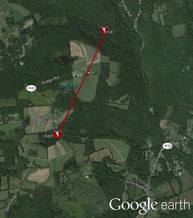
Damage patterns and eyewitness reports of a condensation funnel are consistent in suggesting that a small tornado briefly touched near a cluster of residences on State Route 4041 in Fairmount Township. The tornado began over open fields before lifting a small aluminum shed off it's foundation, wrapping it into a nearby tree. Several hardwood and softwood trees were snapped and scattered in all directions along the tornado path. Potatoes and onions were lifted out of a nearby garden. The tornado continued through the woods before impacting a working farm on ridge road. A roof was torn off it's barn, a grain silo was slightly pushed off it's foundation, and a Quonset Hut wall was blown out in the opposite direction of the tornado track. A fairly large commercial chicken coop was also overturned on the property. The tornado crested a ridge further northeast along the farm property, cut a swath through a corn field and knocked down several more trees in a wooded area before lifting above a steep ravine.
Map shows the approximate path of the tornado.
Macroburst East Syracuse to Trenton Falls, NY
Summary
More concentrated wind damage began in the village of East Syracuse on East Avenue. Tree damage was widespread and consisted mainly of downed large trees, some uproots, and a few snapped power poles. No structural damage was evident, except when caused by fallen trees. Thus, estimated wind speeds are in the 65 to 75 mph range at this location.
Sporadic damage continued towards the east northeast along State Route 298 across Lakeport Road, north Peterboro Street, and State Highway 31. A barn was damaged at the intersection of Buck Street and Judd Point Road in Durhamville. Wind speeds in this area remained consistently in the 65 to 75 mph range.
Damage continued farther northeastward until a more concentrated and extensive damage area was found in New London, extending from near the New London Fire Station on Cornell Street through Glur Road and Rome-New London Road, approximately 5 miles southwest of the city of Rome. Please refer to a separate summary on the tabs above.
Sporadic damage then continued towards the east northeast, through the city of Rome. Damage within the city of Rome consisted of some branches down and a few uprooted trees. Winds here, supported by the observation at Griffiss Air Force Base, were in the 60 to 70 mph range.
Sporadic damage likely continued towards the east northeast to the Oneida Herkimer county line, near Trenton Falls.
A few images from the survey, click for a larger view.
|
Power pole down Camilus, NY |
Power pole snapped in East Syracuse, NY |
Trees down in Rome, NY |
For reference:
A macroburst is a convective downdraft with an affected outflow area of at least 2 1/2 miles wide and peak winds lasting between 5 and 20 minutes. Intense macrobursts may cause tornado-force damage of up to ef3 intensity. Straight-line winds are generally any wind that is not associated with rotation, used mainly to differentiate them from tornadic winds.
Picture from the survey can be found on our Facebook page.
Summary
The National Weather Service in Binghamton, NY has confirmed a microburst/straight line wind damage near Remsen in Oneida County New York on July 8, 2014.
Sporadic damage began west of Remsen along Soule Road. While the storm path was 10 miles from this point east northeast to Hinckley Reservoir, by far the most concentrated area of damage was along Route 365 about 4 miles east of Remsen itself. Just south of the stop and go along Route 365 a large swatch of uprooted and snapped trees, mainly hardwood, was found. At this location some minor damage was done to a residence with hundreds of trees uprooted and snapped. All of the trees were flattened in the same general direction, with some of them showing a nice "fan shape" or divergent pattern. Winds here were estimated to be between 85 and 95 mph due to the snapped and uprooted hardwoods, but not rated higher due to only minor damage to the residence.
The damage path continued across Route 365 to just south of Fairchild road or Route 54a near twin rock road. Here a second, smaller and less intense swatch of trees were uprooted with larger branches broken. The damage was not as intense as the first location with winds estimated to be between 75 and 85 mph.
A third and final separate swatch of trees was blown down northeast of the location mentioned above or about two tenths of a mile southwest of the intersection of Sauquoit Street and Route 365. Much like the second location mentioned above the damage was not as intense as the first location but a large swatch of trees, some uprooted, with larger branches was blown down. The damage pattern remained consistent in that trees were uprooted in the same general direction, with some showing a "fan shaped" or divergent pattern. Winds at this location were estimated to be between 75 and 85 mph.
The National Weather Service in Binghamton extends it's thanks to the general public who has been very helpful in giving us specific locations to survey, via our Facebook page.
For reference:
A macroburst is a convective downdraft with an affected outflow area of at least 2 1/2 miles wide and peak winds lasting between 5 and 20 minutes. Intense macrobursts may cause tornado-force damage of up to ef3 intensity. Straight-line winds are generally any wind that is not associated with rotation, used mainly to differentiate them from tornadic winds.
Summary
The storm survey team investigated a swath of mostly scattered tree damage, and some minor structural damage to siding and shingles over the northern portion of Luzerne county. Much of the damage was consistent with what is typically caused by a series of downbursts. Of particular note, however, was a narrow swath of destroyed trees in a steeply sloped wooded area between Bodle Hill Road and Lewis Road where the damage was more intense than other areas. The track of tree damage was approximately one-quarter mile in length and only about 30 yards wide. A car port was also lifted and tossed into the air. Eyewitnesses to the event reported brief swirling winds in a clockwise direction. The enhanced tree and property damage at this location could be a result of terrain induced swirling.
Additional Information: