Overview
A long tracked severe mesoscale convective complex (MCS) moved out of eastern Nebraska and South Dakota into central and western Minnesota, including west-central and northwest Minnesota, on May 12, 2022. This MCS was particularly long lived and intense producing numerous 80+ mph wind gusts and several tornadoes. This event met the classification of derecho. Other notables include the thick dust that accompanied gusty winds, heavy rainfall, as well as strong 60+ mph non-thunderstorm wind gusts on May 13 associated with the strong low pressure within North Dakota.
As of June 30, 2022, the May 12, 2022, Midwest Derecho event holds the highest number of significant wind gust (75+ mph) reports from any one convective complex on record with 68 reports of measured wind gusts 75 mph or greater. The previous record for the highest number of measured, significant wind gusts was 64 reports during the Central Plains-Midwest derecho of December 15, 2021.
Tornadoes:
|
Tornado - North Ottawa
Track Map 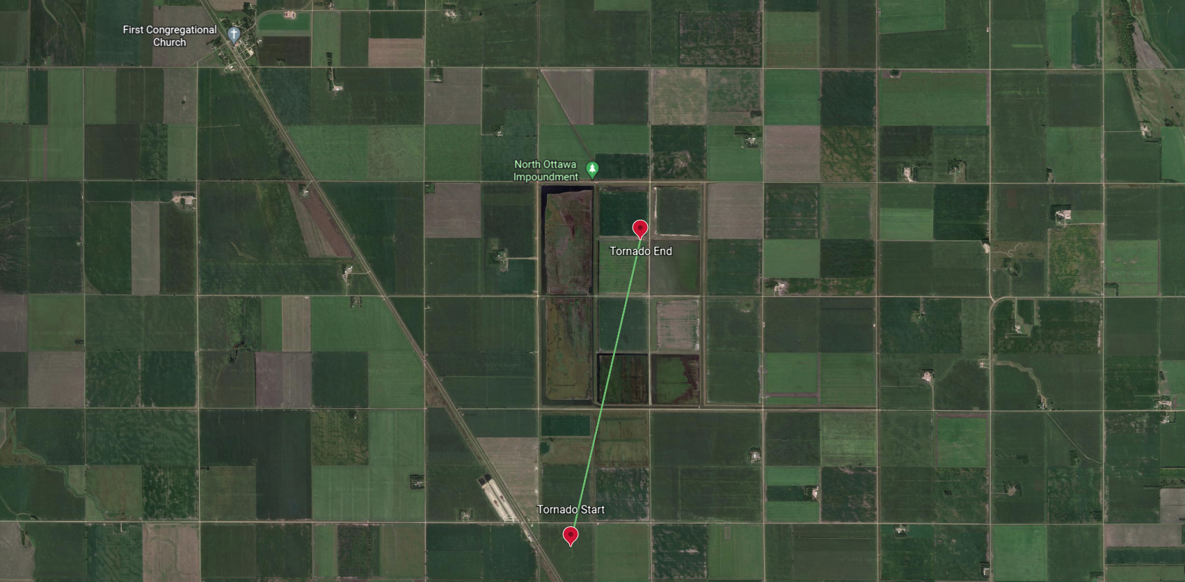 
|
||||||||||||||||
|
Tornado - Le Mars
Track Map 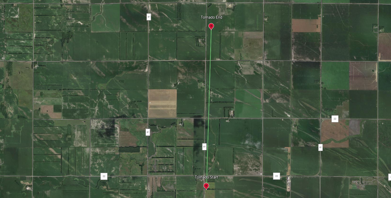
|
||||||||||||||||
|
Tornado - Campbell
Track Map 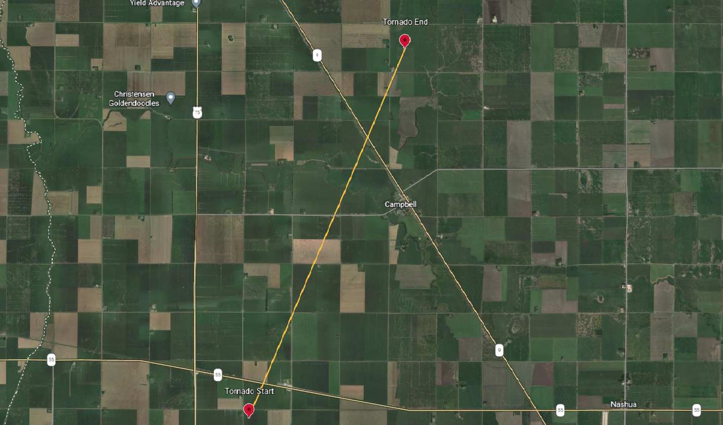
|
||||||||||||||||
|
Tornado - Battle Lake
Track Map 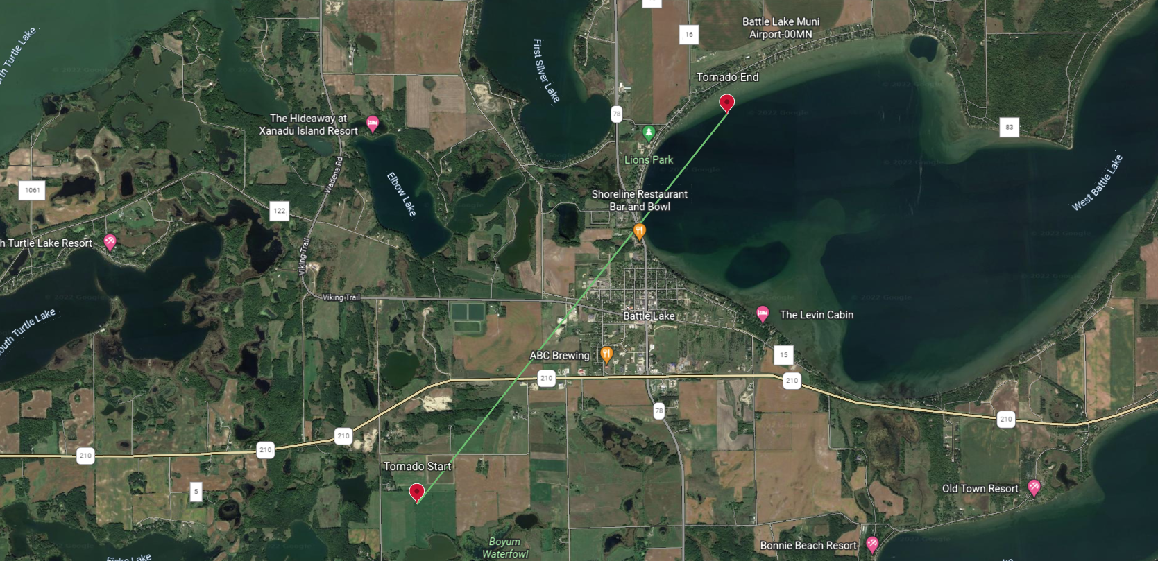
|
||||||||||||||||
|
Tornado - West Mason Lake
Track Map 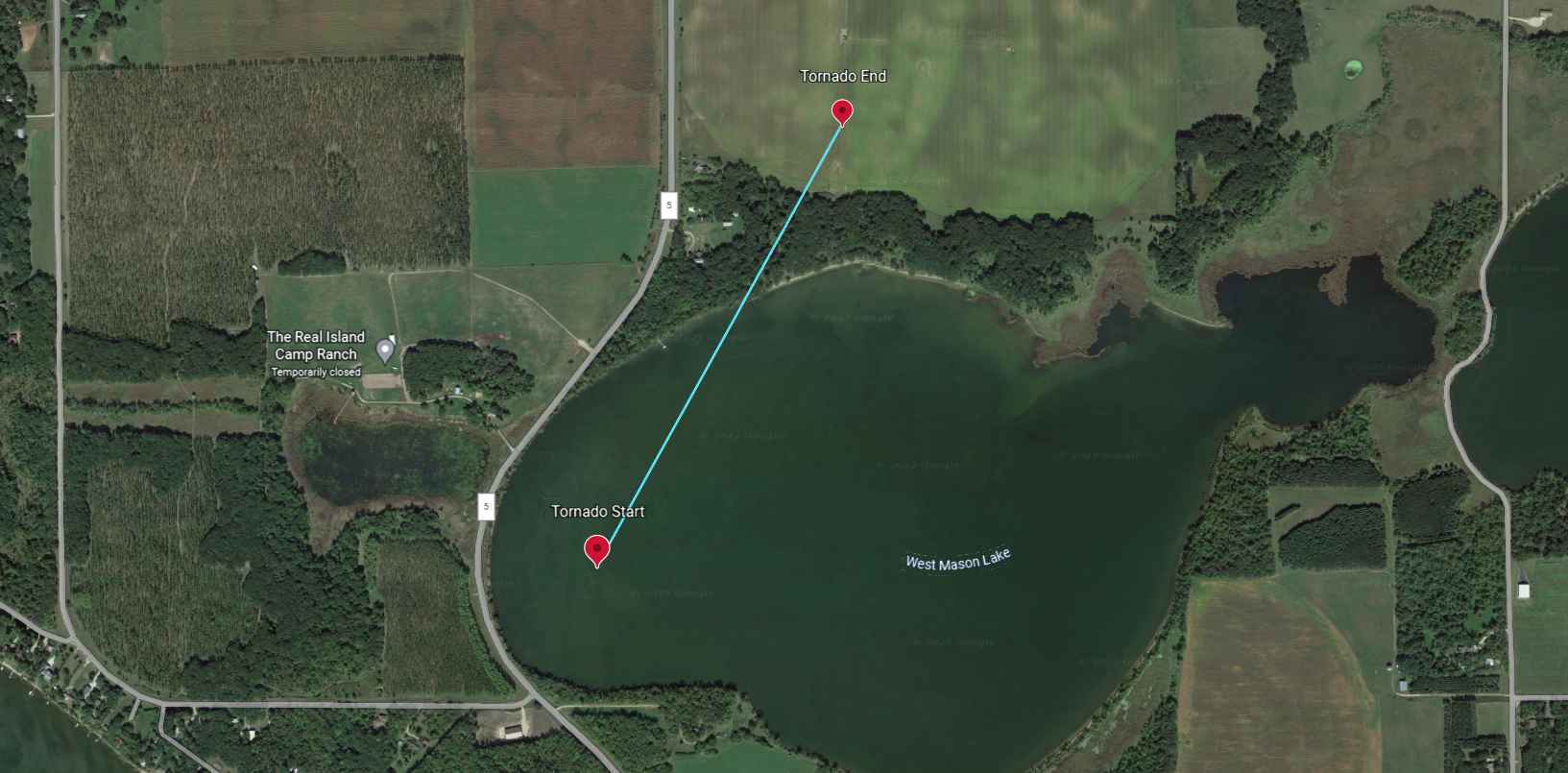
|
||||||||||||||||
|
Tornado - Verndale
Track Map 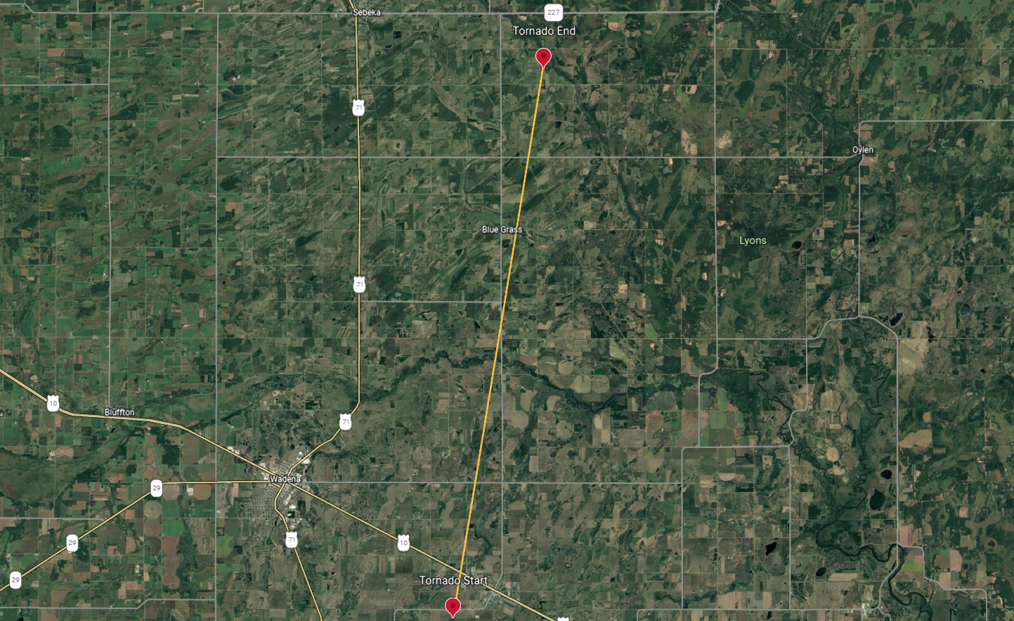
|
||||||||||||||||
The Enhanced Fujita (EF) Scale classifies tornadoes into the following categories:
| EF0 Weak 65-85 mph |
EF1 Moderate 86-110 mph |
EF2 Significant 111-135 mph |
EF3 Severe 136-165 mph |
EF4 Extreme 166-200 mph |
EF5 Catastrophic 200+ mph |
 |
|||||
Wind:
A particularly high number of severe wind gusts were reported from May 12th 2022 Midwest Derecho. Click here for an interactive comprehensive map of storm reports during this event.
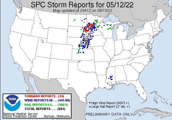
Here is a summary of reports from within the National Weather Service Grand Fork's area of responsibility, including a 94 mph measured wind gust in Verndale, Minnesota:
PRELIMINARY LOCAL STORM REPORT...SUMMARY
NATIONAL WEATHER SERVICE GRAND FORKS ND
1000 AM CDT FRI MAY 13 2022

..TIME...   ...EVENT...      ...CITY LOCATION...     ...LAT.LON...
..DATE...   ....MAG....      ..COUNTY LOCATION..ST.. ...SOURCE....
            ..REMARKS..

0642 PM     TSTM WND GST     2 E EMERADO             47.92N 97.32W
05/12/2022  M60 MPH          GRAND FORKS        ND   MESONET

            GUST AT 10M, COURTESY OF NDAWN.

0706 PM     TSTM WND GST     HANKINSON 9 SSE         45.95N 96.82W
05/12/2022  M66 MPH          RICHLAND           ND   MESONET

            WIND GUST AT THE SOUTH DAKOTA DOT RWIS SITE
            VICTOR AT THE NORTH/SOUTH DAKOTA BORDER.

0711 PM     HAIL             1 NNW VALLEY CITY       46.93N 98.01W
05/12/2022  M1.00 INCH       BARNES             ND   PUBLIC

            CORRECTS PREVIOUS HAIL REPORT FROM 1 NNW
            VALLEY CITY. REPORT FROM MPING: QUARTER
            (1.00 IN.).

0715 PM     TSTM WND DMG     CAMPBELL                46.10N 96.41W
05/12/2022                   WILKIN             MN   LAW ENFORCEMENT

            CORRECTS PREVIOUS TSTM WND DMG REPORT FROM
            CAMPBELL. WILKIN COUNTY LAW ENFORCEMENT
            REPORTS MULTIPLE TREES DOWN AND POWER LINES
            DOWN IN CAMPBELL. TIME ESTIMATED FROM RADAR.

0715 PM     TSTM WND GST     ELBOW LAKE 11 W         45.99N 96.21W
05/12/2022  M70 MPH          GRANT              MN   MESONET

            CORRECTS PREVIOUS TSTM WND GST REPORT FROM 6
            ESE NASHUA. PERSONAL WEATHER STATION. WIND
            GUST OF 70 MPH.

0716 PM     TSTM WND GST     3 S HANKINSON           46.03N 96.89W
05/12/2022  M78 MPH          RICHLAND           ND   MESONET

            PERSONAL WEATHER STATION REPORTS 78MPH WIND
            GUST.

0718 PM     TSTM WND GST     3 SSE CAMPBELL          46.06N 96.38W
05/12/2022  M69 MPH          WILKIN             MN   MESONET

            COURTESY OF NDAWN. GUST AT 3 METERS.

0720 PM     TSTM WND GST     ASHBY                   46.09N 95.82W
05/12/2022  M58 MPH          GRANT              MN   MESONET

            PERSONAL WEATHER STATION AT ASHBY LAKE.

0720 PM     TSTM WND DMG     3 N ERDAHL              46.04N 95.82W
05/12/2022                   GRANT              MN   DEPT OF HIGHWAYS

            CORRECTS PREVIOUS TSTM WND DMG REPORT FROM 3
            N ERDAHL. SEMI-TRUCKS FLIPPED OVER ALONG
            I-94 FROM T-STORMS WINDS.

0723 PM     TSTM WND DMG     BRECKENRIDGE            46.26N 96.59W
05/12/2022                   WILKIN             MN   LAW ENFORCEMENT

            CORRECTS PREVIOUS TSTM WND DMG REPORT FROM
            BRECKENRIDGE. WILKIN COUNTY LAW ENFORCEMENT
            REPORTS POWER LINES AND LARGE TREES DOWN IN
            THE CITY OF BRECKENRIDGE. TIME ESTIMATED BY
            RADAR.

0725 PM     TSTM WND DMG     WAHPETON                46.27N 96.61W
05/12/2022                   RICHLAND           ND   PUBLIC

            ROOF DAMAGE WITH MISSING SHINGLES AND A
            LARGE HOLE IN THE ROOF.

0725 PM     TSTM WND GST     WESTERN                 46.15N 96.18W
05/12/2022  M67 MPH          OTTER TAIL         MN   MESONET

            PERSONAL WEATHER STATION REPORTS A 67MPH
            WIND GUST.

0725 PM     TSTM WND GST     6 W CAMPBELL            46.10N 96.53W
05/12/2022  M63 MPH          WILKIN             MN   MESONET

            PERSONAL WEATHER STATION REPORTS WIND GUST
            OF 63MPH.

0725 PM     TSTM WND GST     2 S WAHPETON            46.24N 96.61W
05/12/2022  M59 MPH          RICHLAND           ND   AWOS

            CORRECTS PREVIOUS TSTM WND GST REPORT FROM 2
            S WAHPETON. 10M WIND GUST.

0725 PM     TSTM WND GST     3 SW MOORETON           46.24N 96.92W
05/12/2022  M76 MPH          RICHLAND           ND   MESONET

            CORRECTS PREVIOUS TSTM WND GST REPORT FROM 3
            SW MOORETON. MOORETON NDAWN GUST AT 10M.
            COURTESY OF NDAWN.

0728 PM     TSTM WND GST     10 SE BRECKENRIDGE      46.16N 96.44W
05/12/2022  M67 MPH          WILKIN             MN   MESONET

            PERSONAL WEATHER STATION REPORTS 67MPH WIND
            GUST.

0730 PM     TSTM WND GST     3 W FERGUS FALLS        46.28N 96.13W
05/12/2022  M73 MPH          OTTER TAIL         MN   AWOS

            REPORTED ON THE 1 MINUTE OBSERVATIONS AT
            FERGUS FALLS AIRPORT.

0730 PM     TSTM WND DMG     WAHPETON                46.27N 96.61W
05/12/2022                   RICHLAND           ND   TRAINED SPOTTER

            TRAINED SPOTTER REPORTS 1-2FT DIAMETER TREES
            DOWN, ROOF DAMAGE IN WAHPETON. TIME
            ESTIMATED.

0730 PM     TSTM WND GST     4 SW FERGUS FALLS       46.24N 96.13W
05/12/2022  M60 MPH          OTTER TAIL         MN   MESONET

            PERSONAL WEATHER STATION REPORTS A 60 MPH
            WIND GUST.

0734 PM     TSTM WND GST     2 NW PARKERS PRAIRIE    46.17N 95.36W
05/12/2022  M60 MPH          OTTER TAIL         MN   MESONET

            COURTESY OF NDAWN AT 3M.

0735 PM     TSTM WND GST     3 NNW CLITHERALL        46.31N 95.66W
05/12/2022  M68 MPH          OTTER TAIL         MN   MESONET

            PERSONAL WEATHER STATION REPORTS 68MPH GUST
            AT 7:35PM.

0740 PM     TORNADO          4 NNW VINING            46.32N 95.57W
05/12/2022  UF0              OTTER TAIL         MN   PUBLIC

            PUBLIC REPORTS A WATERSPOUT ON WEST MASON
            LAKE.

0740 PM     TSTM WND DMG     3 SSE STAR LAKE         46.49N 95.78W
05/12/2022                   OTTER TAIL         MN   PUBLIC

            CORRECTS PREVIOUS TSTM WND DMG REPORT FROM 3
            SSE STAR LAKE. 7 INCH DIAMETER HEALTHY
            BRANCH BROKEN IN MAINE, MN.

0744 PM     HAIL             WRIGHTSTOWN             46.27N 95.19W
05/12/2022  E1.00 INCH       OTTER TAIL         MN   PUBLIC

            QUARTER SIZED HAIL 12S WADENA. SMALL
            BRANCHES DOWN AS WELL.

0744 PM     TSTM WND GST     ROTHSAY                 46.47N 96.29W
05/12/2022  M65 MPH          WILKIN             MN   DEPT OF HIGHWAYS

            GUST FROM THE ROTHSAY RWIS.

0748 PM     FUNNEL CLOUD     1 E WRIGHTSTOWN         46.27N 95.16W
05/12/2022                   OTTER TAIL         MN   LAW ENFORCEMENT

            FUNNEL CLOUD REPORTED BY LAW ENFORCEMENT.

0755 PM     TSTM WND GST     2 NW VERNDALE           46.42N 95.04W
05/12/2022  M94 MPH          WADENA             MN   DEPT OF HIGHWAYS

            REPORTED BY VERNDALE RWIS.

0800 PM     TSTM WND GST     3 ENE BARNESVILLE       46.67N 96.36W
05/12/2022  M58 MPH          CLAY               MN   MESONET

            PERSONAL WEATHER STATION REPORTS A 58 MPH
            WIND GUST.

0800 PM     TSTM WND GST     1 SW SHOREHAM           46.75N 95.91W
05/12/2022  M58 MPH          BECKER             MN   MESONET

            PERSONAL WEATHER STATION REPORTS A 58 MPH
            WIND GUST.

0800 PM     HAIL             ARGYLE                  48.34N 96.82W
05/12/2022  M0.25 INCH       MARSHALL           MN   PUBLIC

            CORRECTS PREVIOUS HAIL REPORT FROM ARGYLE.
            PEA SIZED HAIL WAS REPORTED IN ARGYLE
            MINNESOTA ON SOCIAL MEDIA.

0814 PM     FUNNEL CLOUD     FINGAL                  46.76N 97.79W
05/12/2022                   BARNES             ND   LAW ENFORCEMENT

            FUNNEL CLOUD REPORTED BY LAW ENFORCEMENT,
            RECEDED SHORTLY AFTER.

0814 PM     FUNNEL CLOUD     3 S PARK RAPIDS         46.90N 95.06W
05/12/2022                   HUBBARD            MN   LAW ENFORCEMENT

            CORRECTS PREVIOUS FUNNEL CLOUD REPORT FROM 1
            S PARK RAPIDS. FUNNEL CLOUD REPORTED BY LAW
            ENFORCEMENT, LESS THAN 1/4 OF THE WAY DOWN
            TO THE GROUND.


&&

$$
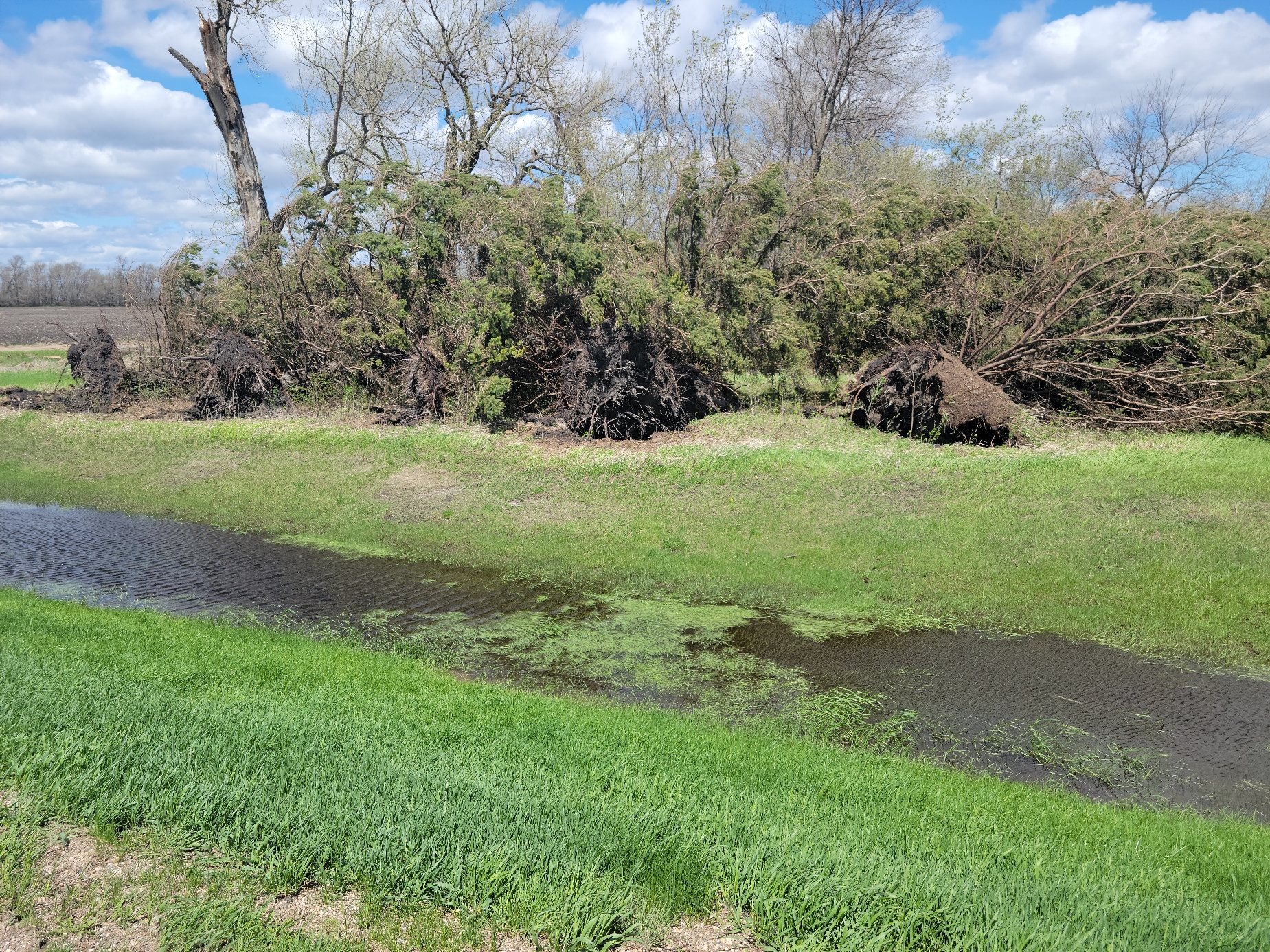
Photos
Click here for a compilation of tweets illustrating the event within eastern South Dakota into Minnesota.
 |
 |
 |
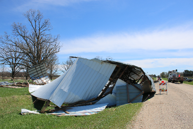 |
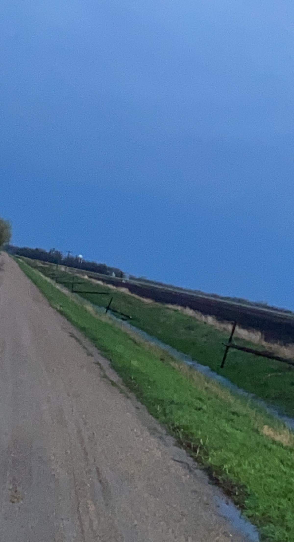
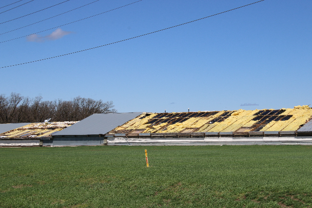
| Trees Uprooted 1E Doran (Megan Wanek) |
Snapped Power Poles due to the North Ottawa tornado (Tina L.) |
Roofing missing from Turkey Barns in Verndale (Reba Kompaa) |
Destroyed Shed 6SE Sebeka (Reba Kompaa) |
Radar
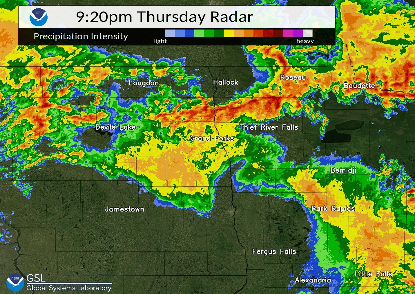 |
| Radar Imagery from May 12th, 2022 |
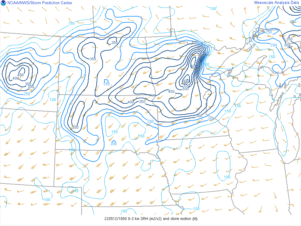
Environment
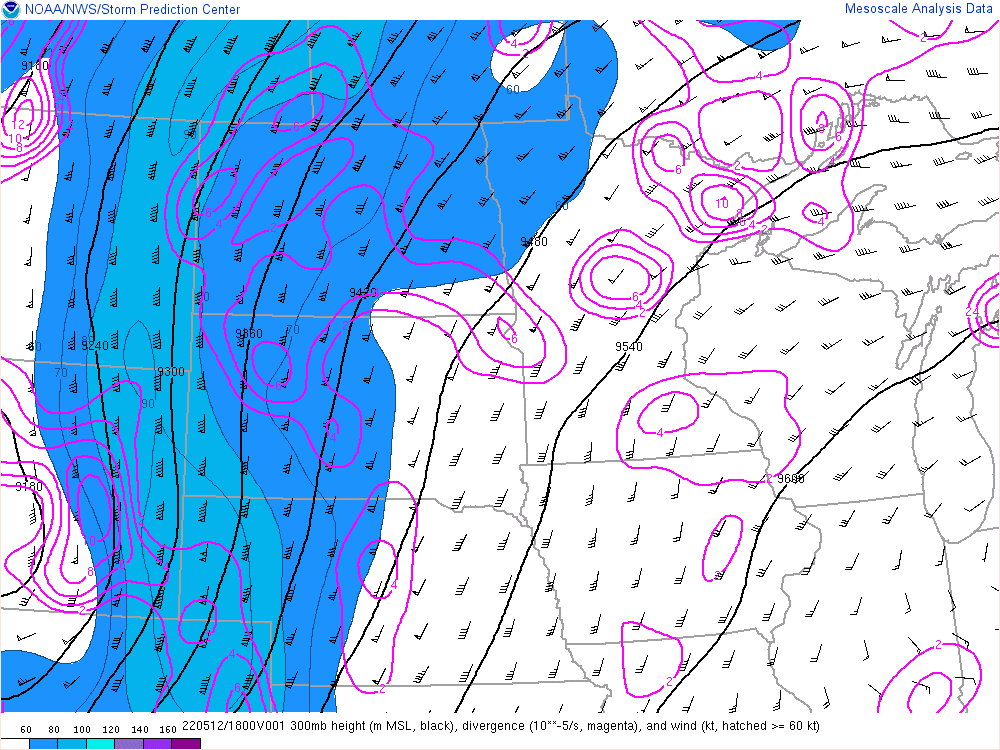
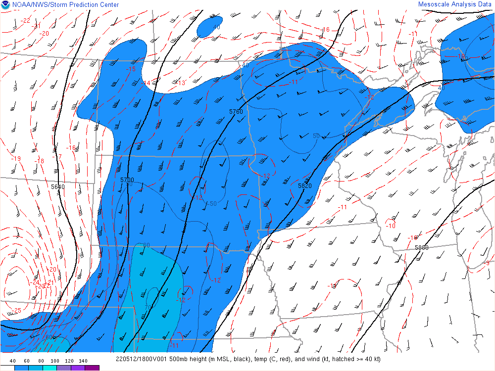
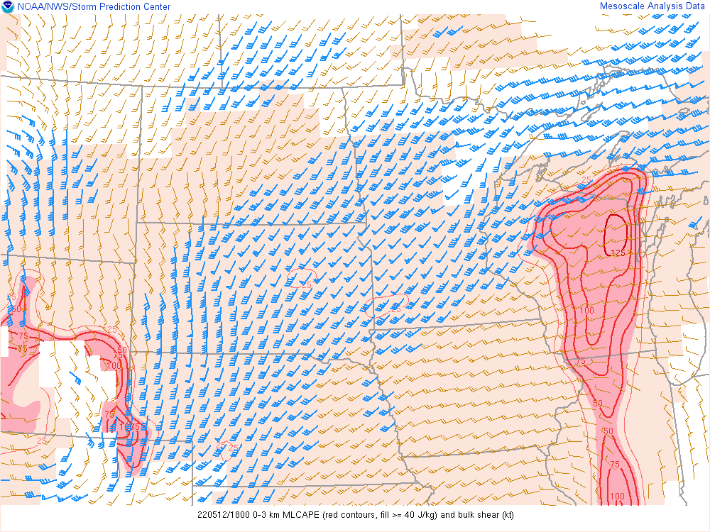
Click here to see SPC's Severe Weather Event archive of May 12, 2022, including mesoscale discussions, environmental data, upper air analysis, soundings, and outlooks.
 |
 |
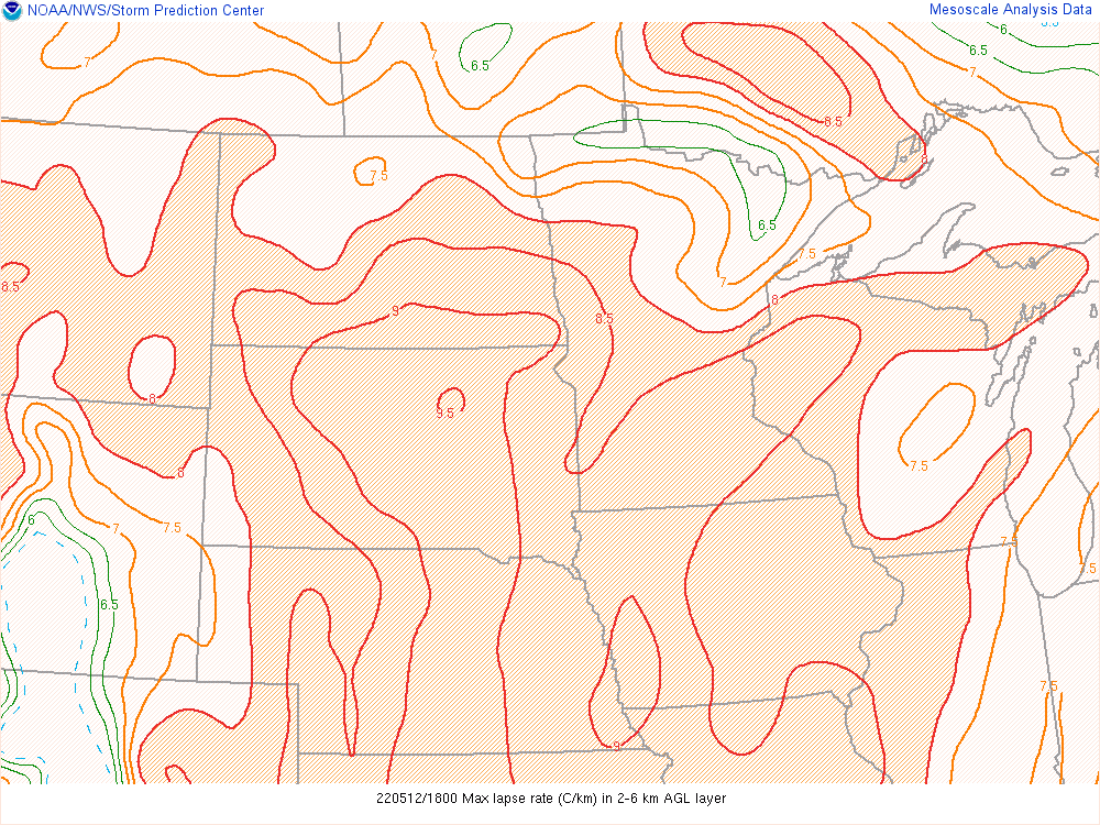 |
| 300 mb 18 - 21 UTC | 500 mb 18 - 21 UTC | Max Lapse Rates 18 - 21 UTC |
 |
 |
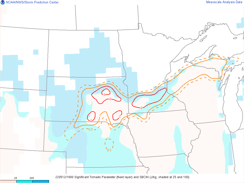 |
| MLCAPE (0-3km) and bulk shear 18 - 21 UTC | 0-3km SRH 18 - 21 UTC | Sig Tor Parameter 18 - 21 UTC |
 |
Media use of NWS Web News Stories is encouraged! Please acknowledge the NWS as the source of any news information accessed from this site. |
|

