Heavy to excessive rainfall over the southern Appalachians may bring areas of flooding Tuesday. Hot to extremely hot temperatures are in place through Tuesday across much of the western U.S. and northern New England. Tropical Storm Erin is forecast to become a Major Hurricane by this weekend as it moves across the central Atlantic Ocean. Monitor future forecasts for any East Coast impacts. Read More >
(Click on any image within these pages for a larger version)
.JPG) |
.JPG) |
 |
.jpg) |
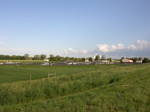
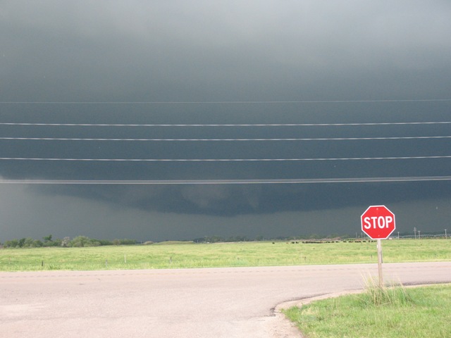
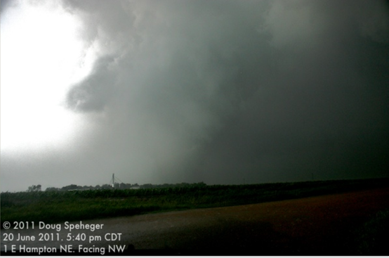
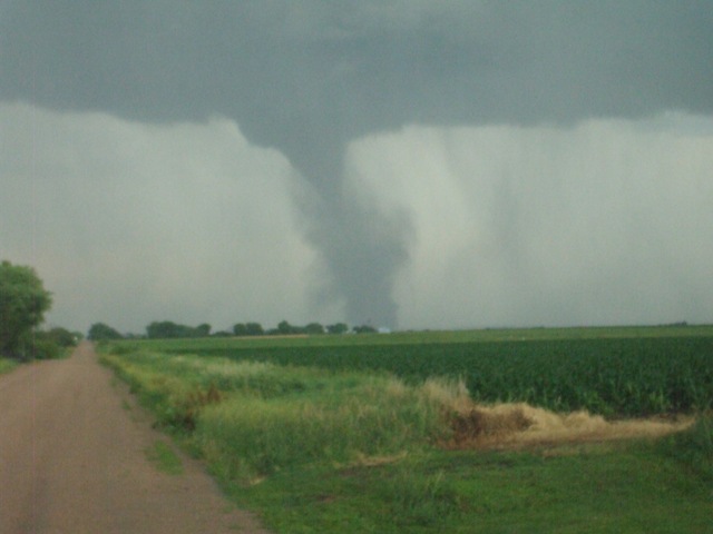
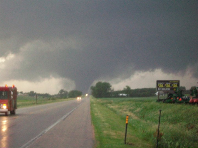
| Tornado 5 miles south of Elm Creek just east of Hwy 183. Photo Courtesy of Bryce Kintigh. |
Tornado 5 miles south of Elm Creek just east of Hwy 183. Photo Courtesy of Bryce Kintigh. |
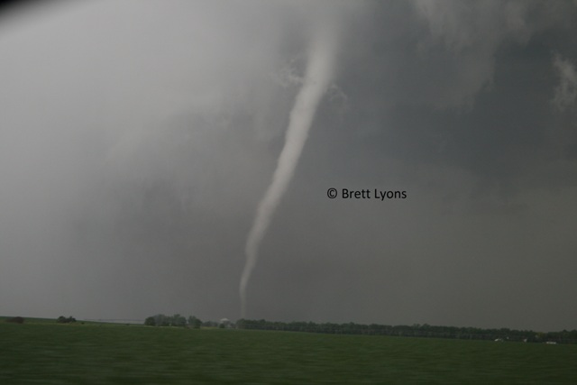
Tornado west of Osceola on Highway 92. Photo Courtesy of Greg Dumas. | Tornado near Bradshaw. Photo courtesy of Brett Lyons. |
 |
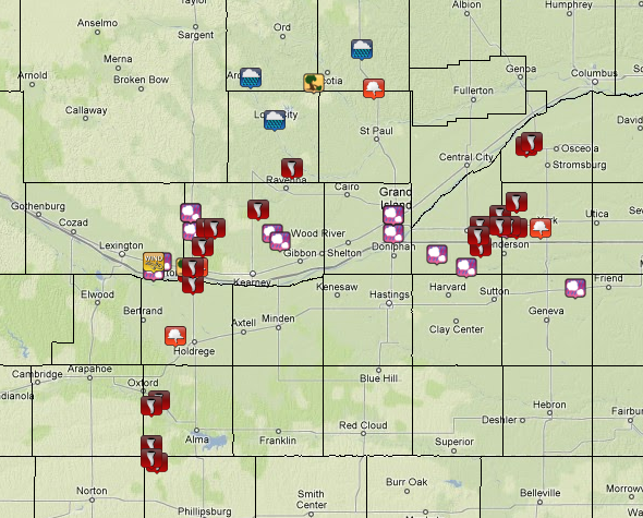 |
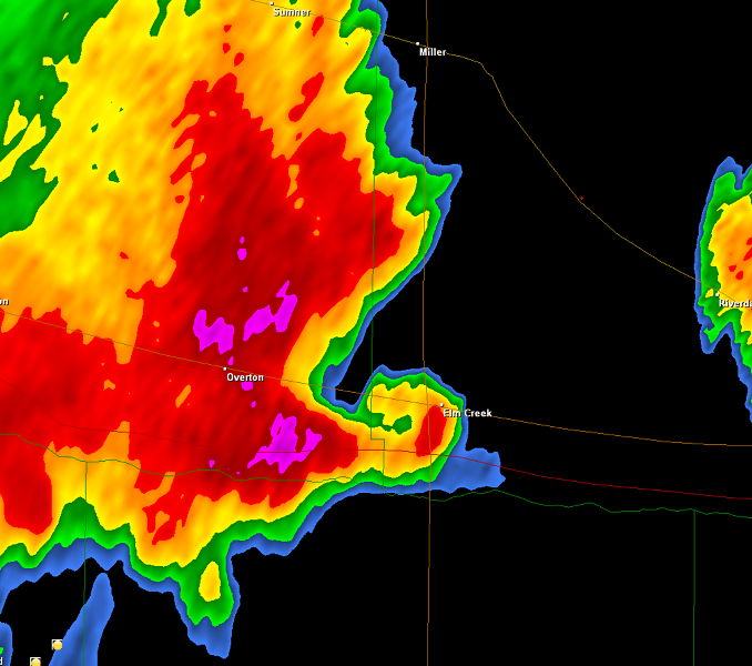
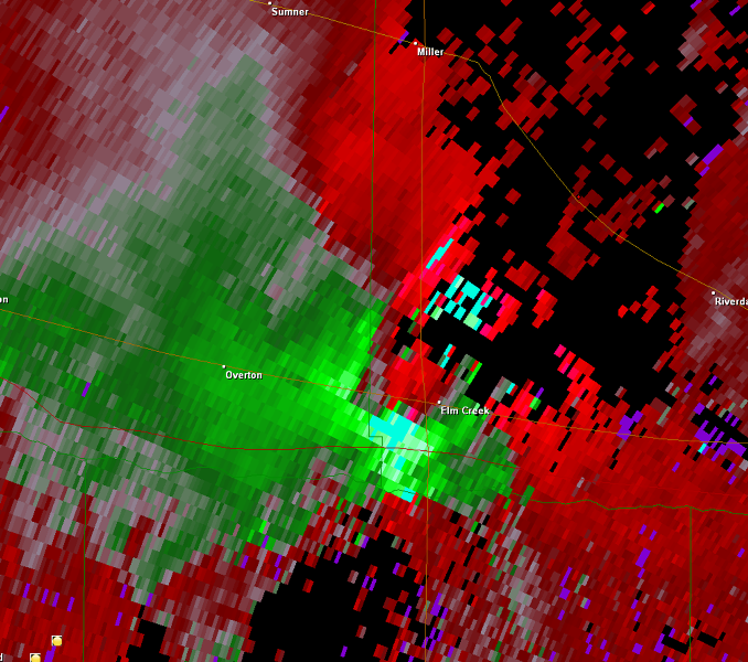
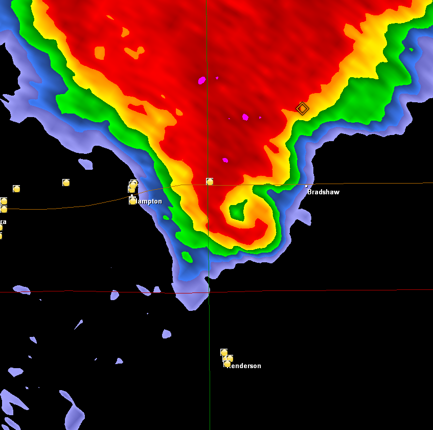
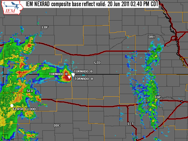
| The radar loop above shows the evolution of thunderstorm activity across south central Nebraska and north central Kansas during the afternoon and evening hours of June 20. | June 20, 2011 Preliminary Storm Reports. Click here for detailed reports. |
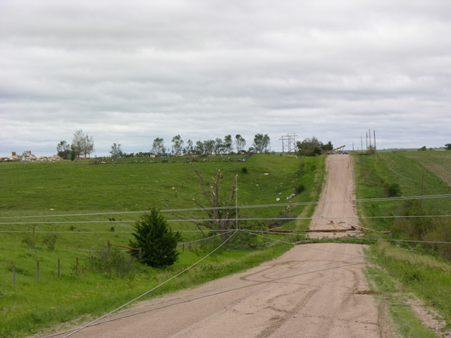
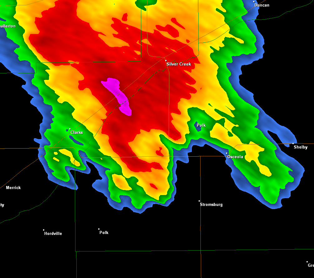
EF-3 Tornadoes: Amherst & Polk/Osceola
|
|
EF-3 Tornado - Polk/Osceola, NE (Polk County) (click link to the left for a separate page with additional photos and details)
 |
 |
 |
 |
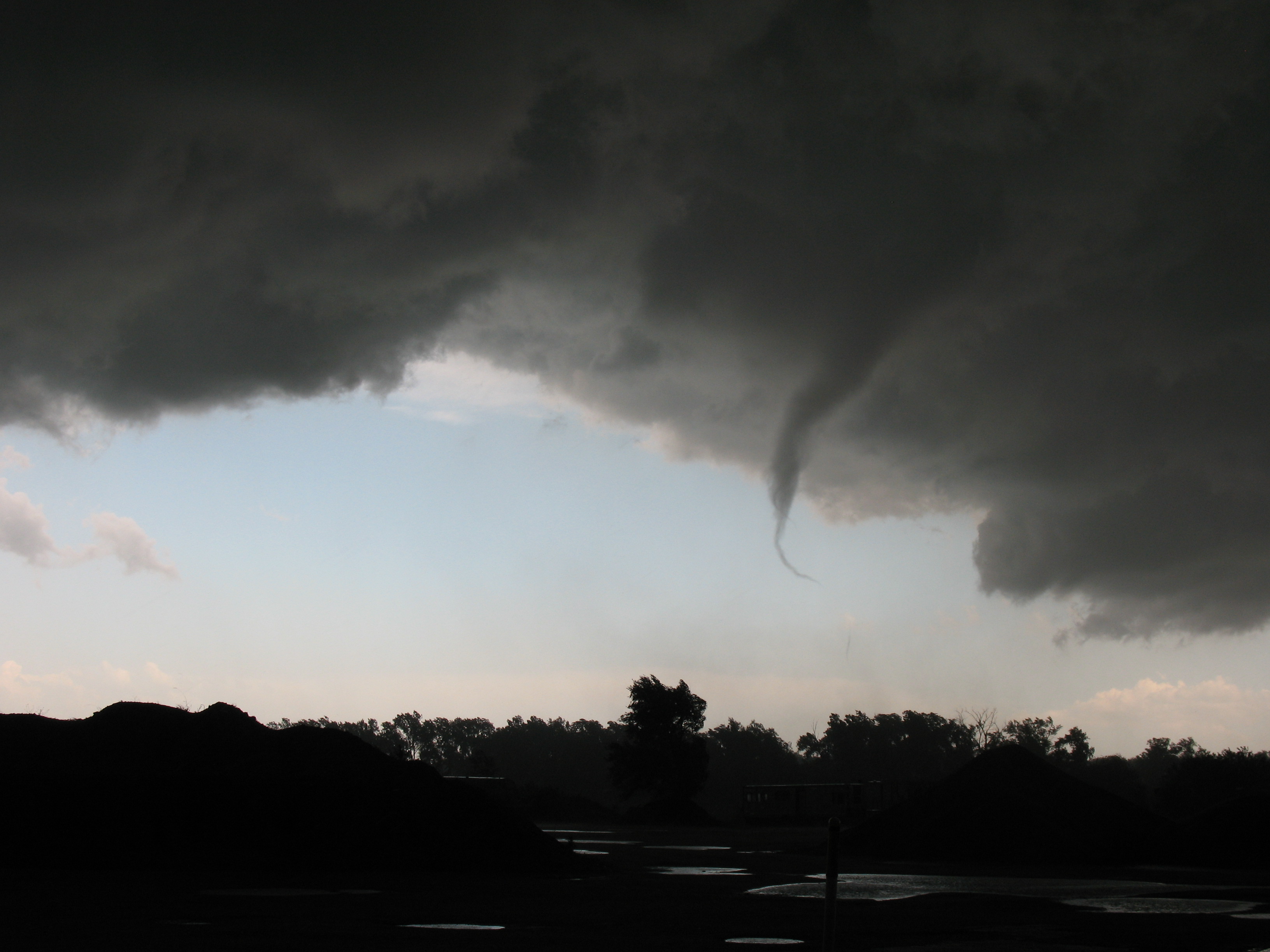
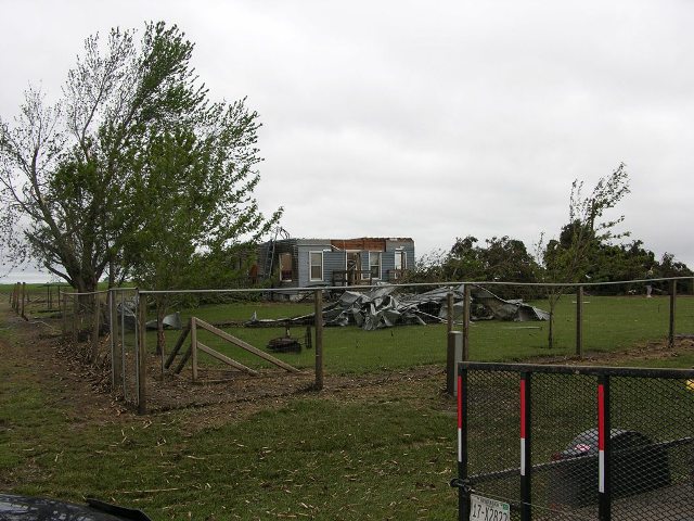
| A photo of the tornado by Tony Vogel, looking west from the outskirts of Osceola around 6:15 pm CDT. | House destroyed by the tornado on Highway 92 west of Osceola. Photo by NWS Staff. |
House destroyed by the tornado on Highway 92 west of Osceola. Photo by NWS Staff. |
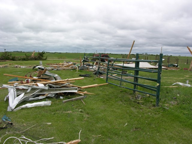
House destroyed by the tornado on Highway 66 near Polk. Photo by NWS Staff. |
 |
 |
 |
 |
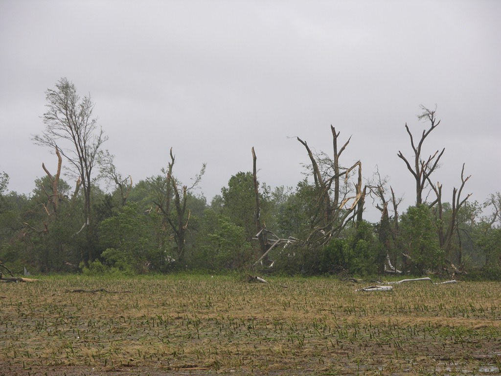
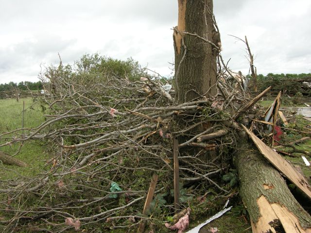
| Trees stripped by the tornado on Highway 92 west of Osceola. Photo by NWS Staff. |
Tractor crumpled and tossed in field on Highway 92 west of Osceola. Photo by NWS Staff. |
Twisted tree limbs and debris on Highway 92 west of Osceola. Photo by NWS Staff. |
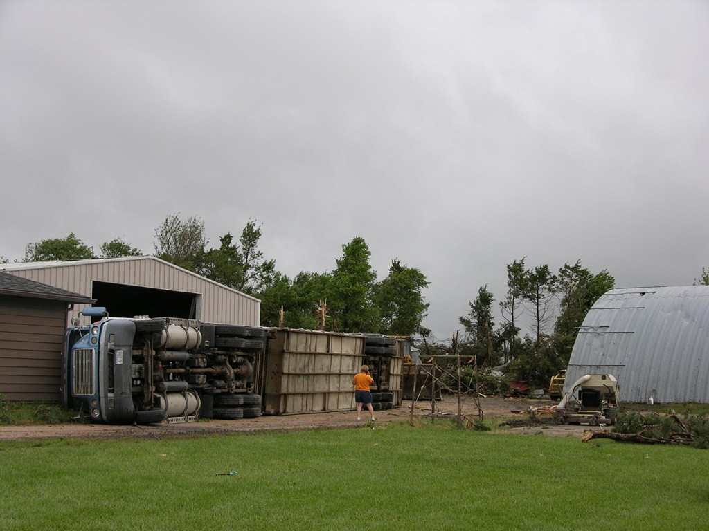
Semi overturned and tree damage by the tornado on Highway 66 near Polk. Photo by NWS Staff. |
 |
 |
|
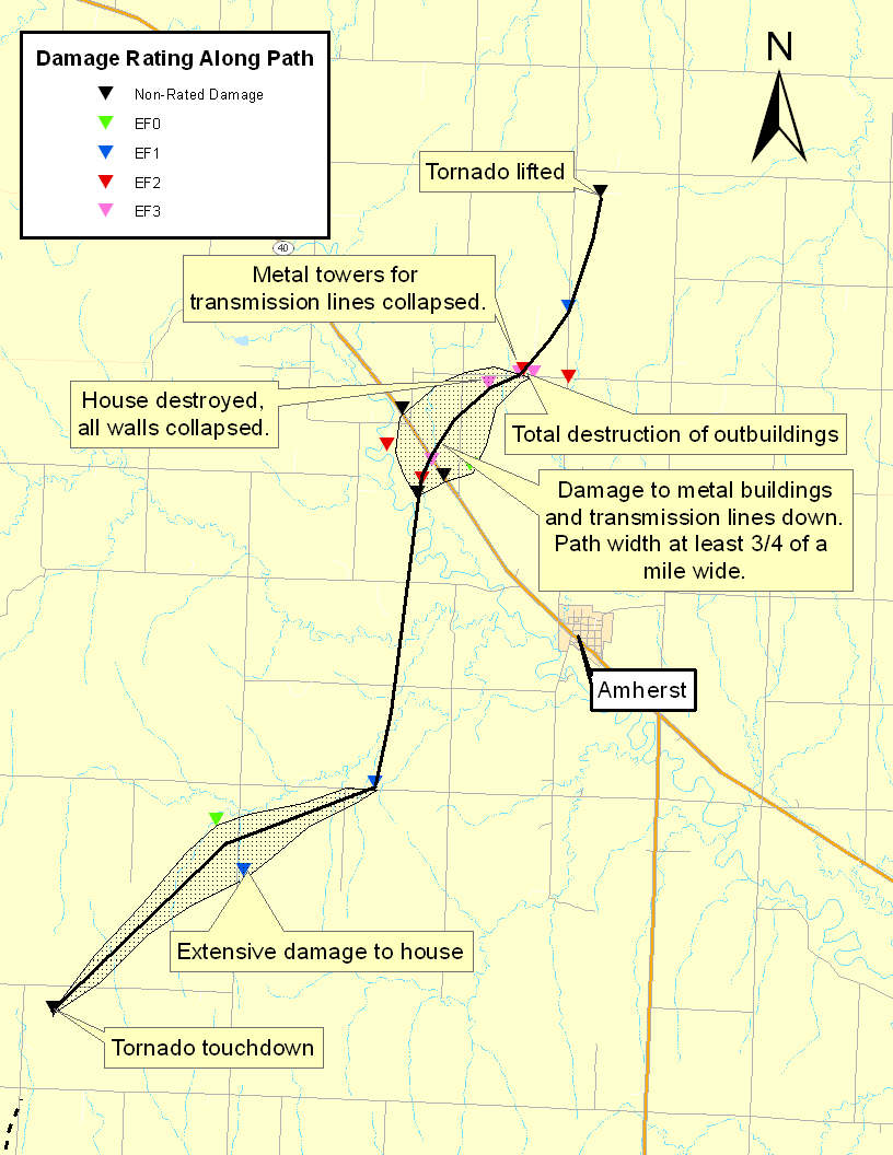
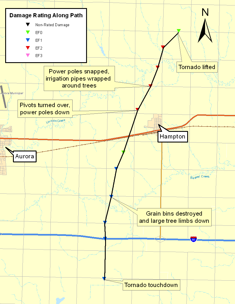
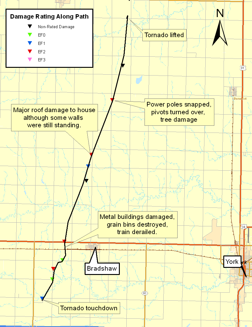
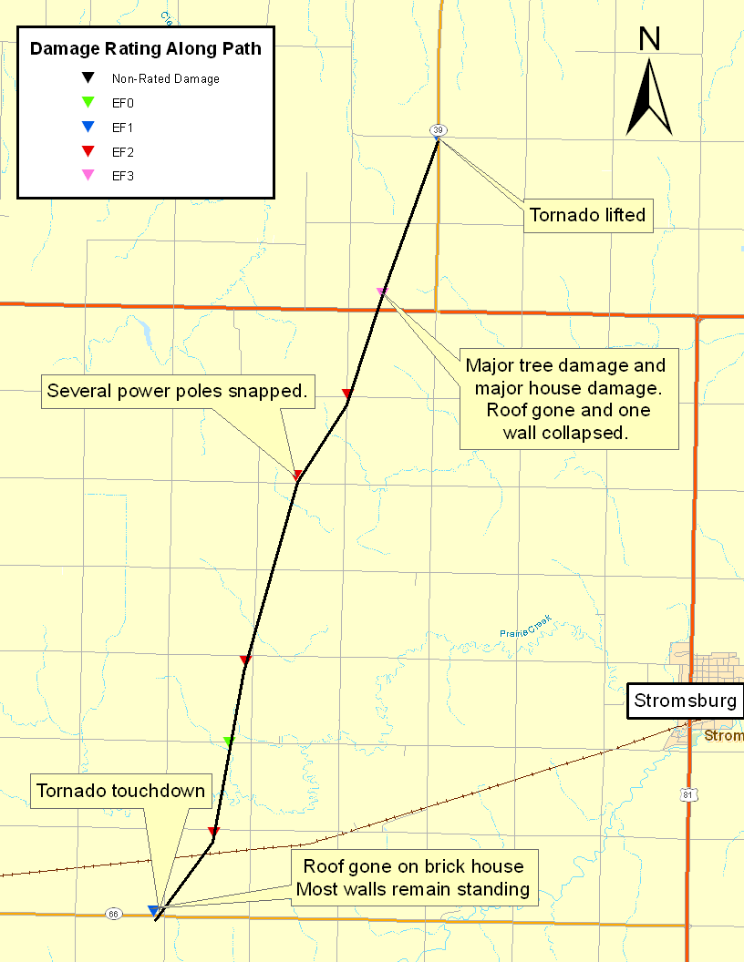
Storm damage survey and track of the Polk/Osceola tornado. |
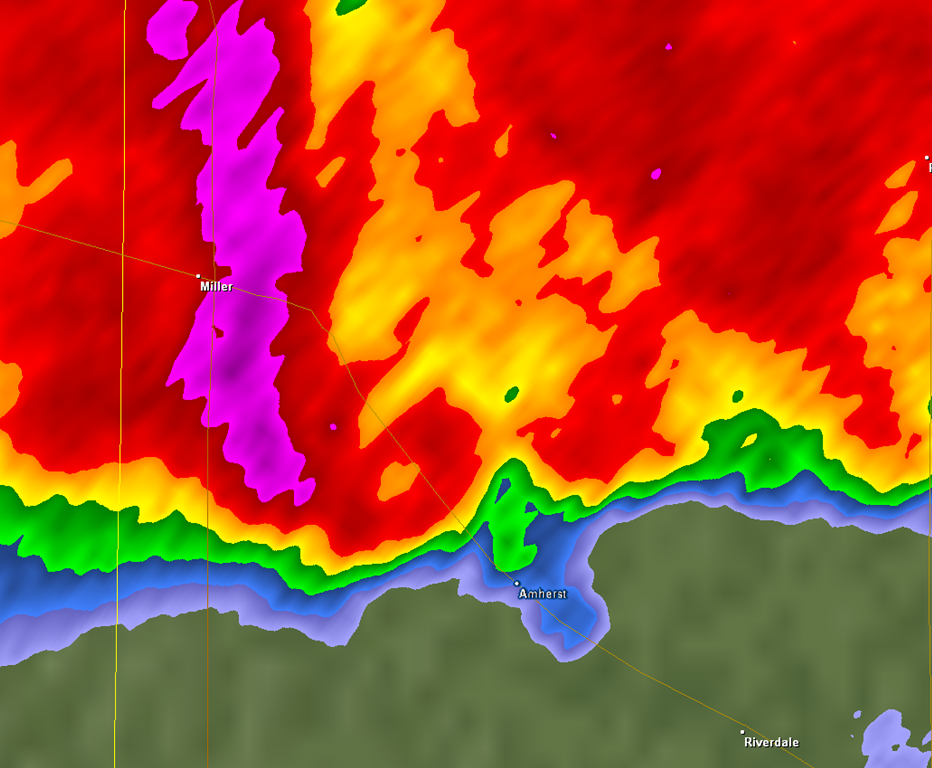
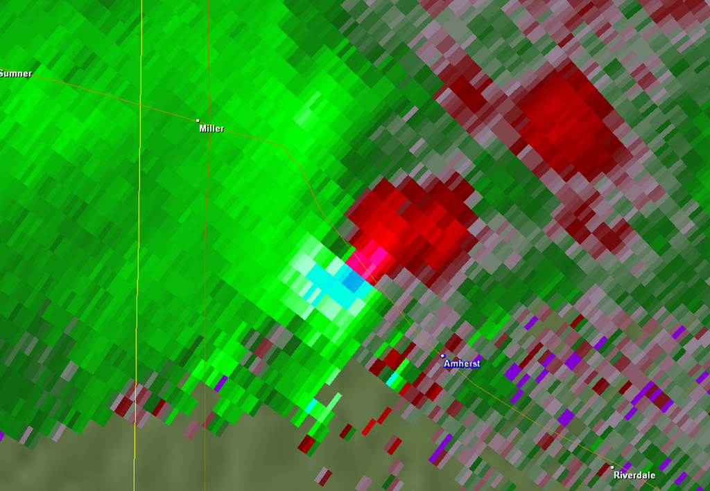
KUEX Reflevtivity from approximately 6:17 p.m. CDT. Tornado would have been on the ground on/near Highway 92. |
EF-2 Tornadoes: Elm Creek, Rockville, Hampton & Bradshaw
EF-2 Tornado - Elm Creek, NE (Buffalo County) (click link to the left for a separate page with additional photos and details)
|
|
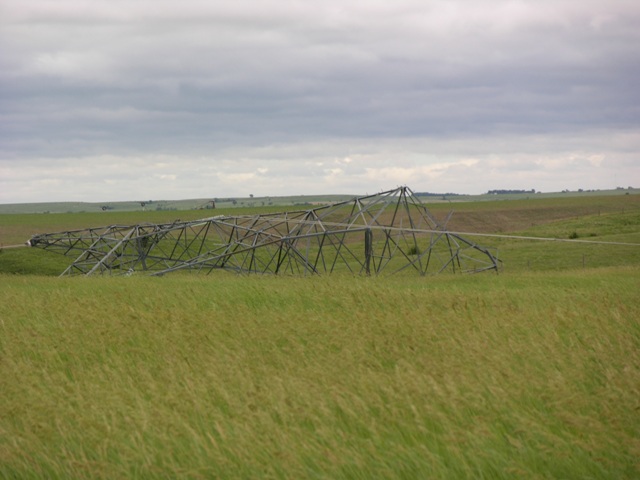
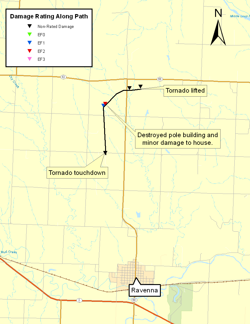
EF-2 Tornado - Rockville, NE (Sherman County)
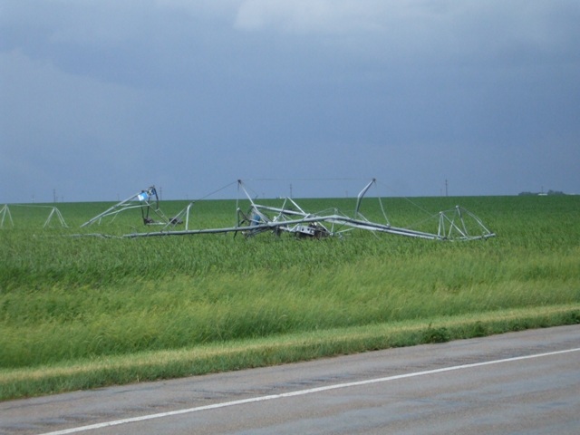
This tornado touched down approximtely 6 miles southwest of Rockville, moving to the north before taking a turn to the east as it approached the intersection of Highways 68 and 82A, and lifed approximately 4 miles southwest of Rockville. Along the path of this tornado, a pole building was destroyed and a home and surrounding trees sustained minor damage. The maximum wind speed of this tornado was estimated to be 120 mph.
 |
|
Storm damage survey map and track of Rockville tornado. |
|
|
EF-2 Tornado - Bradshaw/Polk, NE (York & Polk Counties) (click link to the left for a separate page with additional photos and details)
|
|
EF-1 Tornadoes: Long Island, KS, Stamford & North Loup, NE
EF-1 Tornado - Long Island, KS (Phillips County)
This tornado moved into northwest Phillips County approximately 5 miles west of Long Island, after affecting the Almena area in Norton County, shifting to the northeast before lifting approximately 4 miles northwest of Long Island. A few farm outbuildings sustained damage. The maximum wind speed of this tornado was estimated to be 90 mph.
EF-1 Tornado - Stamford, NE (Harlan County)
This tornado skipped along a path which started approximately 8 miles south of Stamford and ended approximately 4 miles north of Stamford. It was noted that this tornado was stationary and multi-vortex early on in its life, and as it shifted to the north destroyed an outbuilding, quonset, and grain bin. Numerous tree limbs were also knocked down. The maximum wind speed of this tornado was estimated to be 95 mph.
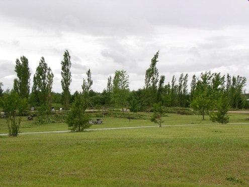
EF-1 Tornado - South of North Loup, NE (Valley County)
This tornado touched down near the Davis Creek Reservoir, or approximately 5 miles south of North Loup, and lifted approximately 4 miels south of North Loup. At the Davis Creek Campground, it was estimated ath 60 percent of the trees were damaged, and 2 restroom facilities suffered roof damage. The maximum wind speed of this tornado was estimated to be 90 mph.
 |
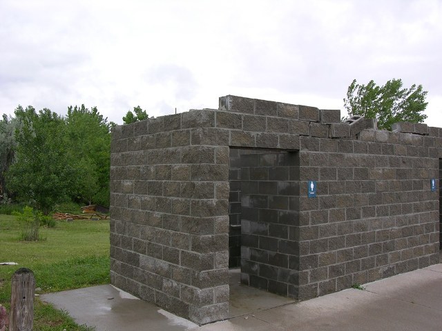 |
| Trees down at Davis Creek Reservoir. | Restroom facility unroofed at Davis Creek Reservoir. |
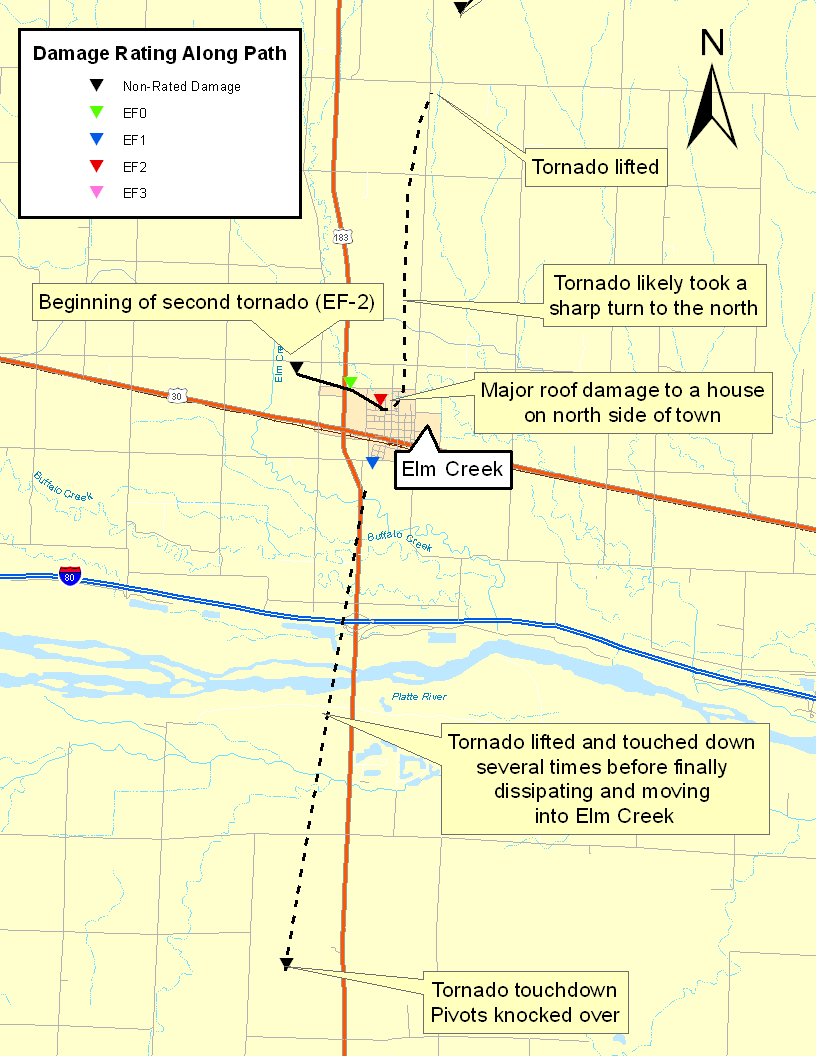
EF-0 Tornadoes: South of Elm Creek, Pleasanton & Farwell
EF-0 Tornado - South of Elm Creek, NE (Phelps & Buffalo Counties)
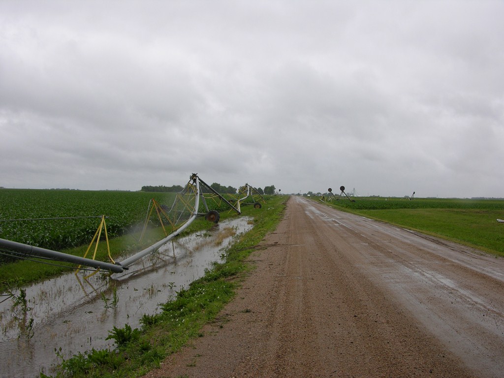
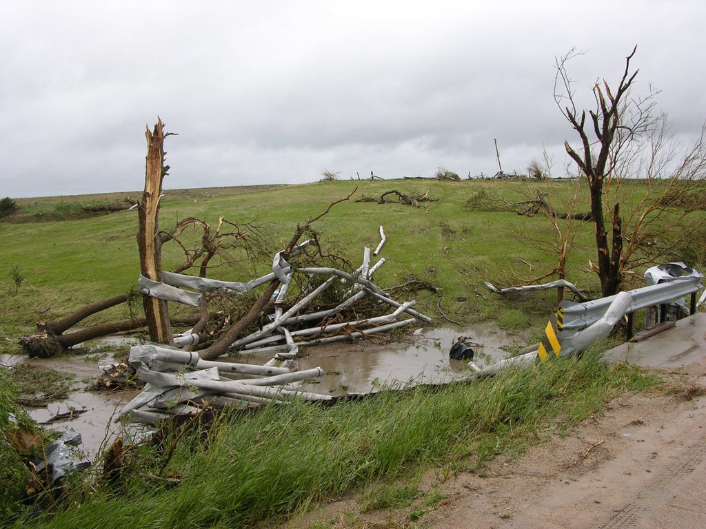
This tornado touched down in northern Phelps County, approximately 6 miles south-southwest of Elm Creek, and moved north into southern Buffalo County, dissipating just south of Elm Creek. This tornado lifted and touched back down several times along its path, with the main damage coming from overturned irrigation pivots. The maximum wind speed of this tornado was estimated to be 80 mph.
EF-0 Tornado - Pleasanton, NE (Buffalo County)
EF-0 Tornado - Farwell, NE (Howard County)
 |
|
Tornado near Farwell. |
|
With 12 confirmed tornadoes, several of them significant, this Monday afternoon proved to be the most active tornado day in over three years within the Hastings County Warning Area, since May 29, 2008. This severe weather outbreak primarily targeted western and northeast portions of the area, largely sparing locations south of the Highway 6 corridor between Holdrege and Geneva. The final tornado breakdown per the EF-Scale included two EF-3, four EF-2, three EF-1 and three EF-0. Despite considerable damage to mainly rural residences, these tornadoes resulted in no fatalities and only one known non-life threatening injury when a semi-truck was tipped over near Elm Creek in Buffalo County. This Elm Creek tornado was also the only one to directly strike a community, although there were several close calls within a mile or two of places such as Amherst, Hampton and Bradshaw. Interestingly, tornadic storms also spared the immediate Tri-City population centers of Grand Island, Hastings and Kearney, despite damaging events occurring nearby to both the west and the east. This was largely due to the fact that an expansive mid-level dry intrusion became anchored over central sections of South Central Nebraska and North Central Kansas, "protecting" this area from storm development. NWS Hastings would like to thank ALL storm spotters, law enforcement/emergency management, and storm chasers who assisted in providing a wealth of valuable severe weather and tornado reports during this event!
|
 |
 |
 |
|
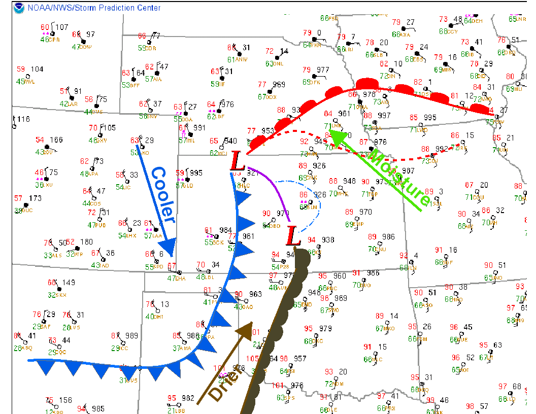
Central Plains surface weather map valid at 4 PM June 20, 2011, depicting low pressure system and fronts |
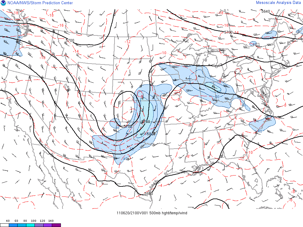
500 millibar analysis valid at 4 PM June 20th, depicting strong mid level low pressure system. |
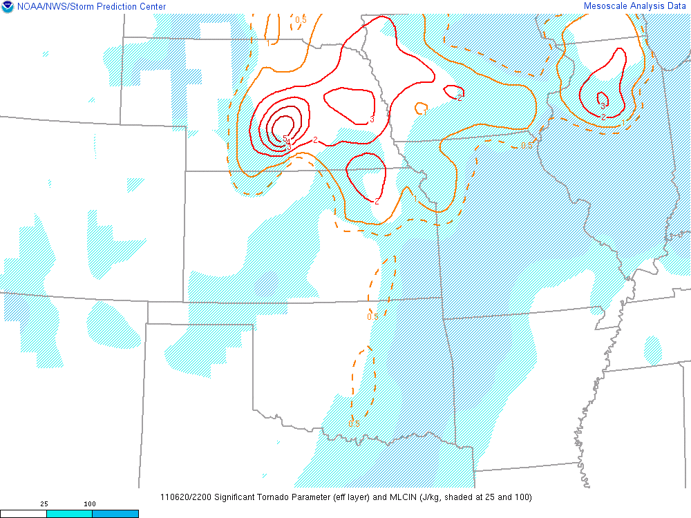
Analysis of derived "Significant Tornado Parameter" valid 5 PM June 20th |
 |
 |
 |
|
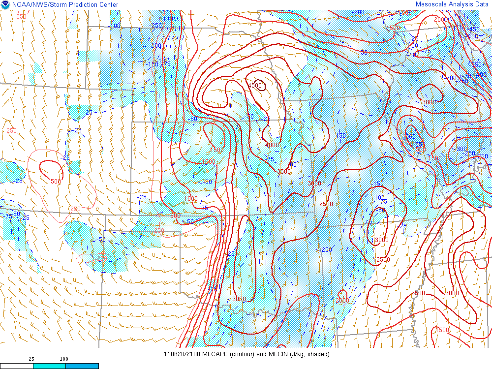
Mixed-layer Convective Available Potential Energy (MLCAPE) valid at 4 PM June 20th, 2011 |
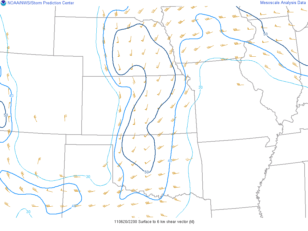
0-6 km bulk shear magnitude valid 5 PM, June 20th |
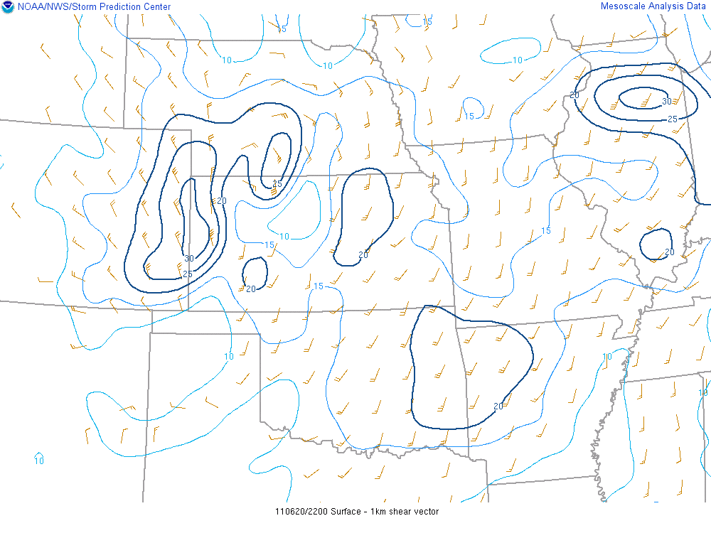
0-1 km bulk shear magnitude valid 5 PM, June 20th |
|
|
This page was composed by the staff at the National Weather Service in Hastings, Nebraska. |  |