A second Pacific cold front will cross the Pacific Northwest Wednesday followed by another atmospheric river. Each of these features will bring additional periods of gusty winds, mountain snow, and heavy to excessive rainfall with renewed flooding. Heavy lake effect snow continues into Tuesday east of Lakes Erie and Ontario. Read More >
| Fast Facts | Reports | Hail | Hail Safety | Meteorology & Radar | Other Links |
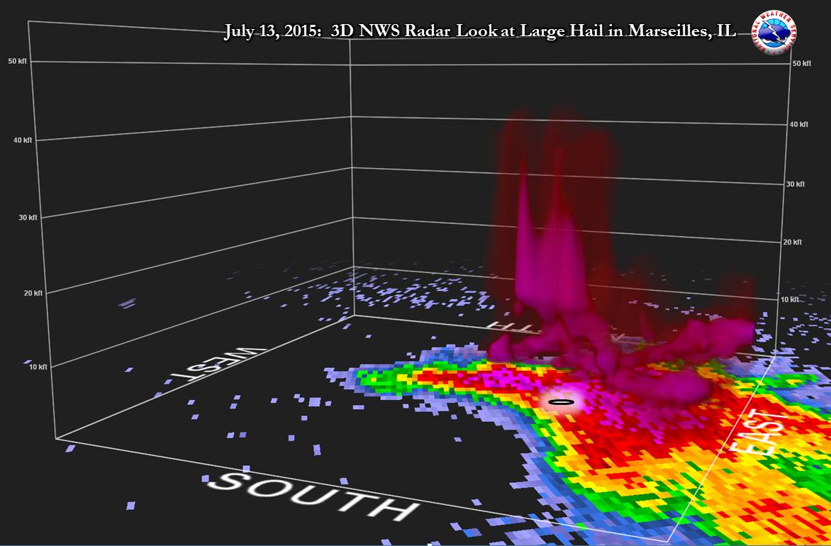
Many of the storms were supercells meaning they were well-organized and rotating. This rotation was observed by trained storm spotters with several of the storms and for long durations, including wall clouds and funnel clouds. Their reports were especially helpful to the warning process. For more on why only one tornado formed, please see the Meteorology & Radar section.
The possibility of severe weather on July 13th had been mentioned in NWS forecast products since the morning of July 10th.
 |
|
|
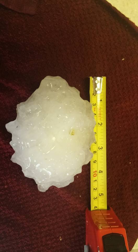
The National Weather Service received many photos of the large hail on July 13th and these visual reports assisted us with warning messages to better stress the dangerous nature of the storms, as well as verification efforts after. Thank you!
It is important to remember that severe storms are dangerous, and hail to the size of Monday's can injure and be deadly. While photos may be beneficial to us, ensure safety first and foremost. It is absolutely fine if the hail pictures have to wait to after the storm has ended, because after all, hail of this size will take quite a while to melt!
A reminder that the best place to be in severe storms is inside and central in a sturdy structure, away from windows, and putting as many walls between you and the severe storm as possible.
The primary storm mode during the mid-afternoon through late evening on July 13th was supercellular, that is the storm by definition had a rotating updraft. Rotating updrafts tend to be stronger and result in a tilting of the updraft, which keeps the storm better organized and is more supportive of a longer lifecycle, and thus increased chances for severe weather.
Many of the storms on July 13th had rotation in the lower levels that was visible from the ground by trained storm spotters. However, only one of storms in the NWS Chicago County Warning Area produced a tornado despite relatively favorable, broad (synoptic) scale parameters for tornadoes such as moderate shear, very high instability, and at least somewhat of a defined focus at first (old outflow boundary). The lack of tornadogenesis was thought to be due to a few variables on July 13th, some of which may have been more of a key factor than others. These deterrents were hypothesized to be:
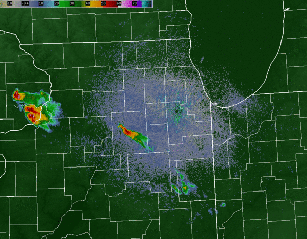
| NWS Chicago Doppler Radar 0.5° Base Reflectivity Loop: 5:15 pm - 10:30 pm |
 |