
Gusty winds are expected from portions of the Mid-Atlantic into the Northeast through the night following the system that brought rain to the area. An atmospheric river will move into the Northwest late today into Saturday bringing moderate to heavy rainfall, mountain snow, windy conditions, and high surf to the area over the weekend. Read More >
FORECAST OPERATIONS
At one time, creating a forecast meant sitting down at a computer, opening a word processor, and manually typing the anticipated conditions across a "zone". Zones comprised a group of counties which would experience similar conditions.
That was not long ago– this process of forecast creation (left image) lasted well into the 1990s. At that time it
However, the increase in capacity and sophistication of 21st Century computing has resulted in a tremendous advancement in spatial and temporal resolution of forecast products. At the same time, the Internet has made rapid delivery of detailed graphical depictions possible. The marriage of the two has resulted in a shift away from the written word.
Now, each local office maintains a database of digital forecast grids, with more than one thousand gridded fields. These
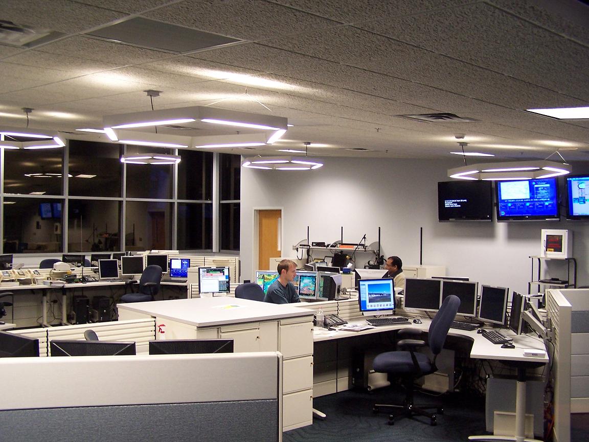
In the image to the right is the forecast operations center. This is where all forecasts for our County Warning Area are made. The forecast position in front is the short term forecast desk, and in back is the long term desk. The continuous weather watch is conducted from the short term desk. All forecast decisions and products in the near term are made here, with decisions in the later periods originating from the long term side. Usually a 24 hour breakpoint is used between the two desks, but that can vary depending upon the weather pattern and the individual workloads of the forecast team. Our operational support desk sits to the left (behind the bookcases). This person keeps NOAA Weather Radio running, conducts our upper air balloon observations, reviews hydrology data, and performs various other tasks to keep forecast operations running smoothly. Each of these topics will be addressed later.
In addition to contributing to the first day or so of the traditional 7 day forecast, the short term forecaster also contributes to the first day of the Coastal Waters (marine) Forecast. They are responsible for terminal forecasts (called TAFs) and route forecasts (TWEBs) for aviation purposes; these products are issued every 6 hours, and updated as needed. This forecaster is also responsible for fire weather forecasts and spot briefings, and Short Term Forecasts as the weather requires. "Short fused" warnings, such as for Severe Thunderstorms, Tornadoes, Flash Floods, and marine warnings, would be the decision of this person as well. As you can tell, a lot of responsibility falls on this one person during active weather days. That would be when some of the workload is shifted to the long term forecaster. In warning situations, additional staff would be on hand or called in to assist with all these duties. They would occupy the extra workstations in the foreground. The warning process is explained in greater detail under the radar operations section of this tour.
Meanwhile, the long term forecaster is responsible for most of the 7 day forecast, traditionally distributed via radio and other media sources. "Longer fused" items, such as winter storm watches/warnings, windchill or heat advisories/warnings, and flood watches-- to name a few-- would be the responsibility of this person.
Before forecasters decide what the forecast will be, they need to review the latest weather information. That process will be described on the next page.
|


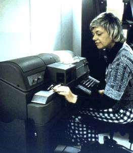 represented a big step forward from previous techniques, such as teletype (right image), which was our primary mode of communication through the 1970's, and into the early 1980's.
 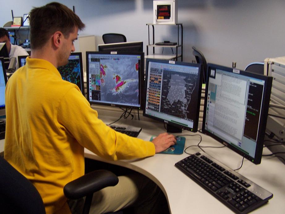 grids are used locally to create forecast products in numerous formats. The grids are also submitted to the National Digital Forecast Database [NDFD]. The NDFD is a mosaic of weather elements. The data can be accessed by users to drive many site specific applications. Details regarding the NDFD can be found on the National Weather Service website at:
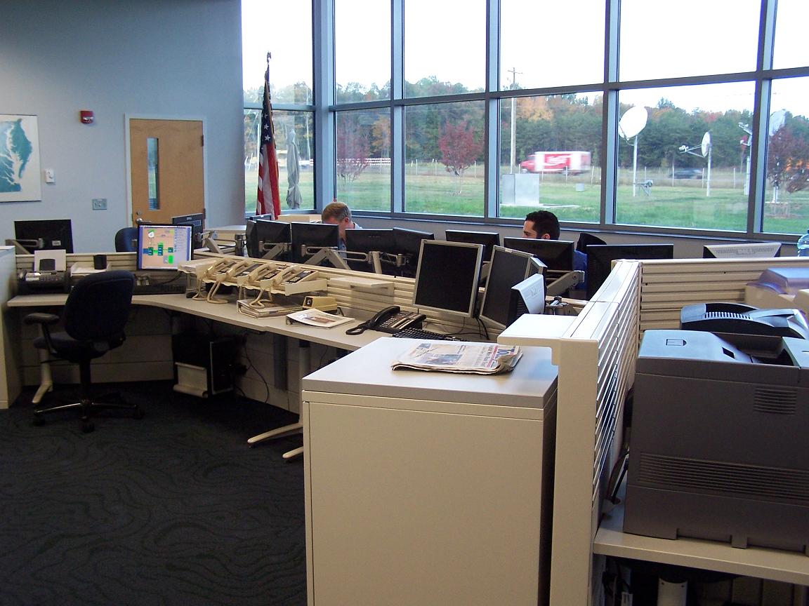
 Coastal Flood
 FAQ
FAQ