
Synopsis
 A slow moving upper level disturbance over eastern Texas combined with a stalled frontal boundary just south of the Alabama and northwest Florida coastline (seen in the AWIPS graphic to the right). This helped to produce widespread showers and storms across coastal Alabama and northwest Florida beginning on June 8th.
With a deep tropical airmass in place, these storms produced rainfall rates of 2-3 inches per hour and continuously trained on June 9th and 10th over Mobile and Baldwin Counties in southern Alabama and Escambia and Santa Rosa Counties in northwest Florida. The heaviest rainfall occurred between 12 and 18 UTC on the 9th. Yet another band of heavy rain moved across the area between 12 and 18 UTC on the 10th. While the majority of the shower and storm activity ended on the 10th, Mobile County received one last surge of rainfall on the 11th.
Some locations received over 1 FOOT of rain which caused life-threatening flash flooding. Numerous roads, businesses and residences were flooded and some water rescues and evacuations had to be carried out. 3 Flash Flood Emergencies were issued due to high water rescues and a private dam failure in southern Mobile County.
Radar loop coming soon!
As the rainfall graph below shows, KPNS (ASOS station in Pensacola, FL) went from 0.72" of rain at 12 UTC on the 9th to an astonishing 12.99" of rain by 21 UTC on the 9th. That is more than 12 inches of rainfall in 9 hours! KPNS recorded 15.07" of rainfall during this multi-day heavy rainfall event and KMOB (ASOS station in west Mobile, AL) recorded 11.91" of rain during this event.

Rainfall Totals (CoCoRaHS Timeframe: June 7th at 7am - June 12th at 7am)
| FLORIDA TOTALS | ||
| Location | Rainfall (inches) | Source |
| West Pensacola 10.9 SW | 27.72 | CoCoRaHS |
| Pensacola (Chandelle Subdivision) | 21.60 | Spotter |
| Milton 10.9 SSW | 18.44 | CoCoRaHS |
| Pensacola 4.8 N | 15.42 | CoCoRaHS |
| Pensacola 3.8 N | 15.27 | CoCoRaHS |
| Pensacola International Airport | 15.07 | ASOS |
| Pensacola Naval Air Station | 14.67 | ASOS |
| Ensley 2.1 ENE | 12.24 | CoCoRaHS |
| Bellview 1.7 NW | 12.06 | CoCoRaHS |
| Escambia County EOC | 9.94* | EMA |
| Gulf Breeze | 9.14* | Spotter |
| Pace 2.4 N | 9.00 | CoCoRaHS |
| Gulf Shores | 8.80 | ASOS |
| Crestview 2.8 NNW | 6.19 | CoCoRaHS |
*2-day total June 8 & 9
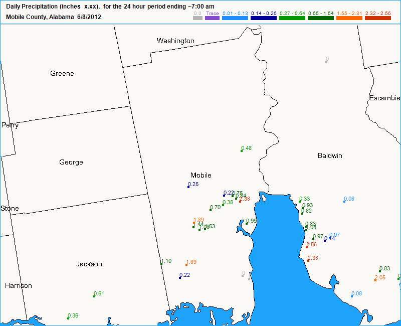
Commentary for the Daily CoCoRaHS Precipitation Report from June 10th at the West Pensacola 10.9 SW station is displayed on the right.
| ALABAMA TOTALS | ||
| Location | Rainfall (inches) | Source |
| Tillmans Corner 4.3 WNW | 22.68 | CoCoRaHS |
| Mobile 10.2 WSW | 21.29 | CoCoRaHS |
| 8 S of Mobile Regional | 18.83 | Spotter |
| Mobile 11.9 WSW | 17.92 | CoCoRaHS |
| Mobile 11.4 WSW | 17.38 | CoCoRaHS |
| Mobile 7.4 W | 17.25 | CoCoRaHS |
| Orange Beach 3.0 ENE | 14.77 | CoCoRaHS |
| Mobile 4.4 WNW | 14.56 | CoCoRaHS |
| Mobile 1.2 WSW | 13.52 | CoCoRaHS |
| Mobile 4.7 W | 13.17 | CoCoRaHS |
| Mobile 2.6 WNW | 13.05 | CoCoRaHS |
| Mobile 5.1 S | 12.95 | CoCoRaHS |
| Mobile 1.8 W | 12.82 | CoCoRaHS |
| Orange Beach 2.1 NE | 12.79 | CoCoRaHS |
| Grand Bay 0.6 NW | 12.35 | CoCoRaHS |
| Mobile Regional Airport | 11.91 | ASOS |
| Mobile 5.7 WSW | 11.61 | CoCoRaHS |
| Wilmer 7.9 SE | 11.26 | CoCoRaHS |
| Orange Beach 1.3 E | 11.11 | CoCoRaHS |
| Foley 2.0 SSW | 10.98 | CoCoRaHS |
| Fairhope 1.5 WSW | 10.1 | CoCoRaHS |
| Brookley Field | 6.78 | ASOS |
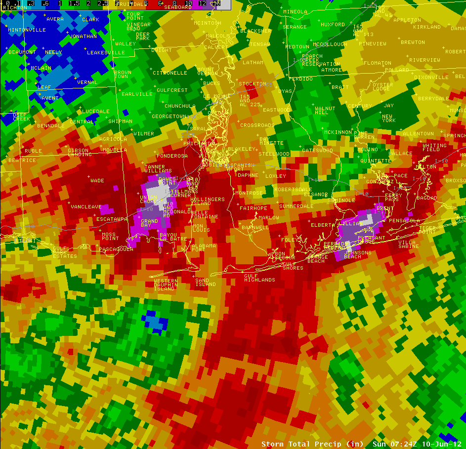
The graphic below (from our AWIPS system) shows the Storm Total Precipitation (June 7-10) from KMOB Radar. The highest radar estimates were around 15”, but the radar slightly underestimated the rainfall totals.
Records
KPNS (Pensacola, FL ASOS) recorded 13.11” which was the 2nd highest 1-day rainfall ever recorded.
KMOB (Mobile, AL ASOS) set a daily rainfall record with 5.79”, breaking the old record of 1.39” set in 1968.

Storm Reports
Escambia County EMA reported most of West Pensacola was flooded, included most roads and several residences and businesses. The first floor of Baptist Hospital in Pensacola, FL had water in it.
Water entered houses in Perdido Bay, FL.
100 people had to be evacuated from an apartment complex in Warrington, FL (just west of Pensacola) due to rapidly rising flood waters.
Santa Rosa County EMA reported water entering residences in Gulf Breeze, FL. Numerous roads were closed due to flooding.
Numerous roads were covered with water in southern Baldwin County.
Numerous roads in Mobile County were flooded. Mobile County EMA reported water rescues were conducted on Gunn Road, Merwood Court and Wakefield Road.
14 acre private lake dam failed near Dawes Lake Road and Nugget Drive in southern Mobile County. This resulted in flooding of homes in the subdivision.
The following event pictures were received from the Florida Division of Emergency Management.


The first picture shows major street flooding along Hwy 90 & McDonald Road east of St. Elmo, AL. The next 2 pictures from Pensacola, FL show a bridge washed out and Burger King flooded at Brent Lane & US Hwy 29.

Last picture shows the major street flooding at Airport Road and 9th Avenue in Pensacola, FL.
Acknowledgements: Page created by Morgan Barry (Forecaster), Gene Jacobi (OPL) and Ryan Rogers (forecaster).
LAST UPDATED: October 2016

