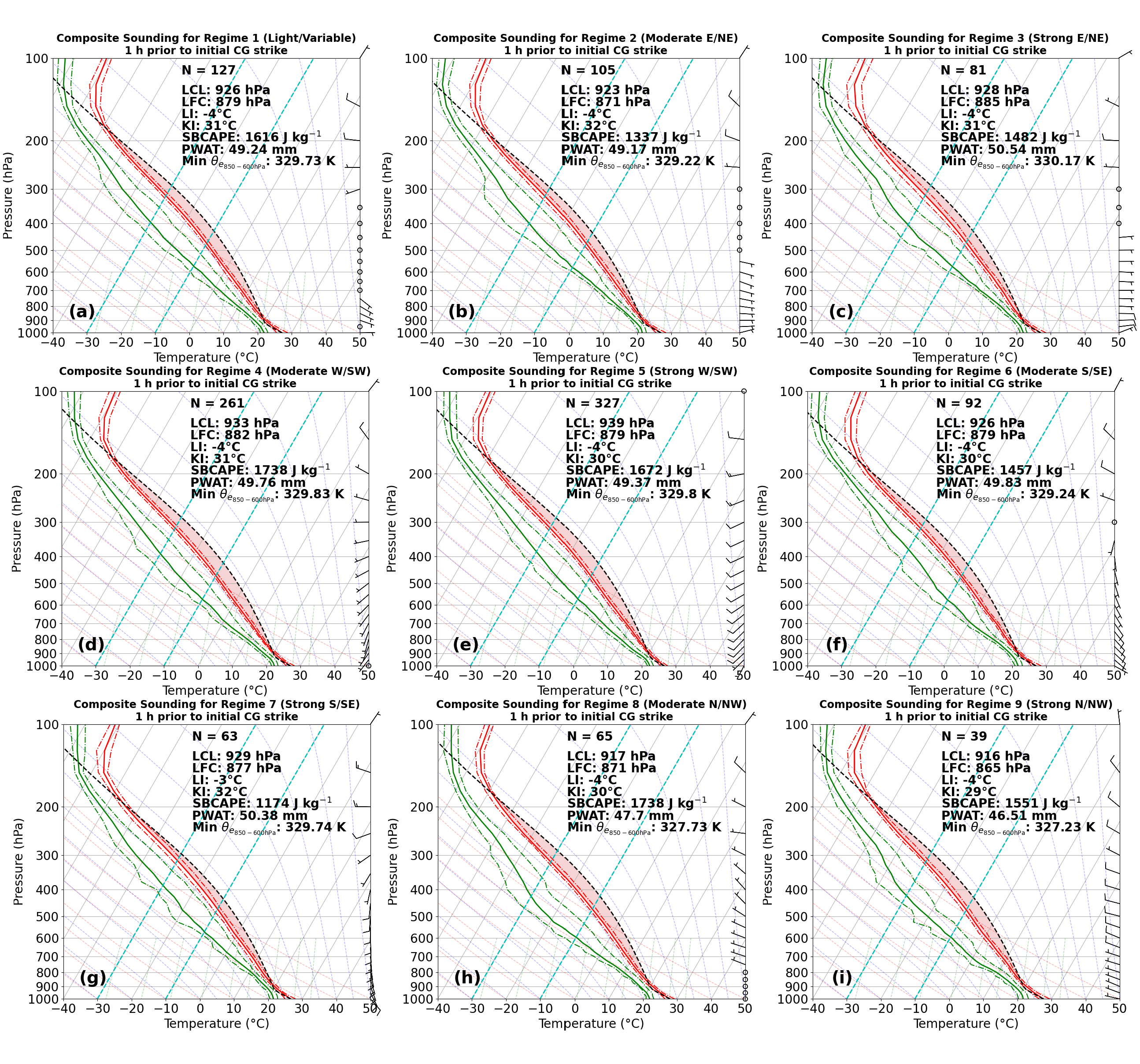
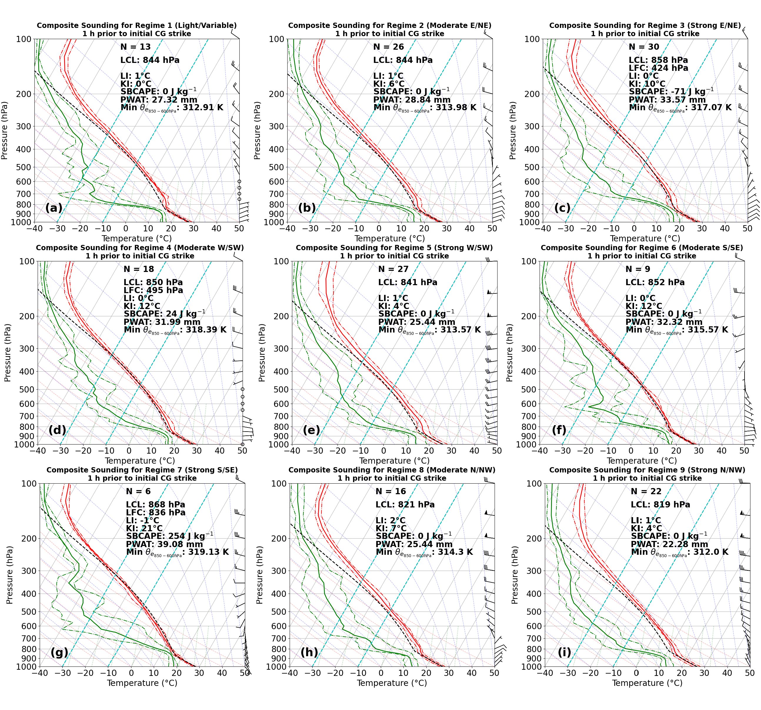
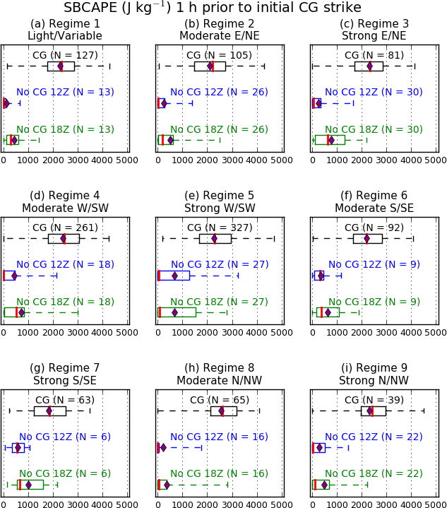
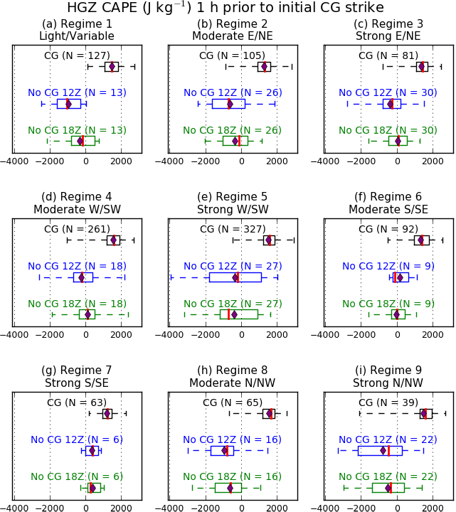
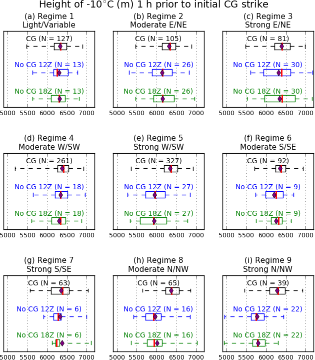
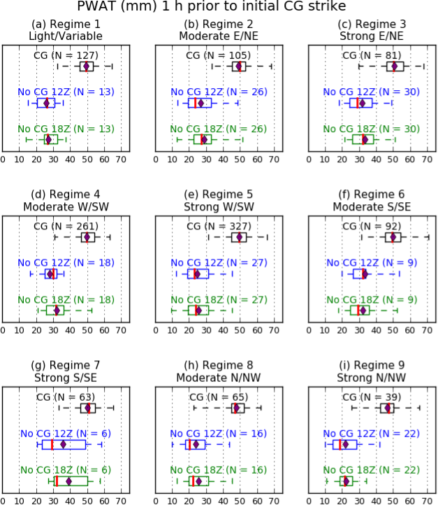
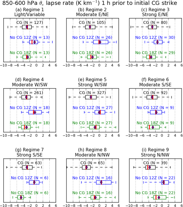
This study focused on the NWS Tampa Bay County Warning Area. NOAA RAP model analysis data was used to partition events into nine NWS Tampa Bay flow regimes (below left) based on 1200 UTC mean vector wind in the red box on the below right image. These regimes were the same ones used to create the Florida Summer Thunderstorm Climatology web pages. First Cloud-to-Ground (CG) and non-CG (null) events were identified for May-September (2012-2021) using USPLN lightning data between 1200 and 2359Z. Composite soundings display the mean and 25th/75th percentile vertical temperature and dewpoint profiles and composite mean convective parameters for first CG events in each regime one hour before a first CG event and at 1800 UTC for non-CG (null) events. Environmental parameter distributions use box-and-whisker plot approach for first CG events at -1 h and non-CG events at 1200 and 1800 UTC |
||
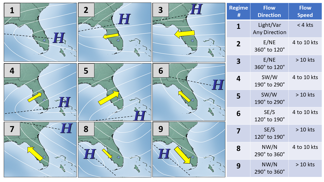
Flow Regimes |
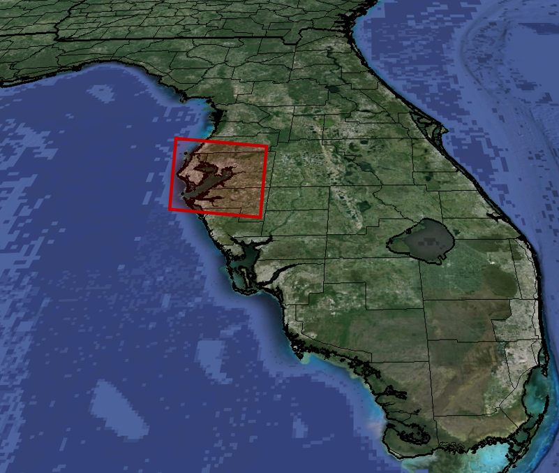
Regime Analysis Box |
|
|
All images on this page can be magnified by clicking, and resized back to original size with a second click. |
||
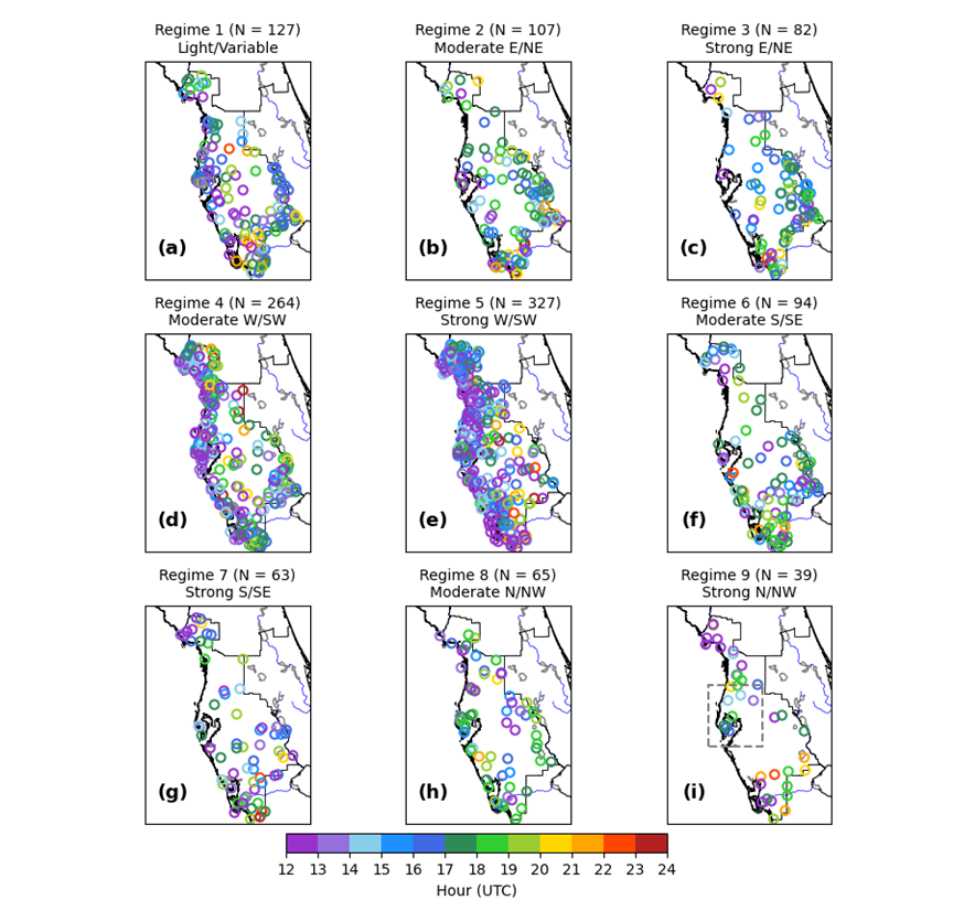
Spatiotemporal Distributions of First CG Events: |
Spatial Distribution |
 |
| |
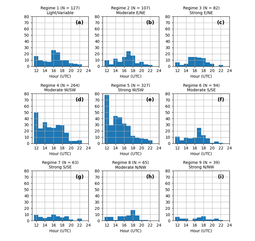
Temporal Distribution |
 |
Composite Environmental Soundings: |
First CG Events |
 |
| |
Non-CG Events |
 |
Convective Parameter Distributions: |
CAPE |
 |
| |
CAPE in Hail Growth Zone (-10 to -30℃ layer) |
 |
| |
Height of -10℃ Surface |
 |
| |
Precipitable Water |
 |
| |
Convective Stability |
 |