
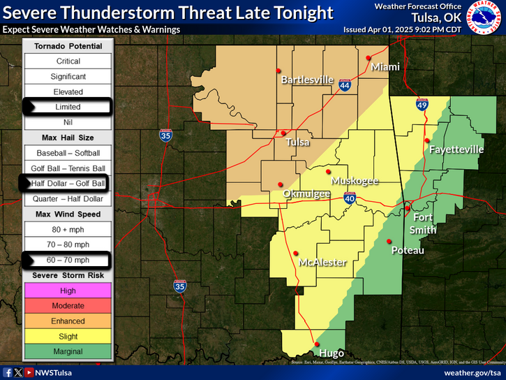
Isolated strong to severe thunderstorms are possible in parts of the Midwest and the south-central Plains. Heavy rainfall pose a risk of flash flooding in the Desert Southwest and northeast New Mexico, especially in burn scars, and in the urban corridor of southeast Florida. Read More >
Last Map Update: Fri, Sep 20, 2024 at 4:07:08 am CDT
| Latest Text Product Selector (Selected product opens in a new window) | |
 |
 |
 |
 |
 |
 |
| Decision Support | Hazards | Models | Observations | Climate | Hydrology |
 |
 |
 |
 |
 |
 |
| Social Media | Satellite | Fire Weather | Weather Radio | Spotter Training | Text Products |


 Tulsa Radar
  Weather Map
 Fort Smith Radar