
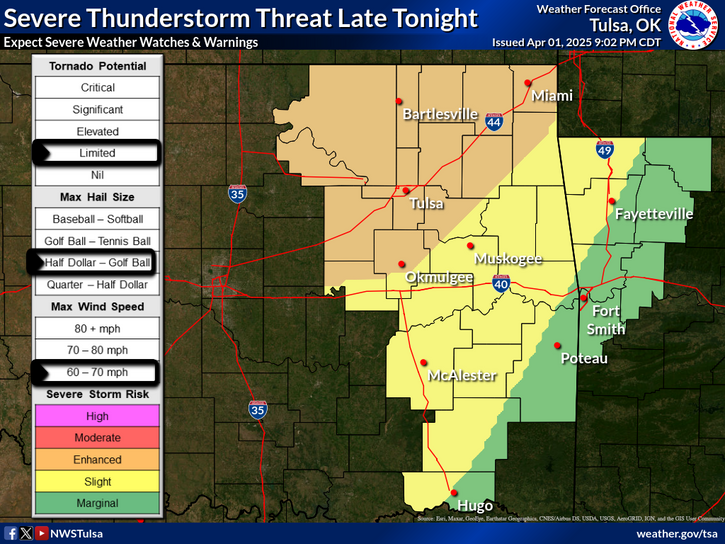
Isolated severe thunderstorms are forecast Monday afternoon from the Ozarks into parts of the Tennessee and lower Ohio Valleys. A tropical disturbance could form by the middle part of next week over the northwestern Caribbean Sea. Gradual development is possible as it moves into the Gulf of Mexico late week with possible U.S. impacts next weekend. Read More >
Last Map Update: Mon, Sep 23, 2024 at 5:28:27 am CDT
| Latest Text Product Selector (Selected product opens in a new window) | |
 |
 |
 |
 |
 |
 |
| Decision Support | Hazards | Models | Observations | Climate | Hydrology |
 |
 |
 |
 |
 |
 |
| Social Media | Satellite | Fire Weather | Weather Radio | Spotter Training | Text Products |


 Weather Map
 Fort Smith Radar