
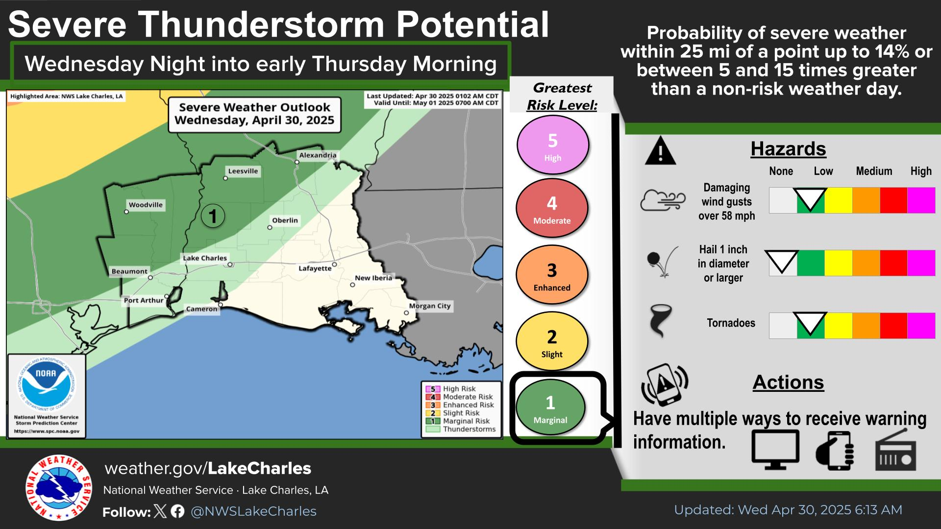
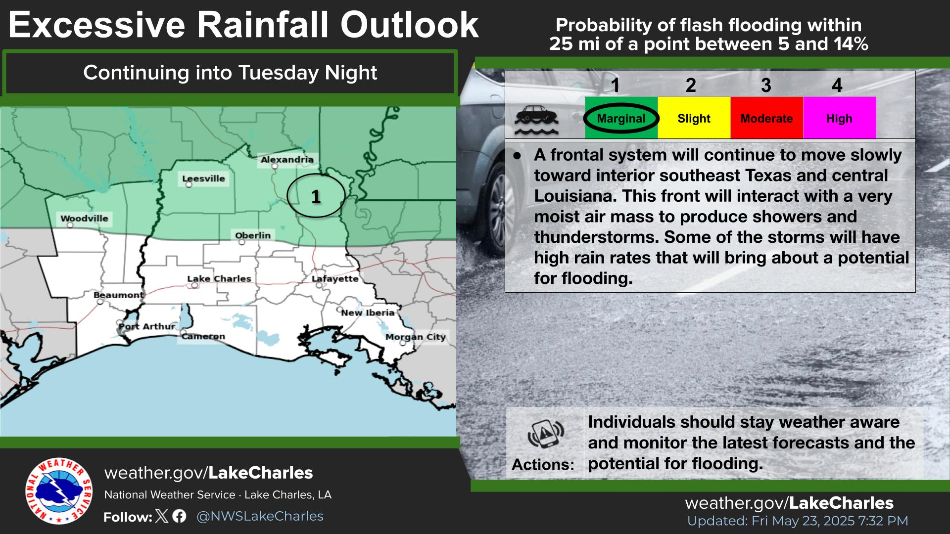
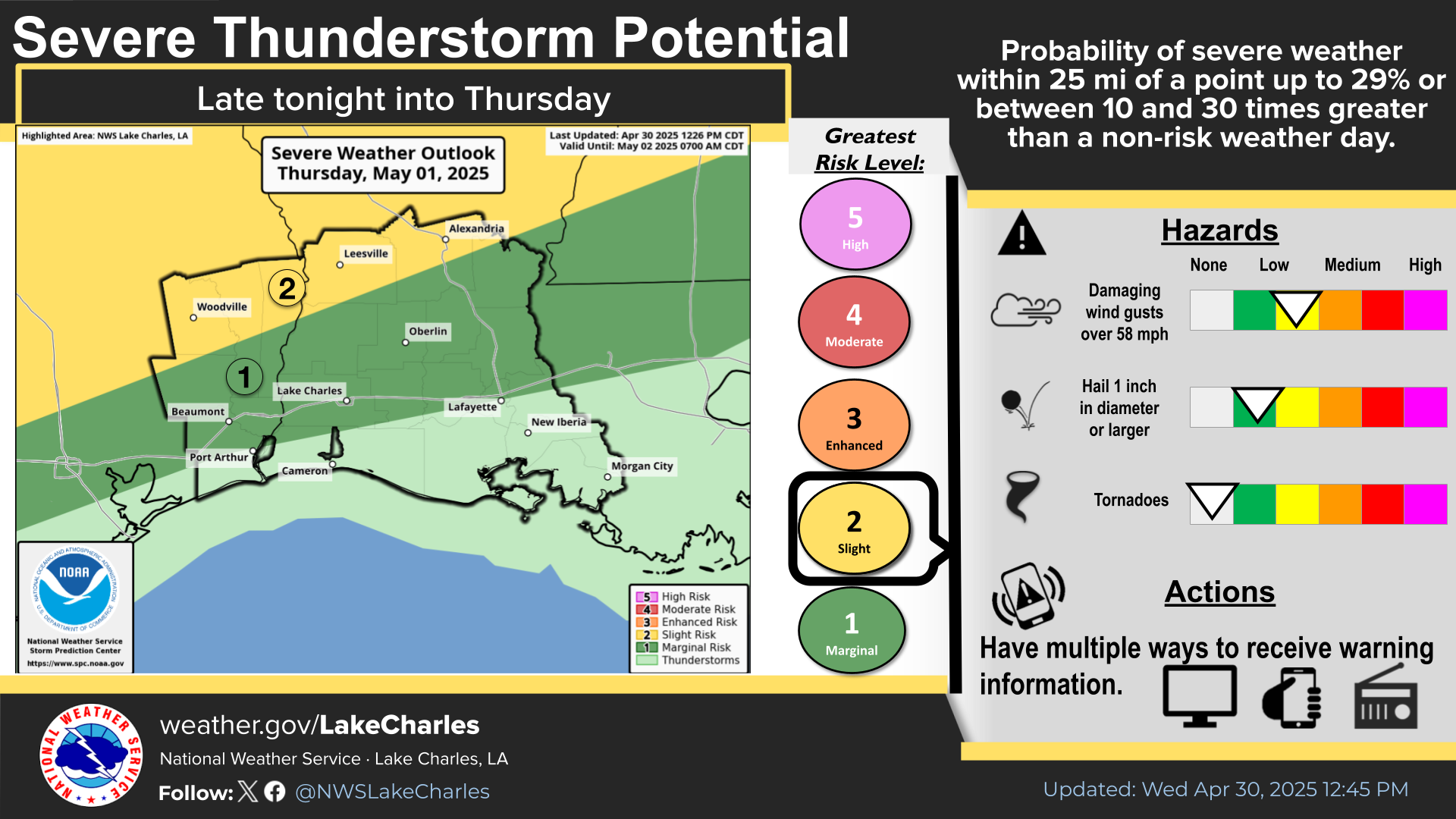
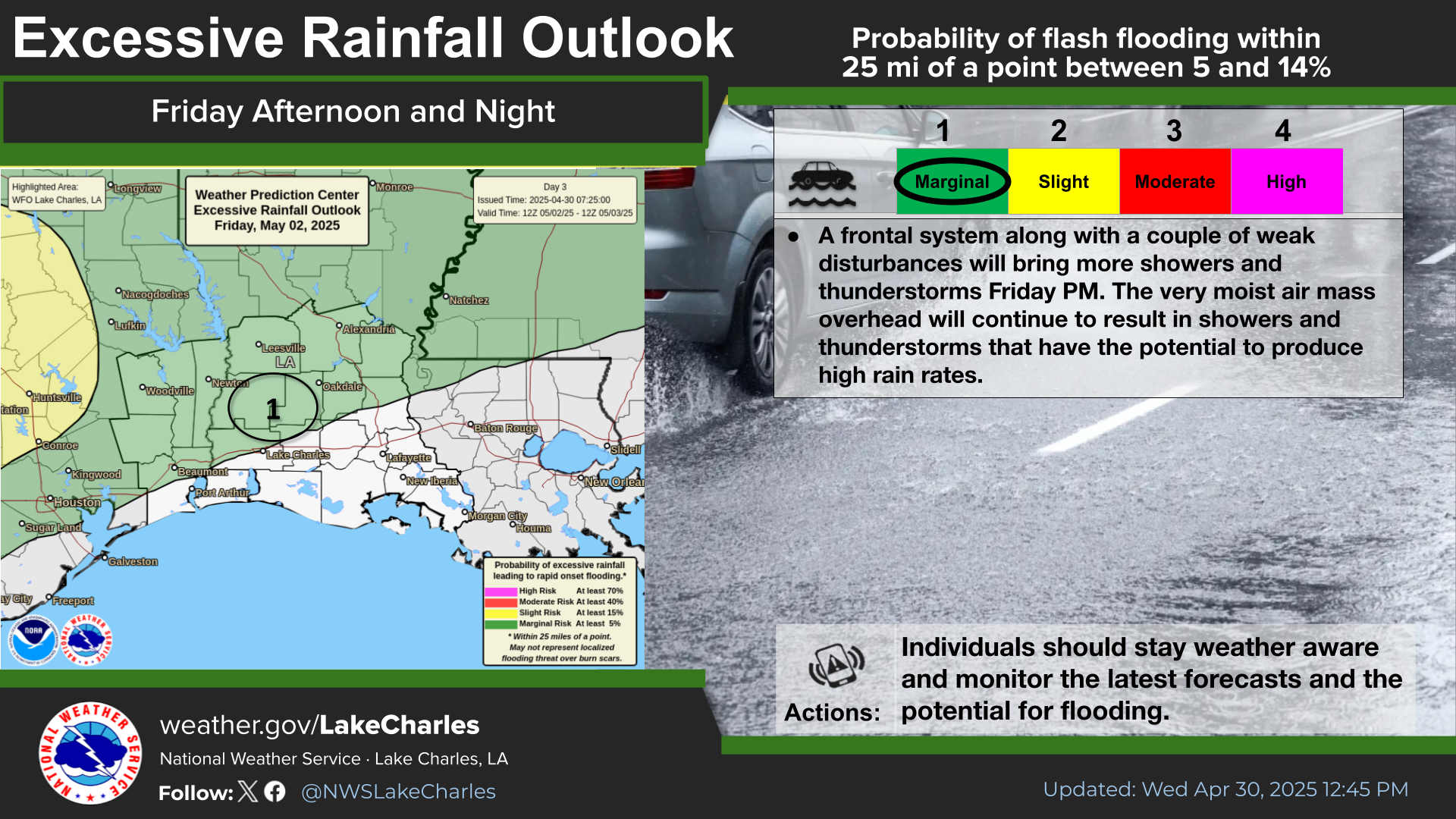
Excessive rainfall may produce locally considerable flash flooding over parts of the northwestern Gulf Coast, lower Mississippi River Valley, and Deep South through Thursday. Potential Tropical Cyclone One is forecast to become a tropical storm (Arthur) as it moves along or just off the northwestern Gulf coast through Wednesday. An outbreak of severe weather is forecast in the Midwest Wednesday. Read More >
Last Map Update: Wed, Jun 17, 2026 at 4:12:29 am CDT
| Latest Text Product Selector | |
|
||||||||||||||||||||||||||||||||||||||||||||||||||||||||||||||||||||||||||||||||||||||||||||||||||||||||||||||||||||||||||||||||||||||||||||||||||||||||||||||||||||||||
| Current Weather |
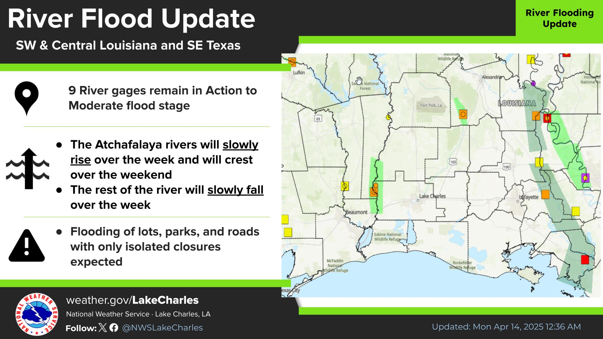
Rivers & Lakes |
Forecast Maps |
Hour By Hour Forecast |
Tropical Weather |
| Marine Forecast |
Text Bulletins |
Forecast Discussion |
NOAA Weather Radio |
Submit Storm Report |


 Local Radar
 Regional Satellite
 Weather Map