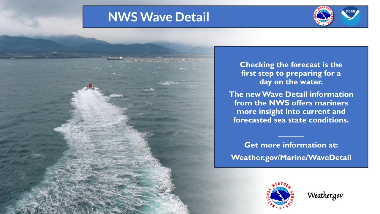
National Weather Service United States Department of Commerce


Attention Mariners!

Check out our New Coastal Waters Forecast with Wave Detail !!

Click here for more information on this experimental coastal water forecast wave component detail initiative

We are seeking feedback on this over the next several months, so please send us your input via this user survey


NOAA's nowCOAST

GIS-based web mapping portal displaying near real-time observations, analyses,
tide predictions, model guidance, watches/warnings, and forecasts.


MARINE & COASTAL OBSERVATIONS

Latest Summary of Marine and Coastal Observations


LOCAL BUOY OBSERVATIONS:

OTHER MARINE OBSERVATIONS:


MARINE FORECASTS & HAZARDS

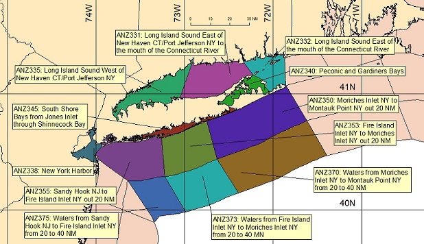
 Click Map for Zone Forecast and Hazards

Coastal Marine Zone Forecasts by the New York, NY Forecast Office - As of March 30, 2021, marine zone ANZ330, Long Island Sound East of New Haven, CT/Port Jefferson, has been split into two zones; ANZ331, Long Island Sound East of New Haven CT/Port Jefferson NY to the mouth of the Connecticut River and ANZ332, Long Island Sound East of the mouth of the Connecticut River. More Details found here.


map showing marine forecast zones near New York, NY

ANZ331 Long Island Sound East of New Haven CT/Port Jefferson NY to the mouth of the Connecticut River ANZ332 Long Island Sound East of the mouth of the Connecticut River ANZ335 Long Island Sound West of New Haven CT/Port Jefferson NY ANZ338 New York Harbor ANZ340 Peconic and Gardiners Bays ANZ345 South Shore Bays from Jones Inlet through Shinnecock Bay ANZ350 Moriches Inlet NY to Montauk Point NY out 20 NM ANZ353 Fire Island Inlet NY to Moriches Inlet NY out 20 NM ANZ355 Sandy Hook NJ to Fire Island Inlet NY out 20 NM ANZ370 Waters from Moriches Inlet NY to Montauk Point NY from 20 to 40 NM ANZ373 Waters from Fire Island Inlet NY to Moriches Inlet NY from 20 to 40 NM ANZ375 Waters from Sandy Hook NJ to Fire Island Inlet out 20 to 40 nm ANZ331 Long Island Sound East of New Haven CT/Port Jefferson NY to the mouth of the Connecticut River ANZ332 Long Island Sound East of the mouth of the Connecticut River ANZ335 Long Island Sound West of New Haven CT/Port Jefferson NY ANZ338 New York Harbor ANZ340 Peconic and Gardiners Bays ANZ345 South Shore Bays from Jones Inlet through Shinnecock Bay ANZ350 Moriches Inlet NY to Montauk Point NY out 20 NM ANZ353 Fire Island Inlet NY to Moriches Inlet NY  out 20 NM ANZ355 Sandy Hook NJ to Fire Island Inlet NY out 20 NM ANZ370 Waters from Moriches Inlet NY to Montauk Point NY from 20 to 40 NM ANZ373 Waters from Fire Island Inlet NY to Moriches Inlet NY from 20 to 40 NM ANZ375 Waters from Sandy Hook NJ to Fire Island Inlet out 20 to 40 nm


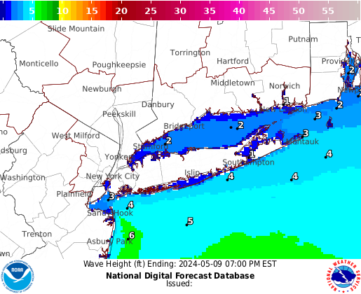
Click Map for Graphical Forecast


LOCAL TEXT WATCHES, WARNINGS & STATEMENTS:

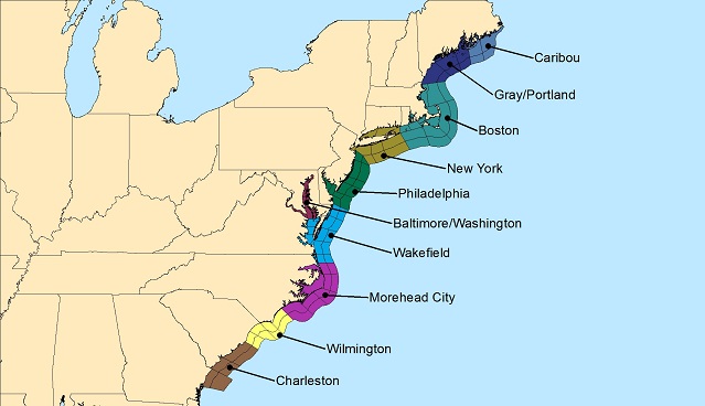
Click Map for East Coast Marine Forecasts and Hazards

Caribou marine zones Gray/Portland marine zones Boston marine zones New York marine zones Philadelphia/Mount Holly marine zones Baltimore/Wash DC marine zones Wakefield marine zones Newport/Morehead  City marine zones Wilmington marine zones Charlston marine zones Caribou marine zones Gray/Portland marine zones Boston marine zones New York marine zones Philadelphia/Mount Holly marine zones Baltimore/Wash DC marine zones Wakefield marine zones Newport/Morehead City marine zones Wilmington marine zones Charlston marine zones

OFFSHORE MARINE FORECASTS:


TIDAL & CURRENT INFO

Local Tides and Coastal Flooding Page


MAPS/CHARTS & RADIOFAX


SEA SURFACE TEMPERATURE


MARINE MODELS


SAFETY & EDUCATIONAL INFO


COLD WATER SAFETY


Marine Observations Needed!!
If you would like to report an observation of hazardous winds, waves or weather on the waters or if you find our marine forecast is un-representative of conditions on the local waters, PLEASE CONTACT US.Your observations and feedback are essential in helping us improve our marine services.
Our contact info is:
e-mail: okx.spotters@noaa.gov
phone: 1-800-226-0217


Top of Page | Home Page