Remember that it only takes one spark to start a devastating wildfire. In fact, most wildfires in the U.S. are caused by human activities - and fireworks are a major culprit. Let's protect our landscapes and communities. Please follow all local fire restrictions, leave the big shows to the professionals, and never use fireworks near dry vegetation.


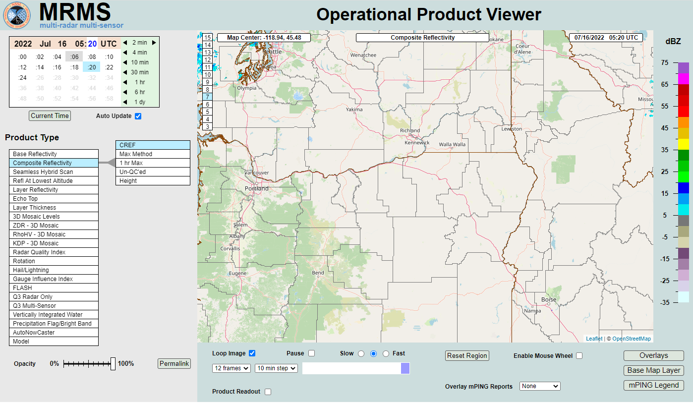 MRMS Radar Imagery
 Radar
Radar Satellite
 Graphical Forecasts
 Forecast Discussion
 Current Weather
 Climate
 Recent Weather
 Hour by Hour Forecast
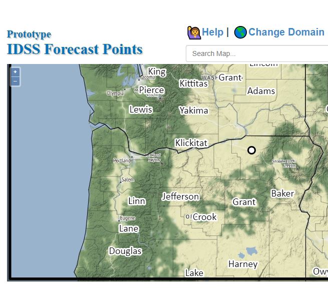 Alternate Point Forecast
 Forecast Maps
 Fire Weather
 Precipitation Amount Potential
 Rivers & Lakes
 Drought
 Air Quality
 Weather Stats