
A rare March heat wave is ongoing with much above-normal temperatures over the Southwest U.S. through this weekend. Periods of critical fire weather will persist from the central Rockies to the central and southern Plains through the weekend as gusty winds and low relative humidity continue. A Kona low will continue to bring several rounds of moderate to heavy rainfall to Hawaii through Sunday. Read More >
Last Map Update: Sat, Mar 21, 2026 at 2:54:13 am PDT

|
Text Product Selector (Selected product opens in current window)
|
|


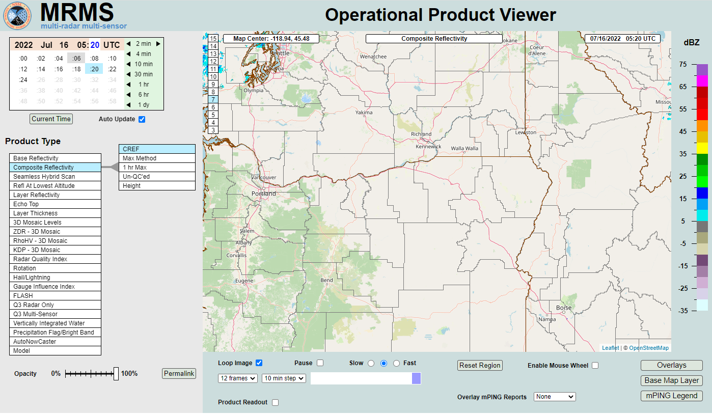 MRMS Radar Imagery
 Radar
Radar Satellite
 Graphical Forecasts
 Forecast Discussion
 Current Weather
 Climate
 Recent Weather
 Hour by Hour Forecast
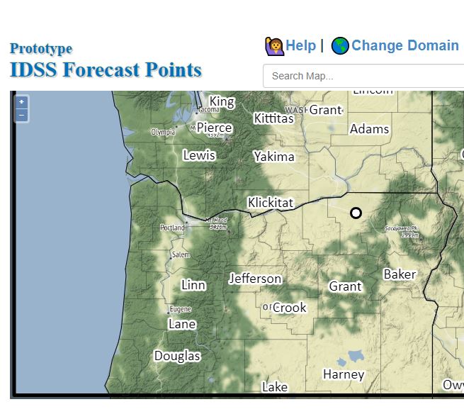 Alternate Point Forecast
 Forecast Maps
 Fire Weather
 Precipitation Amount Potential
 Rivers & Lakes
 Drought
 Air Quality