Overview
|
A significant tornado outbreak occurred on Friday April 17 2026 across the Upper Midwest. Thunderstorms developed in the early afternoon around 1 pm along a cold front in southeast Minnesota and along a warm front in western Wisconsin yielding two waves of storms for many. Tornadoes quickly formed from these storms as they grew and moved east. The supercell storms, natures most organized and damaging, shifted east through the afternoon, finally exiting central Wisconsin after 630 pm. The most tornadoes occurred locally north of Interstate 90 in southeast Minnesota and west-central Wisconsin. Preliminary reports suggest over 100 homes were damaged. So far, only one person sustained minor injuries in Iowa. With 10 tornadoes, this outbreak is our largest April tornado outbreak. |
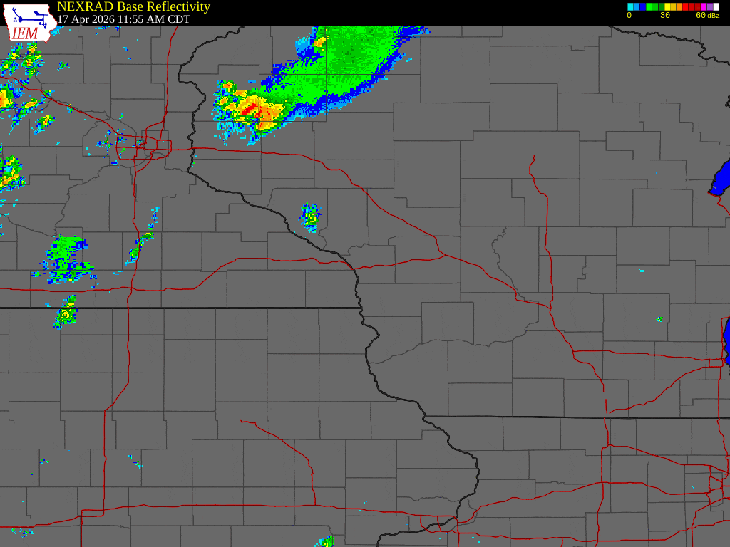 Radar loop from approximately1-8 pm April 17 2026 |
Tornadoes
Select a tornado from the table to zoom into the track and view more information. The default table view is limited to 8 tracks, but can be scrolled by a mouse wheel or dynamically expanded. Additionally, the table can fill the entire window by clicking the small circular expanding arrow icon at the very top right of the table and returned to its original size by clicking the button again. The side information panel that opens over the map can be closed using the "X" on the upper right corner of the pop-up. Zoom into the map and click damage points to see detailed information and pictures from the surveys.
|
NOTE: times shown below are local to your device's time zone. |

The Enhanced Fujita (EF) Scale classifies tornadoes into the following categories:
| EF0 Weak 65-85 mph |
EF1 Moderate 86-110 mph |
EF2 Significant 111-135 mph |
EF3 Severe 136-165 mph |
EF4 Extreme 166-200 mph |
EF5 Catastrophic 200+ mph |
 |
|||||
| Tornadoes that fail to impact any ratable damage indicators on the EF-Scale are rated EF-Unknown (EF-U) | |||||
Photos & Video
Tornadoes near Rochester
 |
 |
 |
 |
| Near Simpson, SW of RST (Rob Lichner) |
East and North of Airport (Rob Lichner) |
Around 230 pm (Sean Kelly) |
Around 230 pm (Sean Kelly) |
 |
.jpg) |
|
|
| Looking SE from Downtown (Jesse Wheeler) |
Looking Toward Rock Dell @ 153 pm (Sean Kelly) |
Around 230 pm (Sean Kelly) |
Around 230 pm |
Buffalo County WI
 |
|||
| Near Waumandee (Bri Rotering) |
Caption (source) |
Caption (source) |
Caption (source) |
Hail
 |
 |
||
| 1.5" hail in northwest Rochester, MN (Erin Swenson) |
Half dollar size hail in St. Charles, MN (Amy Collins) |
Caption (source) |
Caption (source) |
Header
| Caption (source) |
Caption (source) |
Caption (source) |
Caption (source) |
Storm Reports
 |
Preliminary Local Storm Report...Summary
National Weather Service La Crosse WI
108 PM CDT Sat Apr 18 2026

** Note these reports will not mention the tornadoes surveyed after 9 am 4/18 **
** See the 'Tornado' tab above for information on the tornadoes that occurred **

..TIME...   ...EVENT...      ...CITY LOCATION...     ...LAT.LON...
..DATE...   ....MAG....      ..COUNTY LOCATION..ST.. ...SOURCE....
            ..REMARKS..

0136 PM     Hail             1 W Hayfield            43.89N 92.87W
04/17/2026  M1.75 Inch       Dodge              MN   Emergency Mngr


0137 PM     Hail             Hayfield                43.89N 92.85W
04/17/2026  M1.00 Inch       Dodge              MN   Emergency Mngr


0141 PM     Hail             Hayfield                43.89N 92.85W
04/17/2026  M1.00 Inch       Dodge              MN   Public


0145 PM     Hail             Mantorville             44.07N 92.76W
04/17/2026  M0.25 Inch       Dodge              MN   Cocorahs


0145 PM     Hail             1 S Kasson              44.01N 92.75W
04/17/2026  M1.00 Inch       Dodge              MN   Emergency Mngr


0145 PM     Hail             Kasson                  44.03N 92.75W
04/17/2026  M0.88 Inch       Dodge              MN   Trained Spotter


0146 PM     Hail             Kasson                  44.03N 92.75W
04/17/2026  E0.25 Inch       Dodge              MN   Public


0146 PM     Hail             Hayfield                43.89N 92.85W
04/17/2026  M1.00 Inch       Dodge              MN   Public


0150 PM     Tornado          5 NE Sargeant           43.86N 92.73W
04/17/2026                   Dodge              MN   Law Enforcement

            Sheriff deputy reported that a tornado
            formed and dissipated and then a second
            tornado touched down.

0203 PM     Hail             Boscobel                43.14N 90.70W
04/17/2026  M0.70 Inch       Grant              WI   Trained Spotter


0204 PM     Hail             Dexter                  43.72N 92.70W
04/17/2026  M1.00 Inch       Mower              MN   Public


0212 PM     Hail             5 ESE Douglas           44.09N 92.48W
04/17/2026  E0.70 Inch       Olmsted            MN   Cocorahs


0213 PM     Hail             4 N Rochester           44.07N 92.48W
04/17/2026  M1.75 Inch       Olmsted            MN   Trained Spotter


0213 PM     Hail             3 SE Douglas            44.08N 92.54W
04/17/2026  E1.00 Inch       Olmsted            MN   Public

            Report from mPING: Quarter (1.00 in.).

0215 PM     Hail             2 WNW Oronoco           44.17N 92.57W
04/17/2026  M1.00 Inch       Olmsted            MN   Public


0215 PM     Hail             2 SE Douglas            44.09N 92.55W
04/17/2026  M0.25 Inch       Olmsted            MN   Public


0217 PM     Tornado          1 N Stewartville        43.87N 92.49W
04/17/2026                   Olmsted            MN   NWS Storm Survey

            This EF-2 tornado (estimated peak wind 130
            mph) formed just northeast of Stewartville
            around 2:17 pm and traveled about 10 miles
            northeast damaging numerous homes and farms.
            Some of the worst damage was seen near
            Marion Road just northeast of Highway 52
            where homes were more severely damaged with
            roof removal and partially collapsed
            exterior walls. The tornado was on the
            ground for about 14 minutes using radar
            estimation. At its widest, mainly in rural
            areas, it was approximately 175 yards.

0225 PM     Funnel Cloud     5 N Stewartville        43.93N 92.49W
04/17/2026                   Olmsted            MN   Trained Spotter

            Trained spotter to their southeast.

0232 PM     Tornado          4 N Stewartville        43.92N 92.49W
04/17/2026                   Olmsted            MN   Public

            Rochester Tower reported tornado on the
            ground near Highway 63.

0245 PM     Hail             8 NW Thorp              45.04N 90.92W
04/17/2026  M1.00 Inch       Taylor             WI   Trained Spotter


0247 PM     Tornado          1 NNW Saratoga          43.38N 92.41W
04/17/2026                   Howard             IA   Emergency Mngr

            *** 1 INJ ***
            Tornado confirmed via photos from Riceville
            firefighter. One house reported damaged. A
            box truck was also directly hit by the
            tornado and forced into a ditch. The driver
            appeared to have minor injuries.

0253 PM     Tornado          2 NNW Elgin             44.16N 92.27W
04/17/2026                   Wabasha            MN   Public

            Tornado touched down north of Elgin where it
            flipped a semi. It caused damage on 2
            farmsteads. Ended 1 3/4 miles north of 247
            near County Rd 2.

0257 PM     Tornado          4 S Plainview           44.11N 92.17W
04/17/2026                   Wabasha            MN   Public

            Tornado caused roof damage and removed a
            barn off of its foundation at 50500 County
            Rd, Plainview, MN. Residents saw the tornado
            and took shelter in a basement. No injuries.

0300 PM     Hail             Saint Charles           43.97N 92.06W
04/17/2026  M1.50 Inch       Winona             MN   Public


0305 PM     Hail             Saint Charles           43.97N 92.06W
04/17/2026  E1.25 Inch       Winona             MN   Public


0305 PM     Hail             Saint Charles           43.97N 92.06W
04/17/2026  M1.50 Inch       Winona             MN   Public


0305 PM     Hail             Altura                  44.07N 91.94W
04/17/2026  M1.00 Inch       Winona             MN   Emergency Mngr


0306 PM     Hail             1 S Tomah               43.98N 90.50W
04/17/2026  M0.25 Inch       Monroe             WI   Public


0310 PM     Hail             3 SE Douglas            44.08N 92.53W
04/17/2026  M1.25 Inch       Olmsted            MN   Public


0315 PM     Hail             Tomah                   43.99N 90.50W
04/17/2026  M0.88 Inch       Monroe             WI   Amateur Radio


0315 PM     Hail             1 S Tomah               43.98N 90.50W
04/17/2026  M0.88 Inch       Monroe             WI   Public


0319 PM     Hail             Tomah                   43.99N 90.50W
04/17/2026  M1.00 Inch       Monroe             WI   Public


0319 PM     Hail             Tomah                   43.99N 90.50W
04/17/2026  E1.00 Inch       Monroe             WI   Public


0319 PM     Hail             Rollingstone            44.10N 91.82W
04/17/2026  E1.00 Inch       Winona             MN   Public


0327 PM     Tornado          Cream                   44.32N 91.77W
04/17/2026                   Buffalo            WI   NWS Storm Survey

            This EF3 tornado (maximum estimated wind
            speed 140 mph) formed a few miles southwest
            of the town of Cream around 3:27 pm and
            traveled 8 miles to the northeast finally
            lifting north of Montana around 3:43 pm. The
            tornado damaged a family home residence of
            good construction removing many exterior
            walls and the roof near State Road 88 south
            of Cream. This damage suggests lower EF3
            wind speeds. The upstream damage to trees
            suggests the tornado intensified heading
            into this area. Many trees were downed or
            snapped on the path with farm outbuildings
            also being destroyed.

0351 PM     Hail             Mondovi                 44.57N 91.67W
04/17/2026  E0.88 Inch       Buffalo            WI   Public

            Dime to nickel size hail in Mondovi. Relayed
            from Eau Claire County comm center.

0356 PM     Hail             Harpers Ferry           43.20N 91.15W
04/17/2026  E1.00 Inch       Allamakee          IA   Public


0400 PM     Hail             Cassville               42.72N 90.99W
04/17/2026  M0.25 Inch       Grant              WI   Public

            Pea size hail for 5 minutes.

0418 PM     Hail             Postville               43.08N 91.57W
04/17/2026  E1.00 Inch       Allamakee          IA   Emergency Mngr

            Quarter size hail in Postville relayed from
            Emergency Manager.

0422 PM     Hail             2 SE Lancaster          42.83N 90.68W
04/17/2026  M0.88 Inch       Grant              WI   Emergency Mngr

            Nickel size hail at Sheriffs office
            southeast of Lancaster.

0427 PM     Tornado          5 E Osseo               44.58N 91.12W
04/17/2026                   Jackson            WI   Law Enforcement

            An officer reported a tornado near the
            intersection of County Rd M and Highway 10
            heading east.

0427 PM     Tornado          1 W Osseo               44.58N 91.24W
04/17/2026                   Trempealeau        WI   Trained Spotter

            Numerous houses and trees damaged along
            County Rd K and Old 17.

0429 PM     Tstm Wnd Dmg     4 SE Osseo              44.54N 91.16W
04/17/2026                   Jackson            WI   Public

            Numerous tree damage.

0436 PM     Rain             4 SE Douglas            44.08N 92.51W
04/17/2026  M1.74 Inch       Olmsted            MN   Public


0442 PM     Tornado          4 NNE Black River Falls 44.35N 90.82W
04/17/2026                   Jackson            WI   Storm Chaser

            Rain-wrapped tornado observed by storm
            chasers.

0508 PM     Hail             1 SE Prairie Du Chien   43.03N 91.13W
04/17/2026  M1.00 Inch       Crawford           WI   Public


0510 PM     Hail             Prairie Du Chien        43.04N 91.14W
04/17/2026  E0.25 Inch       Crawford           WI   Public
Radar
Header
| Caption | Caption | Caption | Caption |
Environment
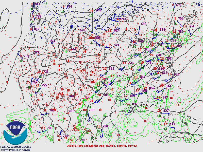
A large scale upper trough approached the upper midwest. This brought cooler temperatures aloft and warm, moist air near the ground, a setup with lots
of "fuel" for thunderstorms. It also brought strong winds out of the southwest aloft and breezy winds out of the south-southeast near the ground - this
difference in winds is known as wind shear and is the other ingredient needed for severe storms.
 |
 |
 |
| Figure 1: 250mb (about 34 kft) weather chart showing a large scale upper trough with strong winds out of the southwest ahead. | Figure 2: 500mb (about 18 kft) weather chart. Strong winds out of the southwest are overspreading the area. | Figure 3: 925mb (about 2500 feet) weather chart. Warm, moist air is being pulled northward from the Gulf. |
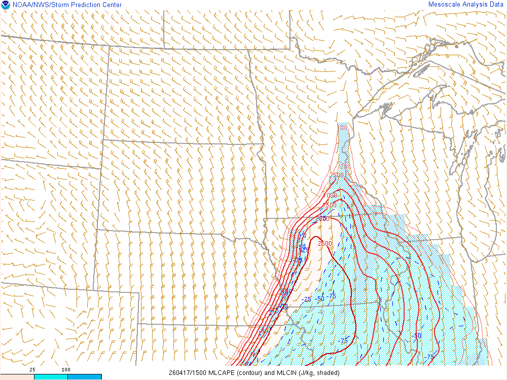
Near-storm environment summary.
 |
 |
 |
| Figure 4: Animation of estimated MLCAPE (fuel for thunderstorms). Values over 2500 J/kg were present, supporting the development of potentially severe storms. | Figure 5: Animation of estimated bulk wind shear. In addition to fuel, strong shear is needed for severe thunderstorms. We had strong shear as well on April 17. | Figure 6: Animation of surface to 500 meter helicity, a measure of wind shear in the lowest part of the atmosphere. Strong shear in the lowest part of the atmosphere - that we had on April 17 - is needed for severe thunderstorms to produce tornadoes. |
Additional environmental data.
| Figure 7: Caption | Figure 8: Caption | Figure 9: Caption |
NWS La Crosse Services
Header
 |
 |
 |
|
| Severe Storm Threat Friday (Issued: Wednesday) |
Severe Storm Threat Friday (Issued: Thursday) |
Severe Storm Threat Friday (Issued: Friday) |
Caption (source) |
 |
 |
 |
|
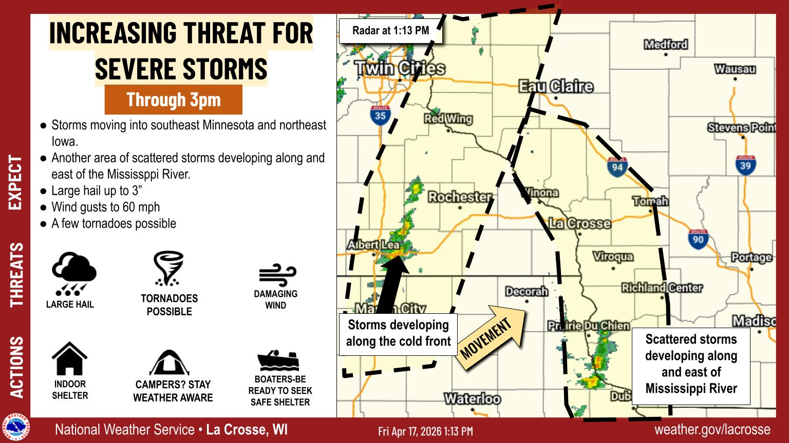
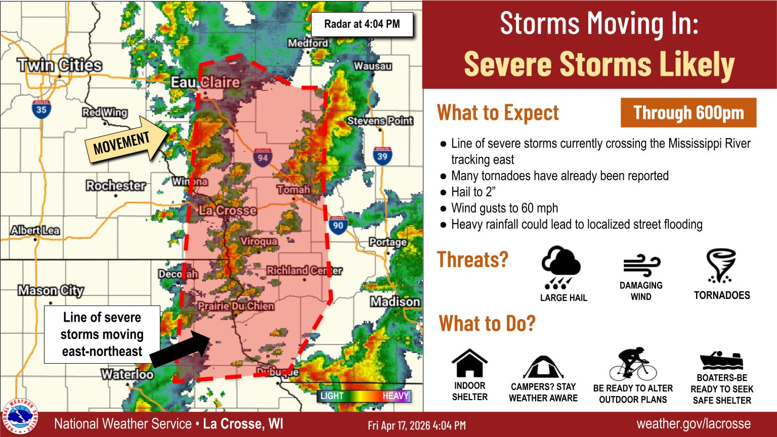
| Short Term Forecast Graphic (Issued: Friday at 115pm ) |
Short Term Forecast Graphic (Issued: Friday at 240pm ) |
Short Term Forecast Graphic (Issued: Friday at 406pm ) |
Caption (source) |
 |
Media use of NWS Web News Stories is encouraged! Please acknowledge the NWS as the source of any news information accessed from this site. |
|


 Weather Story
 Weather Map
 Local Radar