Overview
|
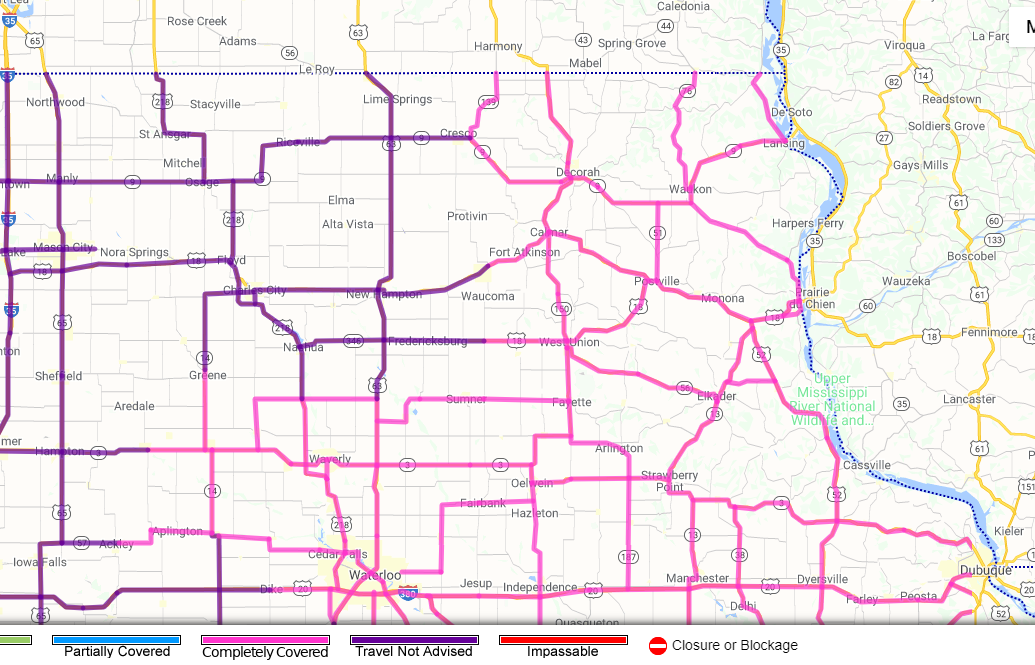
A winter storm brought heavy snow and strong winds to the region on February 4th, 2021. This led to snow covered roads and significant drifting in some areas, along with localized whiteouts. While the snow was heaviest in Wisconsin, the strong winds had a higher impact across parts of northeast Iowa where numerous roads became drifted shut during the afternoon. Travel was not advised in some areas. Ahead of the snow, a mix of freezing rain and sleet also added a light glaze on to untreated roads, parking lots, and sidewalks before the precipitation changed over to all snow during the morning hours. This storm system ushered in sharply colder air leading to an extended period of below normal temperatures and dangerous wind chills. |
 Radar loop from February 4, 2021 |
Snow Reports:
PUBLIC INFORMATION STATEMENT
NATIONAL WEATHER SERVICE LA CROSSE WI
1006 AM CST FRI FEB 5 2021

...SNOWFALL REPORTS FOR FEBRUARY 4...

LOCATION                     AMOUNT    TIME/DATE       LAT/LON

...IOWA...

...ALLAMAKEE COUNTY...
HARPERS FERRY 6.4 SSW        4.8 IN    0700 AM 02/05   43.11N/91.20W
POSTVILLE 5.5 NE             4.2 IN    0700 AM 02/05   43.14N/91.49W

...CHICKASAW COUNTY...
NEW HAMPTON 0.4 SW           5.0 IN    0700 AM 02/05   43.06N/92.32W
NEW HAMPTON                  5.0 IN    0700 AM 02/05   43.06N/92.32W

...CLAYTON COUNTY...
ELKADER 6.8 WSW              4.1 IN    0545 AM 02/05   42.81N/91.52W

...FAYETTE COUNTY...
GUTTENBERG DAM 10            4.0 IN    0700 AM 02/05   42.79N/91.10W
FAYETTE                      3.0 IN    0648 AM 02/05   42.88N/91.83W

...FLOYD COUNTY...
NORA SPRINGS 2.4 SSE         4.0 IN    0700 AM 02/05   43.11N/92.99W
MARBLE ROCK                  3.3 IN    0629 PM 02/04   42.96N/92.87W
CHARLES CITY                 3.2 IN    0700 AM 02/05   43.06N/92.67W
4 E ROCKFORD                 2.5 IN    0633 PM 02/04   43.05N/92.87W

...MITCHELL COUNTY...
ST ANSGAR                    3.2 IN    0630 AM 02/05   43.38N/92.92W
OSAGE                        3.0 IN    0700 AM 02/05   43.28N/92.81W

...WINNESHIEK COUNTY...
3 NNW DECORAH                4.5 IN    0444 PM 02/04   43.35N/91.82W
DECORAH                      4.3 IN    0700 AM 02/05   43.30N/91.80W
DECORAH 7.9 ENE              4.2 IN    0700 AM 02/05
CALMAR                       2.8 IN    0654 PM 02/04   43.18N/91.86W

...MINNESOTA...

...DODGE COUNTY...
KASSON                       3.6 IN    0507 PM 02/04   44.03N/92.75W
HAYFIELD 0.3 SSE             2.9 IN    0700 AM 02/05

...FILLMORE COUNTY...
MABEL                        6.0 IN    0700 AM 02/05   43.52N/91.76W
1 S PETERSON                 5.0 IN    0434 PM 02/04   43.77N/91.83W
PRESTON                      5.0 IN    0700 AM 02/05   43.67N/92.08W
CHATFIELD 9.0 ESE            4.3 IN    0600 PM 02/04   43.79N/92.03W
CHATFIELD                    4.0 IN    0310 PM 02/04   43.84N/92.19W
SPRING VALLEY                4.0 IN    0700 AM 02/05   43.69N/92.39W
2 WSW FILLMORE               3.3 IN    0245 PM 02/04   43.74N/92.31W
WYKOFF 3.1 NW                3.3 IN    0700 AM 02/05   43.74N/92.31W
RUSHFORD                     3.0 IN
1 NW OSTRANDER               3.0 IN    0619 PM 02/04   43.63N/92.44W

...HOUSTON COUNTY...
SPRING GROVE                 5.0 IN    0912 PM 02/04   43.56N/91.64W
LA CRESCENT                  4.8 IN    0620 PM 02/04   43.83N/91.31W
CALEDONIA                    3.8 IN    0700 AM 02/05   43.63N/91.50W

...MOWER COUNTY...
AUSTIN 2.4 W                 4.0 IN    0636 AM 02/05   43.67N/93.02W
2 NE LANSING                 4.0 IN    1251 PM 02/04   43.76N/92.95W
AUSTIN                       3.5 IN    0233 PM 02/04   43.67N/92.97W

...OLMSTED COUNTY...
ROCHESTER 5.7 N              5.6 IN    0700 AM 02/05   44.10N/92.46W
ELBA 4.7 SW                  4.7 IN    0400 PM 02/04   44.04N/92.09W
1 SSW ORONOCO                3.7 IN    0531 PM 02/04   44.15N/92.54W
ROCHESTER 4.7 N              3.5 IN    0700 AM 02/05   44.08N/92.48W
4 NW ROCHESTER               3.3 IN    0631 PM 02/04   44.05N/92.53W
ELGIN 2SSW                   3.0 IN    0700 AM 02/05   44.10N/92.27W
2 NE ROCHESTER               3.0 IN    0600 AM 02/05   44.04N/92.44W
ROCHESTER AIRPORT            3.0 IN    0600 AM 02/05   43.90N/92.49W
ROCHESTER 1.5 WSW            3.0 IN    0700 AM 02/05   44.00N/92.50W
ROCHESTER 2.6 NE             3.0 IN    0700 AM 02/05
STEWARTVILLE 4.3 E           3.0 IN    0400 AM 02/05   43.86N/92.40W
2 NNW ROCHESTER              2.8 IN    0700 AM 02/05   44.05N/92.49W
ROCHESTER 2.5 N              2.8 IN    0700 AM 02/05
ROCHESTER 4.2 N              2.8 IN    0700 AM 02/05

...WABASHA COUNTY...
THEILMAN 1 SSW               3.5 IN    0730 AM 02/05   44.28N/92.19W
0.9 N WABASHA                3.0 IN    0700 AM 02/05   44.38N/92.05W
LAKE CITY                    3.0 IN    0200 PM 02/04   44.45N/92.27W
WABASHA                      3.0 IN    0700 AM 02/05   44.39N/92.05W

...WINONA COUNTY...
MINNESOTA CITY               5.4 IN    0635 PM 02/04   44.09N/91.75W
SAINT CHARLES                4.7 IN    0445 PM 02/04   43.97N/92.06W
LA CRESCENT DAM 7            4.2 IN    0700 AM 02/05   43.89N/91.31W
2 SSE GOODVIEW               4.1 IN    0857 PM 02/04   44.05N/91.70W
WINONA                       4.0 IN    0554 PM 02/04   44.05N/91.66W
3 ESE STOCKTON               4.0 IN    0430 PM 02/04   44.01N/91.71W
WINONA DAM                   4.0 IN    0700 AM 02/05   44.09N/91.67W
WINONA 1.3 SSW               3.1 IN    0700 AM 02/05   44.03N/91.68W

...WISCONSIN...

...ADAMS COUNTY...
0.6 W FRIENDSHIP             8.7 IN    0700 AM 02/05   43.98N/89.83W
OXFORD 4.0 W                 6.0 IN    0700 AM 02/05   43.79N/89.64W
FRIENDSHIP 6.4 N             5.5 IN    0700 AM 02/05   44.06N/89.80W

...BUFFALO COUNTY...
COCHRANE                     5.1 IN    0330 PM 02/04   44.22N/91.84W
BUFFALO                      4.3 IN    0445 PM 02/04   44.24N/91.86W
1 S MONDOVI                  4.0 IN    0730 PM 02/04   44.55N/91.67W
ALMA DAM 4                   4.0 IN    0700 AM 02/04   44.33N/91.92W
MONDOVI                      3.7 IN    0500 PM 02/04   44.56N/91.67W

...CLARK COUNTY...
OWEN 1E                      8.5 IN    0700 AM 02/05   44.95N/90.55W
1 ESE GRANTON                7.5 IN    0642 PM 02/04   44.58N/90.44W
SIDNEY                       7.0 IN    0749 PM 02/04   44.55N/90.63W
LOYAL                        7.0 IN    0535 PM 02/04   44.73N/90.49W
NEILLSVILLE                  7.0 IN    0416 PM 02/04   44.56N/90.59W
6 N CHILI                    6.5 IN    0425 PM 02/04   44.71N/90.34W

...CRAWFORD COUNTY...
LYNXVILLE DAM                9.0 IN    0700 AM 02/05   43.21N/91.10W
STEUBEN 4SE                  8.0 IN    0700 AM 02/05   43.13N/90.84W
1 SW EASTMAN                 7.5 IN    0733 PM 02/04   43.15N/91.03W
1 S DE SOTO                  6.8 IN    0545 PM 02/04   43.41N/91.19W
GAYS MILLS                   6.0 IN    0755 PM 02/04   43.32N/90.84W
EASTMAN                      5.0 IN    0959 AM 02/05   43.17N/91.02W
PRAIRIE DU CHIEN 1.4 N       4.8 IN    0700 AM 02/05   43.06N/91.14W
PRAIRIE DU CHIEN             3.8 IN    0700 AM 02/05   43.05N/91.14W
1 NW PRAIRIE DU CHIEN        3.7 IN    0536 PM 02/04   43.05N/91.15W

...GRANT COUNTY...
CASSVILLE 7.8 ENE            5.9 IN    0700 AM 02/05   42.75N/90.84W
3 SSW BEETOWN                5.9 IN    0630 PM 02/04   42.75N/90.90W
BLUE RIVER                   5.8 IN    0652 PM 02/04   43.19N/90.57W
3 SSE LANCASTER              5.0 IN    0641 PM 02/04   42.81N/90.70W
MUSCODA                      4.5 IN    0656 PM 02/04   43.19N/90.43W
FENNIMORE                    4.0 IN    0727 PM 02/04   42.98N/90.66W

...JACKSON COUNTY...
BLACK RIVER FALLS 1.7 NNE    7.1 IN    0700 AM 02/05   44.32N/90.83W
BLACK RIVER FALLS            7.0 IN    0630 PM 02/04   44.30N/90.85W
MELROSE                      6.5 IN    0732 PM 02/04   44.13N/91.00W
HIXTON                       6.5 IN    0643 PM 02/04   44.38N/91.01W
HATFIELD                     6.0 IN    0732 PM 02/04   44.42N/90.73W

...JUNEAU COUNTY...
MAUSTON                      6.3 IN    0634 PM 02/04   43.80N/90.08W
CAMP DOUGLAS                 6.0 IN    0621 PM 02/04   43.92N/90.27W
ELROY                        5.0 IN    0648 PM 02/04   43.74N/90.27W

...LA CROSSE COUNTY...
COON VALLEY 4.5 NNW          6.6 IN    0700 AM 02/05
2 SSW SAINT JOSEPH           6.6 IN    0542 PM 02/04   43.76N/91.06W
BANGOR                       6.5 IN    0644 PM 02/04   43.89N/90.99W
ROCKLAND                     6.5 IN    0621 PM 02/04   43.91N/90.92W
NWS LA CROSSE                6.5 IN    0600 PM 02/04   43.82N/91.19W
3 SSW BARRE MILLS            6.0 IN    0901 PM 02/04   43.79N/91.15W
MINDORO                      6.0 IN    0749 PM 02/04   44.02N/91.10W
BARRE MILLS                  6.0 IN    0545 PM 02/04   43.84N/91.12W
5 NNE STODDARD               5.8 IN    0856 PM 02/04   43.73N/91.20W
LA CROSSE AIRPORT            5.8 IN    0600 PM 02/04   43.86N/91.27W
WEST SALEM 0.7 W             5.3 IN    0700 AM 02/05   43.90N/91.10W
HOLMEN 1.7 SSE               5.2 IN    0700 AM 02/05   43.93N/91.24W
ONALASKA                     5.0 IN    0733 PM 02/04   43.89N/91.22W
3 ENE LA CROSSE              5.0 IN    0640 PM 02/04   43.84N/91.18W
HOLMEN                       5.0 IN    0637 PM 02/04   43.96N/91.26W
1 NNW ONALASKA               5.0 IN    0439 PM 02/04   43.90N/91.23W
1 SSE LA CROSSE              4.7 IN    0445 PM 02/04   43.81N/91.23W
4 NE NEW AMSTERDAM           4.7 IN    0421 PM 02/04   44.03N/91.27W
LA CROSSE 4NNW               4.6 IN    0700 AM 02/05   43.87N/91.27W
5 SSE LA CROSSE              4.5 IN    0150 PM 02/04   43.76N/91.20W

...MONROE COUNTY...
1 S WILTON                   8.5 IN    0523 PM 02/04   43.80N/90.53W
2 SE TUNNEL CITY             7.8 IN    0600 PM 02/04   43.99N/90.54W
SPARTA                       7.3 IN    0647 PM 02/04   43.94N/90.81W
TOMAH                        7.1 IN    0731 PM 02/04   43.99N/90.51W
4 S SPARTA                   7.0 IN    0455 PM 02/04   43.89N/90.80W
CATARACT                     6.5 IN    0602 PM 02/04   44.09N/90.84W
5 SSW SPARTA                 6.3 IN    0830 PM 02/04   43.88N/90.83W
WILTON                       6.0 IN    0500 PM 02/04   43.81N/90.53W
WARRENS                      6.0 IN    0352 PM 02/04   44.13N/90.50W
CASHTON 3 NNW                5.3 IN    0713 AM 02/05   43.79N/90.80W

...RICHLAND COUNTY...
RICHLAND CENTER              4.5 IN    0513 PM 02/04   43.34N/90.38W

...TAYLOR COUNTY...
MEDFORD                      8.0 IN    0500 PM 02/04   45.14N/90.35W
MEDFORD 0.8 ENE              7.0 IN    0700 AM 02/05   45.14N/90.33W
1 W MEDFORD                  6.0 IN    0300 PM 02/04   45.14N/90.37W

...TREMPEALEAU COUNTY...
ETTRICK 4.0 WNW              5.1 IN    0743 AM 02/05   44.19N/91.34W
2 NNE GALESVILLE             5.0 IN    0717 PM 02/04   44.10N/91.35W
STRUM                        5.0 IN    0659 PM 02/04   44.55N/91.39W
GALESVILLE                   5.0 IN    0610 PM 02/04   44.08N/91.36W
GALESVILLE 4.7 E             4.5 IN    0720 AM 02/05   44.08N/91.26W
2 SSE ELK CREEK              4.0 IN    0450 PM 02/04   44.39N/91.39W
TREMPEALEAU DAM 6            4.0 IN    0800 AM 02/05   44.00N/91.44W
ARCADIA                      3.0 IN    0836 PM 02/04   44.25N/91.49W

...VERNON COUNTY...
LA FARGE                     7.0 IN    0700 AM 02/05   43.57N/90.63W
VIROQUA                      7.0 IN    0659 PM 02/04   43.56N/90.89W
WESTBY                       7.0 IN    0642 PM 02/04   43.65N/90.86W
STODDARD 4.7 NNE             6.7 IN    0700 AM 02/05   43.72N/91.17W
3 S GENOA                    6.5 IN    0642 PM 02/04   43.53N/91.22W
GENOA DAM 8                  6.0 IN    0700 AM 02/05   43.57N/91.23W
VIOLA                        6.0 IN    0841 PM 02/04   43.51N/90.67W
3 NE STODDARD                5.9 IN    0430 PM 02/04   43.69N/91.18W
VIROQUA                      5.8 IN    0700 AM 02/05   43.56N/90.88W
HILLSBORO 2 SW               5.5 IN    0700 AM 02/05   43.63N/90.38W
GENOA                        5.0 IN    0641 PM 02/04   43.57N/91.23W
HILLSBORO 0.5 WSW            5.0 IN    0700 AM 02/05   43.65N/90.35W

OBSERVATIONS ARE COLLECTED FROM A VARIETY OF SOURCES WITH VARYING
EQUIPMENT AND EXPOSURES. WE THANK ALL VOLUNTEER WEATHER OBSERVERS
FOR THEIR DEDICATION. NOT ALL DATA LISTED ARE CONSIDERED OFFICIAL.
Peak Wind Reports:
Public Information Statement
National Weather Service La Crosse WI
648 AM CST Fri Feb 5 2021

...Highest Wind Gusts from 7 AM Thursday, February 4 through
645 AM Friday, February 5...

Location                     Speed     Time/Date       Lat/Lon

...Iowa...

...Chickasaw County...
2 N Ionia                    36 MPH    0400 PM 02/04   43.07N/92.46W

...Fayette County...
Oelwein Municipal Airport    44 MPH    0415 PM 02/04   42.68N/91.97W

...Floyd County...
Charles City Airport         38 MPH    0455 PM 02/04   43.07N/92.62W

...Howard County...
Saratoga                     39 MPH    0845 PM 02/04   43.35N/92.42W
Riceville                    33 MPH    0732 PM 02/04   43.36N/92.48W

...Winneshiek County...
5 NW Frankville              37 MPH    0810 PM 02/04   43.25N/91.70W
Decorah Municipal Airport    33 MPH    0755 PM 02/04   43.27N/91.72W

...Minnesota...

...Dodge County...
2 E Kasson                   37 MPH    0825 PM 02/04   44.02N/92.71W
Dodge Center Airport         35 MPH    0915 PM 02/04   44.02N/92.82W

...Fillmore County...
Preston Airport              36 MPH    0815 PM 02/04   43.68N/92.17W
2 ESE Canton                 35 MPH    1055 PM 02/04   43.52N/91.89W

...Mower County...
1 ENE Dexter                 40 MPH    0905 PM 02/04   43.73N/92.68W
Austin Municipal Airport     37 MPH    0735 PM 02/04   43.67N/92.92W

...Olmsted County...
Rochester International Airp 43 MPH    0854 PM 02/04   43.90N/92.50W
Rochester: Rochester Interna 40 MPH    0336 PM 02/04   43.90N/92.49W
Jct CR 7 I-90 Mile Post 226  39 MPH    0910 PM 02/04   43.96N/92.21W
Mayo Helipad                 38 MPH    0635 PM 02/04   44.02N/92.48W
3 N Stewartville             38 MPH    0335 PM 02/04   43.90N/92.48W
Byron                        34 MPH    0732 PM 02/04   44.04N/92.64W

...Wabasha County...
1 SSE Kellogg                39 MPH    0915 PM 02/04   44.28N/91.99W
Lake City                    33 MPH    0358 PM 02/04   44.32N/92.44W

...Winona County...
1 E Ridgeway                 33 MPH    1140 PM 02/04   43.91N/91.54W

...Wisconsin...

...Crawford County...
Prairie Du Chien  Airport    30 MPH    0855 PM 02/04   43.02N/91.12W

...Grant County...
Lancaster                    42 MPH    0941 PM 02/04   42.83N/90.69W
Boscobel Airport             35 MPH    0653 PM 02/04   43.15N/90.68W
Boscobel: Boscobel Airport   35 MPH    0653 PM 02/04   43.16N/90.68W

...Juneau County...
Volk Field                   38 MPH    0756 PM 02/04   43.92N/90.27W
Necedah                      32 MPH    1148 PM 02/04   44.03N/90.08W
Mauston Airport              31 MPH    0335 AM 02/05   43.83N/90.13W

...La Crosse County...
La Crosse Regional Airport   40 MPH    0753 PM 02/04   43.88N/91.25W
La Crosse - La Crosse Region 32 MPH    0827 PM 02/04   43.88N/91.26W

...Taylor County...
Medford Airport              30 MPH    0855 PM 02/04   45.10N/90.30W

Observations are collected from a variety of sources with varying
equipment and exposures. We thank all volunteer weather observers
for their dedication. Not all data listed are considered official.
Misc Information
 |
 |
 |
 |
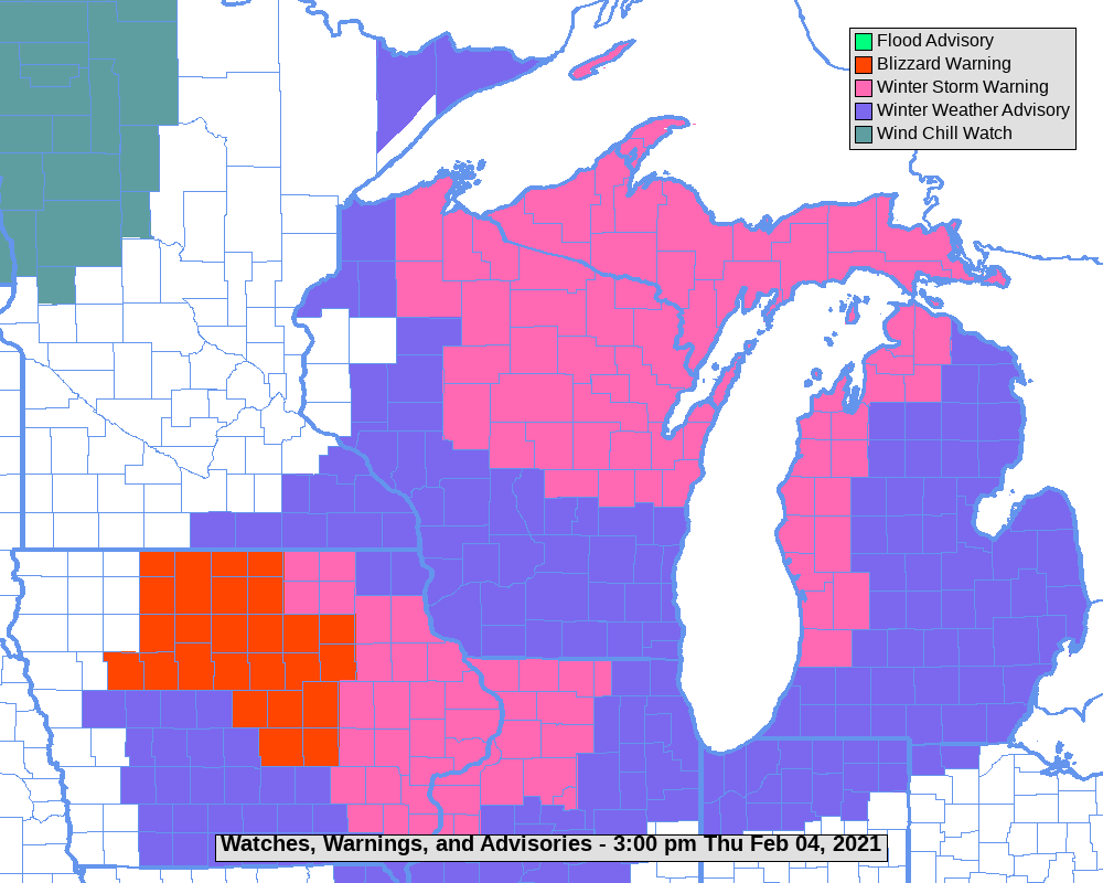
| Warnings and Advisories in effect at the time. (NWS) |
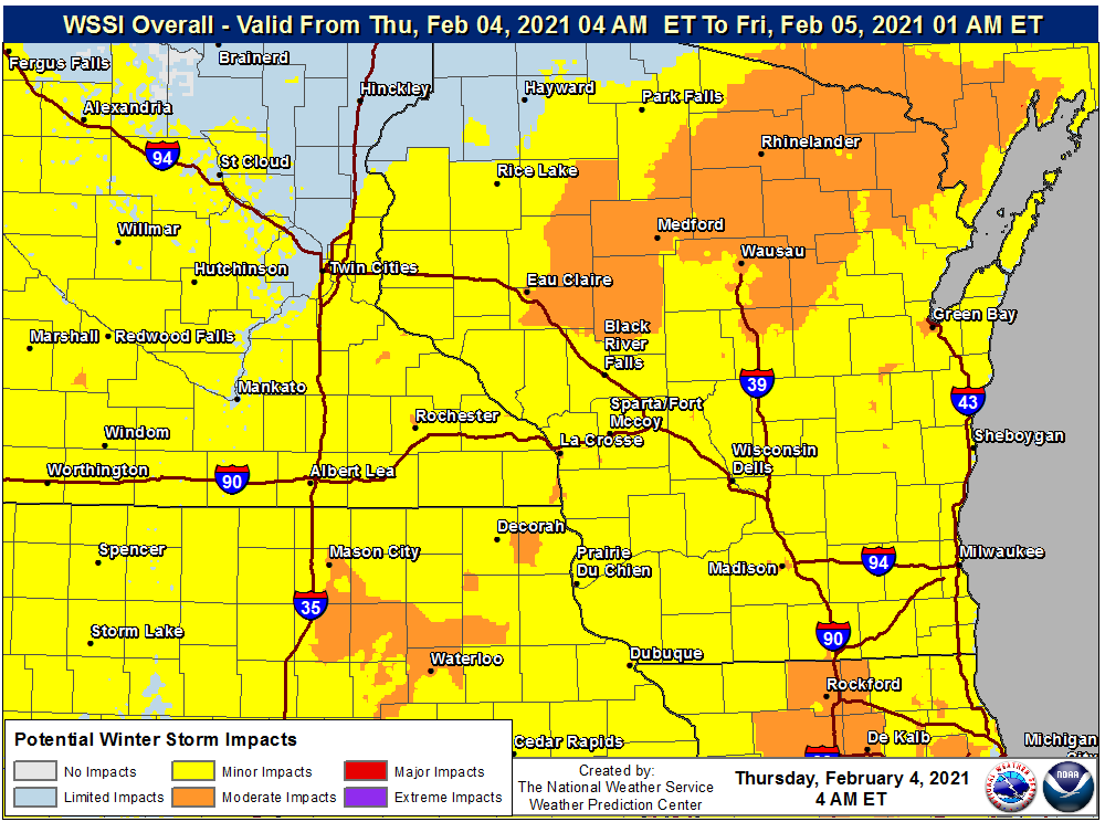
Winter Storm Severity Index (NWS) |
Northeast Iowa road conditions at 11:24 a.m. (IADOT) |
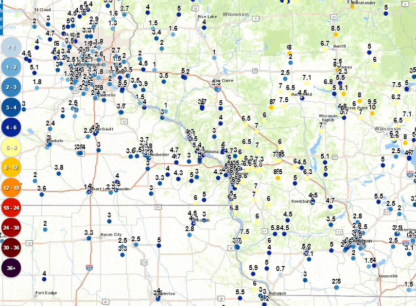
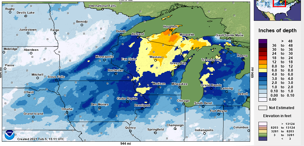
Total observed snowfall (Feb.3-4) (NWS) |
Photos:
 |
 |
 |
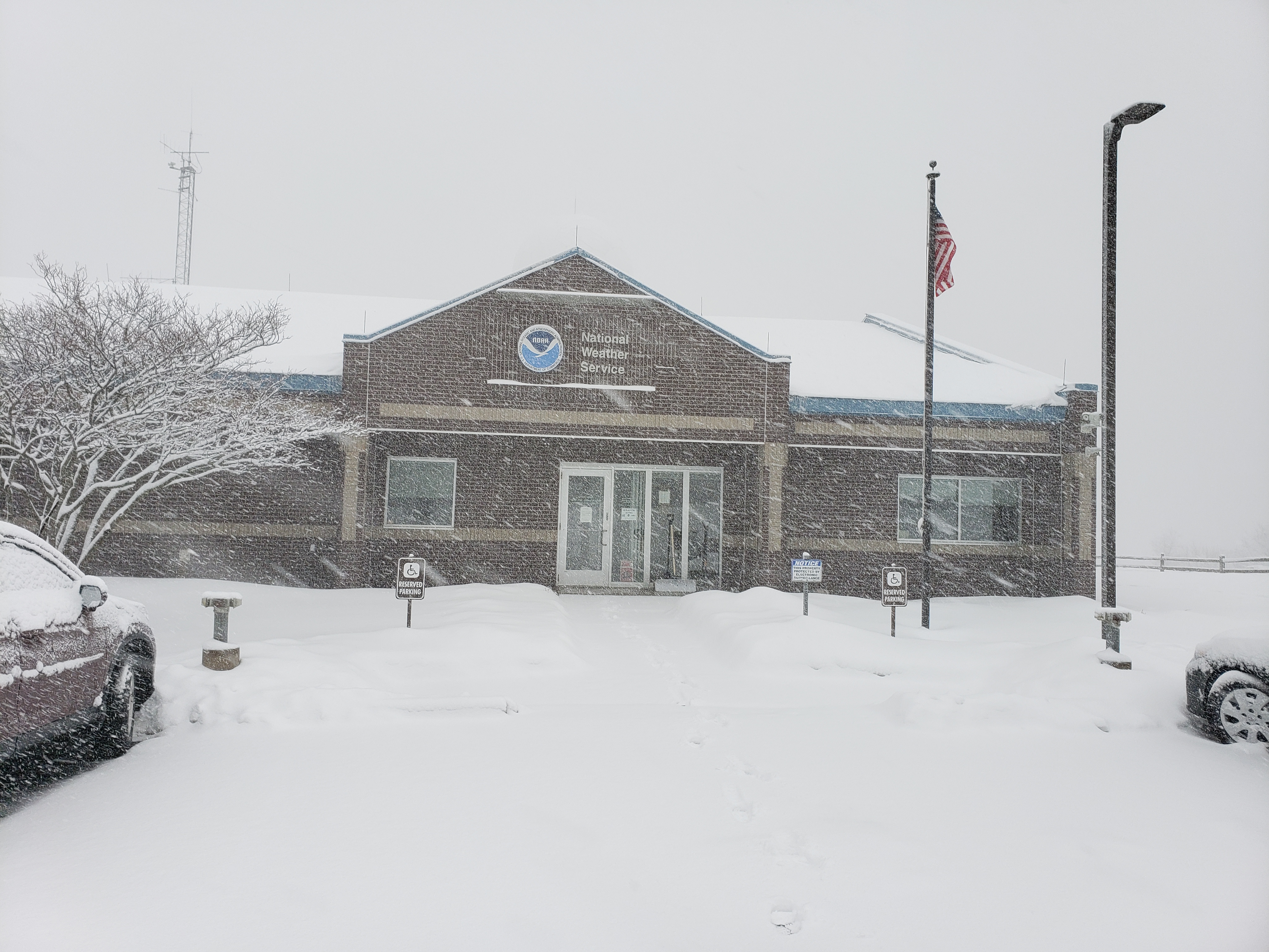
| NWS La Crosse at peak snow (NWS) |
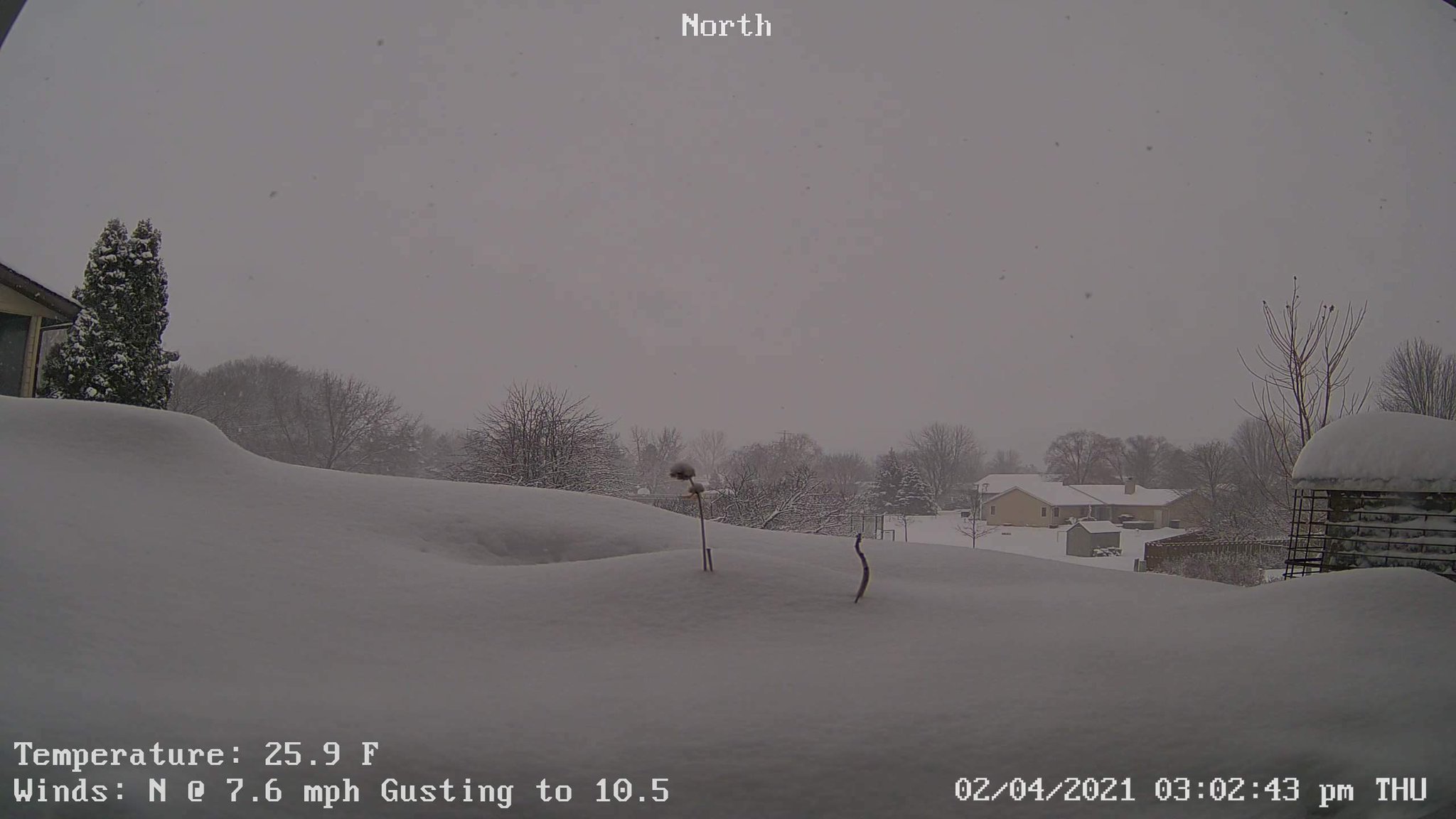
Onalaska, WI (Courtesy of Bill Anderson) |
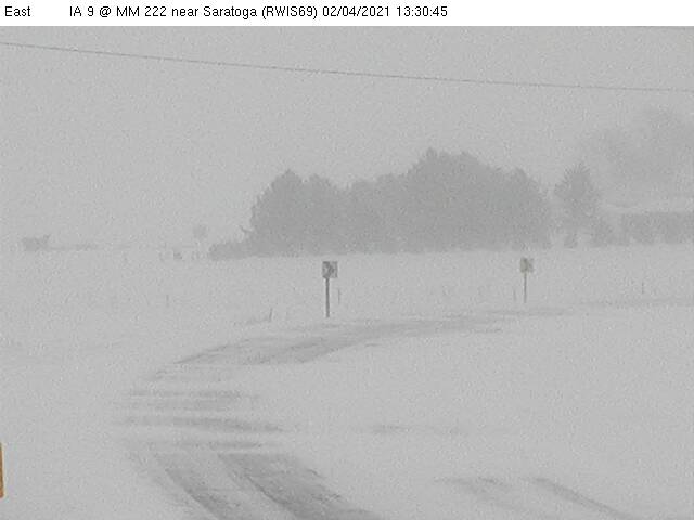
Howard Co. IA webcam (IADOT) |
 |
 |
 |
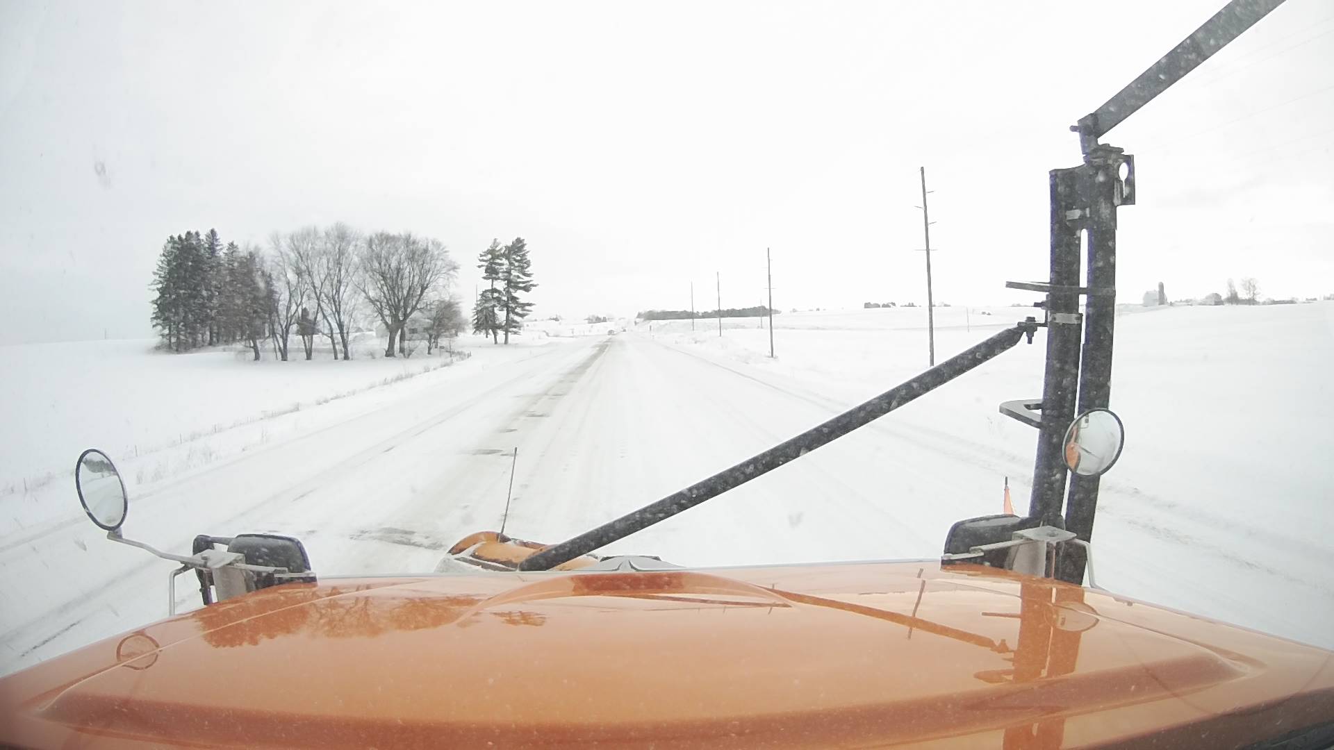
| Rural Iowa on Feb.5th (IADOT) |
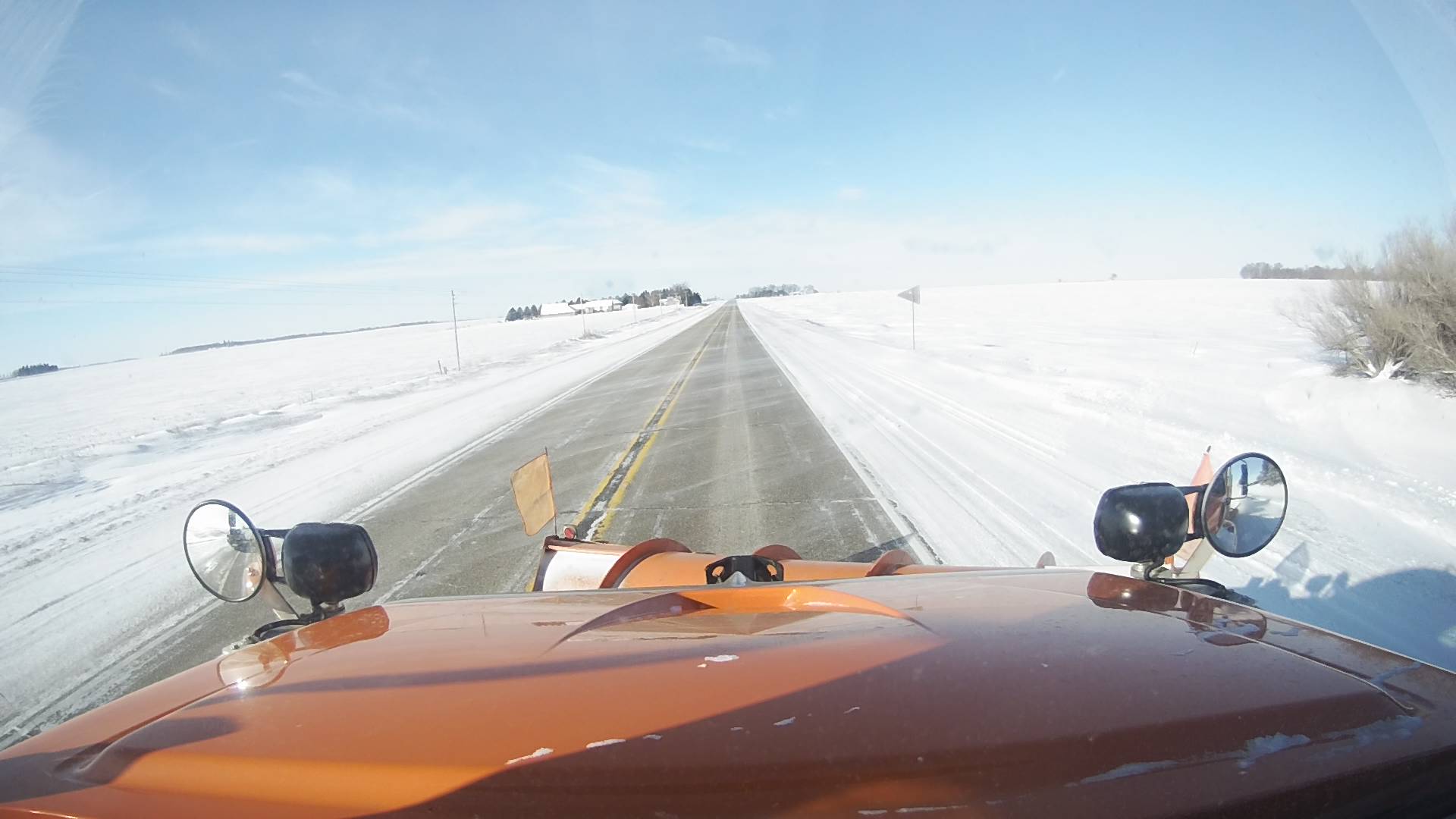
Rural Iowa on Feb.5th (IADOT) |
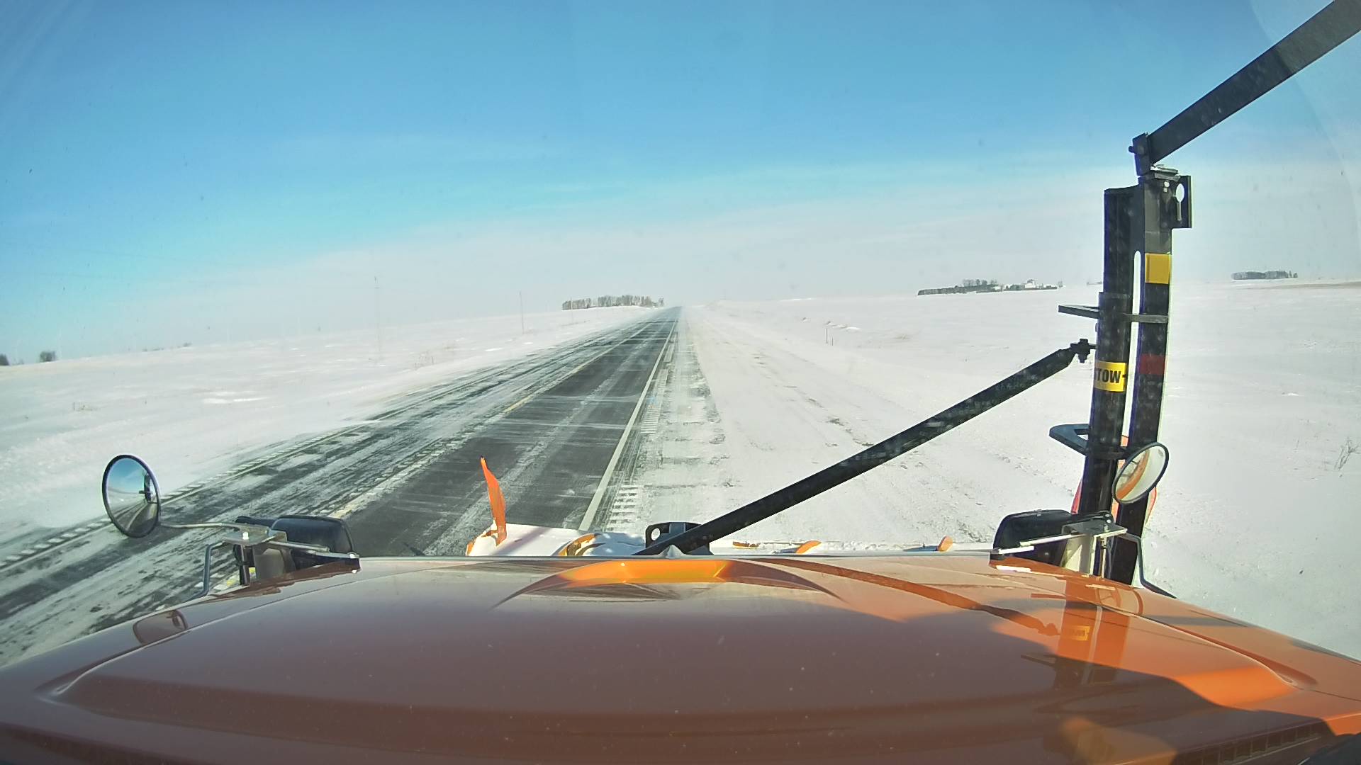
Rural Iowa on Feb.5th (IADOT) |
 |
Media use of NWS Web News Stories is encouraged! Please acknowledge the NWS as the source of any news information accessed from this site. |
|


 Weather Story
 Weather Map
 Local Radar