
Multiple chances exist for severe thunderstorms Monday. The 1st round will be Monday AM as thunderstorms travel SE from ND through MN and into our area. The second round will be Monday afternoon and evening as a cold front drops south across the area and thunderstorms develop. How the morning thunderstorms evolve, will dictate who & when will receive thunderstorms in the afternoon. Read More >
Overview
|
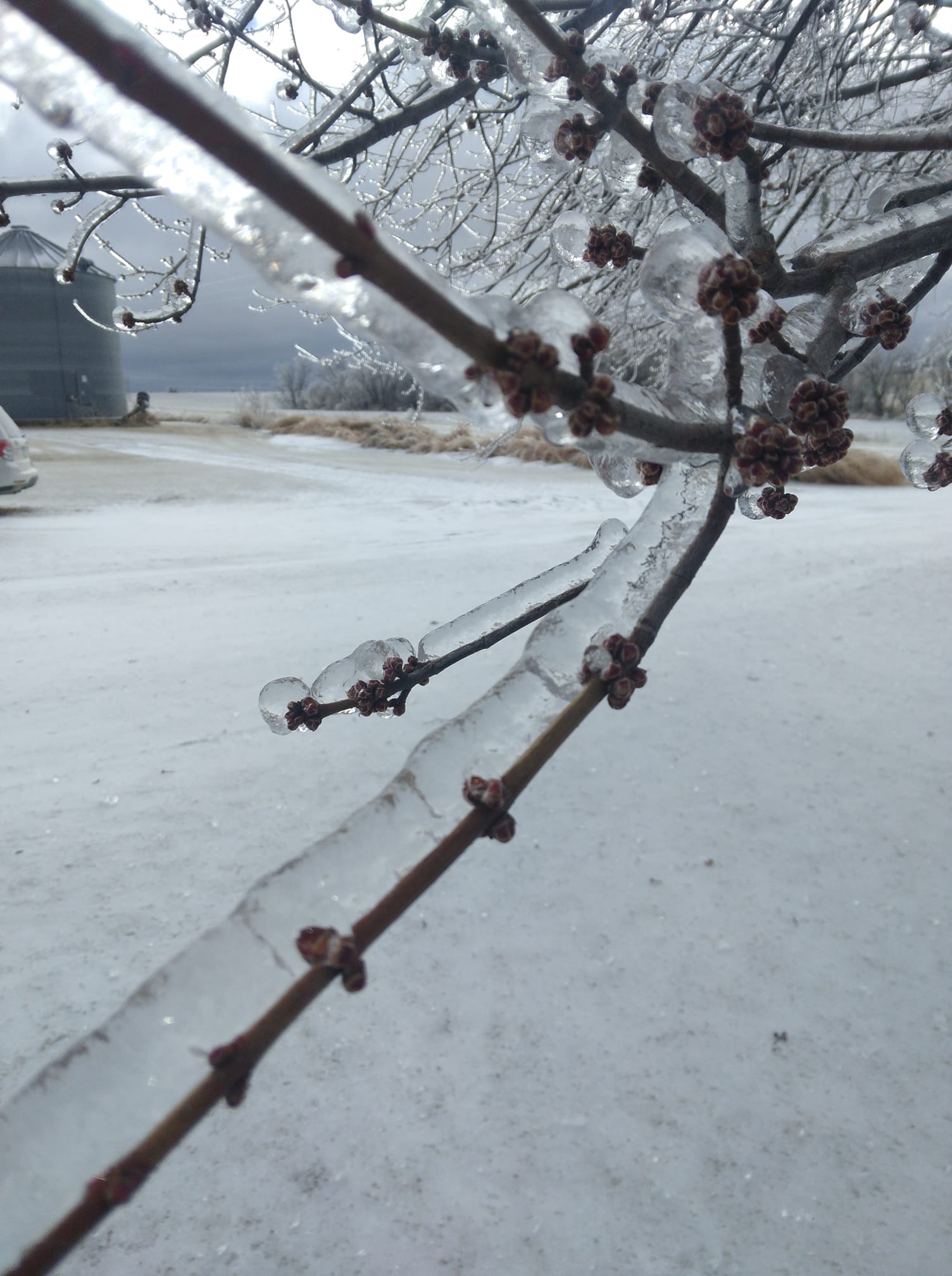
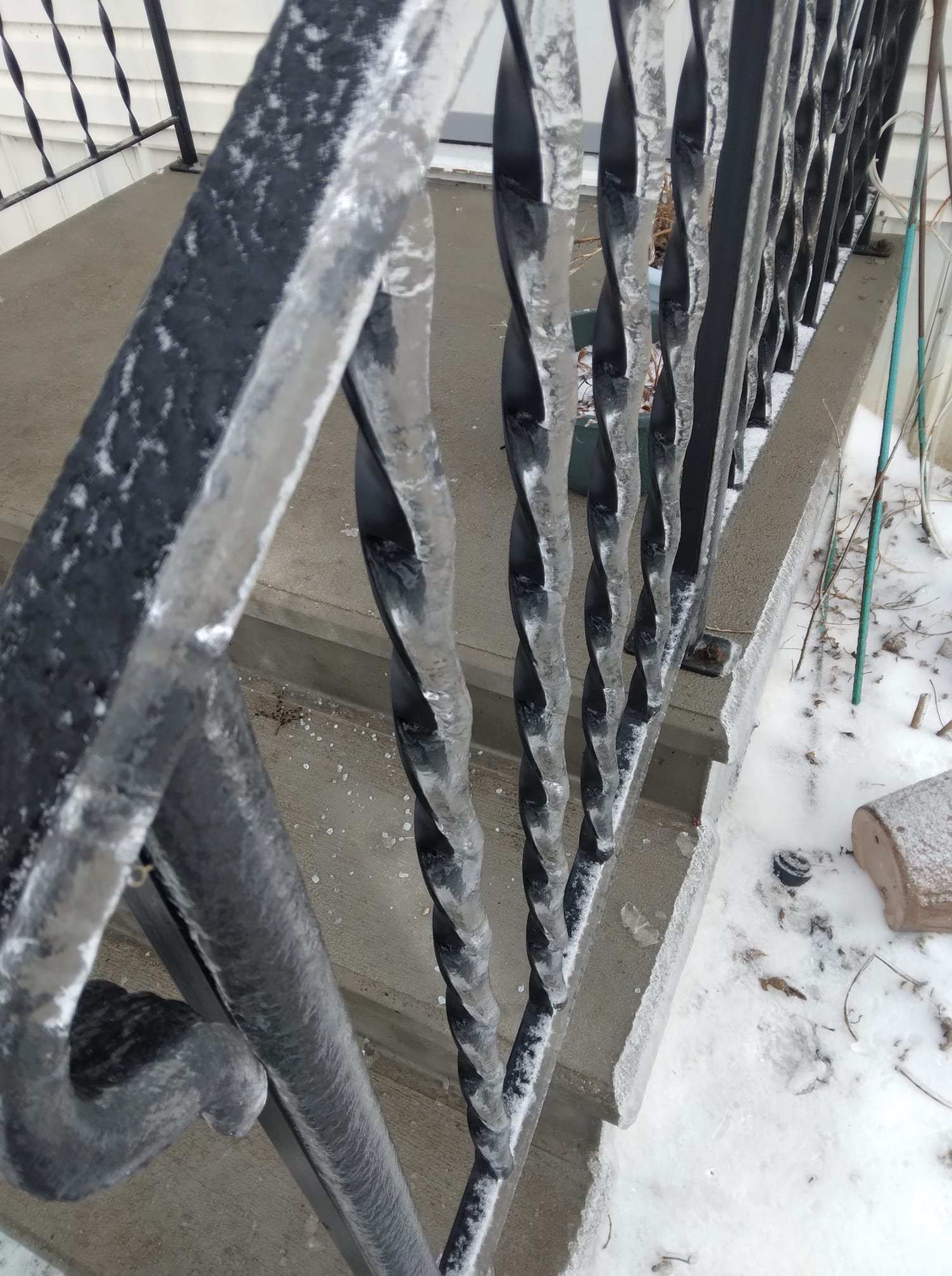
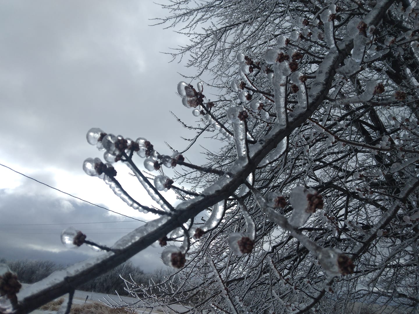
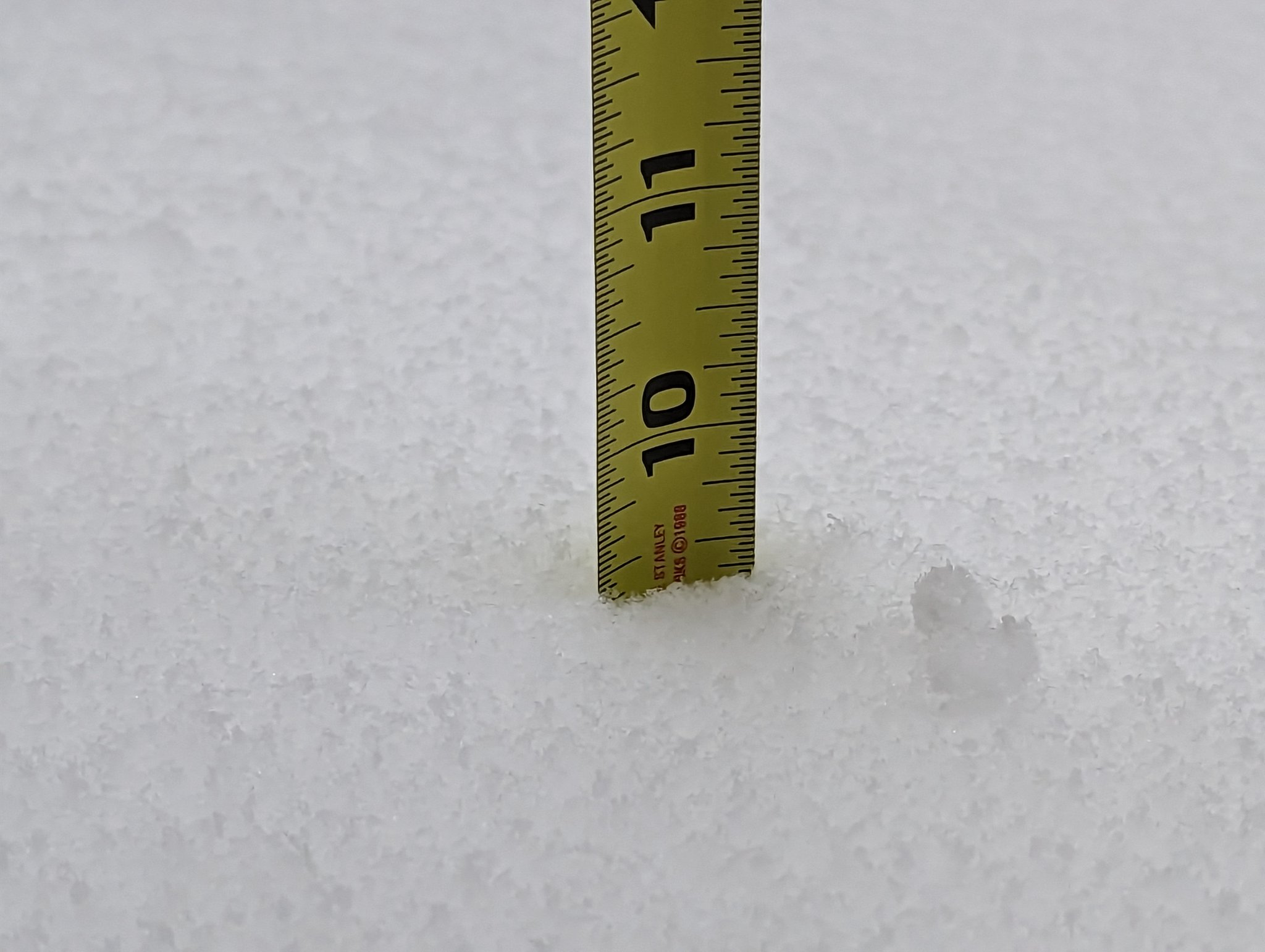
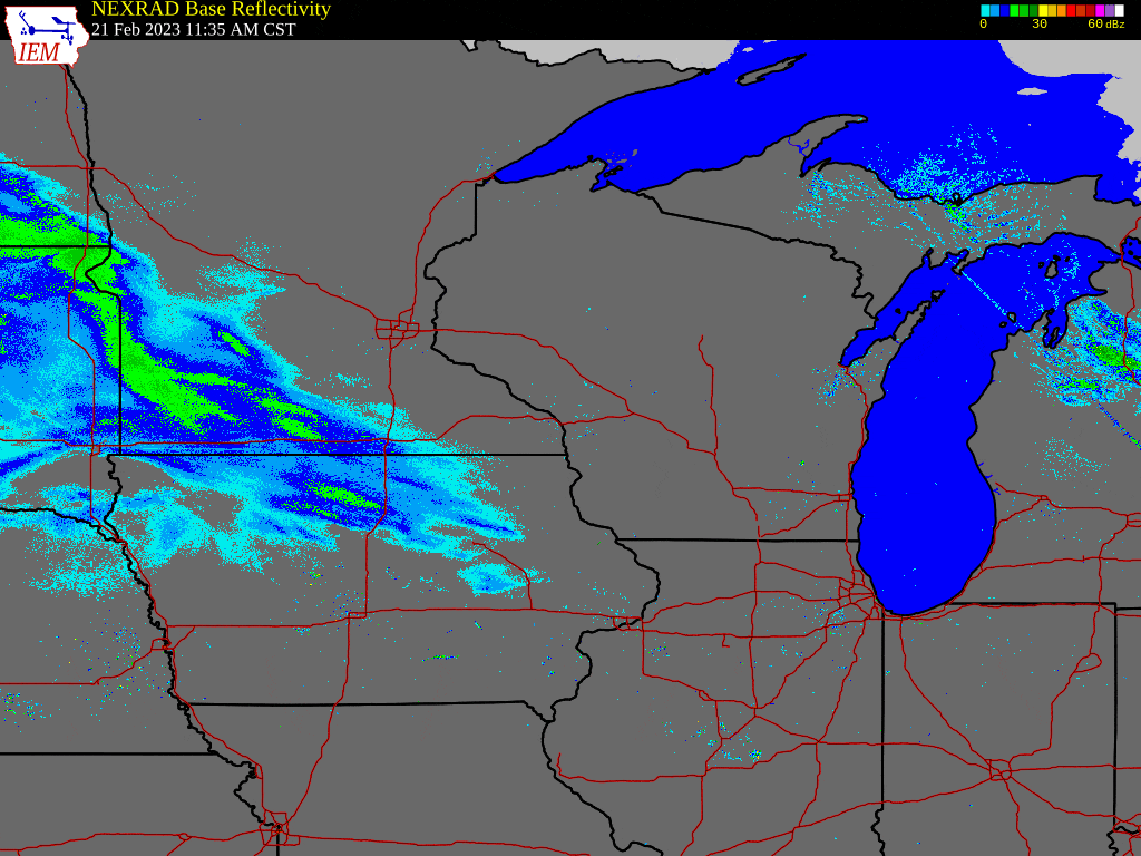
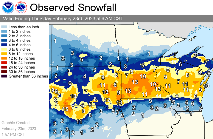
Several inches of snow fell across much of the region beginning Tuesday, February 21, 2023 and ending Thursday, February 23, 2023. Highest accumulations from the two day storm were observed north of the I-90 corridor with several locations topping out over 1 foot. The combination of the heavy snow fall and a wintry mix of sleet and freezing rain disrupted travel across the region. Ice accumulations around 1/4 of an inch were observed along the far southern edge of the forecast area from southern Fayette (IA), Clayton (IA), and Grant (WI). |
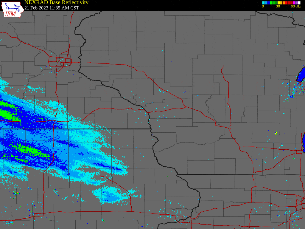 Radar loop from late afternoon February 21st through the morning of February 23rd. |
Snow
LOCATION                     AMOUNT    TIME/DATE       LAT/LON

...IOWA...

...ALLAMAKEE COUNTY...
POSTVILLE 5.5 NE             1.2 IN    0700 AM 02/23   43.14N/91.49W

...CHICKASAW COUNTY...
NEW HAMPTON                  4.0 IN    0700 AM 02/23   43.06N/92.31W

...FAYETTE COUNTY...
FAYETTE                      2.0 IN    0700 AM 02/23   42.88N/91.83W

...FLOYD COUNTY...
NORA SPRINGS 2.4 SSE         3.0 IN    0700 AM 02/23   43.11N/92.99W

...MINNESOTA...

...DODGE COUNTY...
1 NE KASSON                  11.8 IN   1000 AM 02/23   44.04N/92.74W

...FILLMORE COUNTY...
SPRING VALLEY                11.5 IN   0653 AM 02/23   43.69N/92.39W
CHATFIELD 9.0 ESE            10.9 IN   0700 AM 02/23   43.79N/92.03W
WYKOFF 3.1 NW                6.4 IN    0700 AM 02/23   43.74N/92.31W
MABEL                        5.3 IN    0650 AM 02/23   43.52N/91.76W

...HOUSTON COUNTY...
3 N MOUND PRAIRIE            8.0 IN    0828 AM 02/23   43.83N/91.45W
HOKAH 4 NW                   7.2 IN    0700 AM 02/23   43.80N/91.43W
1 ENE MOUND PRAIRIE          7.2 IN    0700 AM 02/23   43.79N/91.42W
1 WSW LA CRESCENT            7.1 IN    0700 AM 02/23   43.82N/91.34W
MONEY CREEK                  6.0 IN    0707 AM 02/23   43.82N/91.62W

...MOWER COUNTY...
RACINE                       10.5 IN   1206 PM 02/23   43.78N/92.48W
AUSTIN 2.4 W                 9.9 IN    0638 AM 02/23   43.67N/93.02W

...OLMSTED COUNTY...
4 N ROCHESTER                13.5 IN   1102 AM 02/23   44.06N/92.48W
ELGIN 2SSW                   12.3 IN   0700 AM 02/23   44.10N/92.27W
BYRON                        12.0 IN   0921 AM 02/23   44.03N/92.64W
6 NNW GENOA                  12.0 IN   1023 AM 02/23   44.19N/92.64W
4 ESE DOUGLAS                12.0 IN   0720 AM 02/23   44.08N/92.51W
1 SSW ORONOCO                12.0 IN   0740 AM 02/23   44.15N/92.54W
ROCHESTER INTL APT           11.5 IN   1200 PM 02/23   43.90N/92.49W
ROCHESTER 4.7 N              9.9 IN    0700 AM 02/23   44.08N/92.48W
2 NW ROCHESTER               9.9 IN    0700 AM 02/23   44.03N/92.50W
5 SW ELBA                    9.7 IN    1110 AM 02/23   44.05N/92.09W
2 NNE ROCHESTER              9.6 IN    0902 AM 02/23   44.04N/92.46W
2 ESE ROCHESTER              9.5 IN    0730 AM 02/23   44.01N/92.44W

...WABASHA COUNTY...
1 W READS LANDING            14.0 IN   0802 AM 02/23   44.40N/92.10W
ELGIN                        12.3 IN   0855 AM 02/23   44.13N/92.25W
HAMMOND                      12.0 IN   1057 AM 02/23   44.22N/92.37W
LAKE CITY                    11.0 IN   1200 PM 02/23   44.44N/92.28W
WABASHA 6.2 WNW              10.5 IN   0700 AM 02/23   44.39N/92.16W

...WINONA COUNTY...
MINNESOTA CITY               13.2 IN   0806 AM 02/23   44.09N/91.75W
2 E WINONA                   11.5 IN   0955 AM 02/23   44.05N/91.62W
WINONA 2.0 ESE               11.4 IN   0700 AM 02/23   44.04N/91.63W
3 NW PICKWICK                9.5 IN    1135 AM 02/23   44.01N/91.63W
LA CRESCENT 4.0 NNW          7.5 IN    0700 AM 02/23   43.88N/91.34W
2 NNW WILSON                 6.5 IN    0825 AM 02/23   43.98N/91.71W

...WISCONSIN...

...ADAMS COUNTY...
OXFORD 4.0 W                 9.5 IN    0700 AM 02/23   43.79N/89.64W
8 ENE FRIENDSHIP             9.0 IN    0700 AM 02/23   44.02N/89.68W

...CLARK COUNTY...
5 S NEILLSVILLE              13.0 IN   0722 AM 02/23   44.49N/90.59W
4 W WILLARD                  11.0 IN   0750 AM 02/23   44.74N/90.80W
1 N HATFIELD                 10.5 IN   1017 AM 02/23   44.43N/90.73W
6 N CHILI                    9.0 IN    0819 AM 02/23   44.71N/90.34W
5 W RIPLINGER                9.0 IN    0932 AM 02/23   44.82N/90.50W

...CRAWFORD COUNTY...
3 NE BELL CENTER             2.5 IN    0820 AM 02/23   43.32N/90.77W
STEUBEN 4SE                  1.0 IN    0700 AM 02/23   43.13N/90.84W

...JACKSON COUNTY...
9 E PRAY                     12.0 IN   0944 AM 02/23   44.35N/90.32W

...JUNEAU COUNTY...
NECEDAH                      13.0 IN   0837 AM 02/23   44.02N/90.07W
MATHER                       11.0 IN   0958 AM 02/23   44.14N/90.31W
1 SW NEW LISBON              11.0 IN   1016 AM 02/23   43.87N/90.18W
CUTLER                       10.5 IN   0959 AM 02/23   44.03N/90.25W
5 NNW MONROE CENTER          10.5 IN   1001 AM 02/23   44.19N/90.00W
MAUSTON                      10.0 IN   0755 AM 02/23   43.80N/90.08W
5 S PLAINVILLE               8.0 IN    0959 AM 02/23   43.65N/89.80W
5 ENE ELROY                  8.0 IN    0920 AM 02/23   43.78N/90.19W
CAMP DOUGLAS                 7.0 IN    0959 AM 02/23   43.92N/90.27W
ELROY                        6.5 IN    1000 AM 02/23   43.74N/90.27W

...LA CROSSE COUNTY...
LA CROSSE AIRPORT            9.8 IN    1200 PM 02/23   43.86N/91.27W
ONALASKA 1.9 E               9.5 IN    0700 AM 02/23   43.89N/91.18W
2 E ONALASKA                 9.5 IN    0713 AM 02/23   43.89N/91.18W
ONALASKA                     9.0 IN    0953 AM 02/23   43.89N/91.22W
HOLMEN 2 S                   9.0 IN    0700 AM 02/23   43.93N/91.25W
NWS LA CROSSE                8.9 IN    1200 PM 02/23   43.82N/91.19W
1 WSW WEST SALEM             8.6 IN    1136 AM 02/23   43.90N/91.10W
4 NE NEW AMSTERDAM           8.6 IN    1200 PM 02/23   44.03N/91.27W
2 S LA CROSSE                7.0 IN    0917 AM 02/23   43.80N/91.23W

...MONROE COUNTY...
TOMAH                        13.0 IN   0751 AM 02/23   43.99N/90.50W
1 SSW TOMAH                  11.0 IN   0638 AM 02/23   43.97N/90.52W
CASHTON 3 NNW                8.9 IN    0751 AM 02/23   43.79N/90.80W

...RICHLAND COUNTY...
2 NNE BLOOM CITY             3.7 IN    1009 AM 02/23   43.52N/90.45W

...TAYLOR COUNTY...
2 N DORCHESTER               11.0 IN   0700 AM 02/23   45.04N/90.34W
WESTBORO                     8.0 IN    0800 AM 02/23   45.35N/90.30W

...TREMPEALEAU COUNTY...
ARCADIA                      10.5 IN   1019 AM 02/23   44.25N/91.49W
ETTRICK 4.0 WNW              9.2 IN    0703 AM 02/23   44.19N/91.34W
4 NW STEVENSTOWN             9.2 IN    0740 AM 02/23   44.07N/91.23W

...VERNON COUNTY...
LA FARGE                     7.5 IN    1024 AM 02/23   43.58N/90.64W
STODDARD 1.5 NE              6.0 IN    0730 AM 02/23   43.67N/91.19W
STODDARD 4.7 NNE             5.3 IN    0700 AM 02/23   43.72N/91.17W
0.5 E VIROQUA                5.0 IN    0700 AM 02/23   43.56N/90.88W
VIROQUA 0.8 ESE              4.0 IN    0700 AM 02/23   43.55N/90.87W

OBSERVATIONS ARE COLLECTED FROM A VARIETY OF SOURCES WITH VARYING
EQUIPMENT AND EXPOSURES. WE THANK ALL VOLUNTEER WEATHER OBSERVERS
FOR THEIR DEDICATION. NOT ALL DATA LISTED ARE CONSIDERED OFFICIAL.
Forecast Services
 |
 |
 |
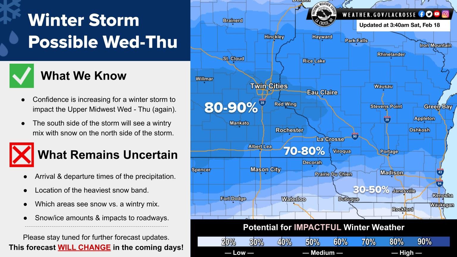
| Outlook - Issued 2/18/2023 (NWS La Crosse) |
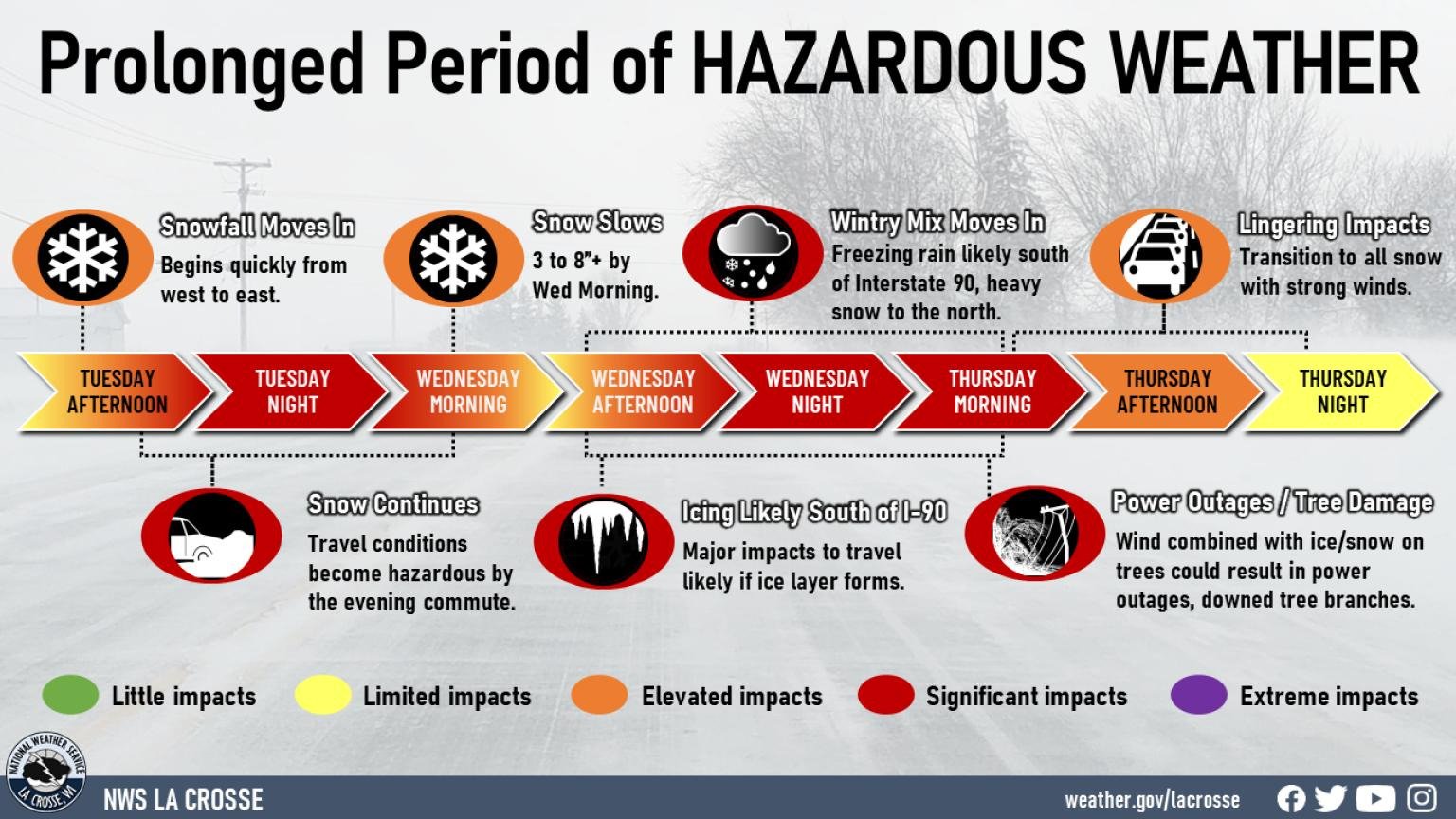
Timeline - Issued 2/19/2023 (NWS La Crosse) |
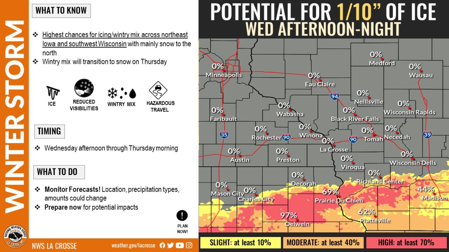
Snow Probabilities - Issued 2/21/2023 Morning (NWS La Crosse) |
 |
 |
 |
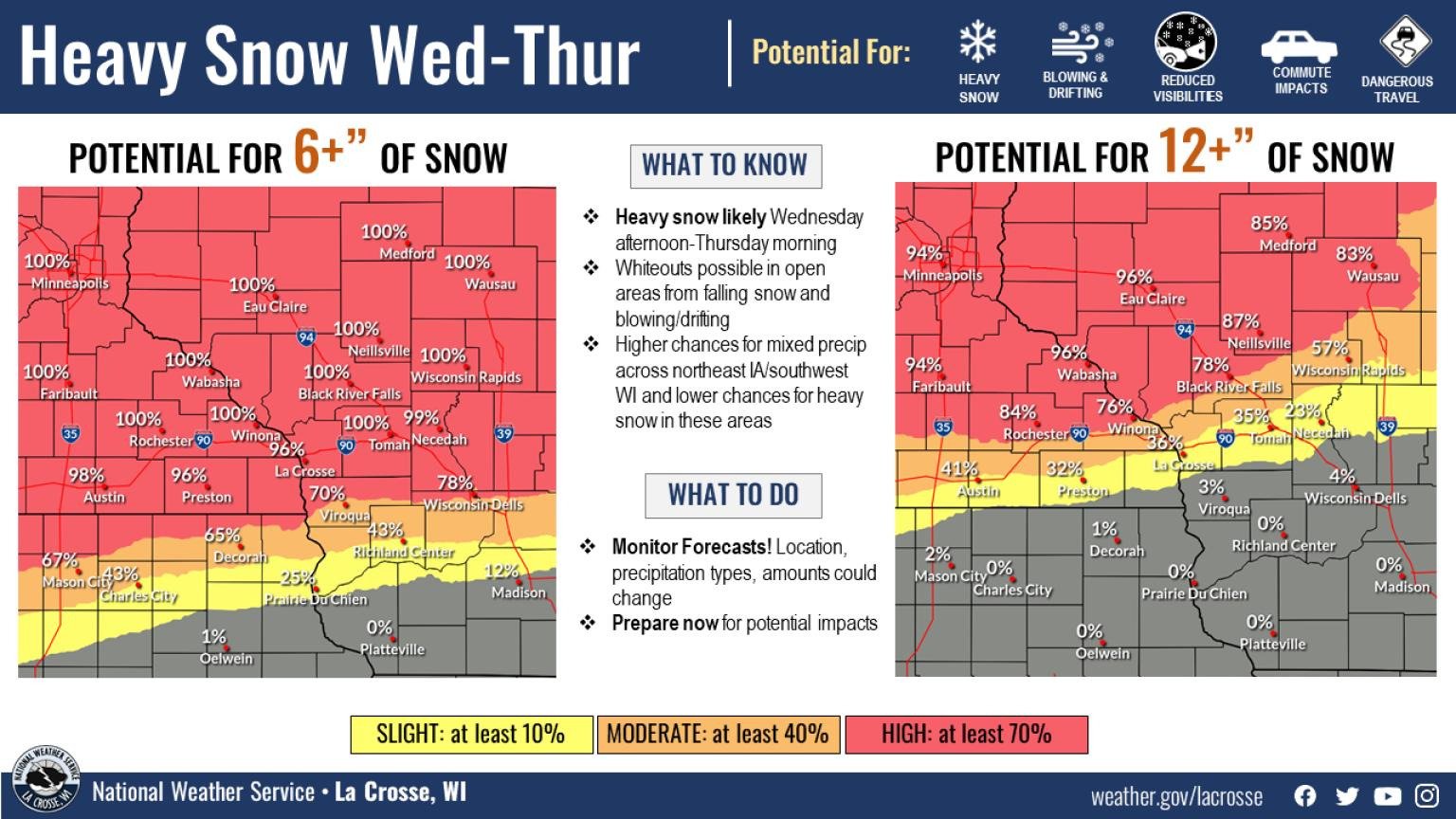
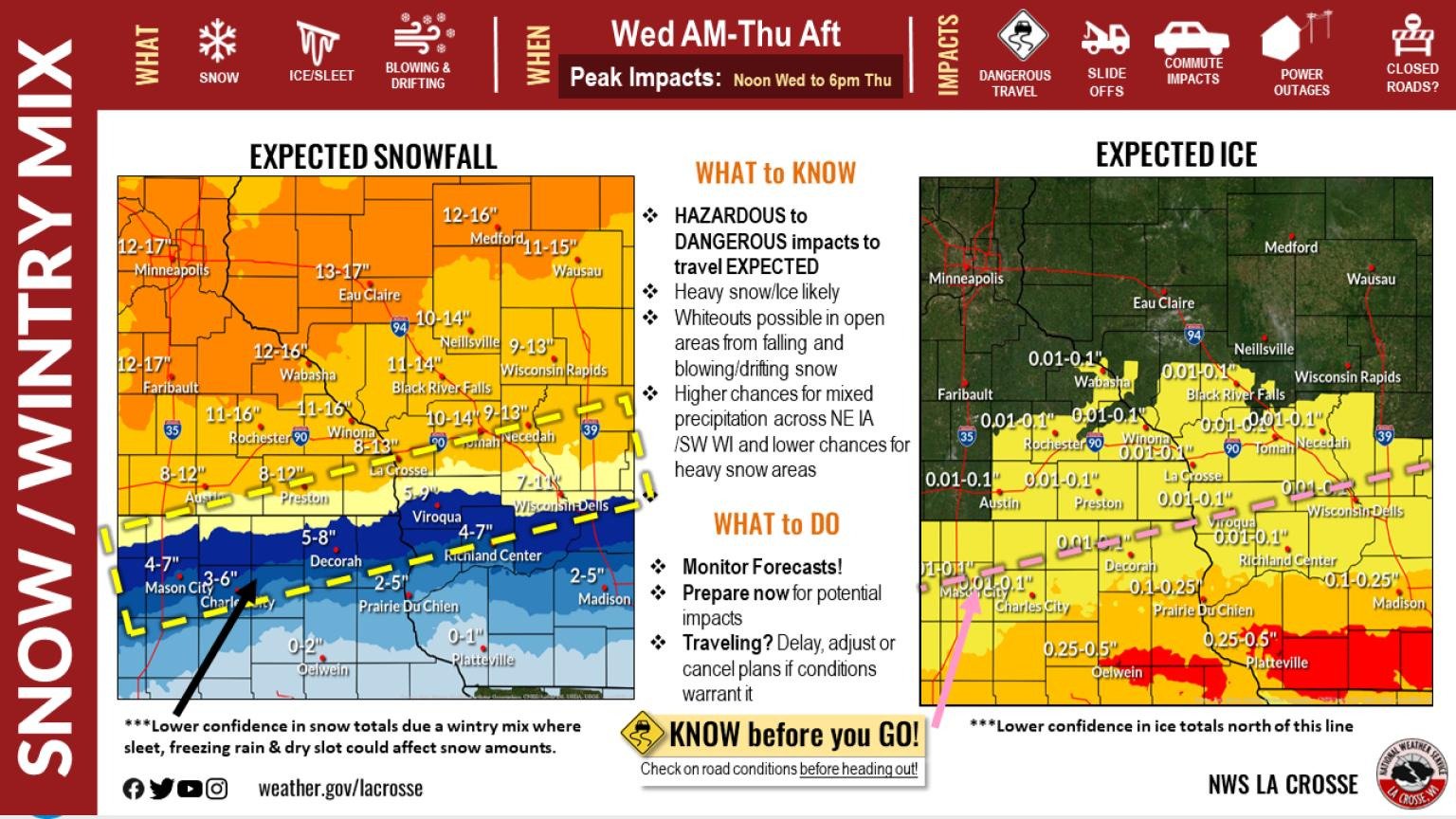
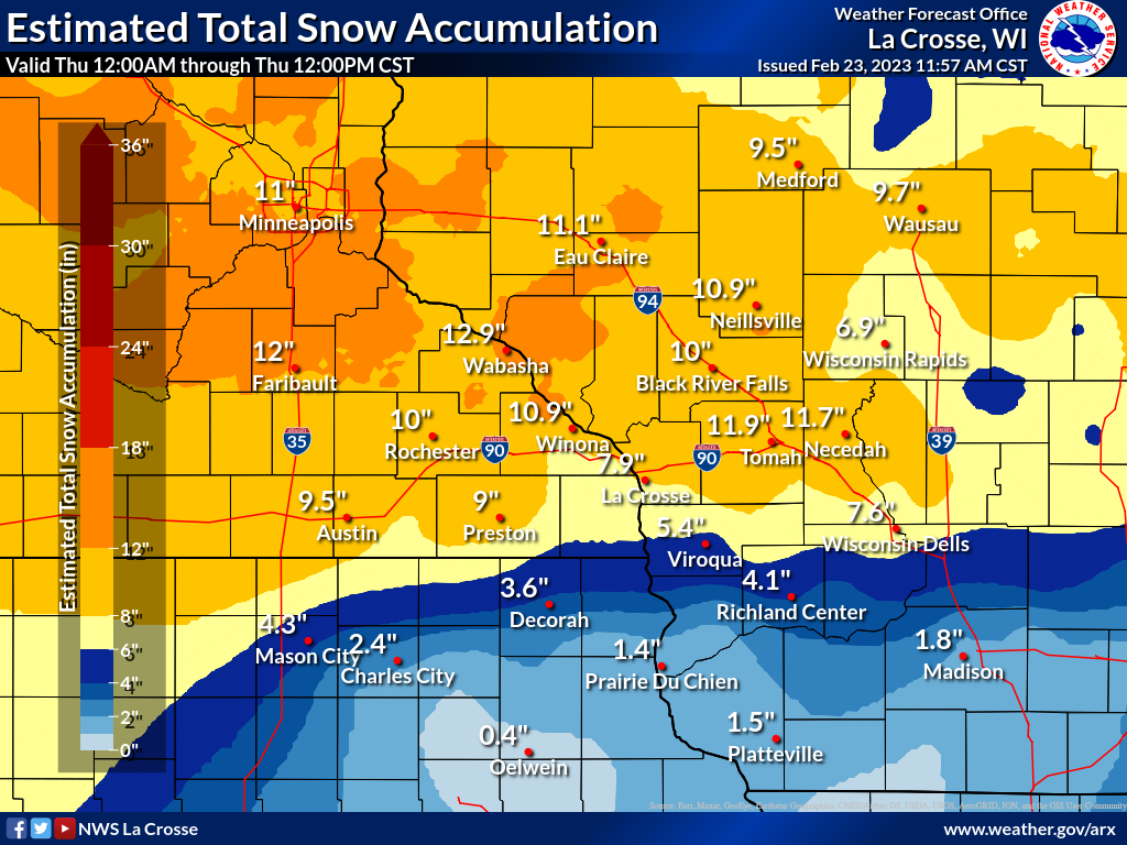
| Accumulation Forecast - Issued Afternoon 2/21/2023 (NWS La Crosse) |
Accumulation Forecast - Issued Afternoon 2/21/2023 (NWS La Crosse) |
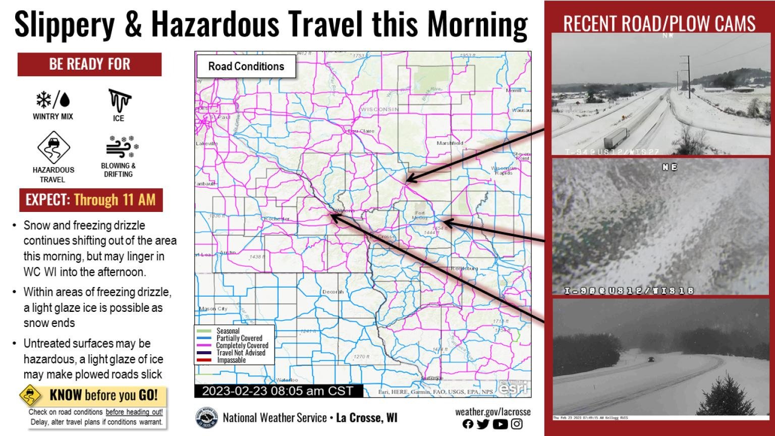
During Event - Issued 2/23/2023 (NWS La Crosse) |
Photos:
 |
 |
 |
 |
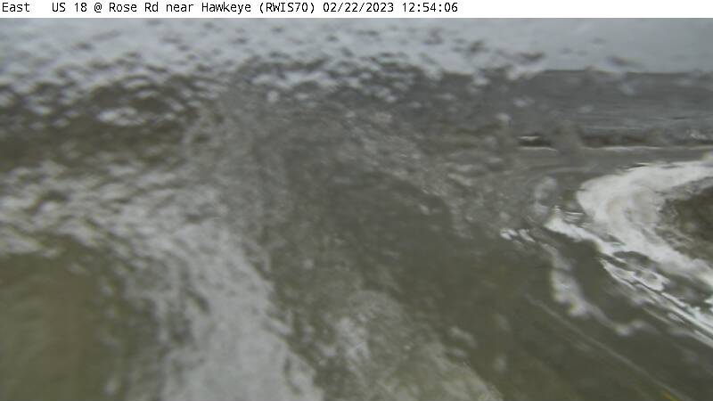
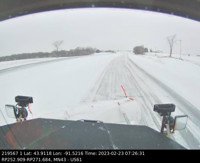
| Hawkeye, IA (Iowa DOT) |
Stanley, IA (Dan Murphy) |
Stanley, IA (Dan Murphy) |
Stanley, IA (Dan Murphy) |
 |
 |
 |
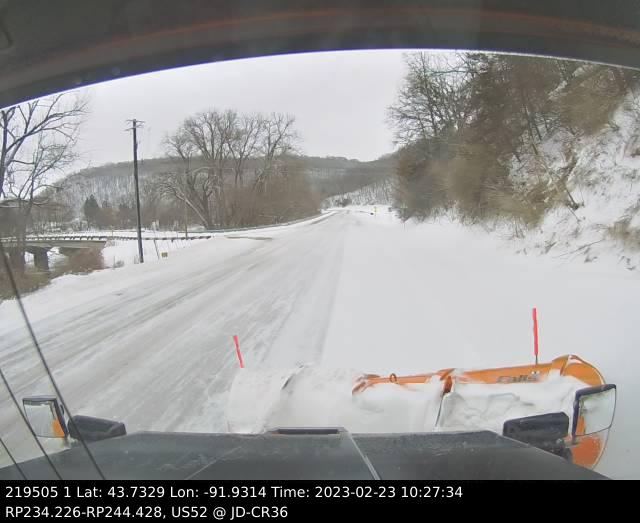 |
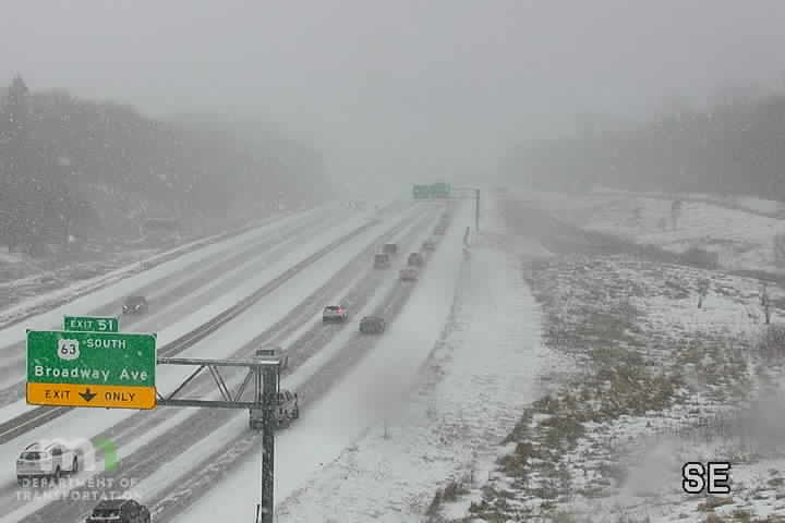
| Rochester, MN (Patrick Hagge) |
Rochester, MN (MN DOT) |
Winona, MN (MN DOT) |
Whalan, MN (MN DOT) |
Radar:
 |
|||
| Regional Radar Loop Afternoon Feb 21st - Morning Feb 23rd |
Caption | Caption | Caption |
Freezing Rain/Ice Accumulation Reports
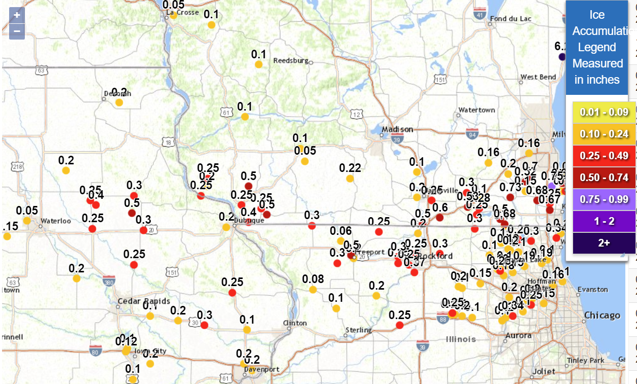
LOCATION                     AMOUNT    TIME/DATE       LAT/LON

...IOWA...

...CLAYTON COUNTY...
STRAWBERRY POINT             0.30 IN   0600 AM 02/23   42.69N/91.53W
1 NNE NORTH BUENA VISTA      0.25 IN   0900 PM 02/22   42.69N/90.95W

...FAYETTE COUNTY...
1 SSE OELWEIN                0.25 IN   0847 PM 02/22   42.66N/91.91W

...WINNESHIEK COUNTY...
7 ESE DECORAH                0.20 IN   0700 AM 02/23   43.28N/91.66W

...WISCONSIN...

...GRANT COUNTY...
DICKEYVILLE                  0.25 IN   0600 PM 02/22   42.63N/90.60W
1 NW BEETOWN                 0.25 IN   0914 PM 02/22   42.80N/90.89W
CUBA CITY                    0.25 IN   0922 PM 02/22   42.61N/90.43W
3 SSW BEETOWN                0.20 IN   0847 AM 02/23   42.75N/90.90W
BLUE RIVER                   0.10 IN   1037 AM 02/23   43.19N/90.57W

...LA CROSSE COUNTY...
2 E LA CROSSE                0.05 IN   0700 AM 02/23   43.83N/91.19W

...MONROE COUNTY...
PORTLAND                     0.10 IN   0700 AM 02/23   43.77N/90.86W

...RICHLAND COUNTY...
2 NNE BLOOM CITY             0.10 IN   1009 AM 02/23   43.52N/90.45W

OBSERVATIONS ARE COLLECTED FROM A VARIETY OF SOURCES WITH VARYING
EQUIPMENT AND EXPOSURES. WE THANK ALL VOLUNTEER WEATHER OBSERVERS
FOR THEIR DEDICATION. NOT ALL DATA LISTED ARE CONSIDERED OFFICIAL.
 |
Media use of NWS Web News Stories is encouraged! Please acknowledge the NWS as the source of any news information accessed from this site. |
|


 Weather Story
 Weather Map
 Local Radar