Overview
|
A winter storm moved out of the southern Plains Monday night January 8th, bringing snow across much of our region into Tuesday evening, January 9th. The strong storm dropped heavy, wet snow across parts of Iowa, northern Illinois and southern Wisconsin. Snow totals in excess of a foot were realized at some locations. In addition, strong northerly winds gusted from 30 to 40 mph at times leading to blowing and drifting. The storm led to difficult to dangerous travel conditions during the heaviest snowfall, along with a lot of activity and school closures. |
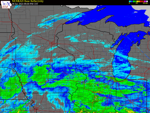 Regional Radar look from the evening of January 8th through the day January 9th, 2024 |
Snow Totals
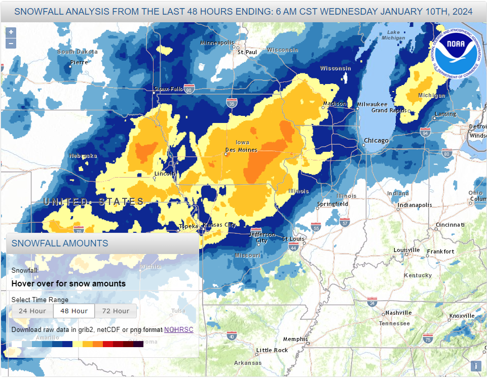
Public Information Statement
National Weather Service La Crosse WI
1111 AM CST Wed Jan 10 2024

...SNOWFALL TOTALS JANUARY 8-9th...

Location                     Amount

...IOWA...

...Allamakee County...
Postville 5.5 NE             8.0 in

...Chickasaw County...
Fredericksburg 0.3 S         5.7 in
New Hampton                  5.5 in
New Hampton 0.4 SW           5.3 in

...Clayton County...
Guttenberg                   12.0 in
Monona 4ENE                  11.5 in
Strawberry Point             11.4 in
Monona 0.2 WNW               11.0 in
Elkader 6SSW                 10.5 in
Littleport                   9.1 in
Marquette                    8.8 in
Elkader 6.8 WSW              8.0 in
Guttenberg Dam 10            6.2 in
McGregor 6.4 WNW             3.5 in

...Fayette County...
Albany 1NE                   11.5 in
Waucoma 1 WNW                8.5 in
Fayette                      7.5 in
Fayette 3N                   7.4 in
Oelwein                      7.0 in
Saint Lucas                  6.0 in

...Floyd County...
Marble Rock                  4.5 in
Charles City                 4.5 in

...Howard County...
Elma                         3.5 in

...Mitchell County...
St Ansgar                    4.2 in
Osage                        3.6 in

...Winneshiek County...
7 ENE Decorah                6.0 in
Decorah                      5.0 in

...MINNESOTA...

...Dodge County...
Kasson 1NE                   2.5 in
Mantorville 1.9 ESE          2.4 in
Mantorville                  2.0 in
Hayfield 0.3 SSE             0.5 in

...Fillmore County...
Mabel                        3.2 in
Wykoff 3.1 NW                2.7 in
Spring Valley                2.6 in
Lanesboro 0.2 SSW            1.9 in
Chatfield                    1.5 in

...Houston County...
Caledonia                    6.0 in
1 ENE Mound Prairie          4.7 in
Hokah 4 NW                   4.7 in
La Crescent 6W               4.0 in

...Mower County...
Waltham 2.0 SE               3.0 in
Adams                        3.0 in
Austin 2.4 W                 2.9 in
Grand Meadow                 2.6 in
Austin Waste Water Treatment 2.0 in
Austin 1.9 ENE               1.7 in
Austin 4WSW                  1.5 in

...Olmsted County...
2 NE Rochester               3.0 in
Stewartville 4.3 E           2.5 in
Chatfield 2.7 NNW            2.4 in
Rochester 4.7 N              2.3 in
Rochester Intl Airport       2.2 in
Rochester 5.7 N              2.1 in
2 NNW Rochester              2.1 in
Elgin 2SSW                   1.4 in

...Wabasha County...
Kellogg 0.1 N                1.6 in
Zumbro Falls 3.5 SSW         1.3 in
Lake City 0.7 SE             1.3 in
Theilman 1 SSW               1.3 in
Wabasha 6.2 WNW              1.1 in
Lake City 0.8 SW             1.0 in

...Winona County...
La Crescent 4.0 NNW          4.1 in
Winona 2.0 ESE               2.1 in
4.2 N Rollingstone           1.0 in

...WISCONSIN...

...Adams County...
White Creek 3ENE             8.8 in
Dellwood                     6.3 in
Grand Marsh                  6.0 in
Big Spring 4NW               5.5 in
Oxford 4.0 W                 5.2 in
0.6 W Friendship             5.1 in

...Buffalo County...
Mondovi 12.1 SSE             2.0 in
Mondovi                      1.8 in
Urne                         1.0 in

...Clark County...
Greenwood                    2.5 in
Thorp 10.1 S                 2.0 in

...Crawford County...
Prairie du Chien 2N          13.2 in
Prairie du Chien 0.6 NE      9.3 in
Prairie du Chien 1SE         9.0 in
Eastman                      9.0 in
Gays Mills                   8.4 in
Seneca 1WSW                  8.3 in
Gays Mills 1NE               8.0 in
Bell Center                  7.9 in
Clayton 4 SSW                6.5 in

...Grant County...
Muscoda                      12.0 in
Cuba City                    10.5 in
Woodman                      10.0 in
Lancaster 4.3 W              9.8 in
Bagley                       9.0 in
Cassville 7.8 ENE            8.0 in
Beetown 3SE                  8.0 in
Muscoda 0.5 WSW              7.6 in
Boscobel                     7.3 in
Bloomington                  7.2 in

...Jackson County...
Melrose 3.6 W                2.7 in

...Juneau County...
Mauston 1E                   8.9 in
Wonewoc                      8.5 in
Elroy                        8.0 in
Camp Douglas                 7.0 in
Hustler 2SW                  4.0 in
Necedah                      4.0 in

...La Crosse County...
NWS La Crosse                5.2 in
Holmen 2S                    4.5 in
La Crosse Airport            4.2 in
Onalaska 1.9 E               4.0 in
West Salem                   3.6 in
Coon Valley 4.5 NNW          3.4 in
La Crosse 4NNW               3.3 in

...Monroe County...
Cashton 3NNW                 7.0 in
Kendall                      6.3 in
Warrens 4.7 WSW              6.0 in
Sparta 4SSW                  5.5 in
Leon                         5.4 in
Tomah 1SSW                   5.1 in
Tomah                        5.0 in
Melvina 6NNE                 5.0 in
Sparta 0.5 SW                4.2 in
Warrens                      4.0 in

...Richland County...
Richland Center 4N           8.9 in
Richland Center              6.3 in

...Taylor County...
Medford 0.8 ENE              1.3 in
Stetsonville 3SSW            1.3 in

...Trempealeau County...
Dodge                        3.0 in
Elk Creek 3SSE               2.0 in

...Vernon County...
Hillsboro 2SW                9.0 in
Viroqua 0.5 E                8.9 in
Hillsboro                    8.0 in
Viola                        7.0 in
Viroqua 2 ENE                6.7 in
Viroqua 0.8 ESE              6.6 in
Stoddard 1.5 NE              4.9 in
Stoddard 4.7 NNE             4.1 in
La Farge                     3.0 in

Observations are collected from a variety of sources with varying
equipment and exposures. We thank all volunteer weather observers
for their dedication. Not all data listed are considered official.

$$

NWS La Crosse
Records
January 9 Precipitation Records

                                                       Records
                       New Record    Previous Record     Began
                       ----------    ---------------    -------
Boscobel Airport, WI  0.32 inches  0.27 inches in 2009    1999
Elma, IA              0.29 inches  0.29 inches in 2009    1907
Hokah WWTP, MN        0.33 inches  0.15 inches in 1995    1948
La Crescent Dam 7, MN 0.33 inches  0.22 inches in 1939    1939
La Crosse 4NNW, WI    0.19 inches  0.12 inches in 2015    1999
La Crosse NWS, WI     0.30 inches  0.15 inches in 2017    1997
La Farge, WI          0.21 inches  0.11 inches in 1999    1940
Preston, MN           0.23 inches  0.20 inches in 2009    1952
Rochester Airport, MN 0.20 inches  0.20 inches in 1963    1886
Rochester AP 2NE, MN  0.15 inches  0.13 inches in 2016    2000
St. Ansgar, IA        0.32 inches  0.31 inches in 2009    1948
Steuben 4 SE, WI      0.38 inches  0.20 inches in 1964    1971
Strawberry Point, IA  0.27 inches  0.20 inches in 2009    1948
Waucoma 1 WNW, IA     0.31 inches  0.23 inches in 1964    1954

January 9 Snow Records

                                                       Records
                       New Record   Previous Record     Began
                       ----------   ---------------    -------
Charles City, IA       6.0 inches  5.2 inches in 1964    1893
Decorah, IA            5.0 inches  5.0 inches in 1952    1893
Fayette IA             4.5 inches  3.4 inches in 2009    1893
Genoa Dam 8, WI        4.2 inches  3.0 inches in 1964    1936
Guttenberg L & D 10 IA 3.0 inches  3.0 inches in 1964    1938
Hokah WWTP, MN         5.2 inches  4.0 inches in 1995    1948
La Crosse NWS, WI      4.8 inches  1.8 inches in 1997    1997
La Farge, WI           4.5 inches  2.0 inches in 1999    1940
Lynxville Dam 9, WI    6.0 inches  2.0 inches in 2009    1936
Oelwein, IA            4.1 inches  2.0 inches in 2015    1924
Osage, IA              3.6 inches  3.3 inches in 2009    1893
Viroqua, WI            5.3 inches  3.0 inches in 1995    1893
Waucoma 1 WNW, IA      8.0 inches  4.2 inches in 2009    1954
Waukon 3NNE, IA        4.2 inches  4.0 inches in 1964    1934
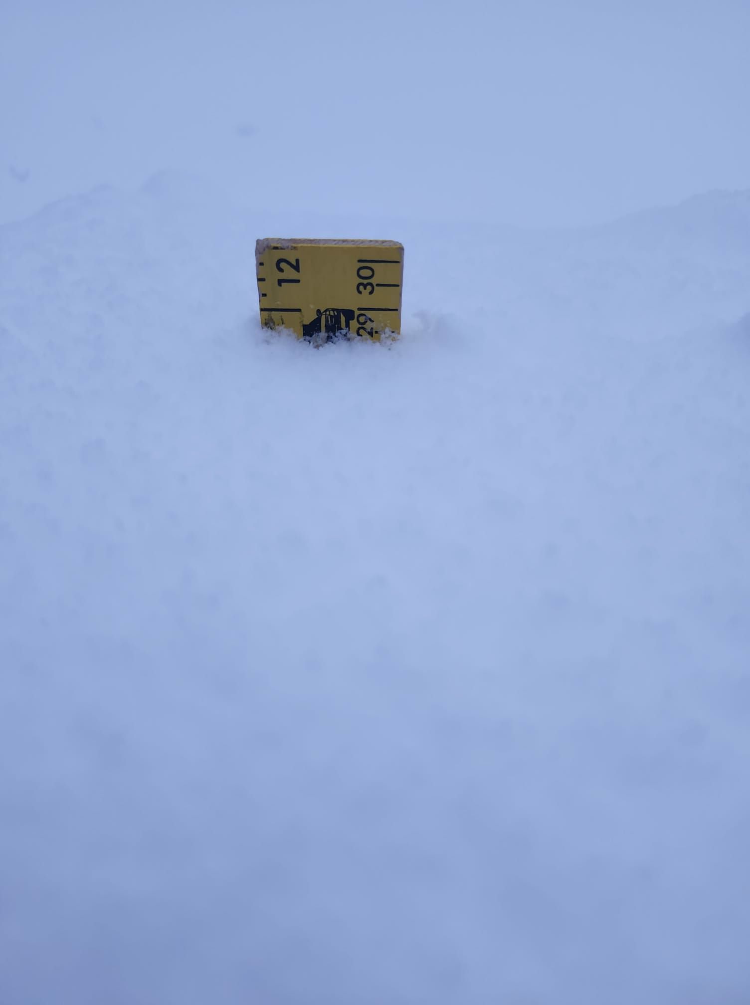
Photos:
 |
 |
 |
 |
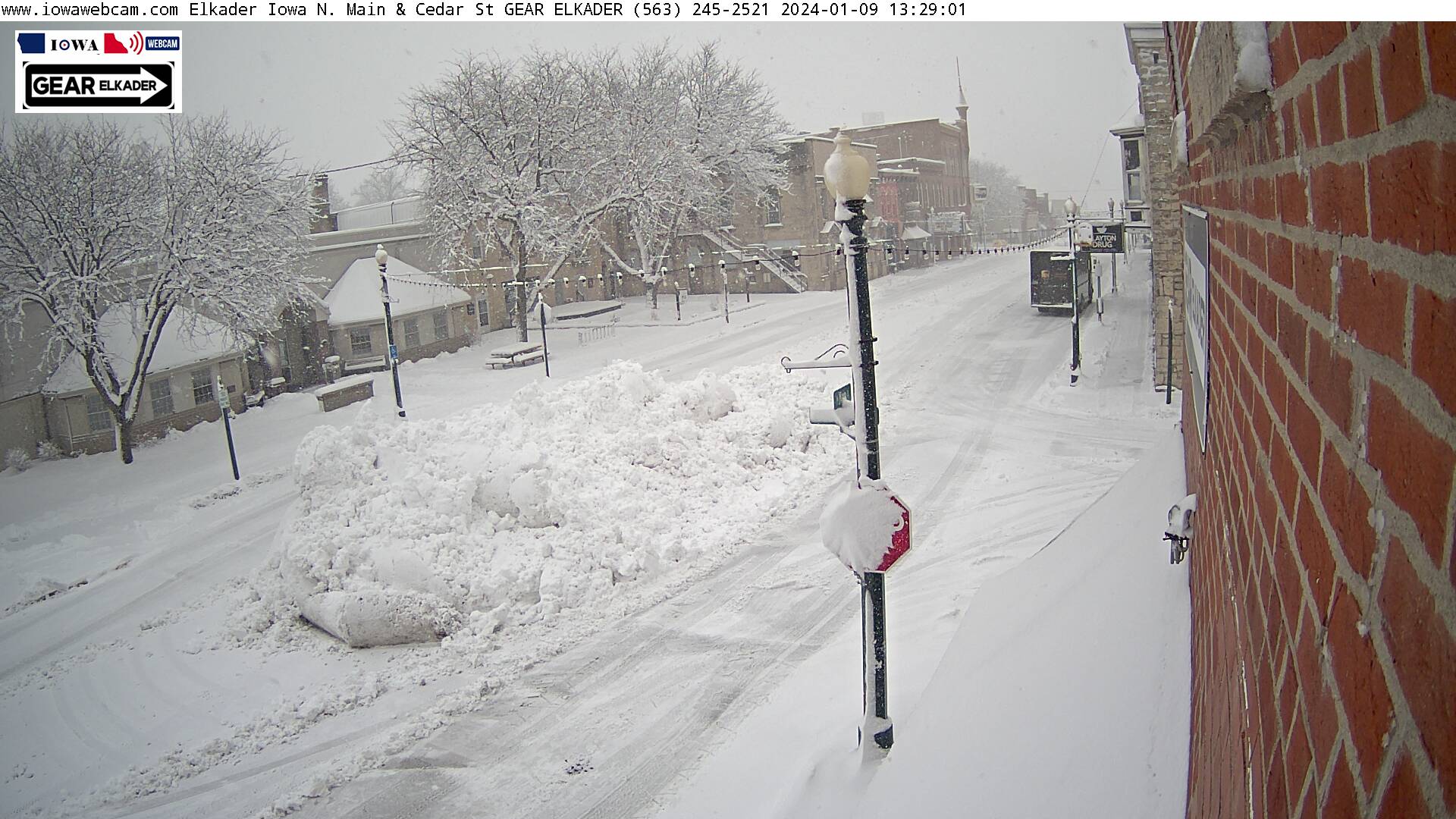
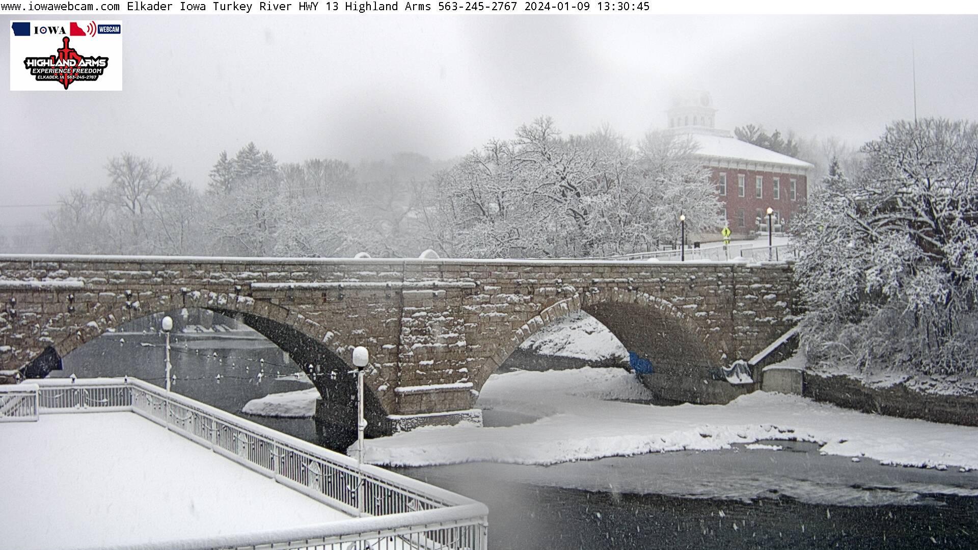
| Elkader, IA (Iowa Webcam) |
Elkader, IA (Iowa Webcam) |
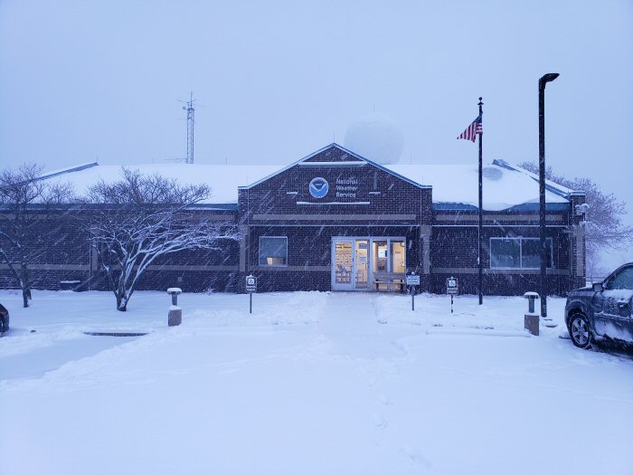
Fresh snow at NWS La Crosse (NWS La Crosse) |
Lima, IA (Courtesy of Michelle Schaefers) |
01092024.jpg) |
|||
| Waukon, IA (Iowa DOT) |
Caption (source) |
Caption (source) |
Caption (source) |
Additional Information
The Forecast & Messaging
 |
 |
 |
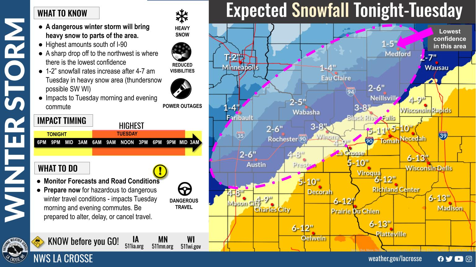 |
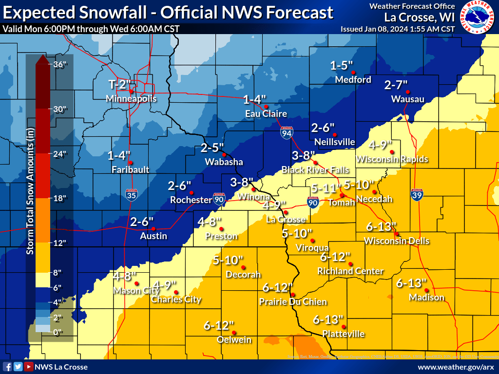
| Expected Snowfall Forecast (Issued Jan.8, 2024) |
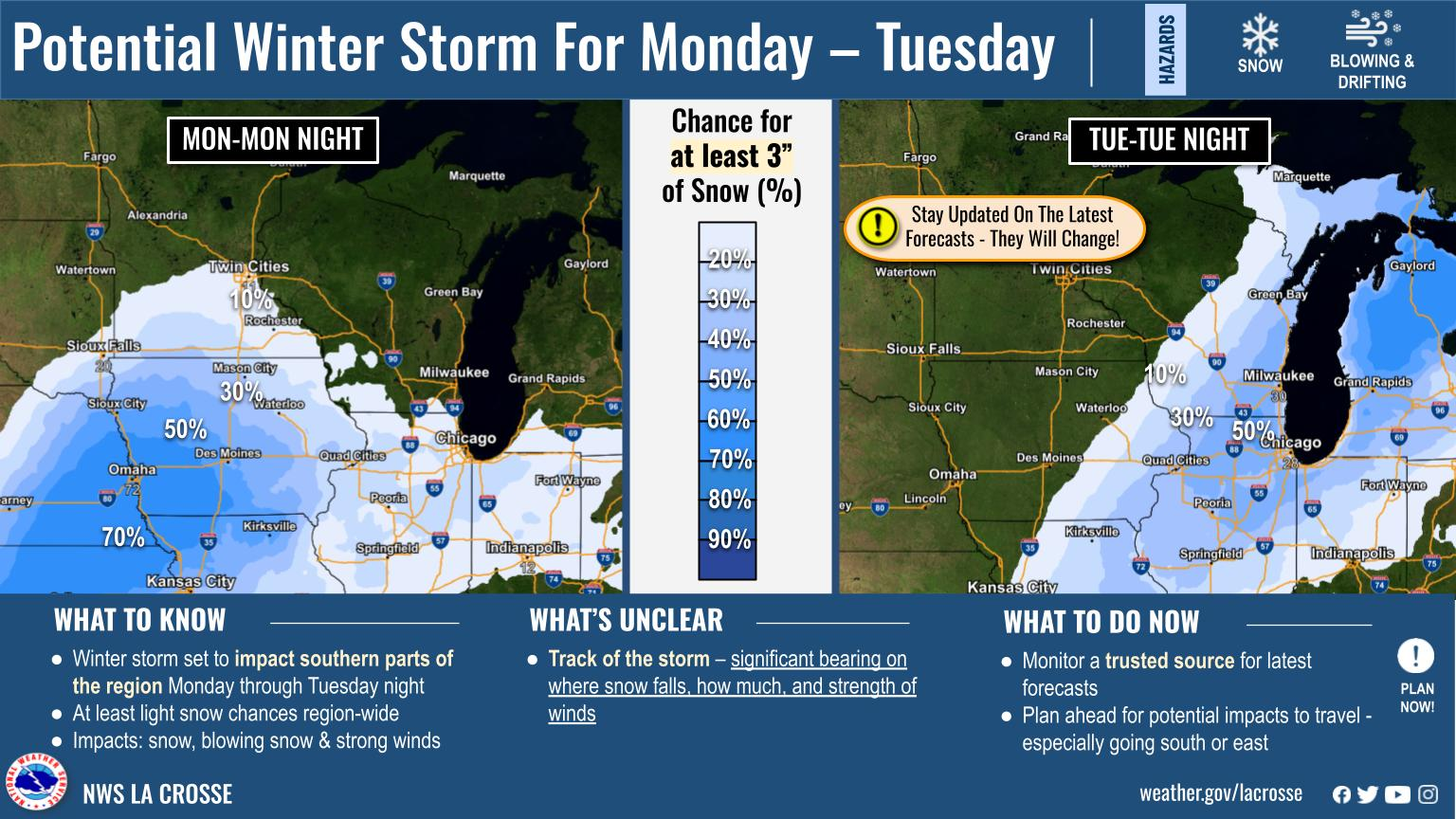
Early storm prediction graphic (Issued Jan.5, 2024) |
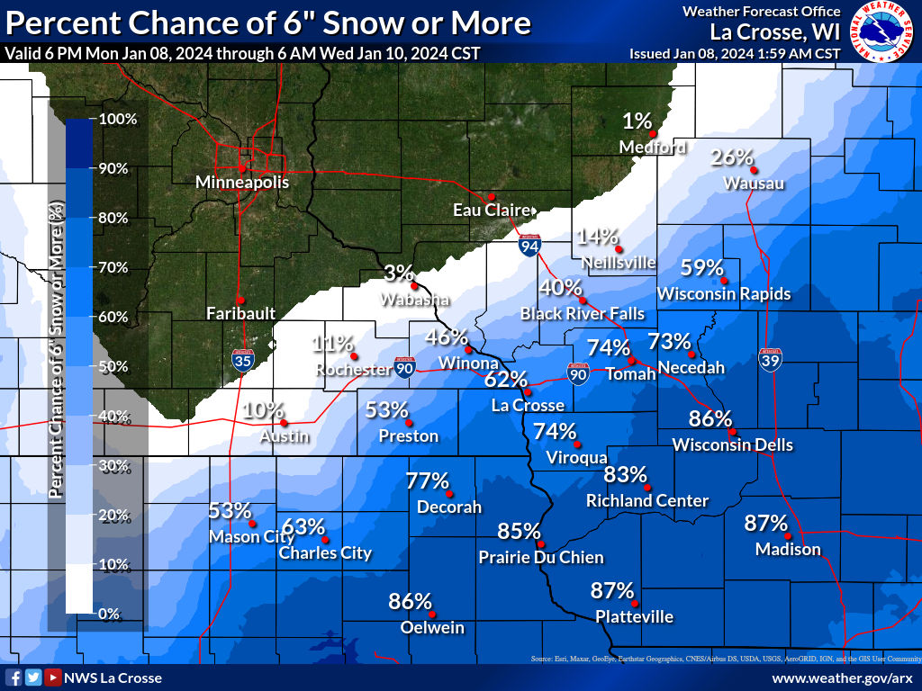
Probability of 6" or more graphic (Issued Jan. 8, 2024) |
Messaging and safety graphic (Issued Jan. 8, 2024) |
 |
 |
 |
|
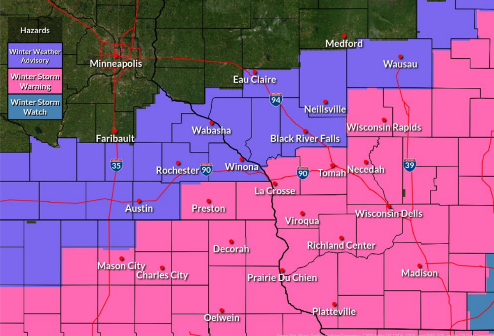
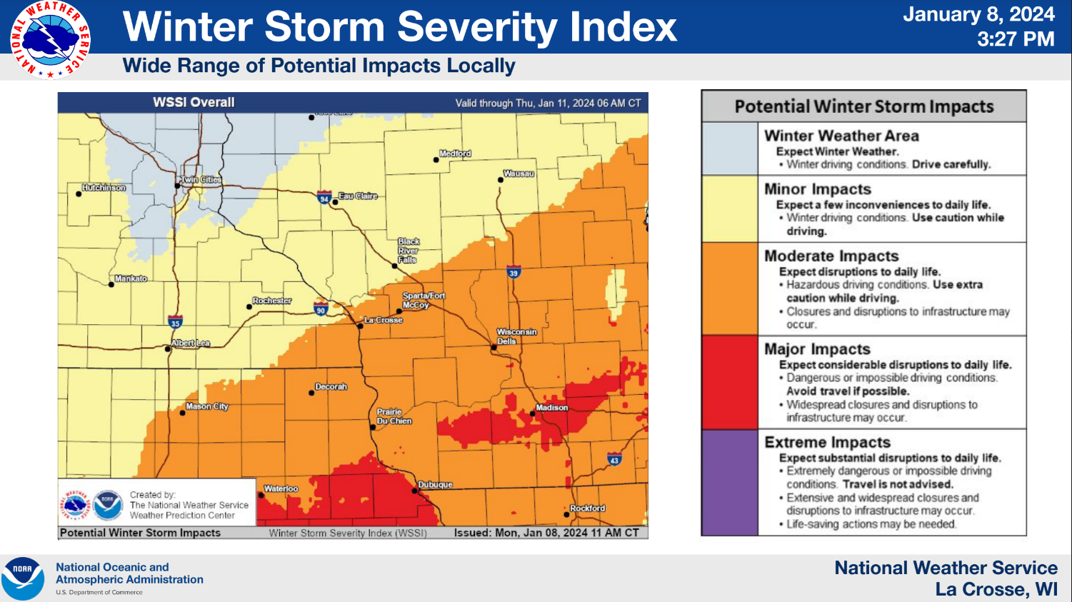
| Warning & Advisory Map | Potential Winter Storm Impacts (Issued Jan. 8, 2024) |
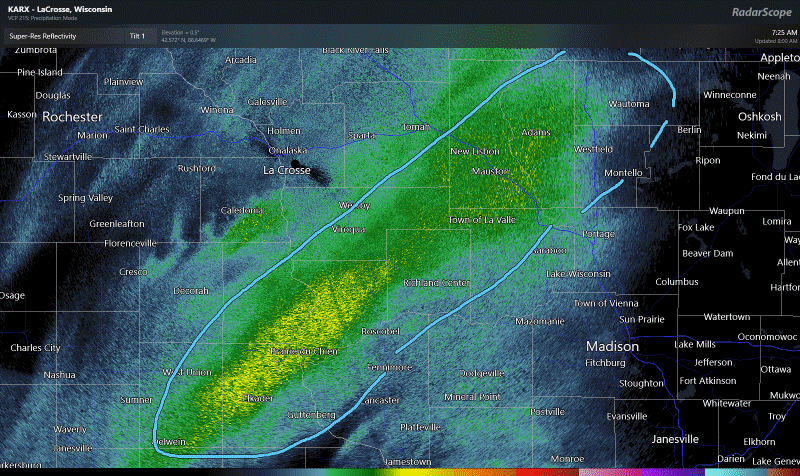
Radar Loop on Jan 9, 2024 [8:00 AM] Heavy snow band with snowfall rates up to 1" per hour in NE IA into central WI. |
 |
Media use of NWS Web News Stories is encouraged! Please acknowledge the NWS as the source of any news information accessed from this site. |
|


 Weather Story
 Weather Map
 Local Radar