Overview
|
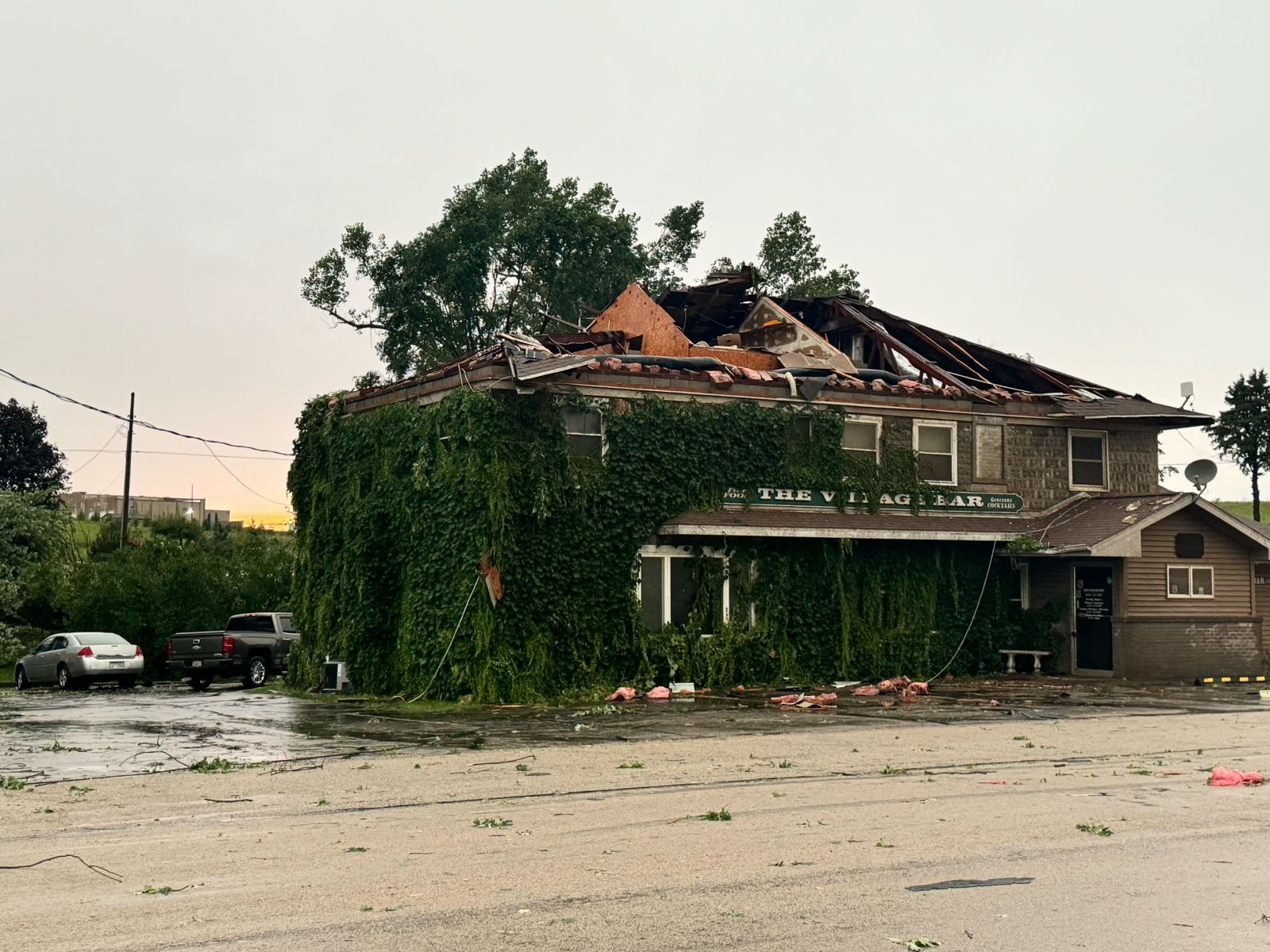
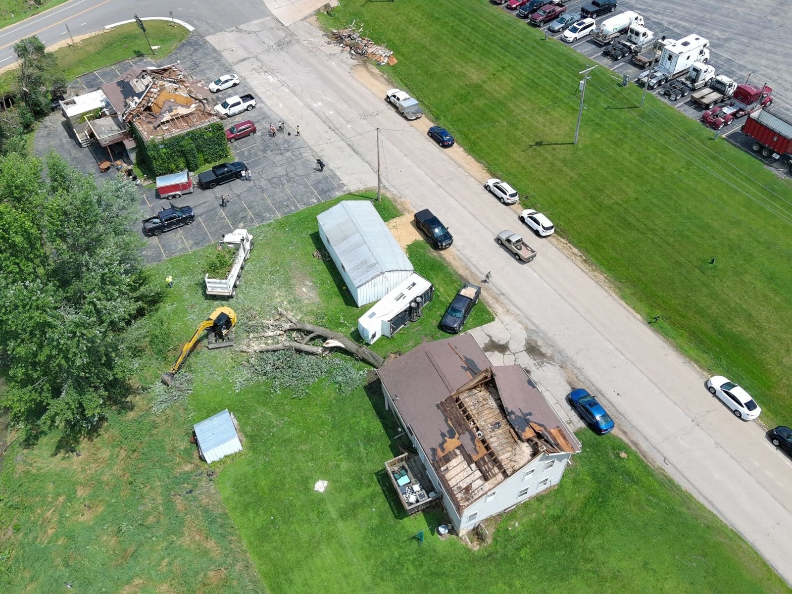
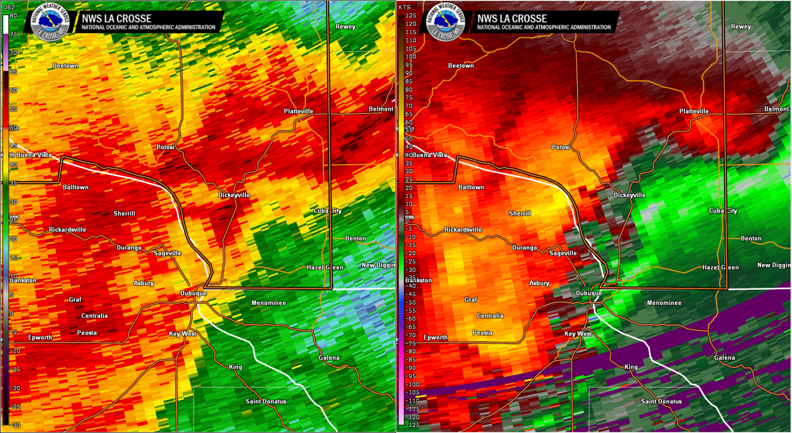
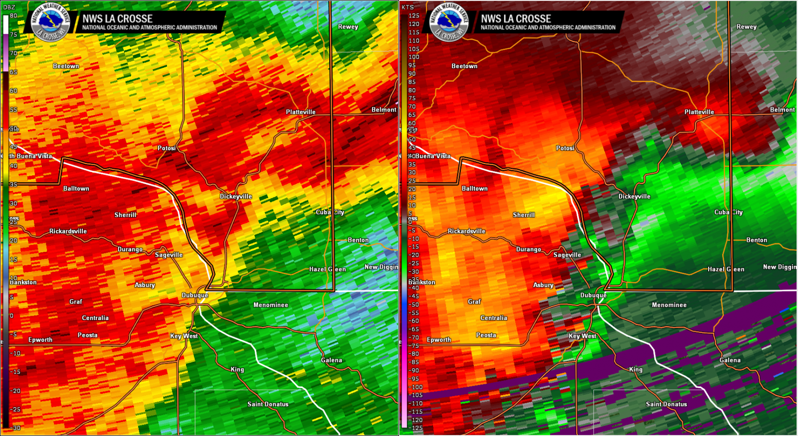
Thunderstorms rapidly developed over central Iowa on the afternoon of Monday, July 15, 2024. These storms quickly intensified as they progressed eastward and morphed into a line of severe storms that clipped portions of northeast Iowa and far southwest Wisconsin. Intense wind gusts to 75 mph were reported on the north end of these storms, and a brief EF1 tornado developed in southern Grant County in Kieler, WI. Localized flash flooding was also reported in southern Grant County. |
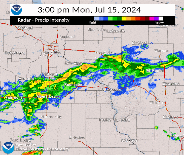 Radar loop from 3 to 8 PM Monday, July 15 |
Tornadoes:
|
Tornado - Kieler, WI
Track Map 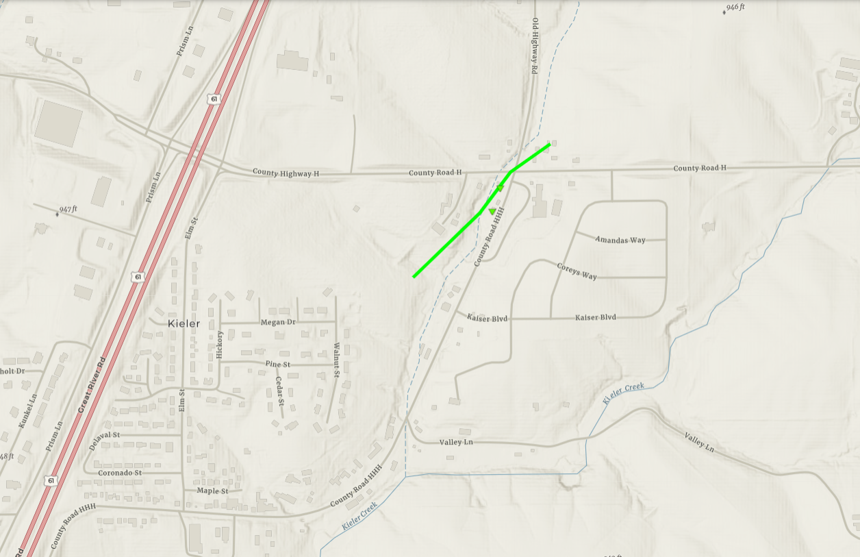 
Downloadable KMZ File |
||||||||||||||||
|
||||||||||||||||
| EF0 Weak 65-85 mph |
EF1 Moderate 86-110 mph |
EF2 Significant 111-135 mph |
EF3 Severe 136-165 mph |
EF4 Extreme 166-200 mph |
EF5 Catastrophic 200+ mph |
 |
|||||
Storm Reports:
..TIME...   ...EVENT...      ...CITY LOCATION...     ...LAT.LON...
..DATE...   ....MAG....      ..COUNTY LOCATION..ST.. ...SOURCE....
            ..REMARKS..

0520 PM     Hail             2 W Cassville           42.70N 91.03W
07/15/2024  M0.88 Inch       Clayton            IA   Public


0558 PM     Tstm Wnd Gst     Guttenberg              42.79N 91.10W
07/15/2024  M52 MPH          Clayton            IA   Trained Spotter


0558 PM     Tstm Wnd Gst     North Buena Vista       42.68N 90.96W
07/15/2024  E75 MPH          Clayton            IA   Law Enforcement


0614 PM     Tstm Wnd Dmg     3 SW Kieler             42.54N 90.62W
07/15/2024                   Grant              WI   Trained Spotter

            Flag pole and large branch broken.


0614 PM     Tornado          Kieler                  42.59N 90.59W
07/15/2024                   Grant              WI   Emergency Mngr

            A brief EF-1 tornado in Kieler produced tree
            and structural damage near County Road H.
            The tornado lasted for 1 minute.


0628 PM     Tstm Wnd Gst     Hazel Green             42.53N 90.44W
07/15/2024  M72 MPH          Grant              WI   Emergency Mngr


&&

$$
 |
Media use of NWS Web News Stories is encouraged! Please acknowledge the NWS as the source of any news information accessed from this site. |
|


 Weather Story
 Weather Map
 Local Radar