Overview
|
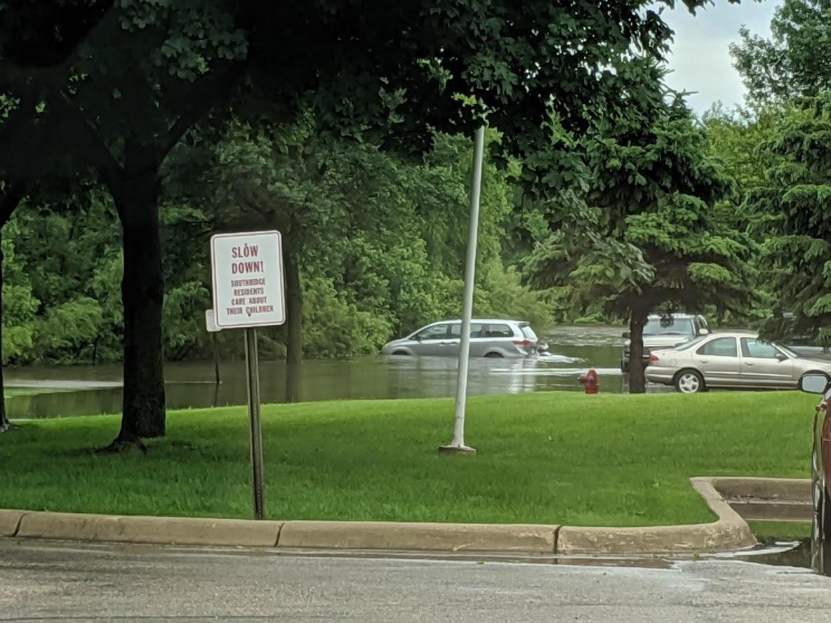
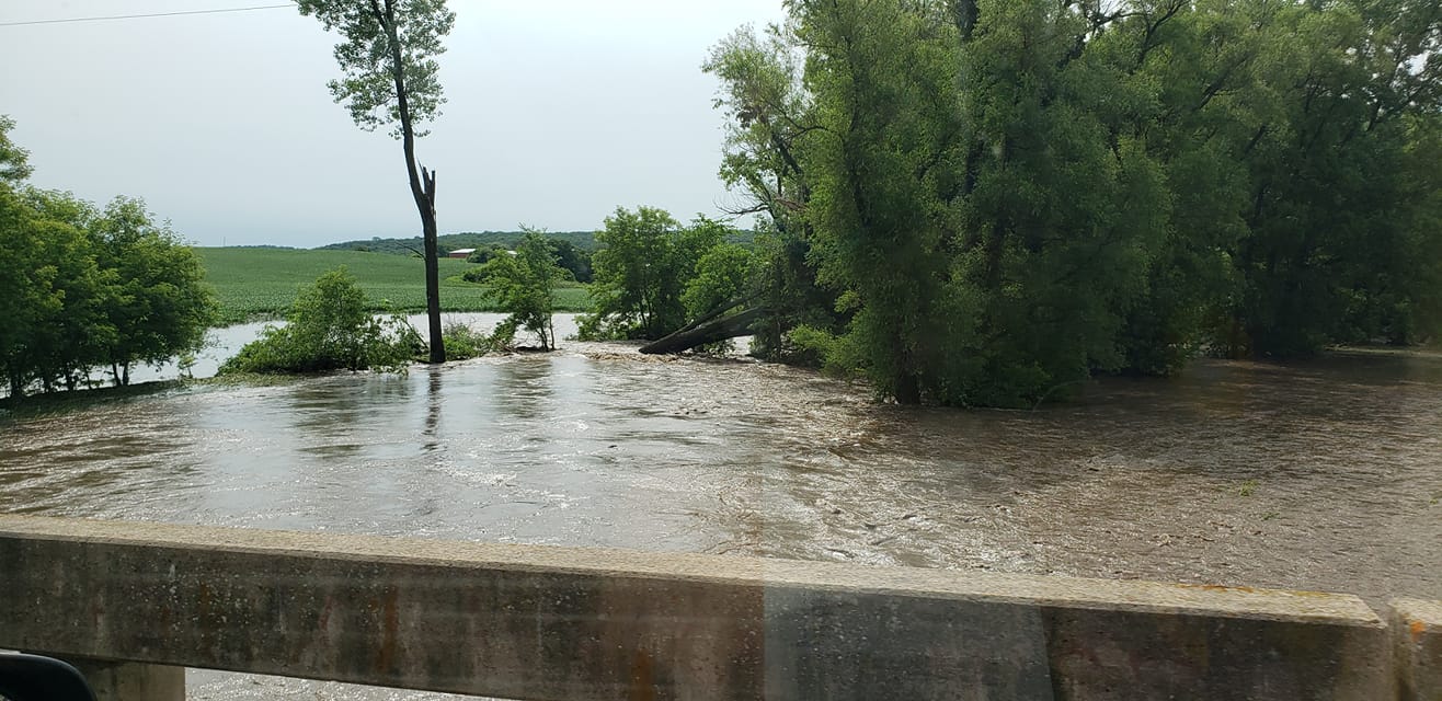
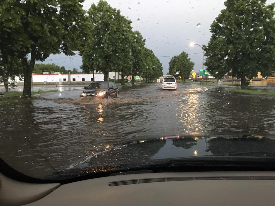
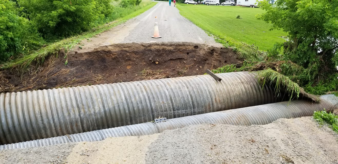
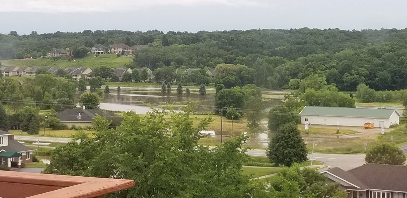
Thunderstorms developed in the evening hours of Thursday June 27th and intensified during the overnight hours. Parts of southeast Minnesota and the city of Rochester were the target of the heaviest rainfall. Rochester International Airport was closed for several hours overnight because of water over the runways where around 5" of rain fell in 6 hours. The hardest hit area was west of the city of Rochester, near Oxbow Park, where flash flooding on the Middle Fork of the Zumbro river swept away 40-60 cattle off one farm. While some reports of people driving into flooded water were received, no lives were lost thankfully! |
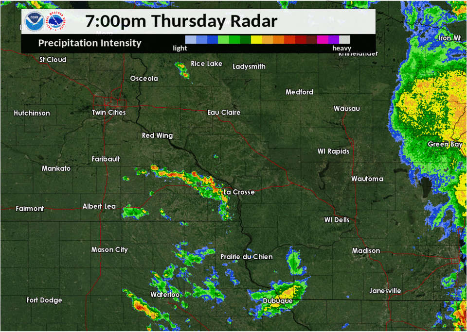 Radar Loop of June 27-28, 2019 |
Flooding
Flood Crests
| River Gauge Site | River Crest Time | River Crest Level |
| Middle Fork Zumbro River at Pine Island, MN | June 28, 12:00 pm | 21.61 ft |
| South Branch, Middle Fork Zumbro River near Oxbow Park, MN | June 28, 9:33 am | 31.48 ft |
| South Fork Zumbro River near Rochester 5SW, MN | June 28, 12:00 pm | 91.65 ft |
| South Fork Zumbro River at Rochester, MN | June 28, 6:30 pm | 16.59 ft |
| Cascade Creek at Rochester, MN | June 28, 12:30 pm | 14.21 ft |
| Cascade Creek near Rochester 3SW, MN | June 28, 9:00 am | 48.15 ft |
Flooding Reports
..TIME...   ...EVENT...      ...CITY LOCATION...     ...LAT.LON...
..DATE...   ....MAG....      ..COUNTY LOCATION..ST.. ...SOURCE....
            ..REMARKS..

0931 AM     FLASH FLOOD      2 N BYRON               44.07N 92.65W
06/28/2019                   OLMSTED            MN   EMERGENCY MNGR

            EMERGENCY MANAGEMENT REPORTED FARMER LOST 40
            TO 60 CATTLE.

0730 AM     FLASH FLOOD      NEW HAMPTON             43.06N 92.32W
06/28/2019                   CHICKASAW          IA   PUBLIC

            STORM SEWERS ARE AT CAPACITY AND AS A RESULT
            THE WATER IS BACKING ONTO THE ROADS.

0658 AM     FLASH FLOOD      3 SW GENOA              44.08N 92.65W
06/28/2019                   OLMSTED            MN   PUBLIC

            CAMPGROUND FLOODED AT OXBOW PARK. AT LEAST 1
            CAR WAS FLOODED.

0555 AM     FLASH FLOOD      3 S WEST CONCORD        44.11N 92.90W
06/28/2019                   DODGE              MN   PUBLIC

            TRUCK TRIED TO DRIVE THROUGH A FLOODED AREA
            ALONG HIGHWAY 56 BETWEEN DODGE CENTER AND
            WEST CONCORD. IT WAS SWEPT OFF ROAD INTO A
            NEARBY FIELD. PASSENGERS ARE OK.

0555 AM     FLASH FLOOD      2 SE DOUGLAS            44.09N 92.54W
06/28/2019                   OLMSTED            MN   PUBLIC

            FLASH FLOODING ALONG WEATHERSTONE DRIVE
            NORTHWEST.

0542 AM     FLASH FLOOD      KASSON                  44.02N 92.75W
06/28/2019                   DODGE              MN   PUBLIC

            HIGHWAY 14 FLOODED IN BOTH DIRECTIONS.

0500 AM     FLASH FLOOD      2 SW WASIOJA            44.06N 92.85W
06/28/2019                   DODGE              MN   EMERGENCY MNGR

            NUMEROUS REPORTS OF ROADS UNDER WATER
            BEGINNING TO COME INTO DISPATCH ACROSS MUCH
            OF NORTHERN DODGE COUNTY.

0458 AM     FLASH FLOOD      4 S ROCHESTER           43.95N 92.47W
06/28/2019                   OLMSTED            MN   PUBLIC

            HIGHWAY US 63 FLOODED.

0430 AM     FLASH FLOOD      4 N STEWARTVILLE        43.91N 92.50W
06/28/2019                   OLMSTED            MN   OTHER FEDERAL

            RUNWAYS FLOODED AT ROCHESTER INTERNATIONAL
            AIRPORT.
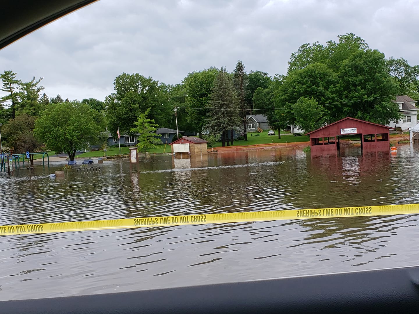
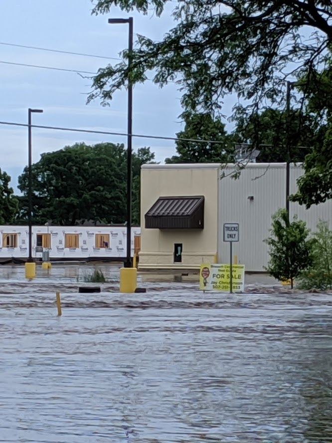
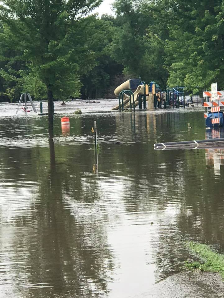
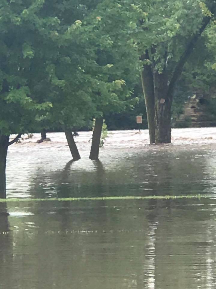
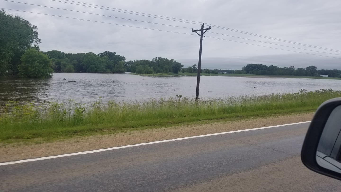
Photos:
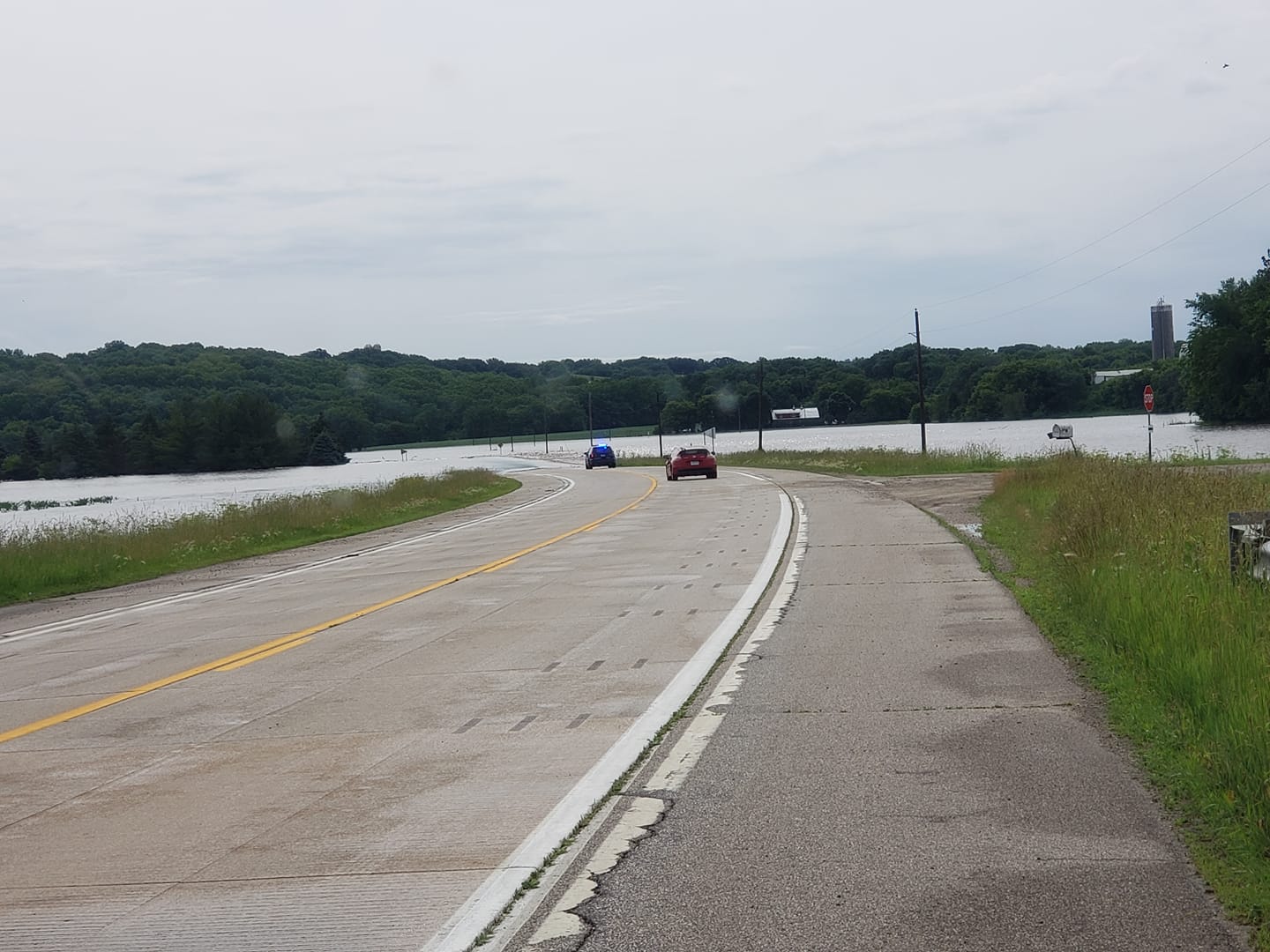 |
 |
 |
 |
| Byron, MN (Photo by Sara Johnson) |
Mantorville, MN (Photo by Sara Johnson) |
Kasson, MN (Photo by Cody Rysavy) |
Kasson, MN (Photo by Cody Rysavy) |
 |
 |
 |
 |
| North of Fountain, MN (Photo by Lisa Hoover) |
North of Fountain, MN (Photo by Lisa Hoover) |
Highway 57 Kasson, MN (Photo by Josh Asfahl) |
605th st. outside Kasson,MN (Photo by Jeff Blumfield) |
 |
 |
 |
 |
| West Side of Rochester, MN (Photo by Tim Hudson) |
Mantorville, MN (Photo by Tina Potter) |
Mantorville, MN (Photo by Tina Potter) |
Salem Corners (Photo by Megan Moskalik Hansen) |
Rain Reports
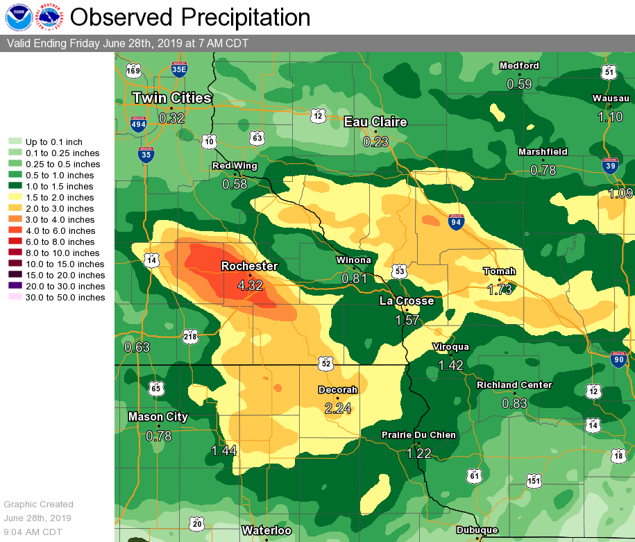 |
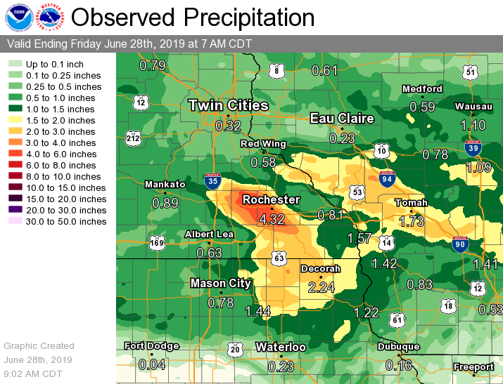 |
| Preliminary Local 24-hour Rainfall Totals (ending Friday June 28 2019 @ 7 am) |
Preliminary Regional 24-hour Rainfall Totals ​(ending Friday June 28 2019 @ 7 am) |
Public Information Statement
National Weather Service La Crosse WI
117 PM CDT Fri Jun 28 2019

...24 HOUR PRECIPITATION REPORTS...

Location                     Amount    Time/Date       Lat/Lon

...Iowa...

...Allamakee County...
Postville 5.5 NE             1.71 in   0700 AM 06/28   43.14N/91.49W
Monona 9.8 N                 1.58 in   0700 AM 06/28   43.19N/91.35W
Lansing 4.1 NW               1.55 in   0700 AM 06/28   43.40N/91.29W
Upper Iowa River             0.90 in   0600 AM 06/28   43.42N/91.51W

...Chickasaw County...
New Hampton                  3.69 in   0700 AM 06/28   43.06N/92.32W
New Hampton 0.4 SW           3.52 in   0700 AM 06/28   43.06N/92.32W

...Clayton County...
Elkader 6SSW                 2.00 in   0700 AM 06/28   42.78N/91.45W
Monona                       1.58 in   0849 AM 06/28   43.04N/91.39W
McGregor                     0.98 in   0847 AM 06/28   43.02N/91.19W

...Fayette County...
Waucoma 3.2 S                2.44 in   0720 AM 06/28   43.01N/92.03W
Oelwein 0.3 E                1.34 in   0946 AM 06/28   42.68N/91.91W
Fayette                      1.30 in   0645 AM 06/28   42.85N/91.82W

...Floyd County...
Charles City                 0.65 in   0700 AM 06/28   43.06N/92.67W
Nashua 2SW                   0.43 in   0600 AM 06/28   42.94N/92.57W
Nora Springs 2.4 SSE         0.33 in   0700 AM 06/28   43.11N/92.99W

...Howard County...
Cresco 1NE                   2.76 in   0725 AM 06/28   43.39N/92.09W
Elma                         2.53 in   0700 AM 06/28   43.24N/92.44W
Riceville                    1.57 in   0845 AM 06/28   43.40N/92.50W

...Mitchell County...
Osage 4.7 E                  1.69 in   0700 AM 06/28   43.28N/92.72W
Osage                        1.58 in   0700 AM 06/28   43.28N/92.81W

...Winneshiek County...
7 ENE Decorah                2.75 in   0715 AM 06/28   43.34N/91.64W
Decorah                      1.78 in   0850 AM 06/28   43.30N/91.79W
Fort Atkinson 0.2 SE         1.71 in   0700 AM 06/28   43.14N/91.93W

...Minnesota...

...Dodge County...
Kasson                       7.50 in   1039 AM 06/28   44.03N/92.75W
Wasioja                      6.30 in   0434 AM 06/28   44.08N/92.82W
Mantorville                  5.75 in   0721 AM 06/28   44.07N/92.76W
Claremont                    5.69 in   0748 AM 06/28   44.04N/93.00W
Claremont 2.5 ESE            4.69 in   0737 AM 06/28   44.04N/92.95W
Hayfield 0.3 SSE             2.81 in   0700 AM 06/28   43.89N/92.85W
Hayfield                     2.68 in   0847 AM 06/28   43.89N/92.85W

...Fillmore County...
5 WSW Cummingsville          5.02 in   0700 AM 06/28   43.84N/92.35W
Chatfield                    4.20 in   0744 AM 06/28   43.84N/92.19W
Chatfield 0.7 SW             3.97 in   0700 AM 06/28   43.84N/92.20W
Preston 3.2 NNE              3.80 in   0630 AM 06/28   43.71N/92.05W
Harmony                      3.80 in   0749 AM 06/28   43.55N/92.01W
Chatfield 9.0 ESE            3.07 in   0700 AM 06/28   43.79N/92.03W
Wykoff 3.1 NW                2.30 in   0700 AM 06/28   43.74N/92.31W
Preston Airport              2.08 in   0836 AM 06/28   43.68N/92.17W
1 S Peterson                 1.64 in   0700 AM 06/28   43.77N/91.83W

...Houston County...
Mabel 2.7 E                  2.31 in   0700 AM 06/28   43.51N/91.71W
Brownsville 3.1 S            1.82 in   0700 AM 06/28   43.65N/91.28W
La Crescent 0.7 N            1.76 in   0730 AM 06/28   43.84N/91.30W
Caledonia                    1.23 in   0700 AM 06/28   43.63N/91.50W
Caledonia 5.4 S              1.05 in   0800 AM 06/28   43.56N/91.51W
Houston 6.9 E                0.93 in   0745 AM 06/28   43.76N/91.43W

...Mower County...
Austin Waste Water Treatment 0.69 in   0700 AM 06/28   43.65N/92.97W
Austin 1.9 ENE               0.66 in   0800 AM 06/28   43.68N/92.94W
Austin 2.7 W                 0.50 in   0700 AM 06/28   43.68N/93.03W
Austin 2.4 W                 0.49 in   0658 AM 06/28   43.67N/93.02W

...Olmsted County...
2 S Predmore                 7.30 in   0600 AM 06/28   43.90N/92.34W
2 SSW Rochester              7.25 in   0753 AM 06/28   43.99N/92.48W
Byron                        6.24 in   0633 AM 06/28   44.04N/92.64W
2 WSW Rochester              6.00 in   0944 AM 06/28   44.01N/92.51W
Rochester Ap 2ne             5.99 in   0700 AM 06/28   43.93N/92.48W
Rochester Intl Airport       5.63 in   0554 AM 06/28   43.90N/92.50W
Rochester                    4.68 in   0533 AM 06/28   44.01N/92.49W
3 S Rochester                4.51 in   0733 AM 06/28   43.97N/92.49W
Rochester 3.2 WNW            4.27 in   0700 AM 06/28   44.04N/92.53W
2 SW Rochester               4.07 in   0504 AM 06/28   43.99N/92.50W
3 SE Douglas                 3.30 in   0701 AM 06/28   44.08N/92.53W
2 NNW Rochester              3.28 in   0700 AM 06/28   44.05N/92.49W
Mayo Helipad                 2.99 in   0635 AM 06/28   44.02N/92.48W
4 ESE Douglas                2.82 in   0717 AM 06/28   44.08N/92.51W
Rochester 4.1 ENE            2.81 in   0830 AM 06/28   44.04N/92.40W
1 W Chester                  2.56 in   0558 AM 06/28   44.00N/92.38W
Rochester 4.7 N              2.42 in   0700 AM 06/28   44.08N/92.48W
Rochester 5.5 N              2.16 in   1000 AM 06/28   44.10N/92.47W
2 W High Forest              2.07 in   0500 AM 06/28   43.85N/92.59W
Rochester 5.8 ENE            1.79 in   0840 AM 06/28   44.05N/92.37W

...Wabasha County...
1 SSE Lake City              4.60 in   0530 AM 06/28   44.43N/92.26W
1 W Reads Landing            3.80 in   0730 AM 06/28   44.40N/92.08W
Lake City                    3.14 in   0700 AM 06/28   44.44N/92.28W
Wabasha 0.9 NNE              3.06 in   0743 AM 06/28   44.38N/92.03W
Lake City 1.0 SE             2.98 in   0800 AM 06/28   44.43N/92.27W
4 N Millville                2.20 in   0540 AM 06/28   44.30N/92.28W
Zumbro Falls 3.5 SSW         1.29 in   0700 AM 06/28   44.24N/92.46W
Plainview                    0.65 in   0639 AM 06/28   44.16N/92.17W

...Winona County...
La Crescent Dam 7            1.47 in   0600 AM 06/28   43.87N/91.31W
Winona 12.0 ESE              1.29 in   0700 AM 06/28   43.99N/91.44W
Minnesota City               0.90 in   0600 AM 06/28   44.16N/91.81W
Winona 1.3 SSW               0.90 in   0710 AM 06/28   44.03N/91.68W
4 SW Winona                  0.87 in   0635 AM 06/28   43.98N/91.71W
Winona 3.8 SE                0.85 in   0700 AM 06/28   44.02N/91.61W
Winona 5.1 WSW               0.76 in   0800 AM 06/28   44.03N/91.77W
Winona Dam 5A                0.74 in   0800 AM 06/28   44.09N/91.67W
Stockton                     0.67 in   0611 AM 06/28   44.03N/91.77W
Altura 5w                    0.66 in   0700 AM 06/28   44.06N/92.04W
Lewiston 0.2 NW              0.61 in   0700 AM 06/28   43.99N/91.87W
Saint Charles                0.61 in   1115 AM 06/28   43.97N/92.06W

...Wisconsin...

...Adams County...
Oxford 4.0 W                 2.54 in   0645 AM 06/28   43.79N/89.64W
Castle Rock                  2.02 in   0600 AM 06/28   43.87N/89.95W
Grand Marsh 1.9 SSW          1.83 in   0700 AM 06/28   43.86N/89.72W
Friendship                   1.63 in   0700 AM 06/28   43.98N/89.83W
Grand Marsh 1.0 W            1.02 in   0700 AM 06/28   43.89N/89.73W
Nekoosa 8.0 SSE              1.01 in   0800 AM 06/28   44.21N/89.85W
Petenwell Lake               0.98 in   1000 AM 06/28   44.08N/90.00W

...Buffalo County...
Alma                         3.50 in   0819 AM 06/28   44.32N/91.91W
Alma Dam 4                   3.15 in   0800 AM 06/28   44.33N/91.92W
Mondovi 12.1 SSE             1.71 in   0700 AM 06/28   44.40N/91.60W
Mondovi 0.5 NNE              1.00 in   0630 AM 06/28   44.58N/91.66W
Cochrane                     0.93 in   0639 AM 06/28   44.22N/91.83W

...Crawford County...
De Soto 1SE                  1.51 in   0600 AM 06/28   43.42N/91.19W
De Soto                      1.15 in   0636 AM 06/28   43.42N/91.19W
Gays Mills                   0.99 in   0800 AM 06/28   43.32N/90.85W
Gays Mills 6.1 SE            0.92 in   0800 AM 06/28   43.26N/90.76W
Gays Mills 0.3 SE            0.90 in   0700 AM 06/28   43.32N/90.85W
1 NNE Prairie Du Chien       0.70 in   0820 AM 06/28   43.05N/91.13W
Prairie Du Chien             0.69 in   0700 AM 06/28   43.05N/91.13W

...Grant County...
Muscoda 0.5 WSW              0.50 in   0941 AM 06/28   43.18N/90.44W
Boscobel                     0.48 in   0803 AM 06/28   43.15N/90.68W
Fennimore                    0.45 in   0850 AM 06/28   42.98N/90.66W

...Jackson County...
Melrose                      3.25 in   0656 AM 06/28   44.13N/91.00W
1 E Black River Falls        1.83 in   0615 AM 06/28   44.30N/90.73W
Mather 3NW                   1.45 in   0700 AM 06/28   44.17N/90.35W

...Juneau County...
Mauston 1SE                  2.82 in   0800 AM 06/28   43.79N/90.06W
Mauston                      2.04 in   0852 AM 06/28   43.80N/90.07W

...La Crosse County...
Onalaska 0.6 SW              1.67 in   0700 AM 06/28   43.88N/91.23W
La Crosse 4.4 SSE            1.63 in   0700 AM 06/28   43.77N/91.21W
St. Joseph 3W                1.60 in   0639 AM 06/28   43.78N/91.10W
La Crosse 4NNW               1.49 in   0730 AM 06/28   43.87N/91.27W
West Salem                   1.35 in   0700 AM 06/28   43.90N/91.09W
Onalaska 2N                  1.34 in   0700 AM 06/28   43.91N/91.23W
La Crosse Regional Airport   1.30 in   0553 AM 06/28   43.88N/91.25W

...Monroe County...
Wilton 4.2 E                 2.45 in   0700 AM 06/28   43.81N/90.44W
Sparta                       2.35 in   0800 AM 06/28   43.94N/90.82W
Warrens 4WSW                 2.16 in   0700 AM 06/28   44.10N/90.59W
Cashton 4.8 N                1.35 in   0700 AM 06/28   43.81N/90.76W

...Richland County...
1 SSE Richland Center        0.77 in   0849 AM 06/28   43.32N/90.38W
Cazenovia 4.3 WNW            0.50 in   0700 AM 06/28   43.54N/90.28W

...Taylor County...
Gad                          1.13 in   1000 AM 06/28   45.14N/90.20W
Medford                      0.80 in   0800 AM 06/28   45.13N/90.34W
3 NE Lublin                  0.41 in   0614 AM 06/28   45.11N/90.69W
Medford                      0.30 in   0633 AM 06/28   45.30N/90.30W

...Trempealeau County...
Ettrick 4WNW                 3.11 in   0737 AM 06/28   44.19N/91.34W
2 S Arcadia                  2.60 in   0640 AM 06/28   44.22N/91.49W
Galesville 1.0 NE            2.24 in   0600 AM 06/28   44.10N/91.34W
Trempealeau Dam 6            1.46 in   0600 AM 06/28   44.00N/91.44W
1 NW Trempealeau             1.35 in   0700 AM 06/28   44.03N/91.46W
Trempealeau 7.6 NNW          1.03 in   0700 AM 06/28   44.11N/91.48W

...Vernon County...
2 NE Genoa                   2.80 in   0838 AM 06/28   43.59N/91.21W
Stoddard 0.1 SW              2.18 in   0700 AM 06/28   43.66N/91.22W
Genoa Dam 8                  2.02 in   0600 AM 06/28   43.57N/91.23W
Viroqua 0.7 WNW              1.97 in   0700 AM 06/28   43.56N/90.90W
Viroqua 0.8 ESE              1.83 in   0700 AM 06/28   43.55N/90.87W
Viroqua                      1.80 in   0700 AM 06/28   43.56N/90.88W
Ontario 3e                   1.20 in   0700 AM 06/28   43.72N/90.53W
Westby 3ENE                  1.00 in   0700 AM 06/28   43.67N/90.81W
Hillsboro 0.5 WSW            0.60 in   0700 AM 06/28   43.65N/90.35W

Observations are collected from a variety of sources with varying
equipment and exposures. We thank all volunteer weather observers
for their dedication. Not all data listed are considered official.

$$
 |
Media use of NWS Web News Stories is encouraged! Please acknowledge the NWS as the source of any news information accessed from this site. |
|


 Weather Story
 Weather Map
 Local Radar