Overview
|
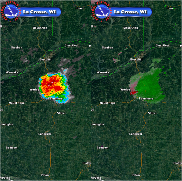
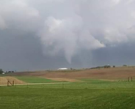
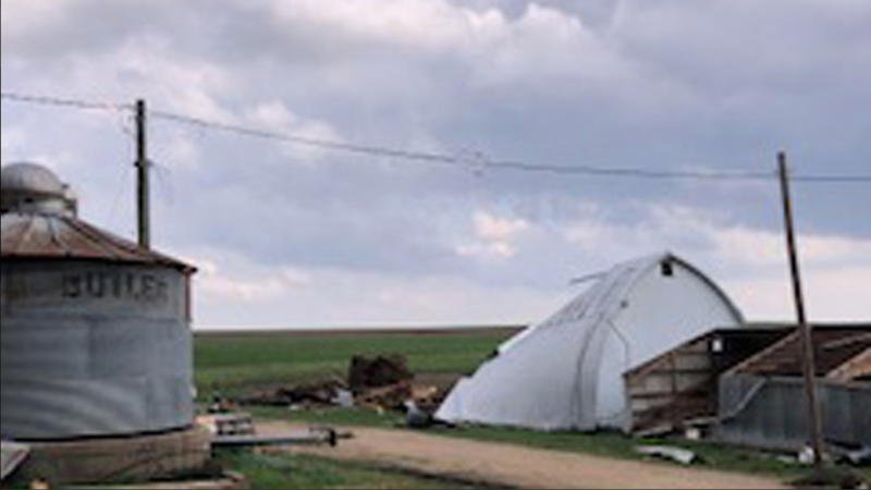
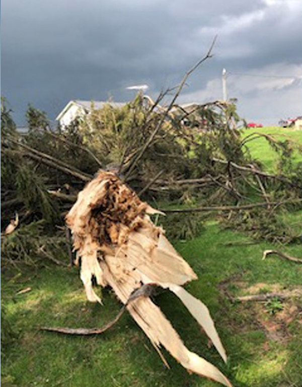
During the early afternoon of Wednesday, May 9th, an isolated thunderstorm resulted in a tornado touchdown between Boscobel and Fennimore in rural Grant County, Wisconsin. The EF0 damaged a house, some outbuildings and trees along Golf Road. |
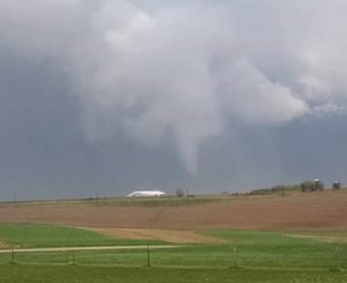 Grant County Tornado |
Tornadoes:
|
Tornado - LOCATION
Track Map 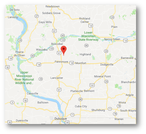 
Downloadable KMZ File |
||||||||||||||||
|
||||||||||||||||
The Enhanced Fujita (EF) Scale classifies tornadoes into the following categories:
| EF0 Weak 65-85 mph |
EF1 Moderate 86-110 mph |
EF2 Significant 111-135 mph |
EF3 Severe 136-165 mph |
EF4 Extreme 166-200 mph |
EF5 Catastrophic 200+ mph |
 |
|||||
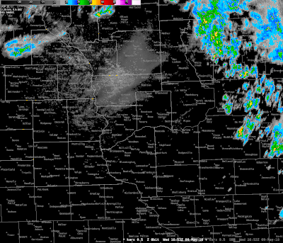
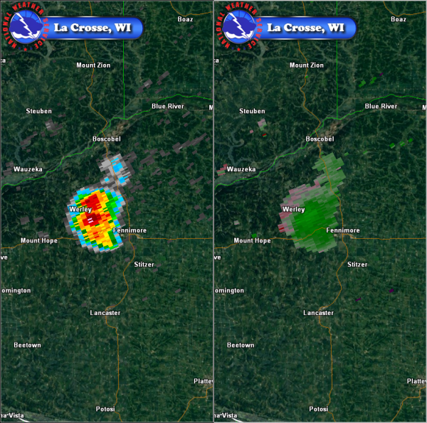
Radar:
Header
 |
 |
 |
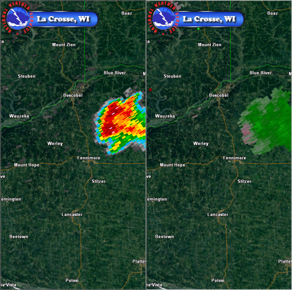 |
| Reflectivity loop | Ref and SRM at 117 pm | Ref and SRM at 126 pm | Ref and SRM at 138 pm |
Storm Reports
PRELIMINARY LOCAL STORM REPORT
NATIONAL WEATHER SERVICE LA CROSSE WI
856 PM CDT WED MAY 9 2018

..TIME...   ...EVENT...      ...CITY LOCATION...     ...LAT.LON...
..DATE...   ....MAG....      ..COUNTY LOCATION..ST.. ...SOURCE....
            ..REMARKS..

0132 PM     TORNADO          3 N FENNIMORE           43.03N 90.65W
05/09/2018                   GRANT              WI   EMERGENCY MNGR

            PRELIMINARY INFORMATION FROM THE GRANT
            COUNTY EMERGENCY MANAGER OF AN EF-0 TORNADO
            WITH ABOUT A 1.5 MILE PATH ALONG GOLF ROAD.
            WINDOWS WERE BLOWN OUT OF A HOUSE, TREES
            DOWNED AND A MACHINE SHED AND BARN WERE
            DAMAGED.


&&

$$
Environment
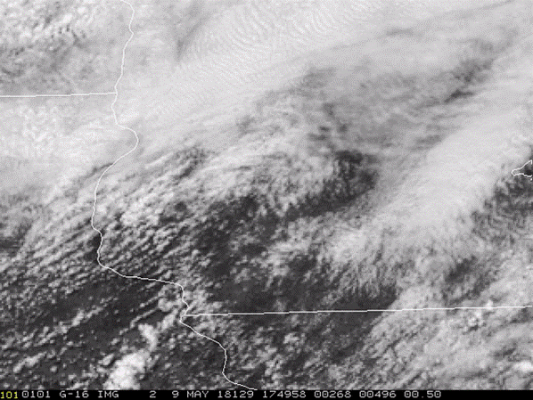
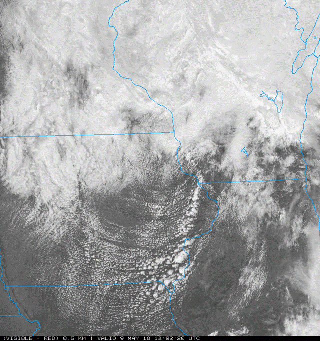
Satellite
 |
 |
|
| Visible Satellite | Visible Satellite at 102 pm | Figure 3: Caption |
Near-storm environment summary.
 |
 |
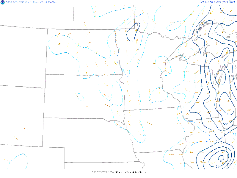 |
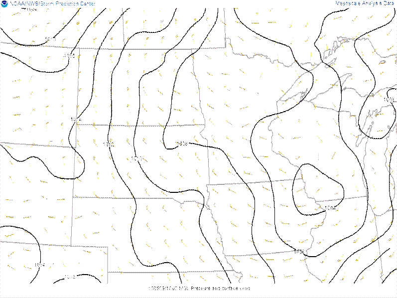
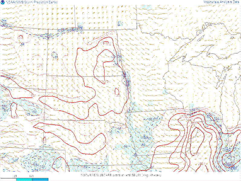
| 1 pm surface pattern | 1 pm surface based instability | 0-1km shear at 1 pm |
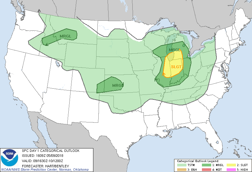
Severe Weather Outlook.
 |
||
| Severe Outlook from 11 am - SPC | Figure 8: Caption | Figure 9: Caption |
 |
Media use of NWS Web News Stories is encouraged! Please acknowledge the NWS as the source of any news information accessed from this site. |
|


 Weather Story
 Weather Map
 Local Radar