
Numerous strong to severe storms are expected to develop from mid afternoon through early evening. Damaging winds will be the main threat, but large hail and tornadoes are also possible. Have multiple ways to receive warnings and stay weather aware if you have outdoor plans. Read More >
Overview
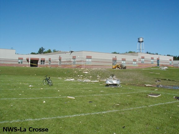
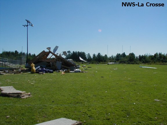
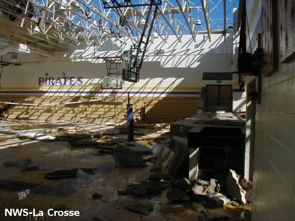
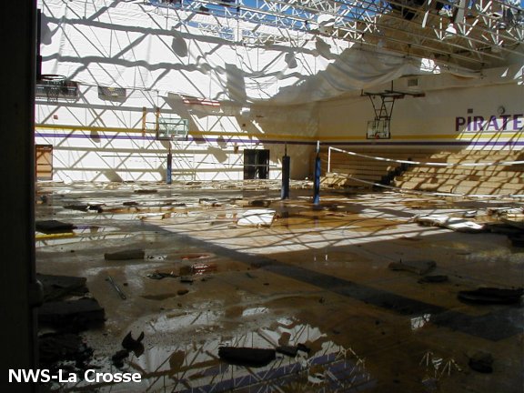
Enter summary/what happened:Tornado:
|
Tornado - Gilman, WI
Track Map  |
||||||||||||||||
|
||||||||||||||||
The Enhanced Fujita (EF) Scale classifies tornadoes into the following categories:
| EF0 Weak 65-85 mph |
EF1 Moderate 86-110 mph |
EF2 Significant 111-135 mph |
EF3 Severe 136-165 mph |
EF4 Extreme 166-200 mph |
EF5 Catastrophic 200+ mph |
 |
|||||
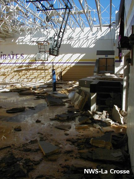
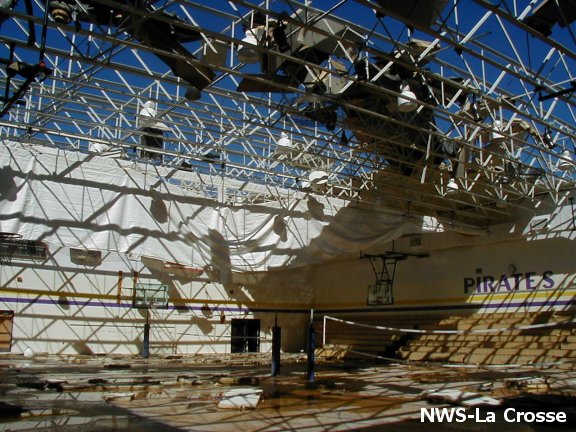
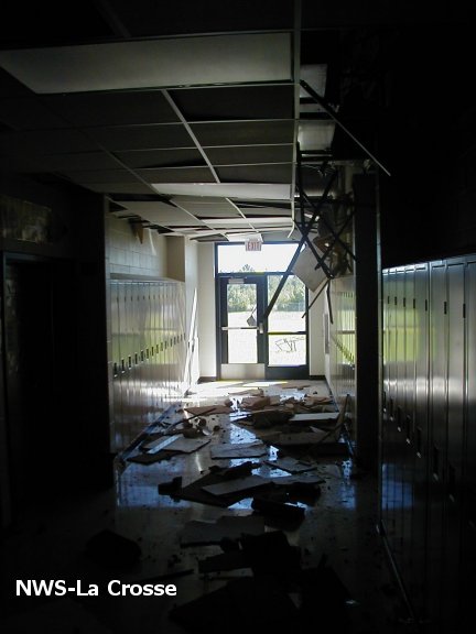
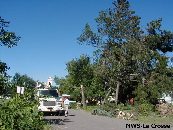
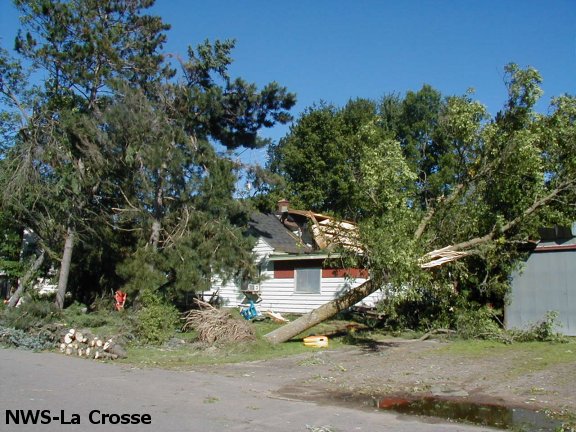
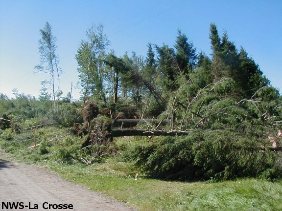
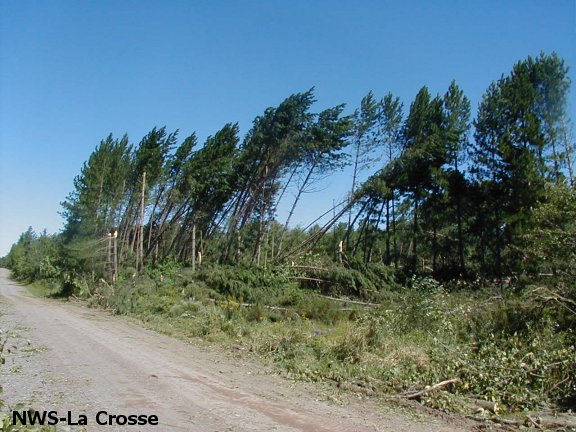
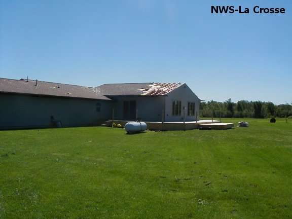
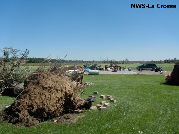
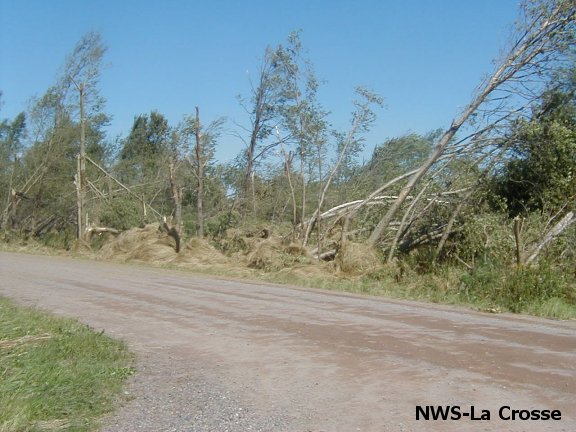
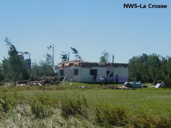
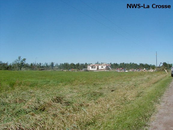
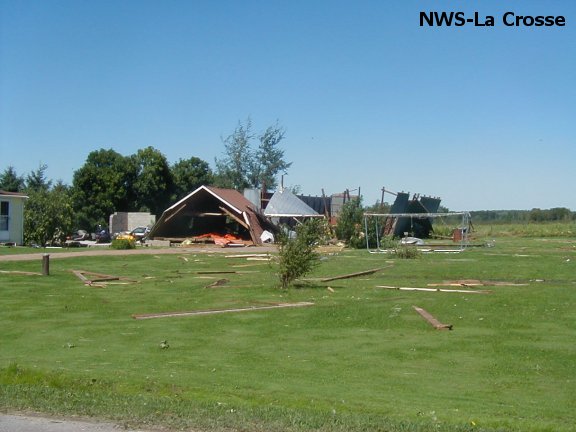
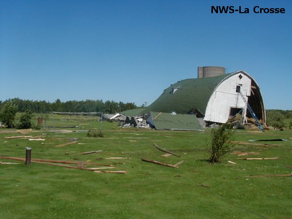
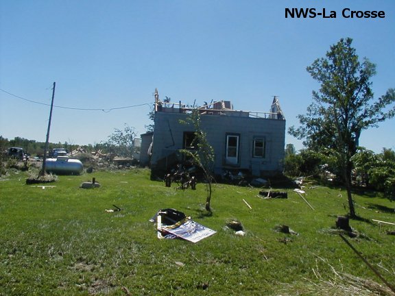
Photos:
 |
 |
 |
 |
 |
 |
 |
 |
 |
 |
 |
 |
 |
 |
 |
 |
 |
 |
 |
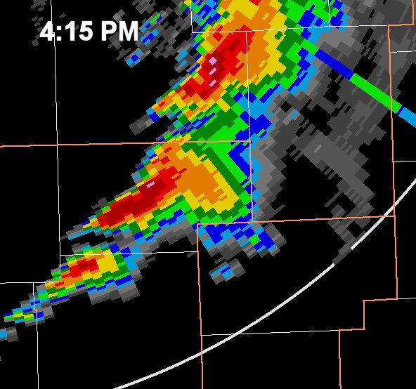
Radar:
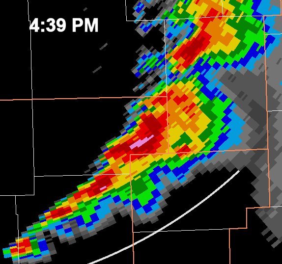
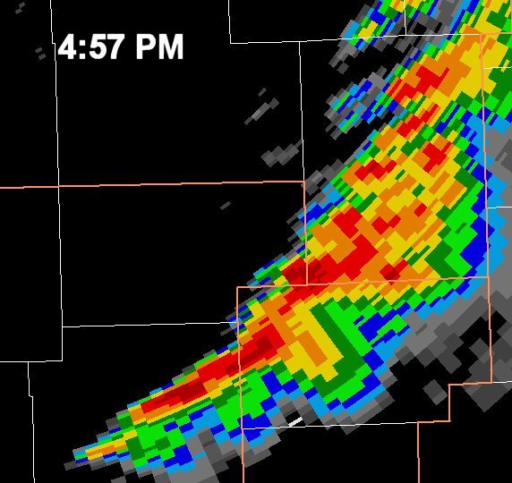
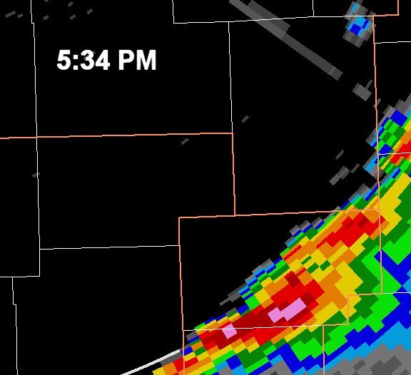
(Note: The La Crosse Doppler Radar (KARX) was not operating for this event due to a lightning strike earlier that day.)
 |
 |
 |
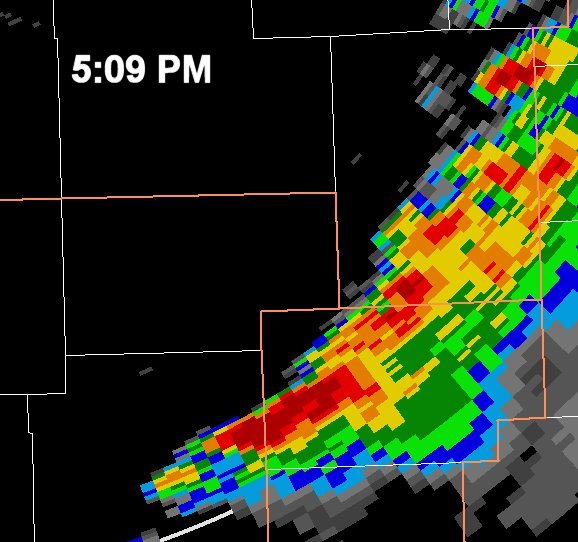 |
| Reflectivity from KDLH - 4:15 p.m. | Reflectivity from KDLH - 4:39 p.m. | Reflectivity from KDLH - 4:57 p.m. | Reflectivity from KDLH - 5:09 p.m. |
 |
|||
| Reflectivity from KDLH - 5:34 p.m. |
 |
Media use of NWS Web News Stories is encouraged! Please acknowledge the NWS as the source of any news information accessed from this site. |
|


 Weather Story
 Weather Map
 Local Radar