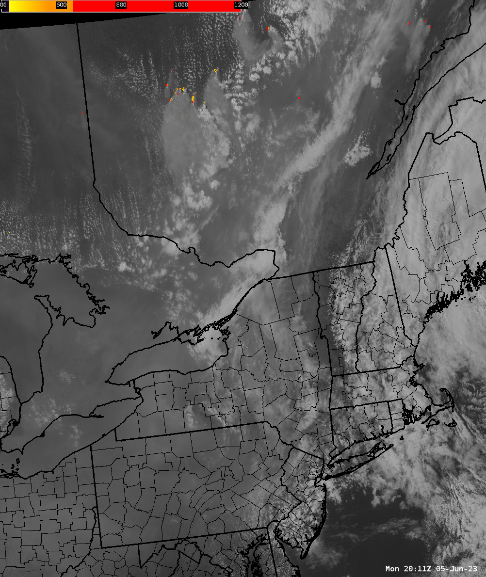
You can even smell it. Loads of smoke being produced by Canadian wildfires, affecting air quality. The satellite loop below shows yellow-orange-red pixels where surface temperature is hot. There are some clouds too but notice the huge plumes of smoke pouring from those fires southbound to NY-PA. And, it's not just Quebec. We are even getting smoke all the way from Northwest Canada. This loop was from 4:11 PM EDT (2011 UT) to 5:21 PM EDT (2121 UTC), on June 5, 2023. Click on the image for a larger view.
This is a GeoColor GOES East satellite loop from 8:56 AM EDT (1256 UTC) to 3:31 PM EDT (1931 UTC) on June 5, 2023. In the loop, the smoke is shown as a milky, translucent haze that spreads over most of New York and Pennsylvania. The brighter white areas are clouds. The smoke was from fires in Quebec, Canada.
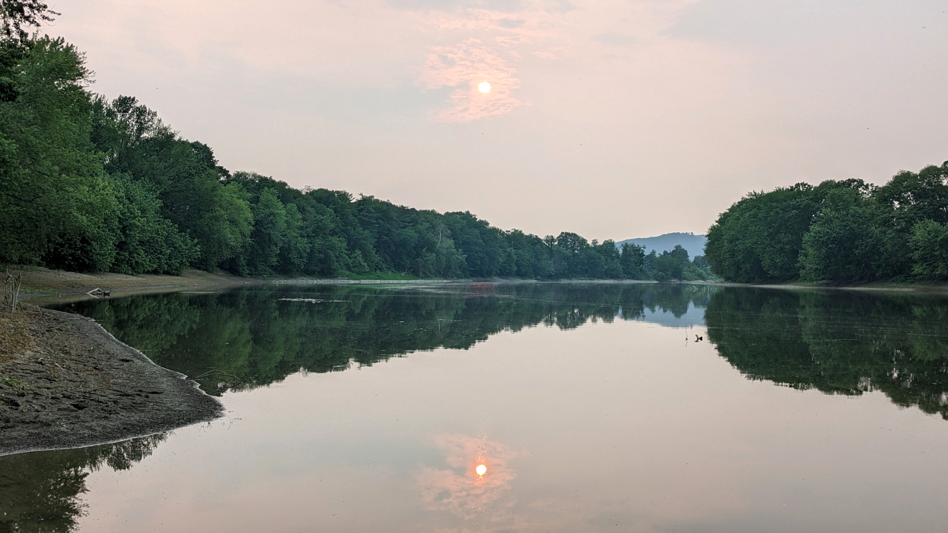
Orange sunset over the Susquehanna River near Nichols, NY.
Note that a similar event happen on July 6, 2002.
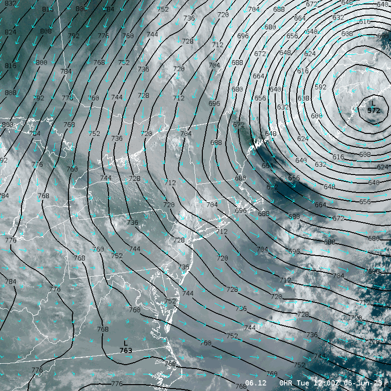
This animation was from June 6, 2023 and runs from 8:00 AM EDT (1200 UTC) to 1:00 PM EDT (1700 UTC). This show GOES East GeoColor Satellite images overlaid with 925 millibar (about 2500 feet above the surface) heights and wind arrows. What this is showing is an area of low pressure to the northeast with a general north to northwest flow from Canada over New York and Pennsylvania. The smoke from the wildfires in Quebec, Canada are carried southward and over New York and Pennsylvania.
The smoke can be see as a milky, translucent area moving across New York and into northern Pennsylvania during the time of this animation. There are some clouds mixed in the smoke and appear white, and opaque.
The June 6 plume of smoke was denser than on the 5th. There was a more pungent smell of smoke across the region. It also reduced the visibilities across the area. Here are some of the lowest visibility reported at area airports.
| Airport | Lowest Visibility in miles |
| Binghamton, NY | 1 1/2 |
| Cortland, NY | 4 |
| Elimra, NY | 1 1/4 |
| Hamilton, NY | 3 |
| Hornell, NY | 3 |
| Ithaca, NY | 3 |
| Norwich, NY | 3 |
| Oneonta, NY | 2 1/2 |
| Penn Yan, NY | 1 1/4 |
| Pocono Mountains, PA | 1 1/2 |
| Rome, NY | 2 |
| Scranton, PA | 1 1/4 |
| Sidney, NY | 3 |
| Skaneateles Aero Drome, NY | 4 |
| Syracuse, NY | 1 1/2 |
Another plume of smoke, thicker than on June 6, moved south and southeast across central New York and northeast Pennsylvania starting during the early morning hours of June 7th.
Below is a GeoColor GOES East satellite loop from June 3, 2023 7:56 PM EDT (2356 UTC) to June 8, 2023 8:51 AM EDT (1251 UTC). Notable features include,
Depending on its density, the smoke can be identified as milky white/tan translucent plume. The denser smoke stands out clouds as a tan plume.
The visibility was again reduced across several areas.
| Airport | Lowest Visibility in miles |
| Binghamton, NY | 1 |
| Cortland, NY | 1 3/4 |
| Elimra, NY | 1/2 |
| Hamilton, NY | 1/2 |
| Hazleton, PA | 1 |
| Hornell, NY | 3/4 |
| Ithaca, NY | 1 |
| Norwich, NY | 1 3/4 |
| Oneonta, NY | 2 |
| Penn Yan, NY | 1/2 |
| Pocono Mountains, PA | 3/4 |
| Rome, NY | 1 |
| Scranton, PA | 3/4 |
| Sidney, NY | 2 |
| Skaneateles Aero Drome, NY | 1 3/4 |
| Syracuse, NY | 1/2 |
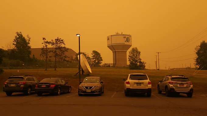
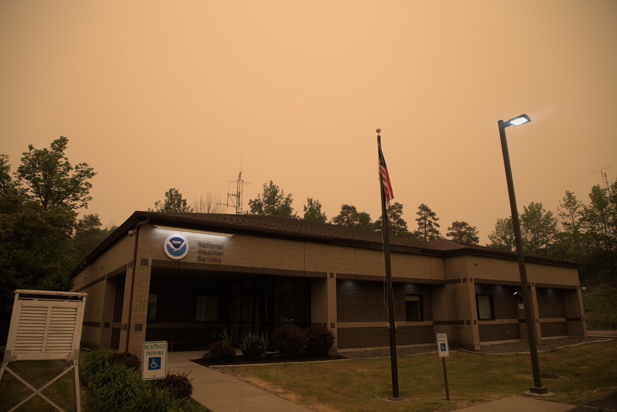
| Pictures at the NWS Binghamton, NY office showing smoky skies | |
|---|---|
 |
 |
Additional Information
Air Quality

