Click on the tabs to view the information.
Tornado Confirmed Near Monroeton in Bradford County Pennsylvania
The information in this statement is preliminary and subject to change pending final review of the event(s) and publication in NWS Storm Data.
Summary
The National Weather Service in Binghamton NY has confirmed a tornado near Monroeton in Bradford County Pennsylvania on July 25.
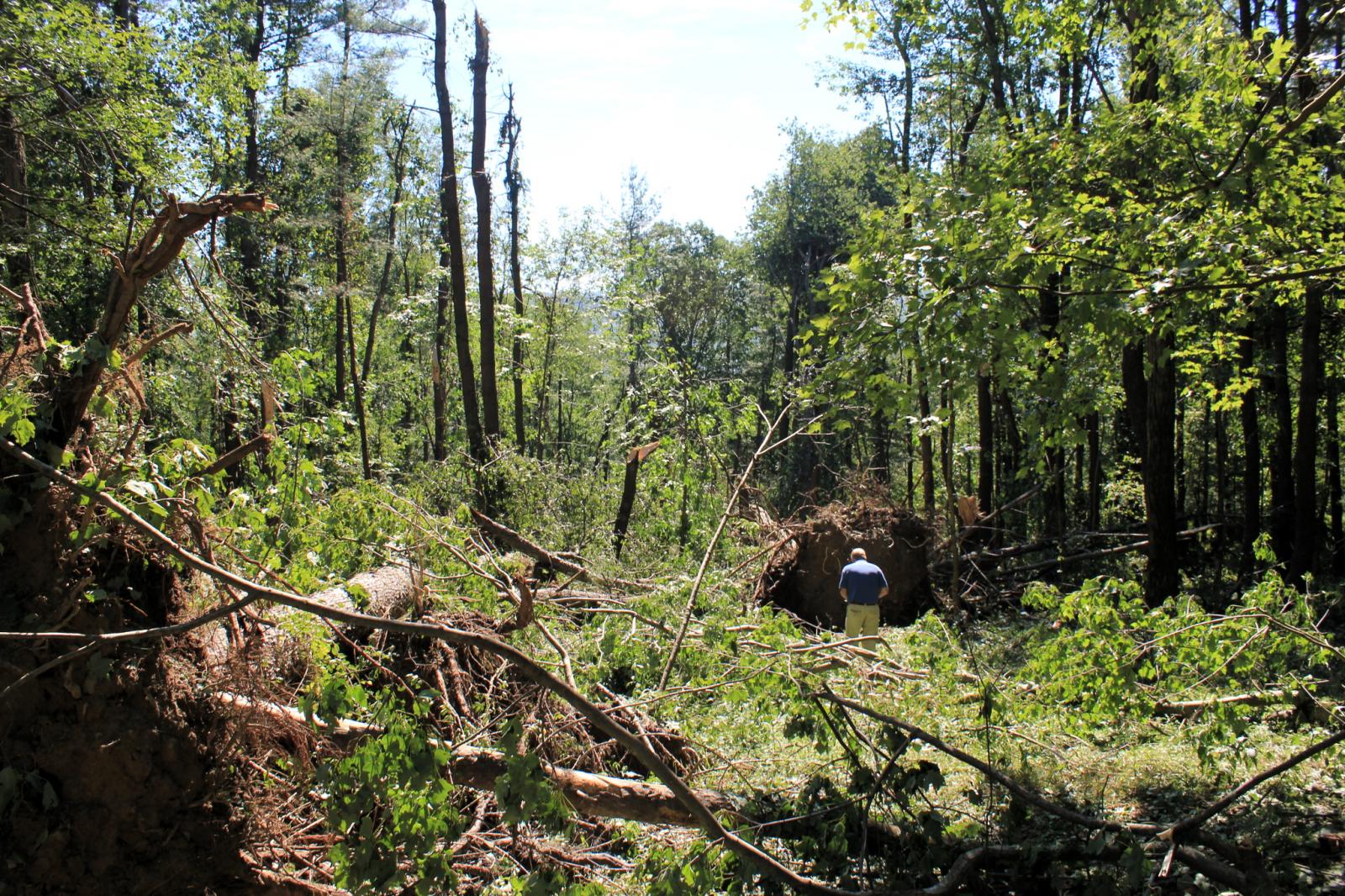
An EF-1 tornado touched down north of Franklin road northwest of Monroeton and tracked southeast for 200 yards before ending. Wind speeds of 100 mph resulted in numerous snaps of softwood trees along the path of the tornado.
For reference: the Enhanced Fujita Scale classifies tornadoes into the following categories:
Microburst /Straight Line Wind Damage/ Confirmed Near Monroeton in Bradford County Pennsylvania
The information in this statement is preliminary and subject to change pending final review of the event(s) and publication in NWS Storm Data.
Summary
The National Weather Service in Binghamton NY has confirmed a Microburst /Straight Line Wind Damage/ near Monroeton in Bradford County Pennsylvania on July 25, 2016.
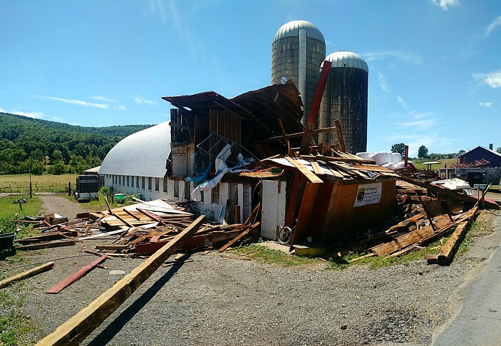
A National Weather Service team has completed a survey of damage from a microburst that occurred on July 25 at 310 pm in Monroeton Pennsylvania. Damaging winds occurred along Marcy Hill Road. The roof was torn off of a house and a barn was heavily damaged. Damage was strewn farther east downwind from the structures along and on either side of the road. Wind speeds were estimated at 100 mph.
Click on images for a larger view.
|
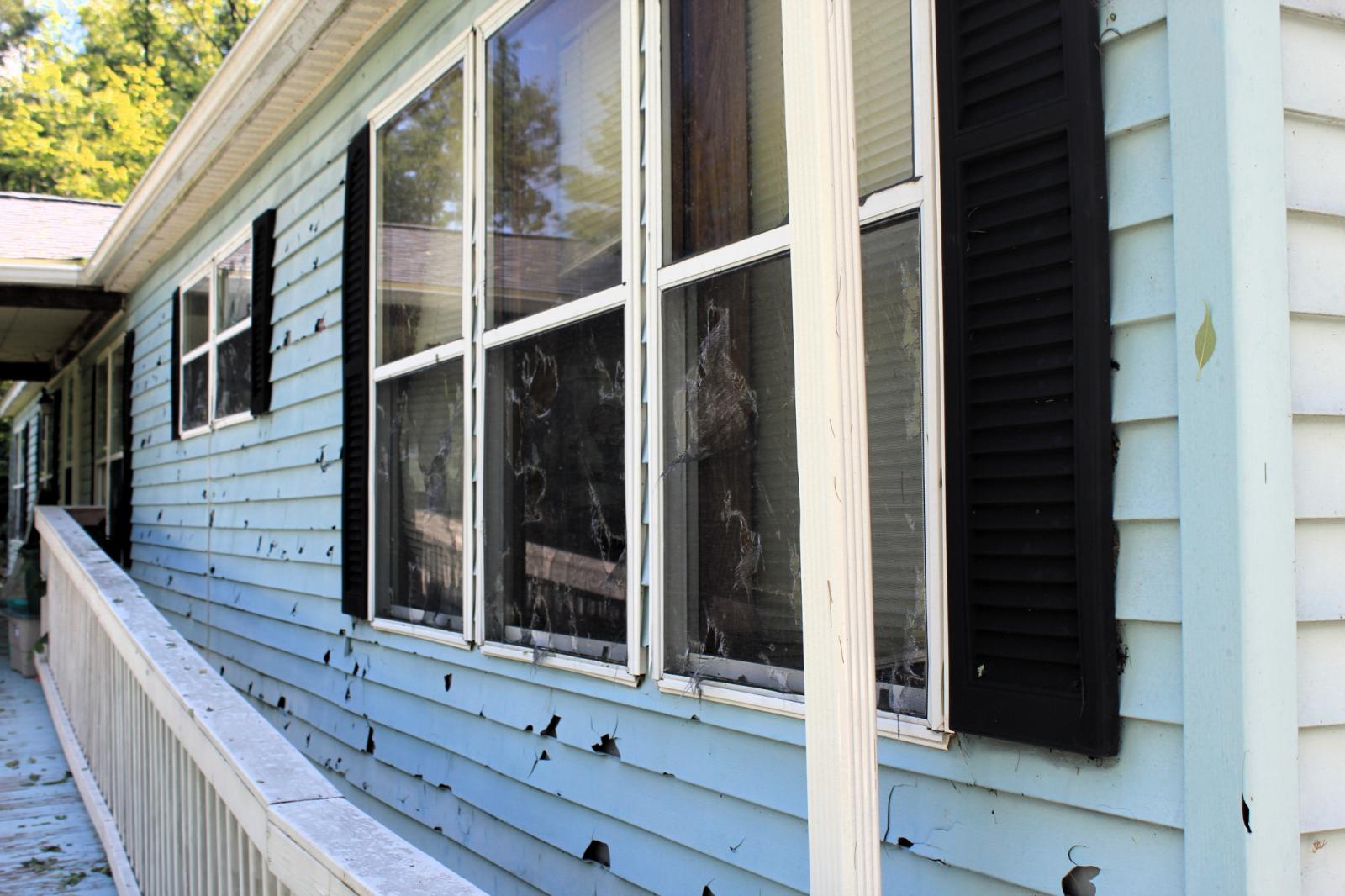
House siding and windows damaged by large hail and wind. |
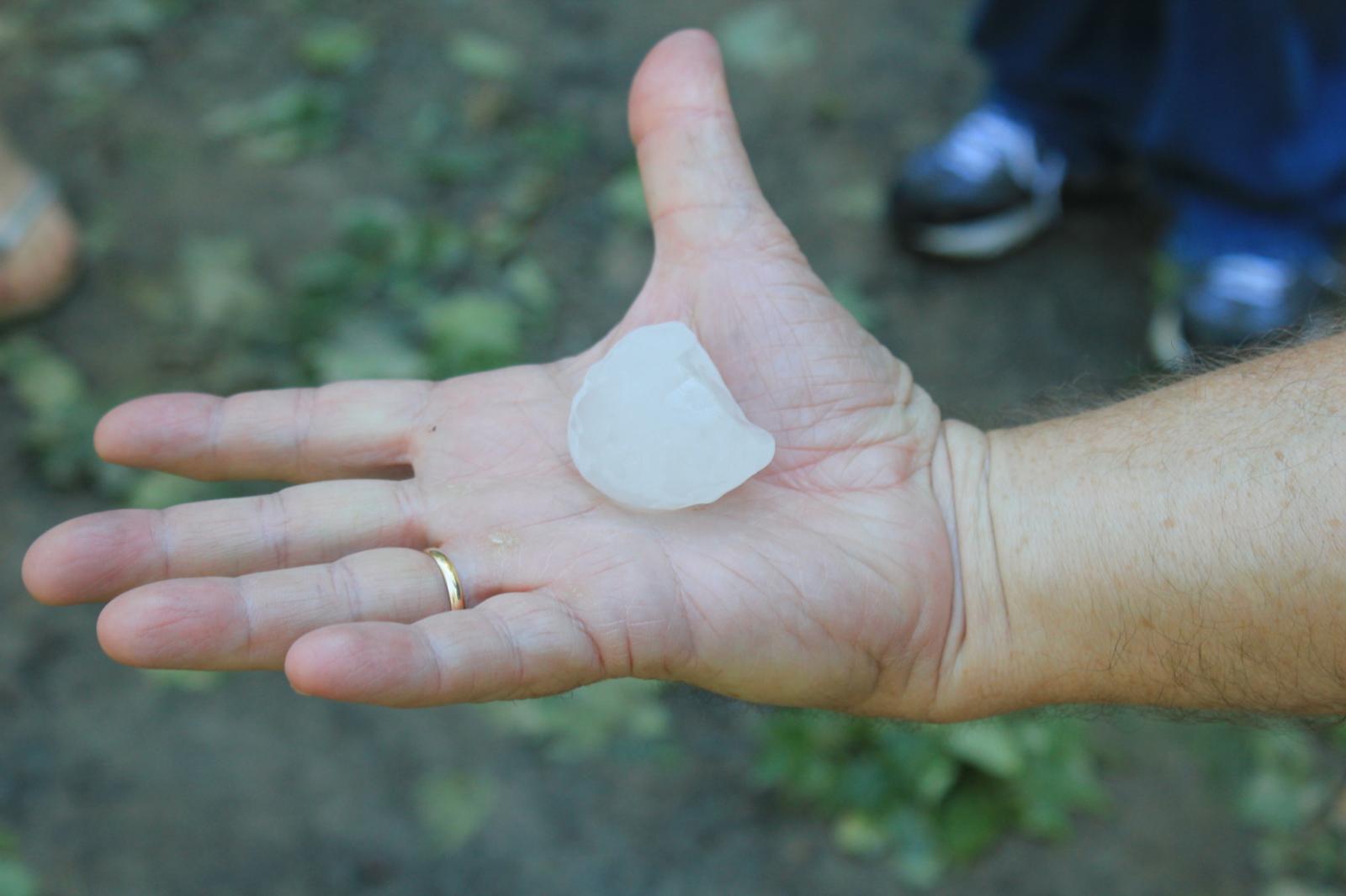
SOO Mike Evans holding a piece of large hail that was kept in a freezer. |
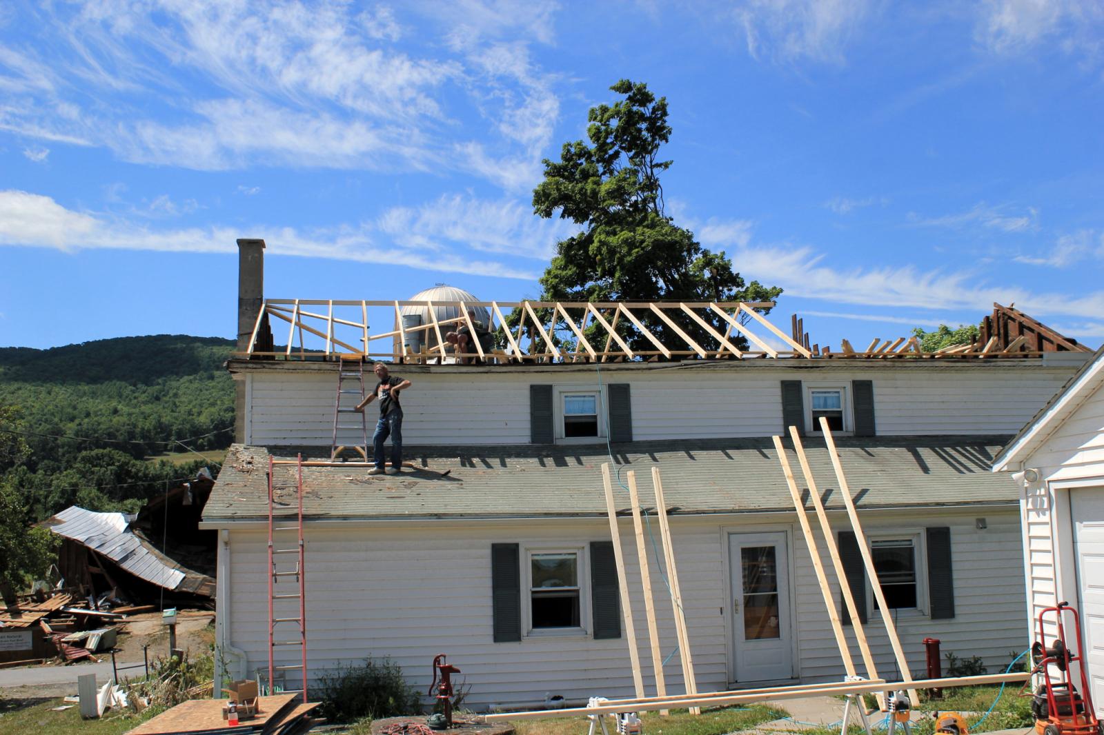
Roof off house being repaired on Marcy Hill Road Monroeton, PA. |
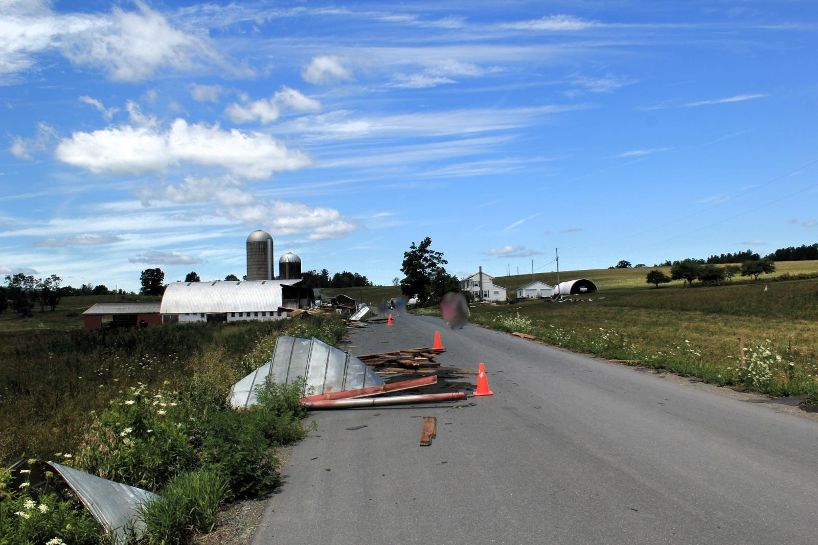
Looking upwind (northwest) with the debris from barn and house on Marcy Hill Road Monroeton, PA. |
For reference
A microburst is a convective downdraft with an affected outflow area of less than 2 1/2 miles wide and peak winds lasting less than 5 minutes. Microbursts may induce dangerous horizontal and vertical wind shears, which can adversely affect aircraft performance and cause property damage. Straight-line winds are generally any wind that is not associated with rotation, used mainly to differentiate them from tornadic winds.
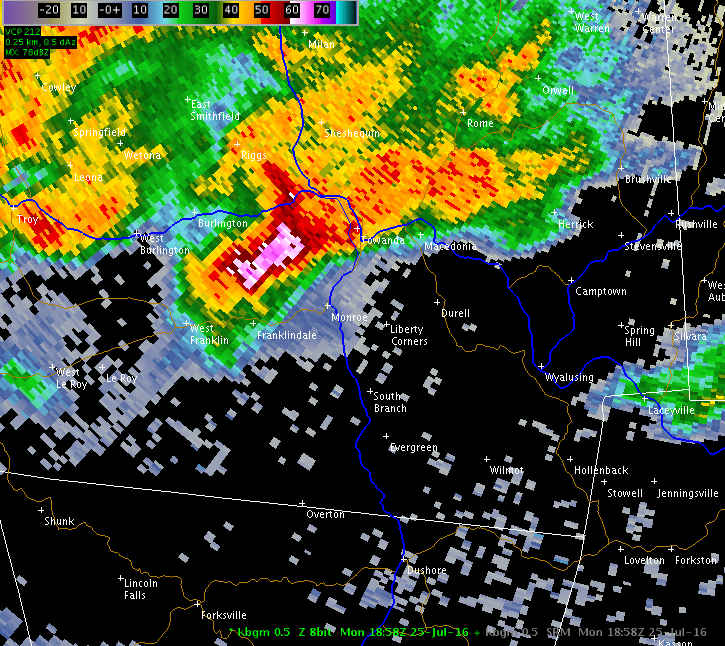
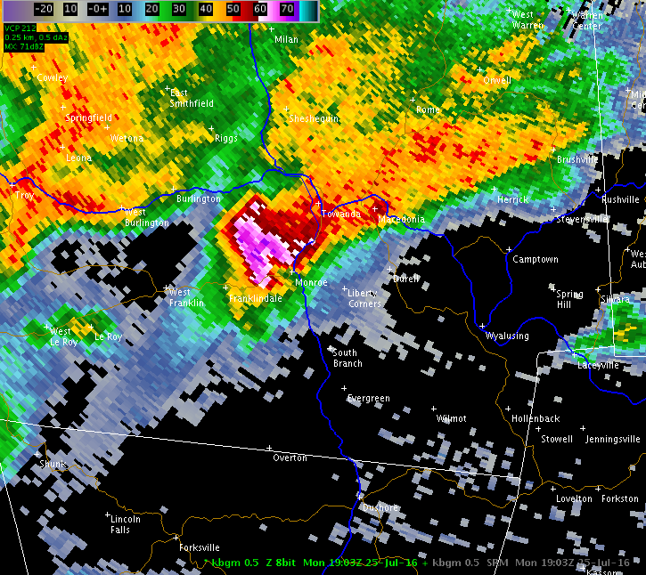
Radar Data and Loops
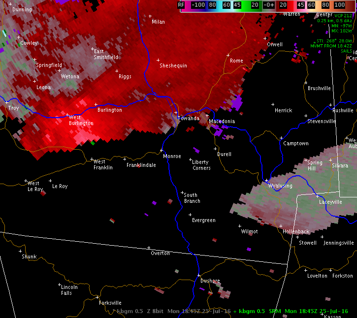
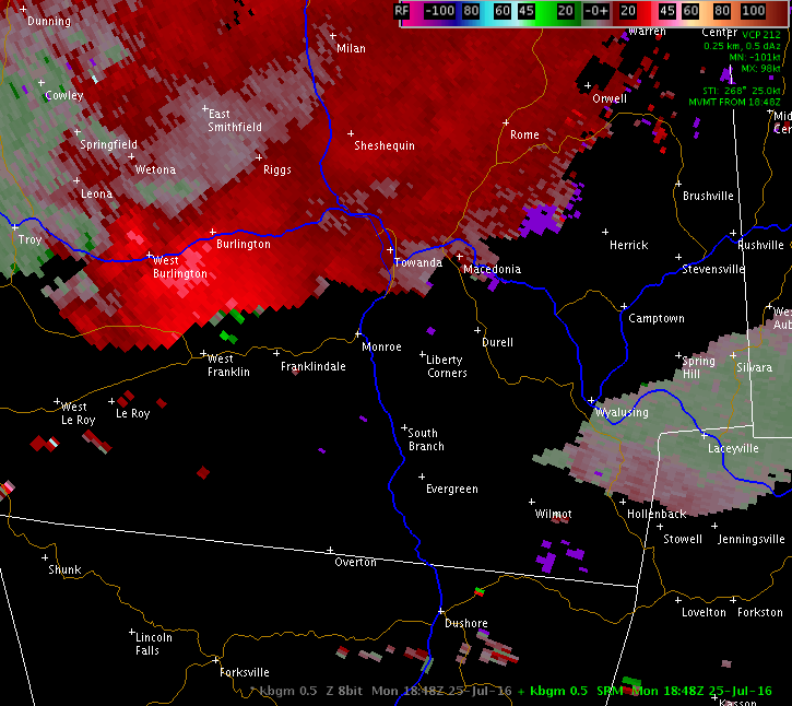
The image below is a four panel display showing base reflectivity at four different elevations, 0.5, 1.5, 2.4, and 3.4 degrees.
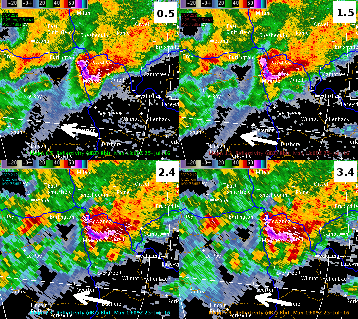
The white arrows shows a feature called three-body scatter spike (TBSS), or hail spike, and is an indication that large hail is contained in the thunderstorm. However, the TBSS signature itself is not real, i.e., it is not raining where the spike is. Instead, it is an erroneous return of weak energy back to the radar after the original beam of energy from the radar hits the large hail in the storm. reference.
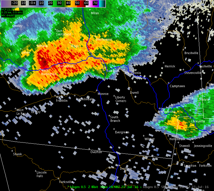
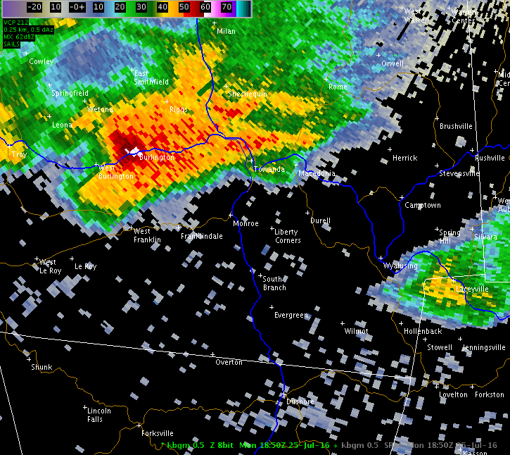
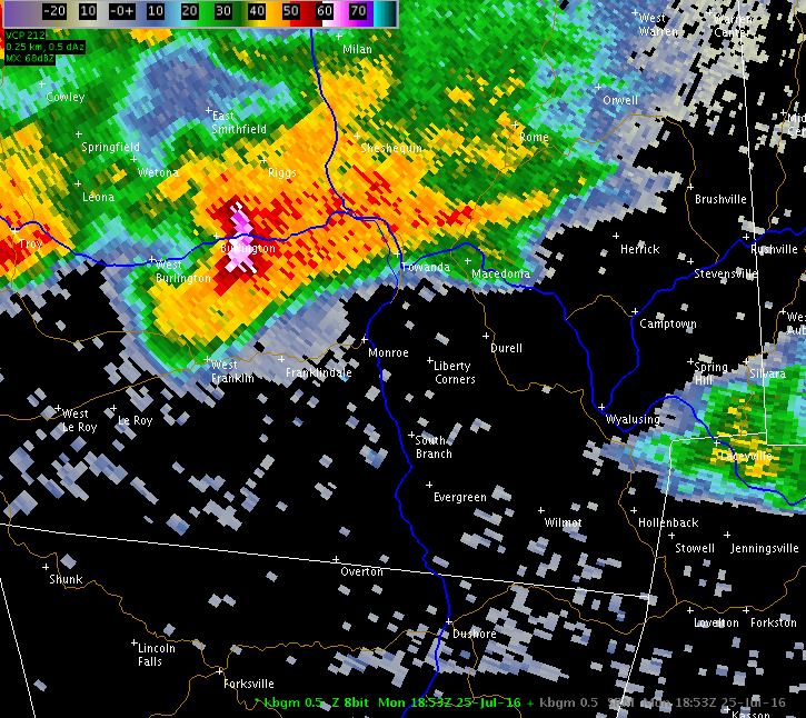
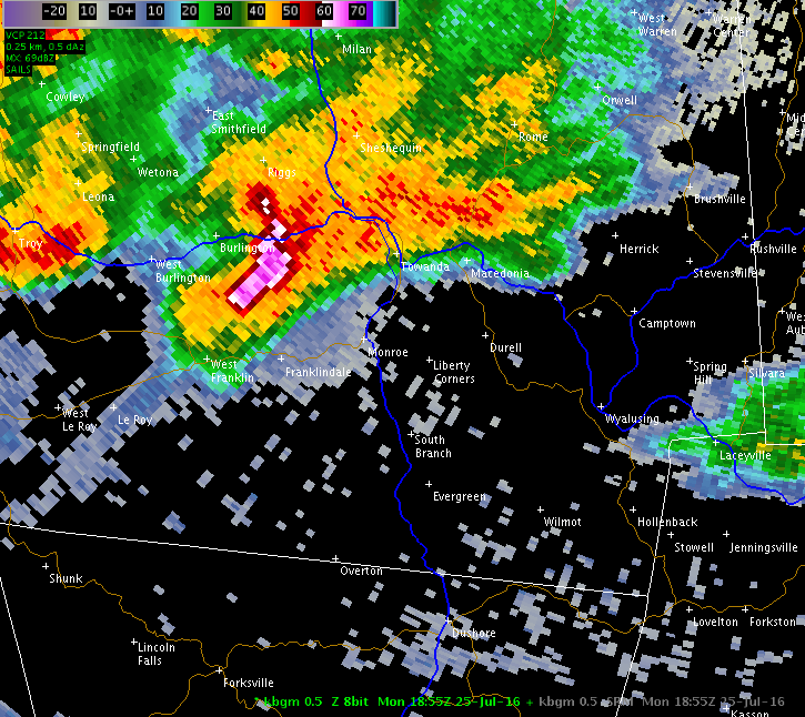
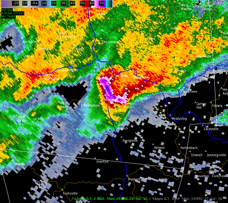
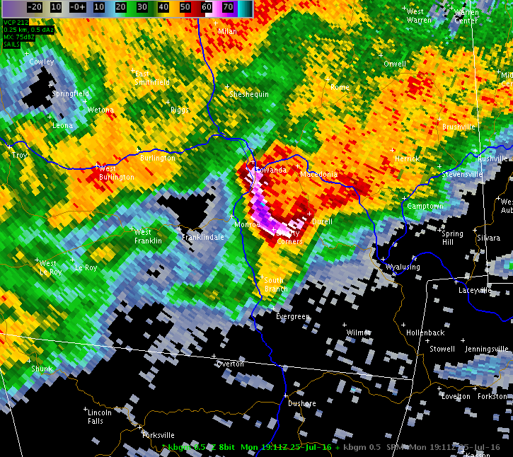
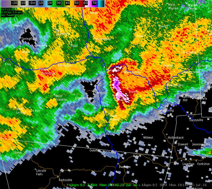
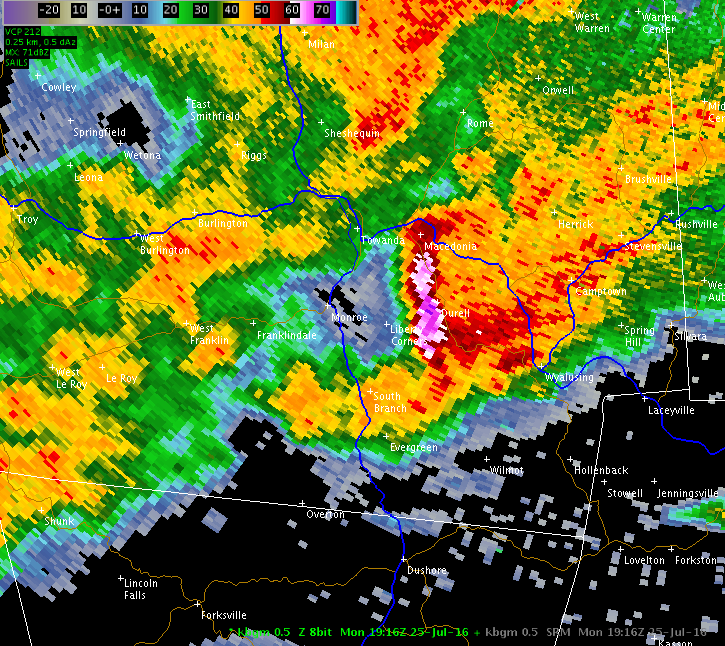
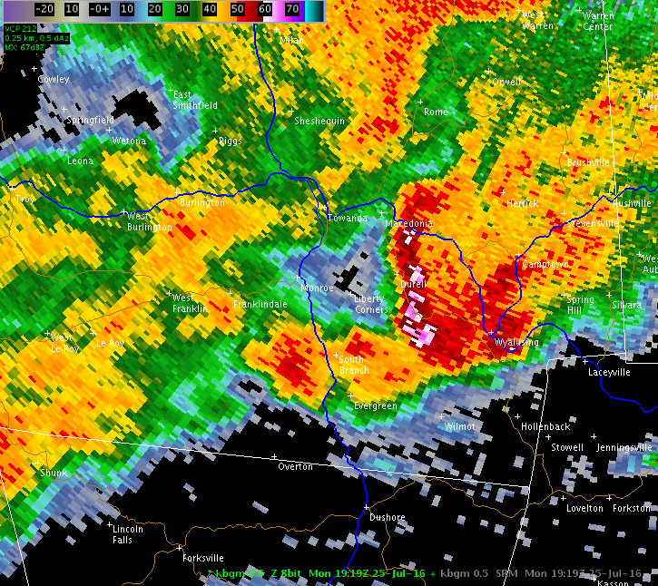
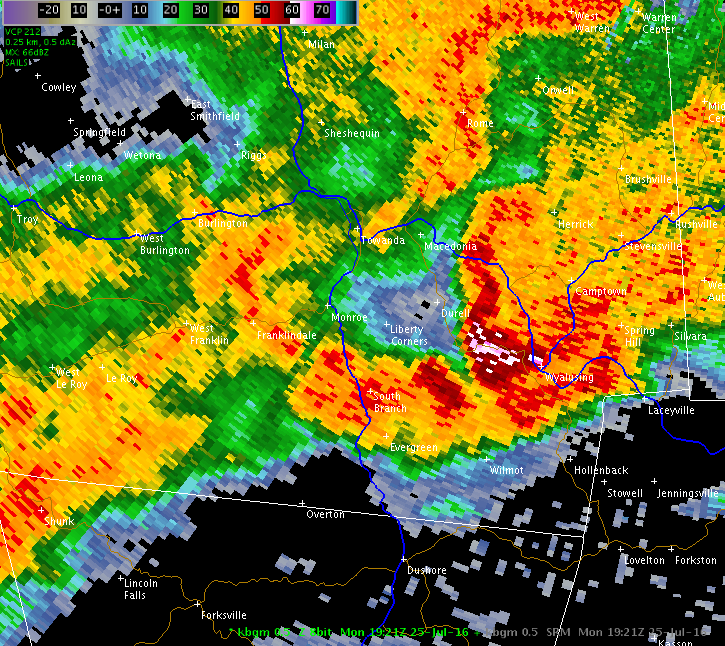
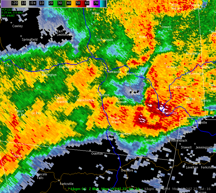
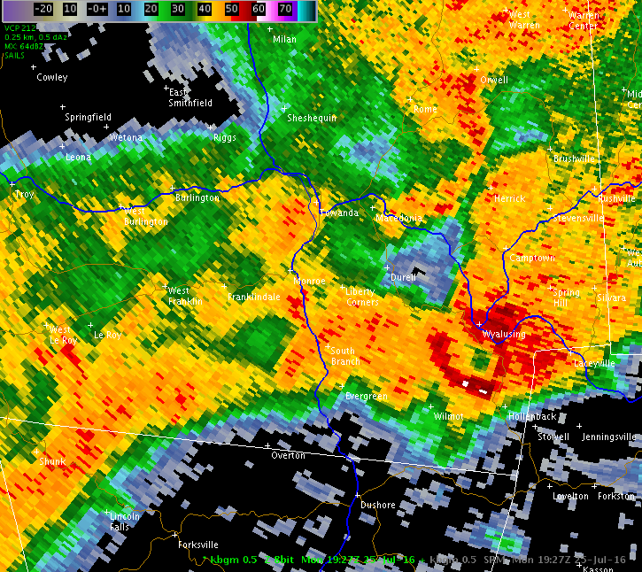
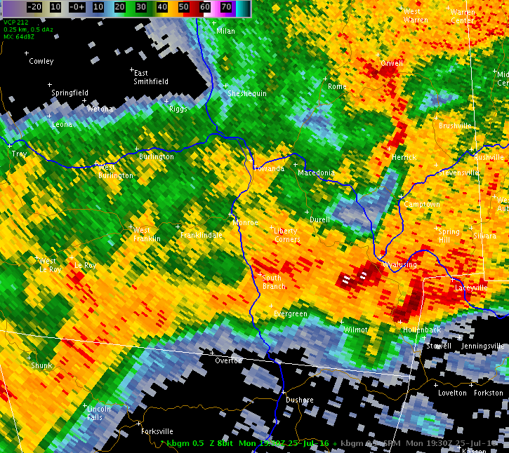
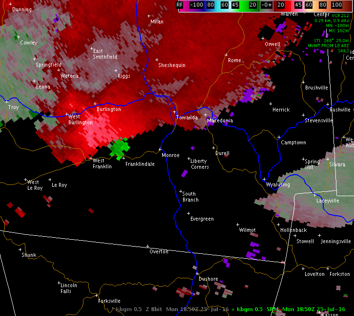
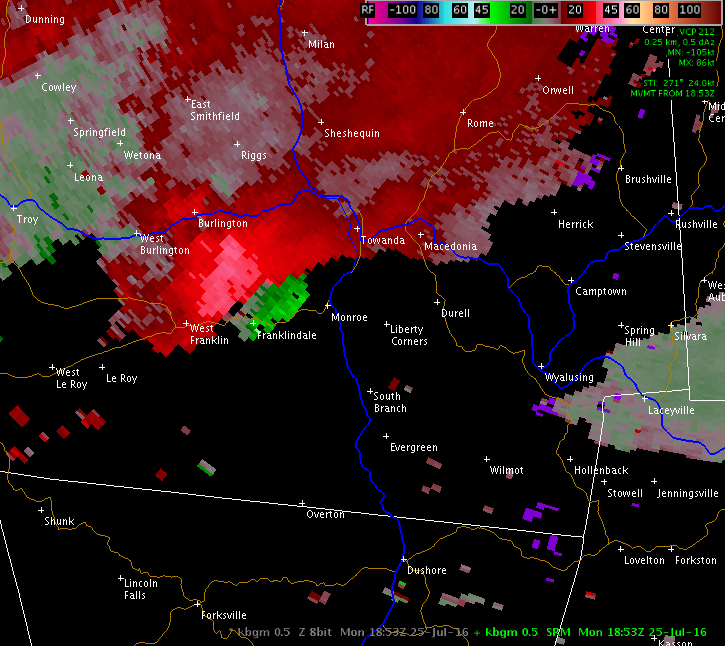
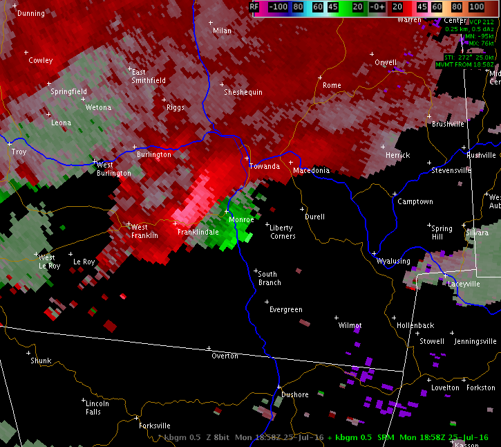
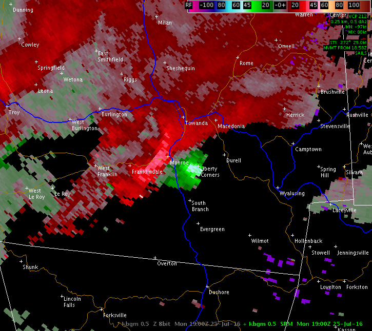
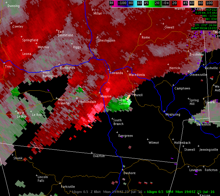
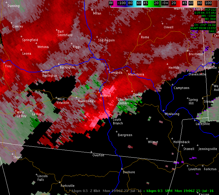
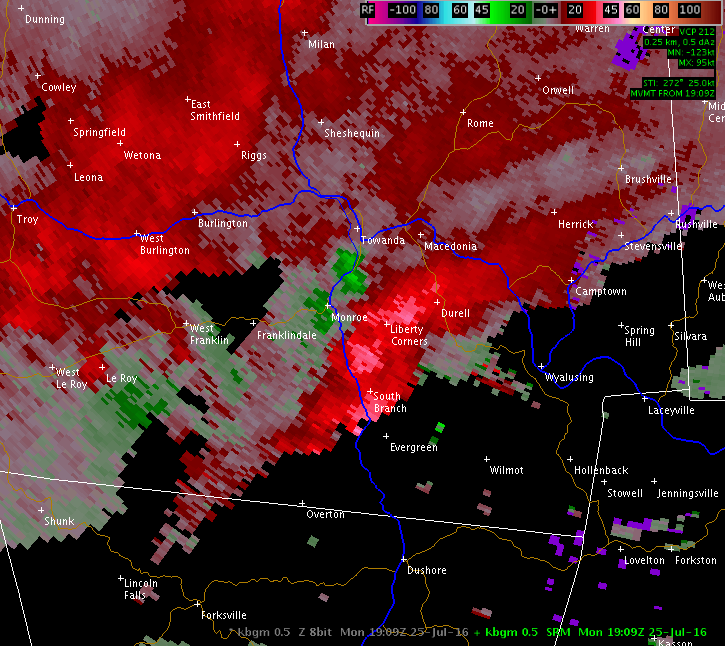
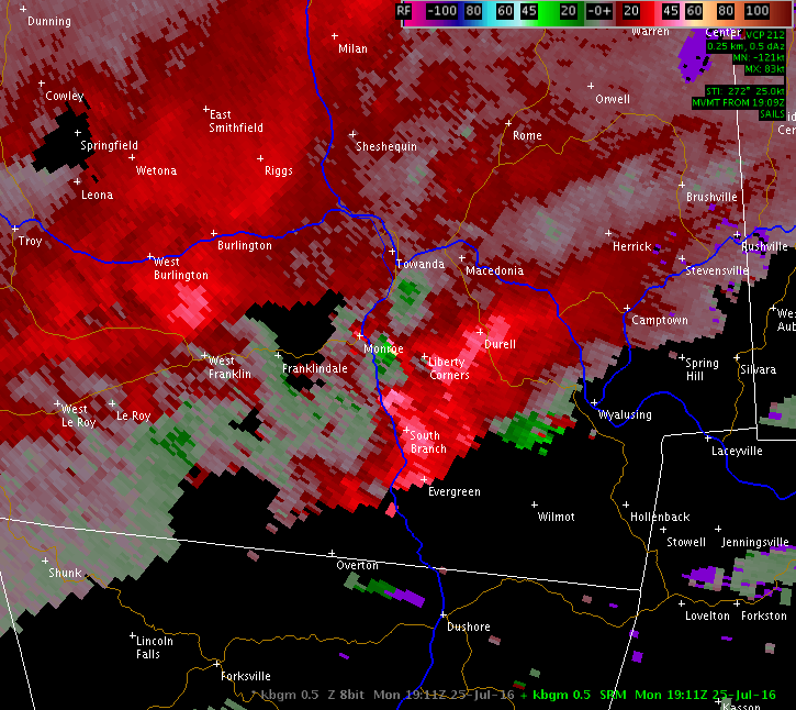
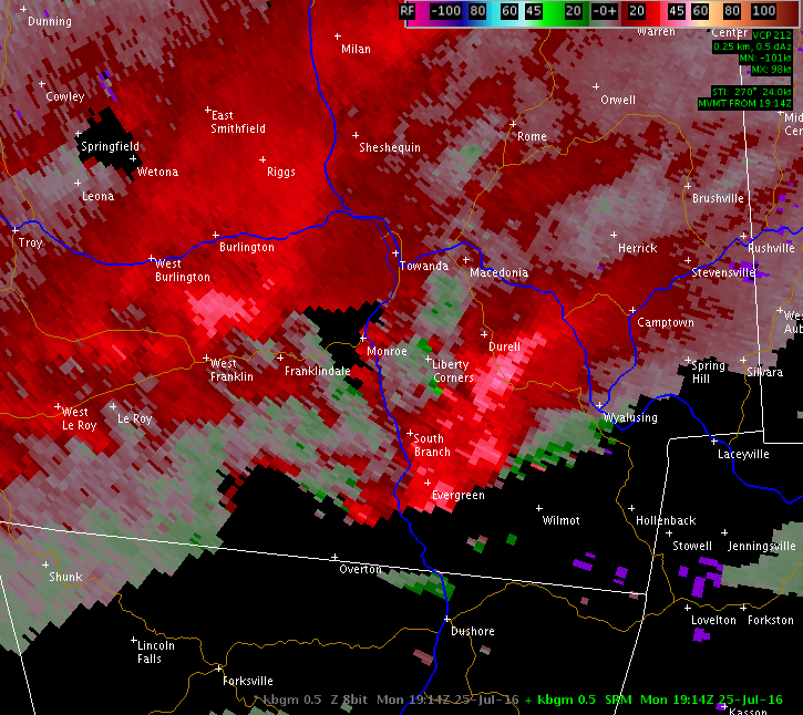
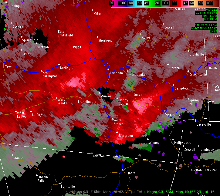
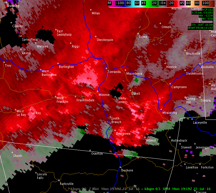
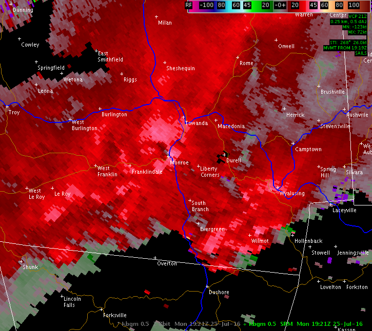
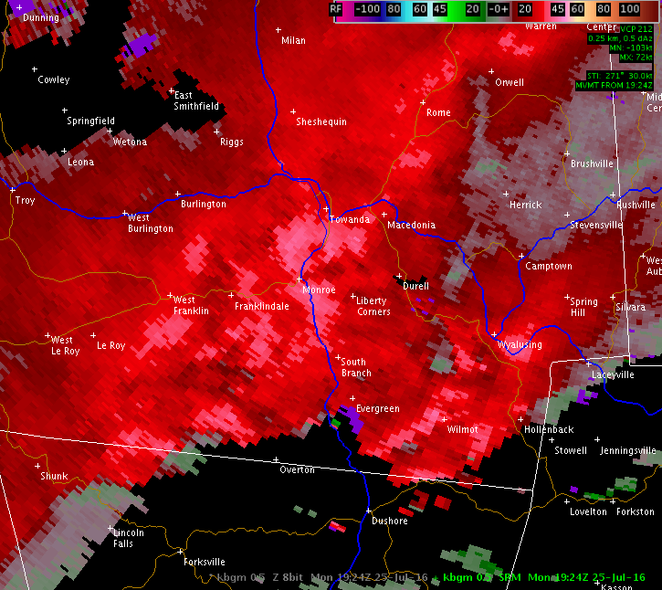
This is a 0.5 degree reflectivity loop from the NWS Binghamton, NY (KBGM) radar of the storm that produced an EF1 tornado, straight line wind damage and large hail in the Monroeton, PA area on July 25, 2016.
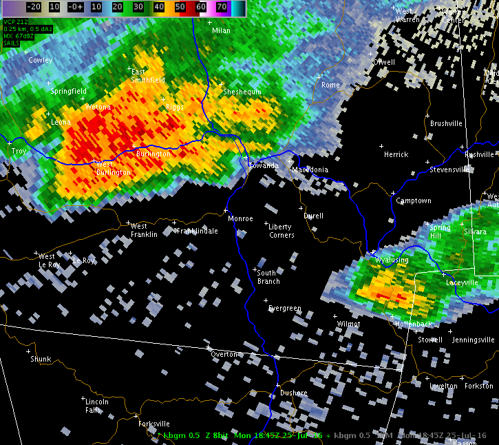
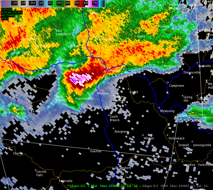
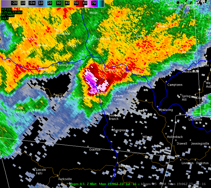
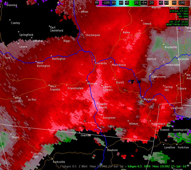
The image below shows 0.5 degree storm relative motion display from the NWS Binghamton, NY (KBGM) radar. The yellow circle was added to this image to show that the storm was rotation at the time of the tornado in the Monroeton, PA area.
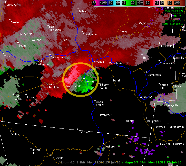
This is a 0.5 degree storm relative motion loop from the NWS Binghamton, NY (KBGM) radar of the storm that produced an EF1 tornado, straight line wind damage and large hail in the Monroeton, PA area on July 25, 2016.


Microburst /Straight Line Wind Damage/ Confirmed Near Hancock in Delaware County New York
Summary
The National Weather Service in Binghamton NY has confirmed a Microburst /Straight Line Wind Damage/ near Hancock in Delaware County New York on July 25 2016.
Straight-line thunderstorm winds uprooted and snapped several trees in 5 locations along a 4 mile path that was roughly 500 yards wide. The damage occurred around 1230 pm EDT on Monday July 25th, 2016.
For reference
A microburst is a convective downdraft with an affected outflow area of less than 2 1/2 miles wide and peak winds lasting less than 5 minutes. Microbursts may induce dangerous horizontal and vertical wind shears: which can adversely affect aircraft performance and cause property damage. Straight-line winds are generally any wind that is not associated with rotation used mainly to differentiate them from tornadic winds.
Additional Information: