Overview
|
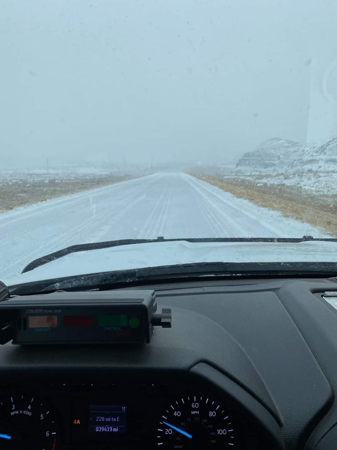
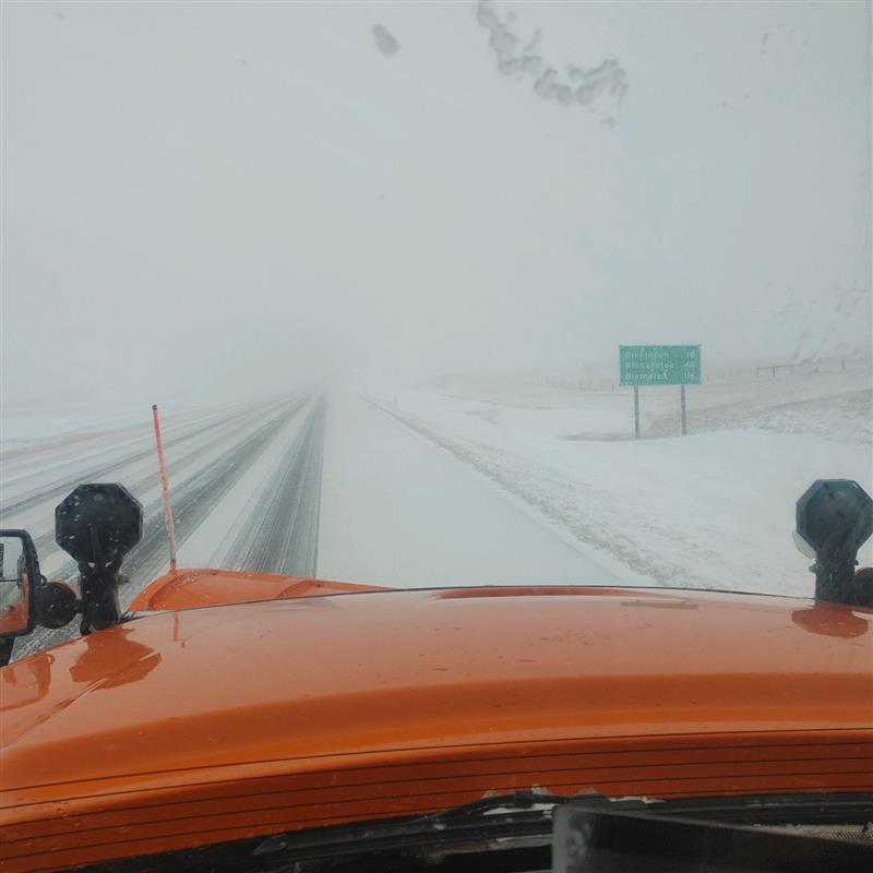
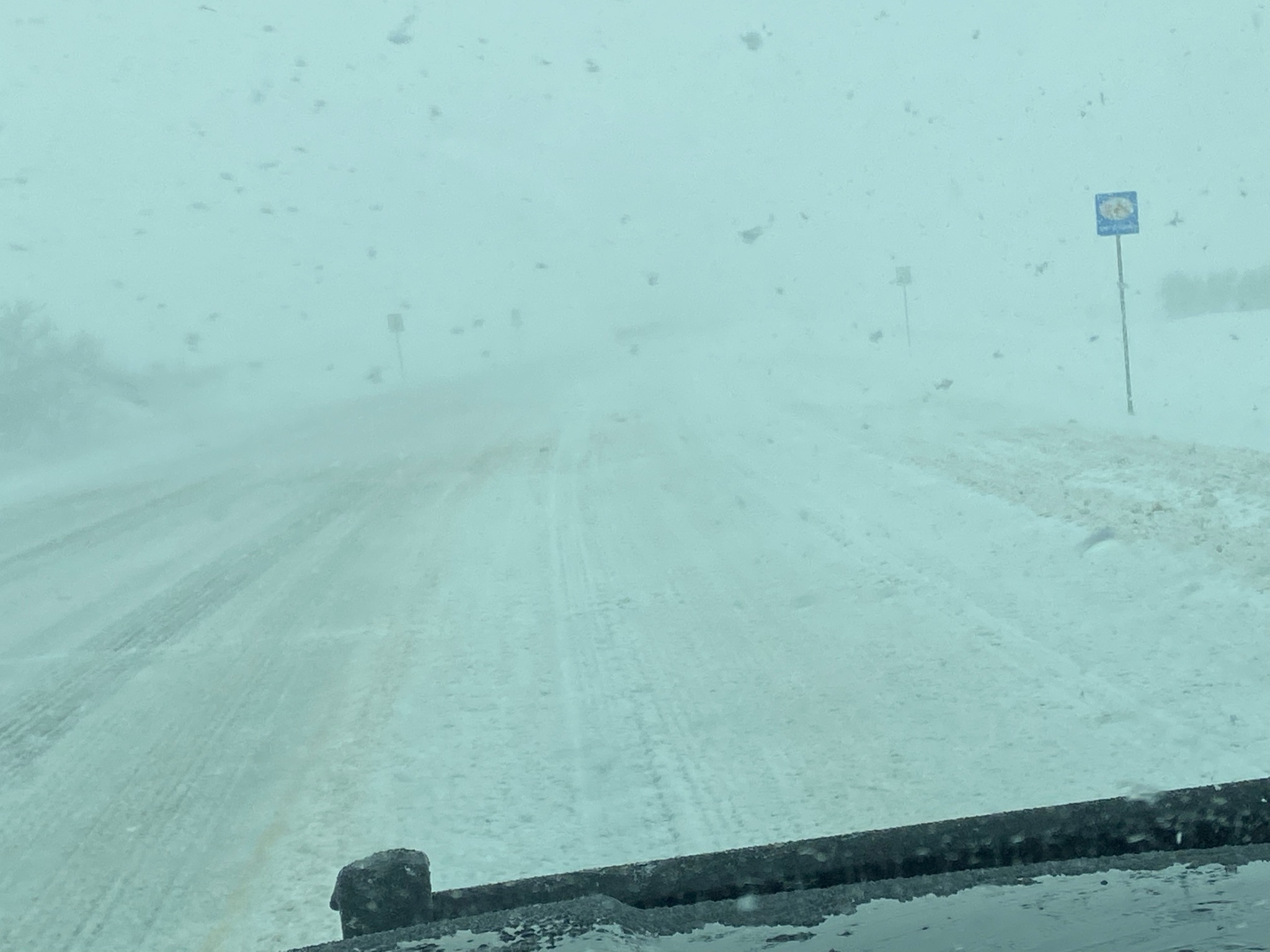
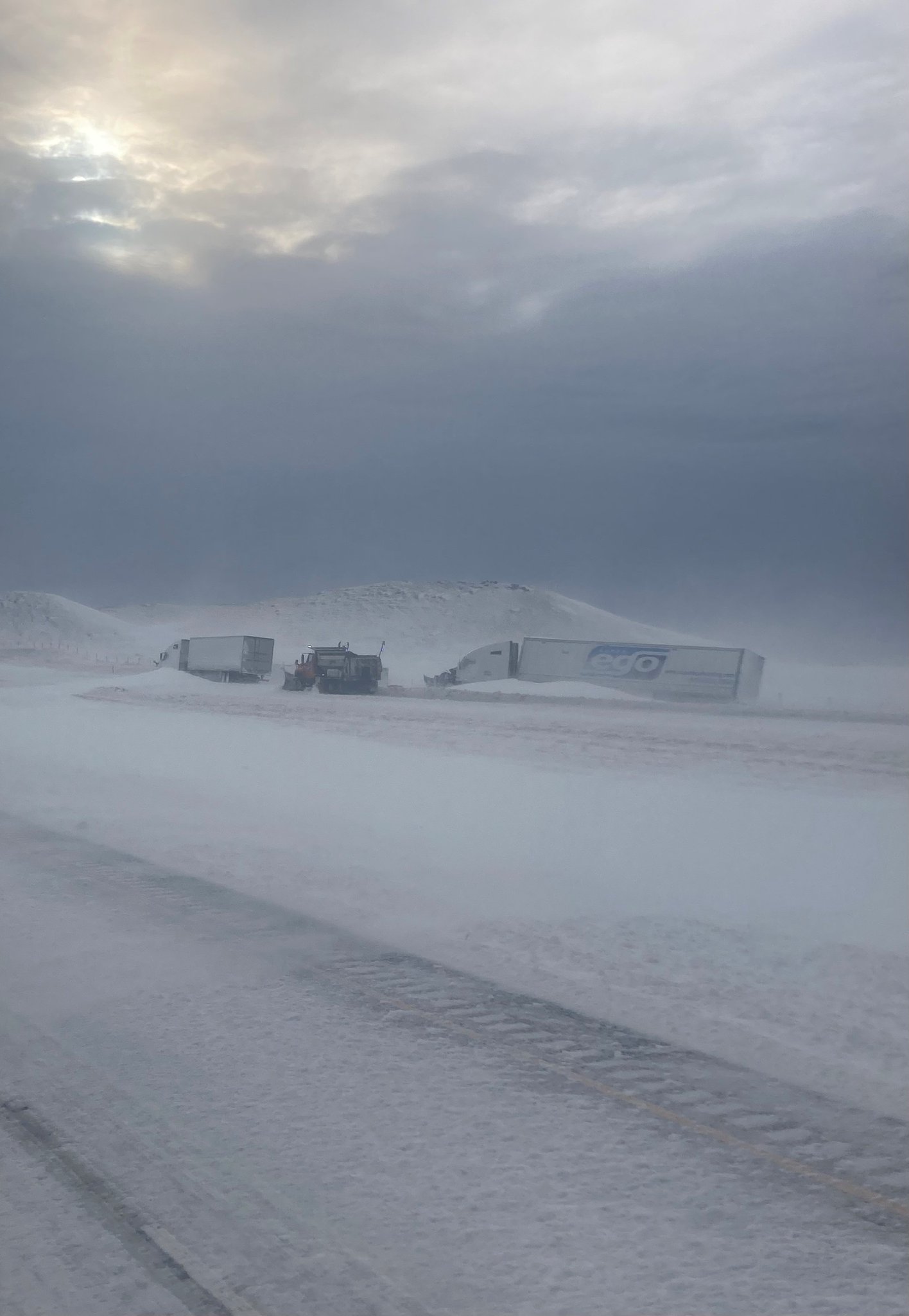
Another powerful Colorado Low, the second of three in less than three weeks, moved across North Dakota from Friday, April 22nd through Sunday, April 24th. Rain showers and even a few thunderstorms with heavy rain occurred on Friday. A wintry mix of rain, freezing rain, sleet and snow fell across the west and north on Saturday, while showers and thunderstorms with heavy downpours pushed through the east. At one point on Saturday there were Blizzard Warnings ongoing in the west while a Tornado Watch was posted for the east! As the system pulled away Saturday night and Sunday, most areas saw snow. Strong winds were observed throughout the storm producing a blizzard across the west and north. The impacts from this storm were adverse and widespread. In some cases, devastating. Roads and highways were closed in the west and north, including Interstate 94 from Mandan to the Montana border. Freezing rain, heavy wet snow, sleet, and wind gusts as high as 79 mph (New Town, ND DOT site) snapped thousands of power poles bringing lines down and causing extensive and extended power outages. The Williston Basin International Airport not only lost power, but had to close the runway due to significant blowing and drifting snow and near zero visibility. The Red Cross opened warming shelters in Williston and Crosby. Lastly, thunderstorms dropped hail and pushed gusty winds that damaged trees through the east. A brief tornado occurred in LaMoure County. Flash and overland flooding occurred with the storms. There was also very significant riverine flooding. |
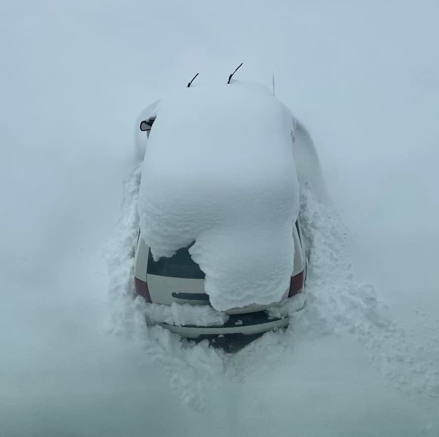 Tioga. Photo courtesy Gloria Bethel |
Photos & Video
Header
 |
 |
 |
 |
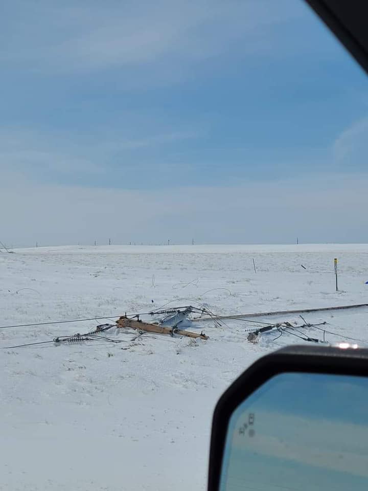
| Power lines down near Williston (Emily Marie) |
Heavy Snow in Crosby (Don Anderson) |
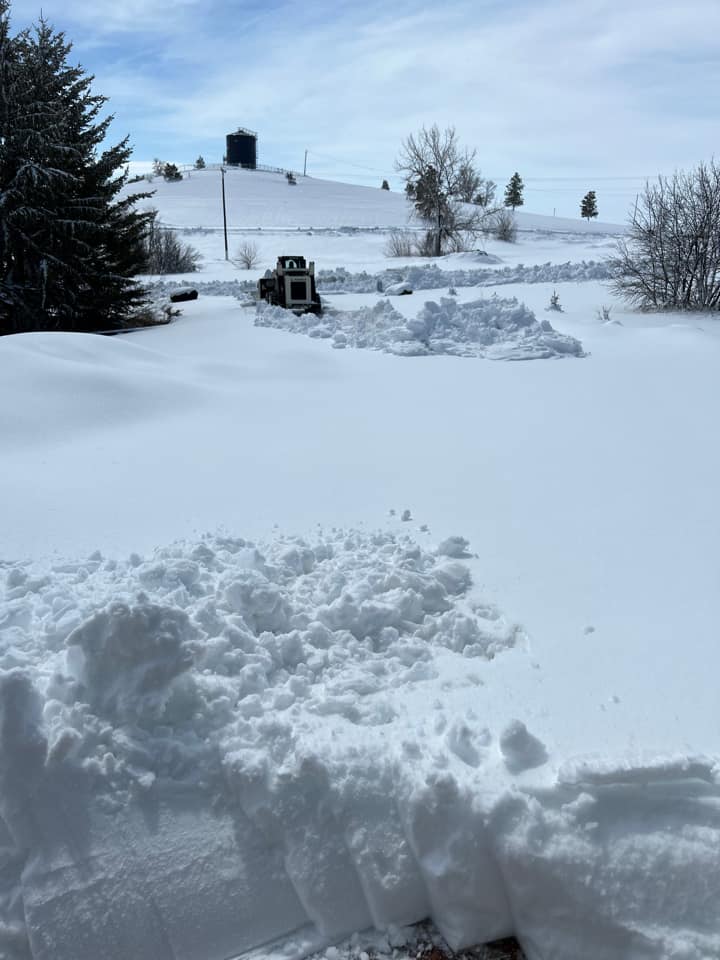
Snow piles up in Alexander ND (Katy Kendrick) |
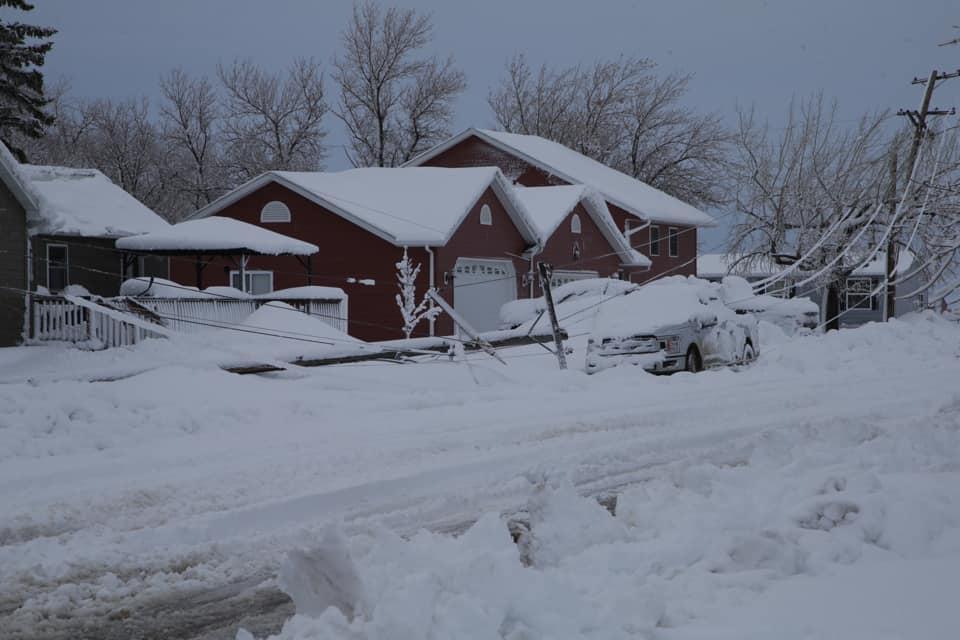
No power in Williston (Ruth Marie Adekunle) |
 |
 |
 |
 |
| Roads in Bowman County (Bowman County Twitter) |
Road Conditions in Belfield (ND DOT Twitter) |
Road Conditions near Hettinger (DOT Twitter) |
Dangerous Road Conditions (DOT Twitter) |
Radar
 |
 |
 |
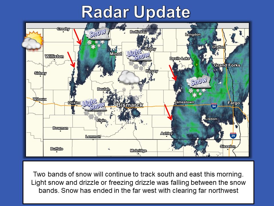 |
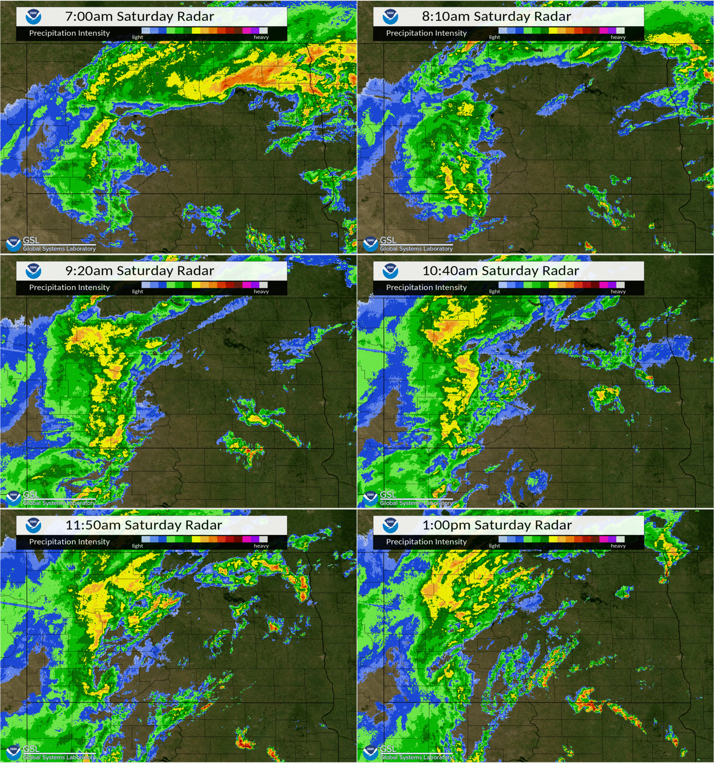
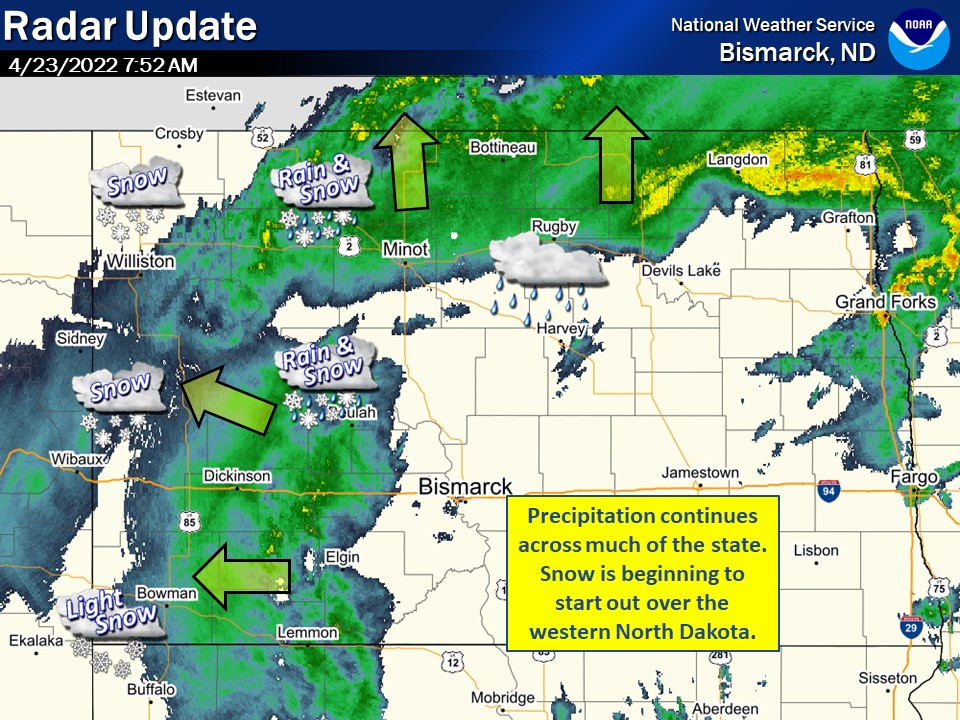
| Saturday Morning Radar Loop | Saturday Afternoon Radar | 8 AM April 23rd Detailed Radar | 11 AM April 24 Radar Update |
Storm Reports
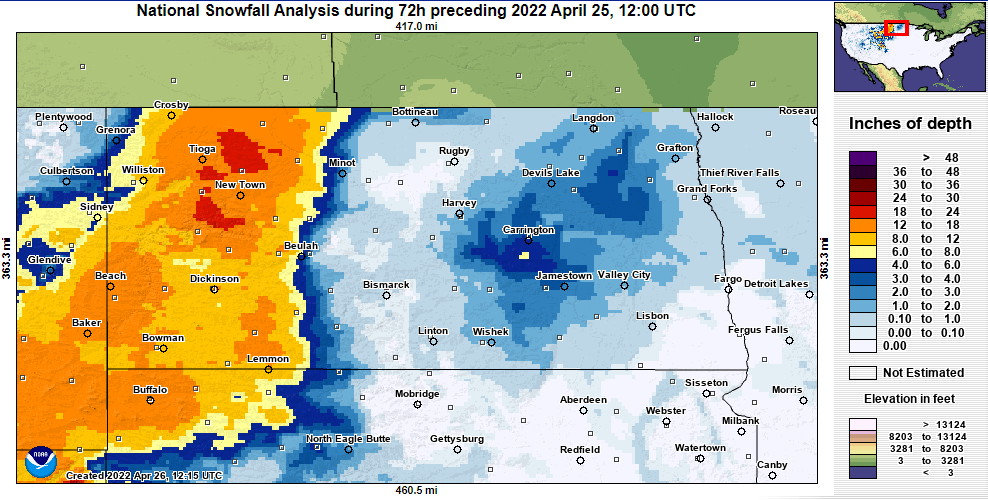 |
| National 72 Hour Snowfall Analysis Ending 7 AM April 25 from NOHRSC |
Public Information Statement
National Weather Service Bismarck ND
351 PM CDT Sun Apr 24 2022

...HERE ARE THE STORM TOTAL SNOWFALL REPORTS WE HAVE RECEIVED SO
FAR FROM THE WEEKEND BLIZZARD...

Location                     Amount     Lat/Lon
1 W Niobe                    18.0 in    48.69N/102.25W
1 S Beach                    17.5 in    46.91N/104.01W
2 NE Grassy Butte            16.0 in    47.42N/103.22W
1 N Dickinson                13.0 in    46.90N/102.79W
Watford City                 12.5 in    47.80N/103.28W
1 WNW Dickinson              12.0 in    46.89N/102.81W
Bowman                       12.0 in    46.18N/103.39W
6 NW Gladstone               11.3 in    46.93N/102.66W
Dickinson                    10.0 in    46.88N/102.79W
Williston                    9.0 in     48.16N/103.63W
Belfield                     9.0 in     46.89N/103.20W
Williston                    8.5 in     48.16N/103.62W
Taylor                       8.5 in     46.90N/102.43W
10 SW New England            8.0 in     46.44N/103.02W
2 NNW Watford City           7.0 in     47.82N/103.29W
Hettinger                    7.0 in     46.00N/102.64W
Regent                       6.0 in     46.42N/102.56W
Lansford                     3.7 in     48.63N/101.38W
Glen Ullin                   2.5 in     46.82N/101.83W
3 S Minot                    2.0 in     48.19N/101.30W

Observations are collected from a variety of sources with varying
equipment and exposures. We thank all volunteer weather observers
for their dedication. Not all data listed are considered official.

$$
Saturday April 23rd Severe Weather Reports
 |
| Severe Weather Reports from Saturday, April 23rd. Click here for more details. |
Environment
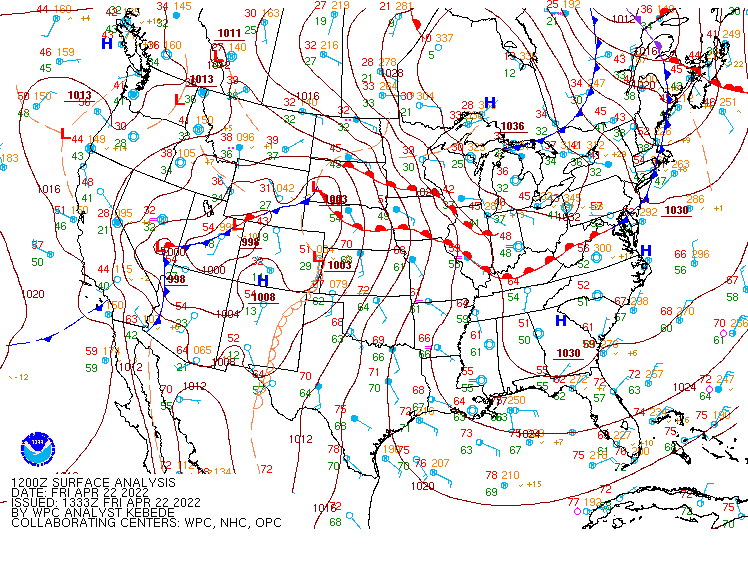
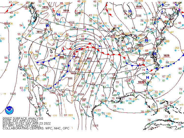
Surface Maps Friday Morning (April 22nd) Through Saturday Morning (April 23rd)
 |
 |
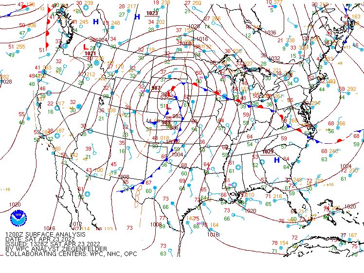 |
| Figure 1: Friday Morning Surface Map | Figure 2: Friday Evening Surface Map | Figure 3: Saturday Morning Surface Map |
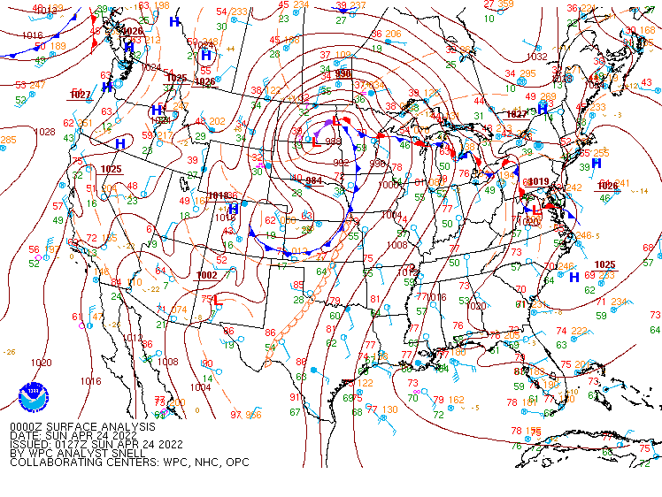
Surface Maps Saturday Evening (April 23rd) through Sunday evening (April 24th)
 |
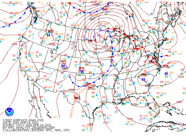 |
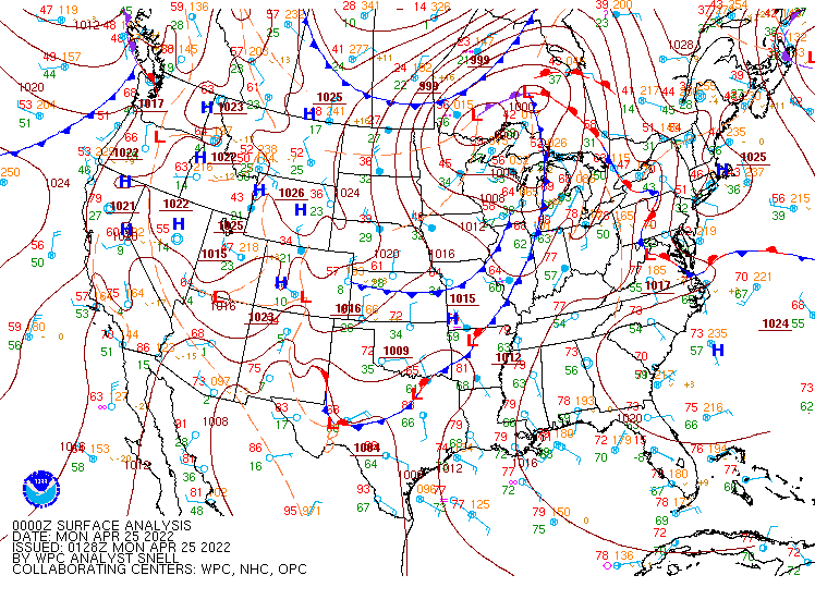 |
| Figure 4: Saturday Evening Surface Map | Figure 5: Sunday Morning Surface Map | Figure 6: Sunday Evening Surface Map |
Satellite data.
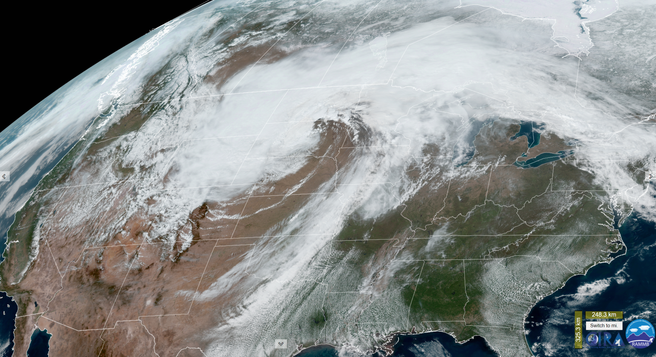 |
| Figure 7: Satellite image from 1 PM CDT on Saturday April 23rd |
 |
Media use of NWS Web News Stories is encouraged! Please acknowledge the NWS as the source of any news information accessed from this site. |
|



 Follow us on X
 Follow us on Facebook
 Follow us on YouTube
 BIS RSS Feed