Dangerous and extreme heat will remain across portions of the central U.S. this week, persisting across the mid to lower Mississippi Valley, Gulf Coast, southern Plains and portions of Texas. A heat wave over the Southwest U.S. will peak this weekend. Heavy to excessive rainfall may produce flash flooding from the Delmarva Peninsula north into the Hudson Valley today and tonight. Read More >
Overview
|
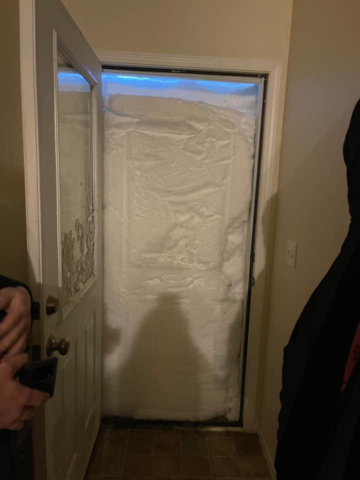
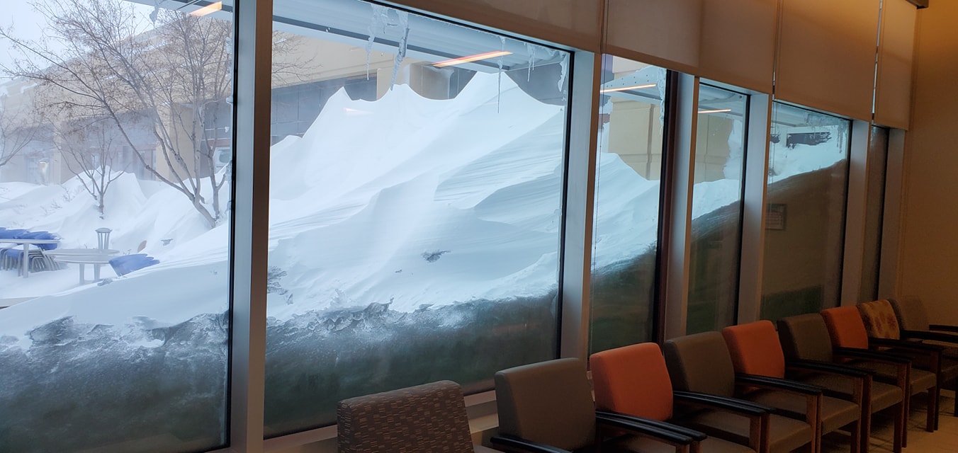
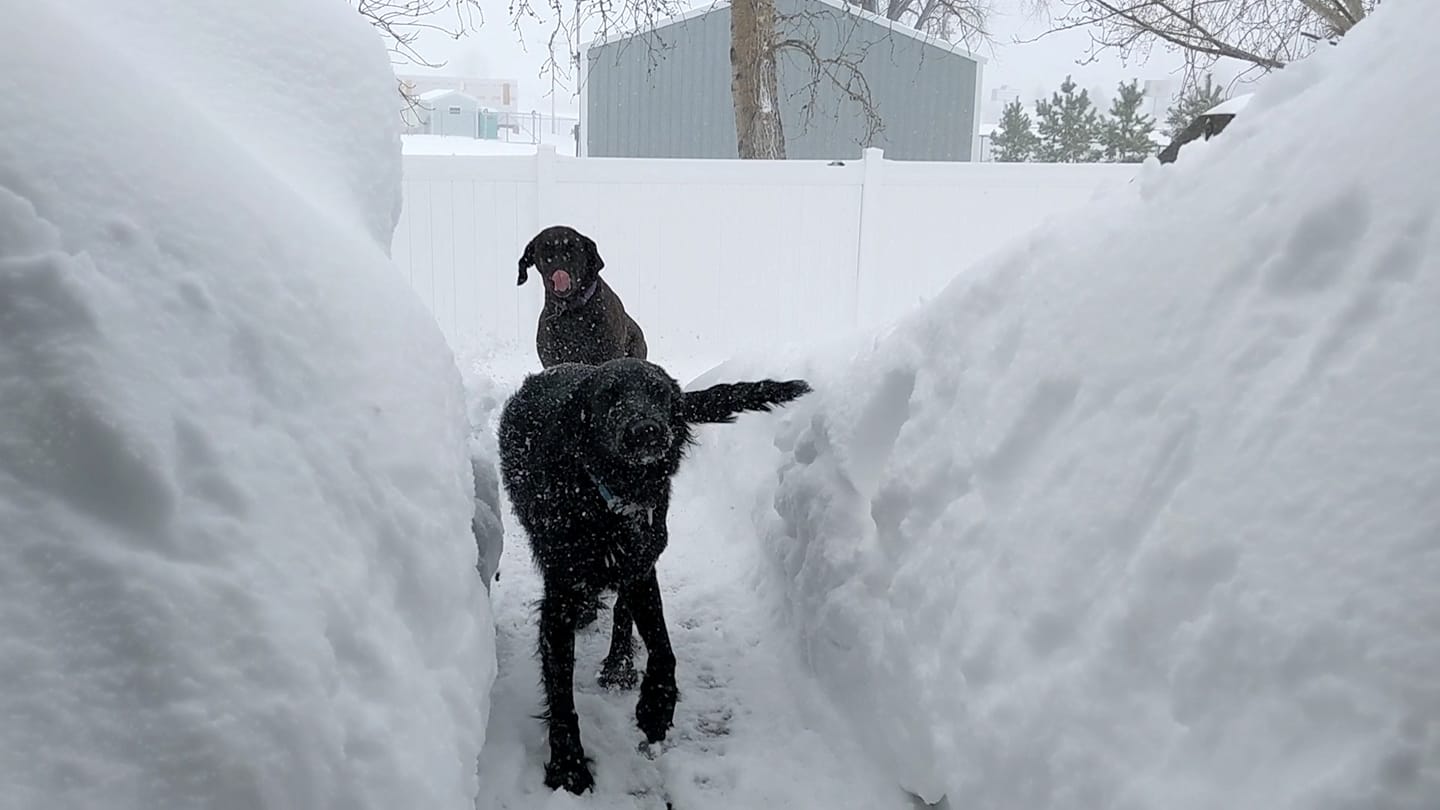
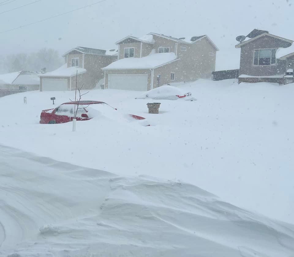
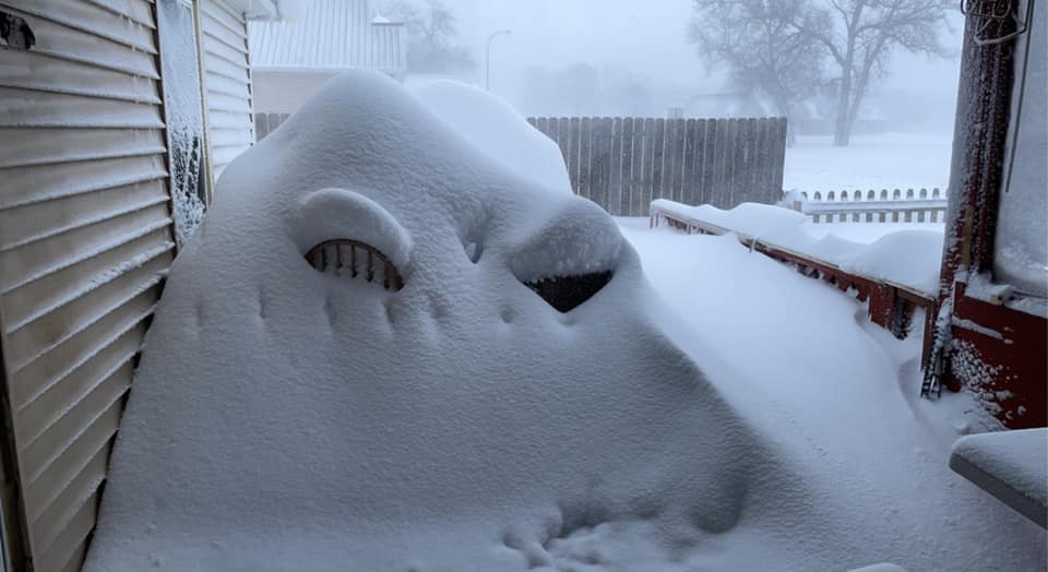
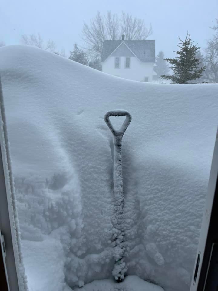
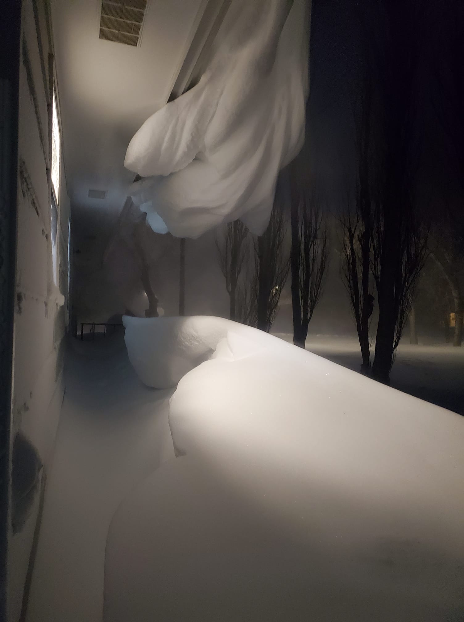
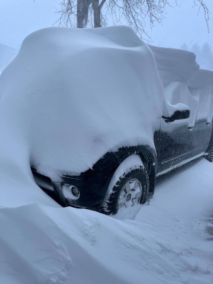
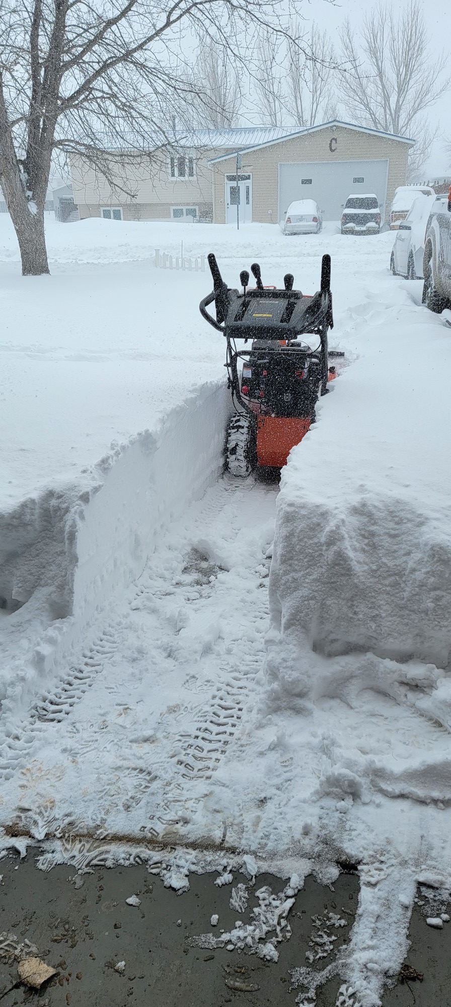
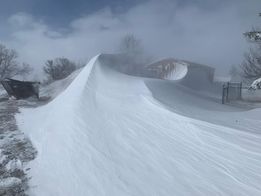
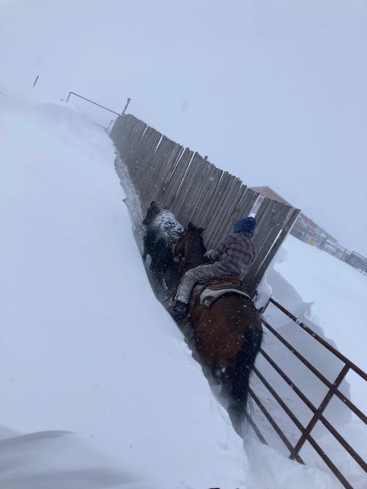
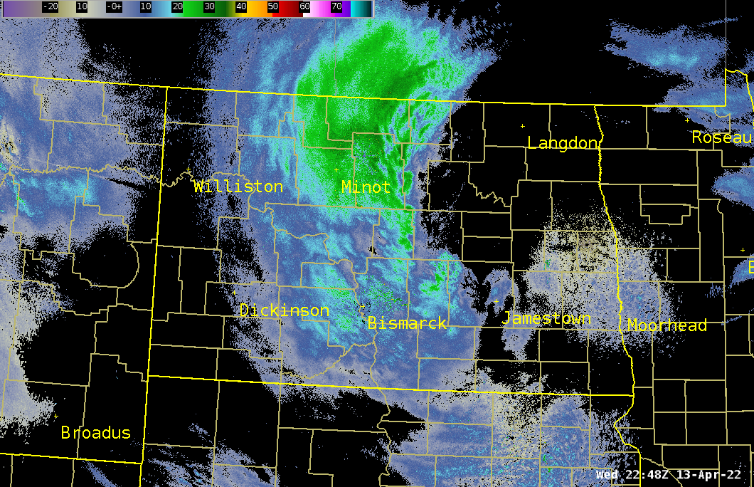
A significant winter storm brought widespread blizzard conditions to western and central North Dakota from April 12th through April 14th, 2022. Snow began in southwestern North Dakota early in the morning on Tuesday, April 12th, and quickly expanded into central North Dakota during the morning hours, then gradually into northern North Dakota through the rest of the day. Conditions deteriorated rapidly due to heavy snow and high winds, with a No Travel Advisory issued by the NDDOT by late morning for much of the southwest and south central. At 5 PM on Tuesday, Interstate 94 was closed from the Montana state line to Jamestown. Many roads were difficult to impossible to travel on due to blowing and drifting snow. Heavy snowfall rates continued Wednesday, and winds shifted to the northwest with many gusts reported around 60 mph. Blowing and drifting snow remained a significant problem. Overall snowfall was 1 to 3 feet, with drifts exceeding 8 feet (see photos below)! While we continue to analyze the data, check back here for updates. |
(Courtesy of Stephanie LeeAnn Wheeler) |
Photos & Video
 |
 |
 |
 |
| Large snow drifts at the CHI St. Alexius Hospital in Dickinson. (Courtesy of Chelsey Petersen) |
Washburn (Courtesy of Phillip Mack Hermann) |
Minot (Courtesy of Theresa Elizabeth) |
Minot (Courtesy of Carlos Mock) |
 |
 |
 |
 |
| Lansford (Courtesy of Jody Hinkle Pletcher) |
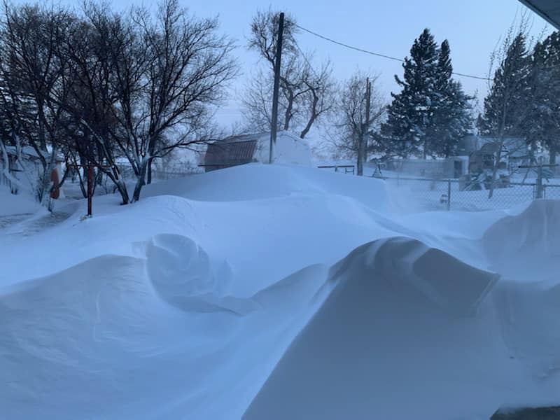
Large snow drifts in Golden Valley. (Courtesy of Joslyn Marie) |
A car buried under a large snow drift in southwest Minot. (Courtesy of Ashley Janssen) |
Underwood (Courtesy of Sharon Carmichael Roberts) |
 |
 |
 |
 |
| 8 to 10 foot tall snow drift in Hebron. (Courtesy of Johnson Farm) |
Snow drifts in a backyard in Tioga. (Courtesy of Karen Odegaard) |
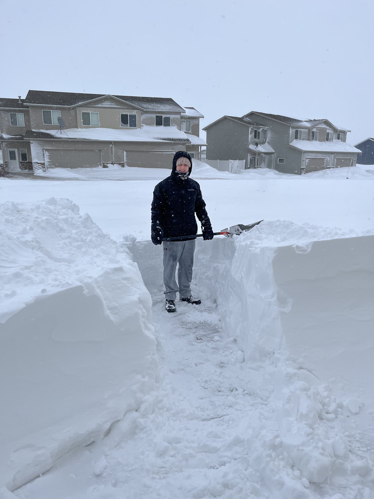
Trying to shovel snow in Minot the morning of Thursday, April 14th. (Courtesy @Carly_GISWx on Twitter) |
A mountain of snow in New England, ND (Courtesy Tia Bossert) |
 |
 |
 |
 |
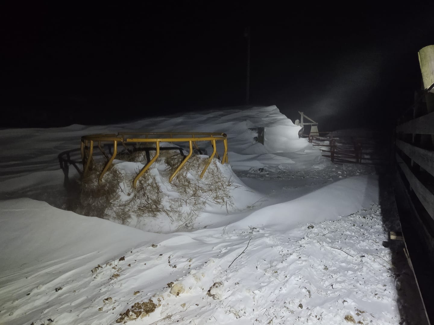
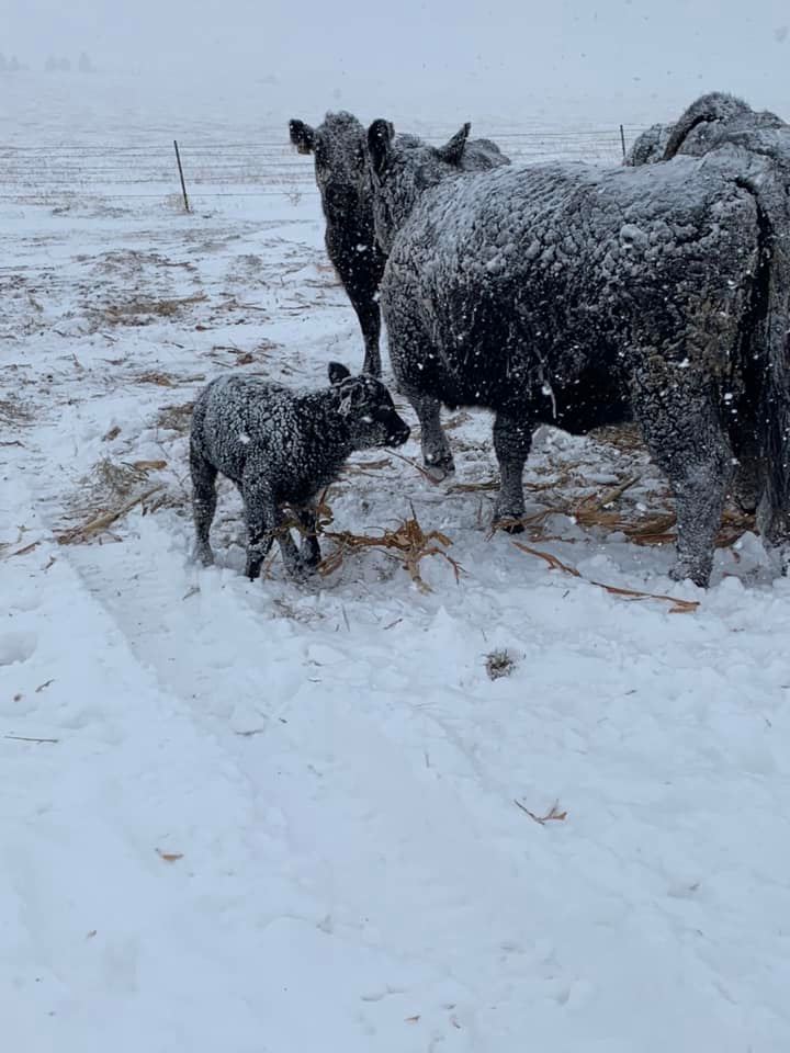
| 2 Day Old Calf in Bowman. (Courtesy of Tracy Boll) |
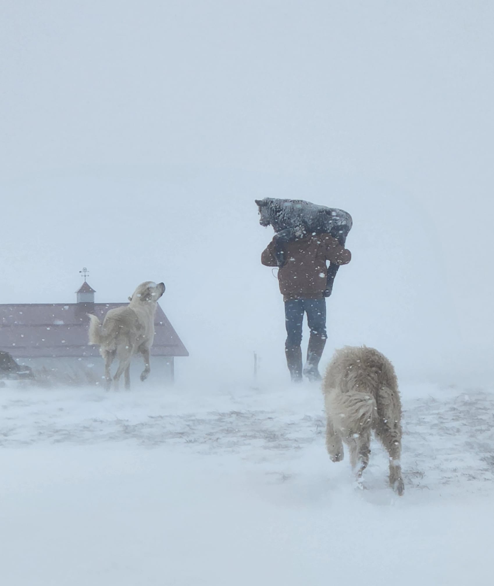
Cattle trying to stay warm. (Courtesy of Jennifer Wing) |
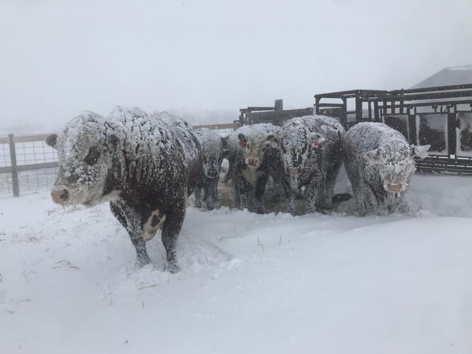
Cattle in Glen Ullin. (Courtesy Dana Wahus) |
Limited space for the horses. (Courtesy Dawn Martin) |
Radar
Header
 |
 |
 |
 |
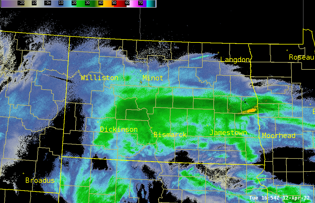
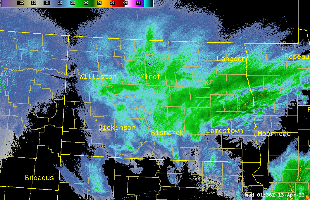
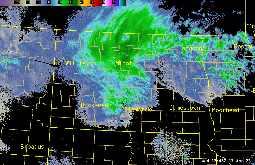
| Heavy Snow Started Tuesday Morning | Heavy snow continued Tuesday evening, with some rain in the east. | Snow starting to wrap around the low Wednesday Morning | Heavy snow showing now signs of letting up Wednesday afternoon |
Storm Reports
 |
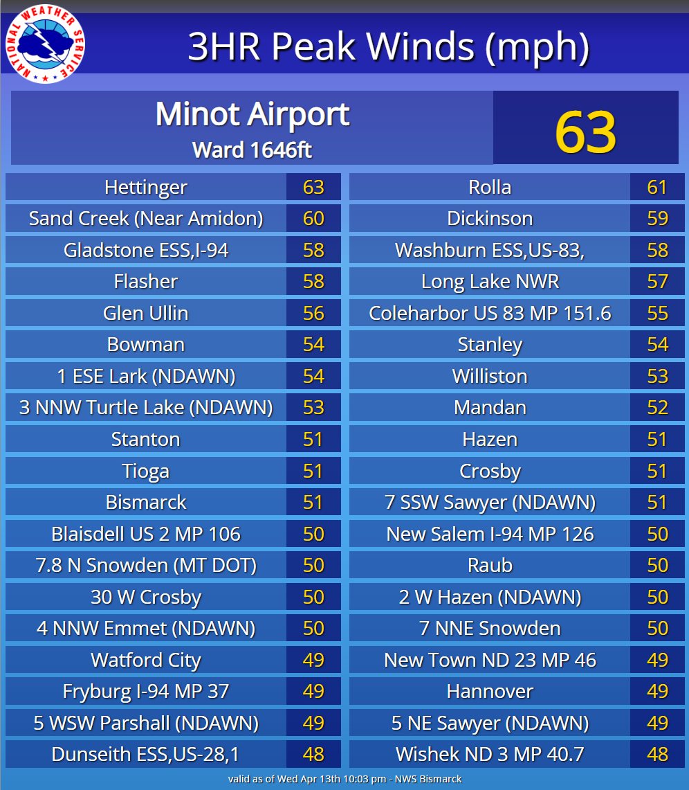 |
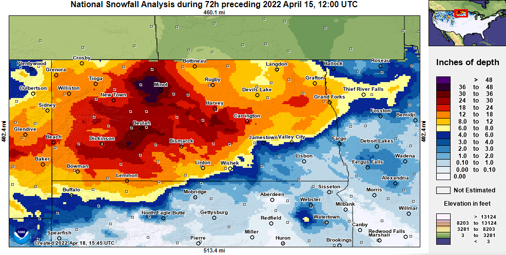
| National 72 Hour Snowfall Analysis Ending 7 AM April 15 from NOHRSC | Strongest wind reports at the peak of the blizzard |
...STATEWIDE STORM TOTAL SNOWFALL FOR NORTH DAKOTA FOR THE MAJOR WINTER
STORM FROM TUESDAY APRIL 12TH THROUGH THURSDAY APRIL 14TH...

BELOW ARE THE ANTICIPATED FINAL SNOWFALL REPORTS FROM THE MAJOR WINTER
STORM FROM TUESDAY APRIL 12TH THROUGH THURSDAY APRIL 14TH.

LOCATION                     AMOUNT    TIME/DATE       LAT/LON
3 NW MINOT                   36.0 IN   0815 AM 04/14   48.26N/101.34W
GLENBURN                     30.5 IN   0607 AM 04/14   48.51N/101.22W
1 E DUNN CENTER              29.5 IN   0900 AM 04/15   47.36N/102.60W
DICKINSON 1.1 WNW            29.2 IN   0800 AM 04/14   46.89N/102.80W
GARRISON                     29.0 IN   0900 AM 04/15   47.66N/101.42W
VELVA 3 NE                   28.0 IN   0800 AM 04/14   48.08N/100.88W
NORWICH                      28.0 IN   0702 PM 04/13   48.25N/100.99W
LANSFORD                     27.5 IN   0500 AM 04/14   48.63N/101.38W
MCCLUSKY                     27.0 IN   0800 AM 04/15   47.49N/100.44W
1 NW HEBRON                  26.5 IN   0808 AM 04/14   46.91N/102.06W
BURLINGTON                   26.0 IN   0926 PM 04/13   48.28N/101.43W
DUNN CENTER 2 SW             26.0 IN   0600 PM 04/13   47.35N/102.65W
DICKINSON                    25.0 IN   0315 PM 04/14   46.88N/102.79W
2 NE GRASSY BUTTE            25.0 IN   530  PM 04/13   47.42N/103.22W
UNDERWOOD                    24.3 IN   0800 AM 04/14   47.46N/101.14W
HAZEN                        24.6 IN   0830 AM 04/14   47.30N/101.62W
HEART BUTTE DAM              24.1 IN   0900 AM 04/15   46.60N/101.81W
TURTLE LAKE                  24.0 IN   0800 AM 04/15   47.52N/100.89W
STANLEY                      24.0 IN   0233 PM 04/14   48.31N/102.38W
CARPIO                       24.0 IN   0741 AM 04/14   48.44N/101.72W
LANSFORD                     24.0 IN   1040 PM 04/13   48.63N/101.38W
10 NE SENTINEL BUTTE         24.0 IN   0953 PM 04/13   47.02N/103.69W
10 NE RICHARDTON             24.0 IN   0936 PM 04/13   47.00N/102.20W
GLENBURN                     24.0 IN   0230 PM 04/13   48.52N/101.22W
5 SE MANNING                 23.0 IN   0202 PM 04/14   47.18N/102.70W
SHERWOOD                     23.0 IN   0630 AM 04/14   48.96N/101.63W
6 S HAZEN                    23.0 IN   1103 PM 04/13   47.21N/101.62W
4.9 NW NEW SALEM             22.5 IN   0900 AM 04/14   46.89N/101.49W
GLEN ULLIN                   22.0 IN   0700 PM 04/13   46.82N/101.83W
MCCLUSKY                     22.0 IN   0600 PM 04/13   47.48N/100.45W
4 WSW SURREY                 22.0 IN   1155 AM 04/13   48.21N/101.21W
2 NW BERGEN                  21.0 IN   0130 PM 04/13   48.02N/100.73W
STANTON                      21.0 IN   1246 PM 04/13   47.32N/101.38W
BEACH                        20.2 IN   0700 AM 04/15   46.92N/104.01W
REGENT                       20.0 IN   0422 PM 04/14   46.42N/102.56W
HARVEY                       20.0 IN   0630 AM 04/14   47.77N/99.94W
5 N BELFIELD                 20.0 IN   1130 PM 04/13   46.96N/103.20W
SHERWOOD                     20.0 IN   0830 PM 04/13   48.96N/101.63W
1 W LOGAN                    20.0 IN   1230 PM 04/13   48.15N/101.17W
0.4 SE LARIMORE              19.2 IN   0830 PM 04/14   47.91N/97.62W
CATHAY 6.5 N                 19.0 IN   0700 AM 04/15   47.65N/99.40W
VOLTAIRE                     19.0 IN   0856 AM 04/13   48.02N/100.84W
TAYLOR                       19.0 IN   0815 AM 04/13   46.90N/102.43W
5 NE MAXBASS                 18.7 IN   0700 AM 04/15   48.77N/101.07W
NWS BISMARCK                 18.3 IN   0427 PM 04/14   46.77N/100.76W
BOWMAN                       18.0 IN   0800 AM 04/15   46.19N/103.40W
MAXBASS 4.9 ENE              18.0 IN   0800 AM 04/14   48.74N/101.04W
CATHAY 6.5 N                 18.0 IN   0700 AM 04/14   47.65N/99.40W
HETTINGER                    18.0 IN   0437 AM 04/14   46.00N/102.64W
WATFORD CITY                 18.0 IN   0815 PM 04/13   47.80N/103.28W
2 E STANTON                  18.0 IN   0915 AM 04/13   47.32N/101.34W
4 NNW FRYBURG                18.0 IN   0830 AM 04/13   46.92N/103.33W
5 NW NEW SALEM               17.8 IN   1248 PM 04/13   46.90N/101.49W
WILLISTON                    17.0 IN   0940 PM 04/13   48.15N/103.63W
10 SW NEW ENGLAND            16.5 IN   0904 PM 04/13   46.44N/103.02W
4 WNW WOLSETH                16.0 IN   1215 PM 04/13   48.46N/101.20W
NEW ENGLAND                  16.0 IN   0700 AM 04/13   46.54N/102.87W
TOLLEY 6.4 N                 15.0 IN   0700 AM 04/15   48.82N/101.85W
NORTHWOOD                    15.0 IN   0926 AM 04/13   47.74N/97.57W
NEW ROCKFORD                 15.0 IN   0950 AM 04/13   47.68N/99.14W
4 SW OBERON                  15.0 IN   1131 AM 04/13   47.88N/99.27W
BOTTINEAU 6.4 ENE            14.0 IN   0843 AM 04/14   48.87N/100.32W
HEBRON                       14.0 IN   1000 AM 04/13   46.90N/102.05W
WALHALLA 3.6 SSE             14.0 IN   0800 PM 04/14   48.87N/97.89W
CROSBY                       13.5 IN   0700 PM 04/14   48.92N/103.30W
FORT YATES                   13.0 IN   0730 AM 04/14   46.09N/100.63W
6 WSW MARTIN                 13.0 IN   1038 AM 04/13   47.79N/100.23W
CARRINGTON                   13.0 IN   1000 AM 04/13   47.45N/99.13W
HATTON                       13.0 IN   0846 AM 04/13   47.64N/97.46W
2 N MANVEL                   13.0 IN   1113 AM 04/13   48.10N/47.18W
GRAND FORKS 3.7 SSE          12.6 IN   0800 PM 04/14   47.86N/97.05W
5.4 WNW HOPE ND              12.5 IN   0700 AM 04/13   47.34N/97.83W
NWS GRAND FORKS              12.5 IN   0900 PM 04/14   47.92N/97.10W
5 NNE LUVERNE                12.3 IN   0950 PM 04/12   47.32N/97.89W
4 S WARREN                   12.3 IN   1049 AM 04/13   48.14N/96.77W
6 ENE NEWBURG                12.5 IN   0945 AM 04/14   48.76N/100.81W
WILLISTON                    12.0 IN   0800 AM 04/15   48.16N/103.63W
TOLLEY 6.4 N                 12.0 IN   0700 AM 04/14   48.82N/101.85W
ELGIN                        12.0 IN   1234 PM 04/13   46.41N/101.84W
SAINT JOHN                   12.0 IN   0854 AM 04/13   48.95N/99.71W
GRAND FORKS                  12.0 IN   0852 PM 04/12   47.92N/97.07W
DEVILS LAKE                  12.0 IN   0730 AM 04/13   48.11N/98.87W
GRAND FORKS AIR FORCE BASE   11.0 IN   0745 PM 04/12   47.96N/97.38W
EAST GRAND FORKS             11.0 IN   0800 PM 04/12   47.93N/97.02W
PINGREE                      9.5 IN    0800 AM 04/15   47.17N/98.91W


OBSERVATIONS ARE COLLECTED FROM A VARIETY OF SOURCES WITH VARYING
EQUIPMENT AND EXPOSURES. WE THANK ALL VOLUNTEER WEATHER OBSERVERS
FOR THEIR DEDICATION. NOT ALL DATA LISTED ARE CONSIDERED OFFICIAL.

$$
Records
April 12th through the 15th, 2022 Official Report Site Snowfall County Records
Produced by NOAA's National Weather Service Bismarck and Grand Forks, North Dakota
One-Day County Snowfall Records
| County / Location | Amount (Inches) / Date | Previous Record / Date / Location |
| Dunn / Dunn Center 1E | 26.0 / 04-13 | broke 22.3 / 03-25-2009 at Halliday |
| Grand Forks / Larimore 0.4SE | 18.9 / 04-13 | broke 18.0 / 03-06-1995 at Grand Forks NWS |
| Mercer / Hazen 0.4SW | 18.0 / 04-13 | tied 18.0 / 04-07-1997 at Zap |
| Sheridan / McClusky | 12.0 / 04-12 | tied 12.0 / 12-26-2016 at McClusky |
Two-Day County Snowfall Records
| County / Location | Amount (Inches) / Date | Previous Record / Date / Location |
| Bottineau / Lansford | 27.5 / 04-13/14 |
broke 24.8 / 12-07/08-2016 at Lake Metigoshe State Park |
| Dunn / Dunn Center 1E | 28.0 / 04-13/14 | broke 25.0 / 04-26/27-1984 at Killdeer 8NW |
| Grant / Heart Butte Dam | 22.0 / 04-13/14 | tied 22.0 / 10-04/05-2013 at Pretty Rock |
| McHenry / Velva | 28.0 / 04-13/14 | broke 26.0 / 04-05/06-1997 at Drake 9NE |
| McKenzie / Grassy Butte 2ENE | 20.0 / 04-12/13 |
broke 18.5 / 12-25/26-2016 at Grassy Butte 2ENE |
| Mercer / Hazen 0.4ESE | 24.0 / 04-13/14 | broke 18.1 / 03-22/23-2011 at Beulah 2NW |
| Sheridan / McClusky | 22.0 / 04-12/13 | broke 20.5 / 03-03/04-1966 at McClusky |
Three-Day County Snowfall Records
| County / Location | Amount (Inches) / Date | Previous Record / Date / Location |
| Bottineau / Lansford | 28.0 / 04-13/14/15 |
broke 24.8 / 12-06/07/08-2016 at Lake Metigoshe SP |
| Dunn / Dunn Center 1E | 29.5 / 04-13/14/15 | broke 25.0 / 04-26/27/28-1984 at Killdeer 8NW |
| McKenzie / Grassy Butte 2ENE | 25.0 / 04-12/13/14 |
broke 20.6 / 12-30/31-2004 and 01-01-2005 at Keene 3S |
| Mercer / Hazen 0.4ESE | 24.6 / 04-13/14/15 | broke 21.0 / 11-28/29/30-2016 at Hazen 0.4ESE |
| Sheridan / McClusky | 27.0 / 04-12/13/14 | broke 22.0 / 03-03/04/05-1966 at McClusky |
Of Note...The monthly snowfall record, for the month of April, was broken at Bismarck. The record was 21.8 inches from April 2013. Through April 17, 2022 Bismarck has had 21.9 inches of snow, breaking the record by 0.1 inches, and the month is not over yet.
Disclaimer...There may be more records tied or broken and that will have to be determined later. Most official sites report on a daily basis though some report once a month (for example, the observer will send April’s data to the NWS during the first few days of May).
Environment
 |
 |
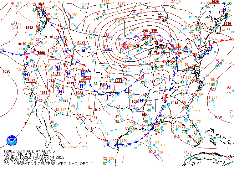 |
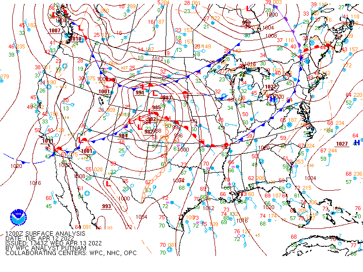
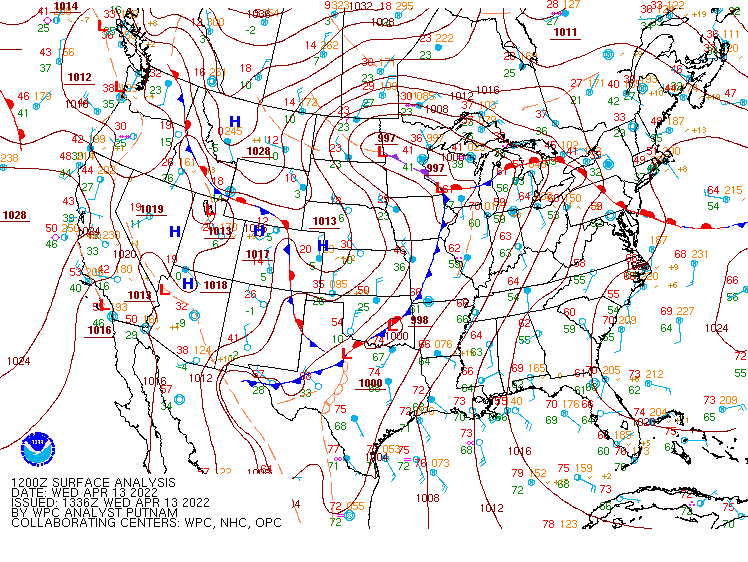
| Figure 1: April 12th Morning Surface Map | Figure 2: April 13th Morning Surface Map | Figure 3: April 14th Morning Surface Map |
 |
Media use of NWS Web News Stories is encouraged! Please acknowledge the NWS as the source of any news information accessed from this site. |
|