Overview
|
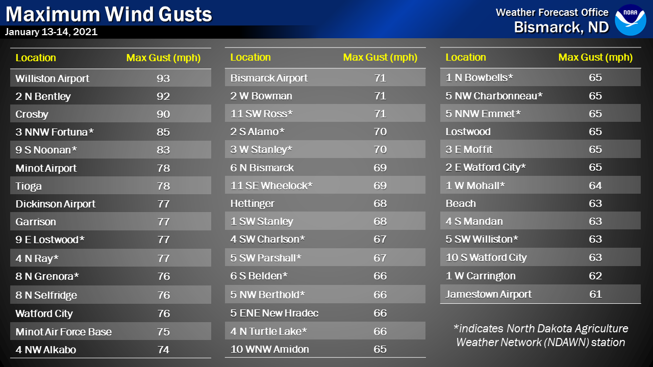
From the late afternoon of January 13 through January 14, 2021, a powerful low pressure system brought very strong winds to western and central North Dakota. The strongest observed wind gust was 93 mph at the Williston Basin Airport. There were many reports of property and tree damage, along with a few power outages. This event will go down as one of the worst non-thunderstorm wind events in recent memory. |
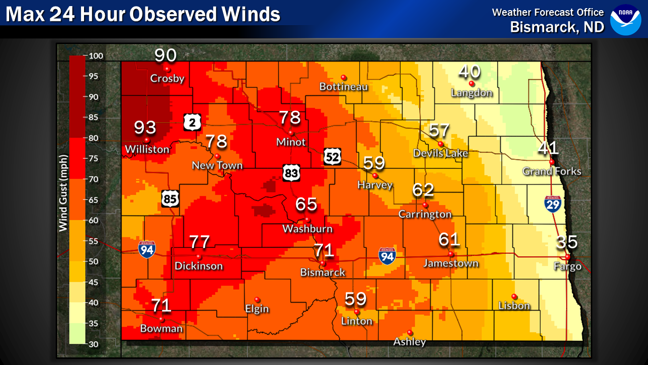 Highest wind gusts observed as of 1 PM CST on Thursday, January 14th. Colors are interpolated between observations. |
Photos & Video
 |
 |
 |
 |
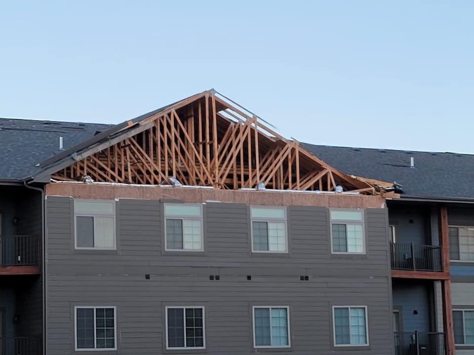
| Damage to an apartment building in Minot, ND (Beth Renae) |
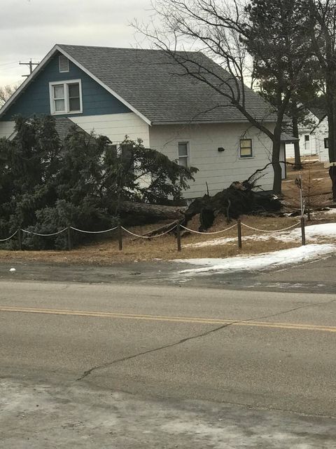
Glen Ullin (Courtney Swart) |
Stateline Casino on Highway 2 (Mike Smith) |
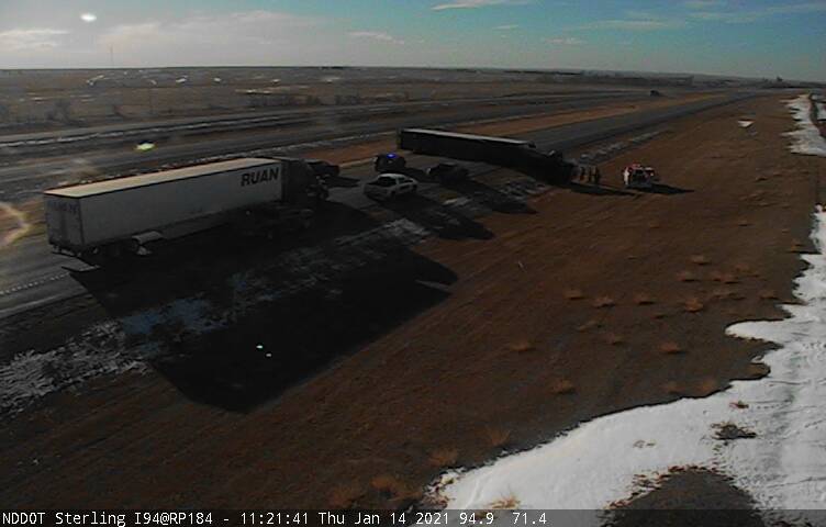
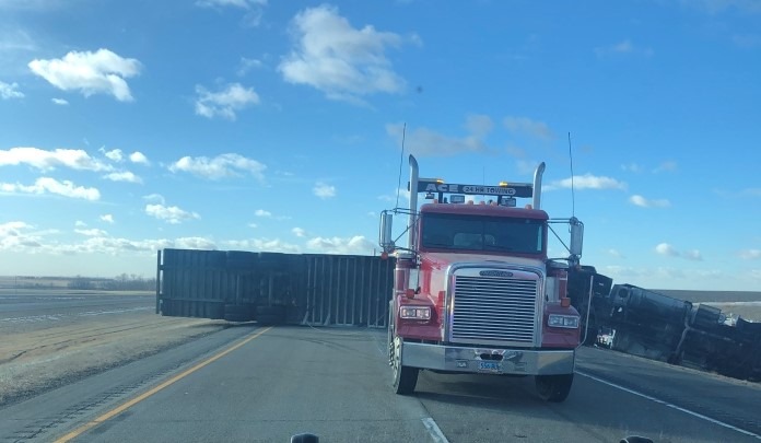
An overturned semitrailer on Interstate 94 near Sterling (NDDOT) |
 |
 |
 |
 |
| Anamoose (Robbie Schindler) |
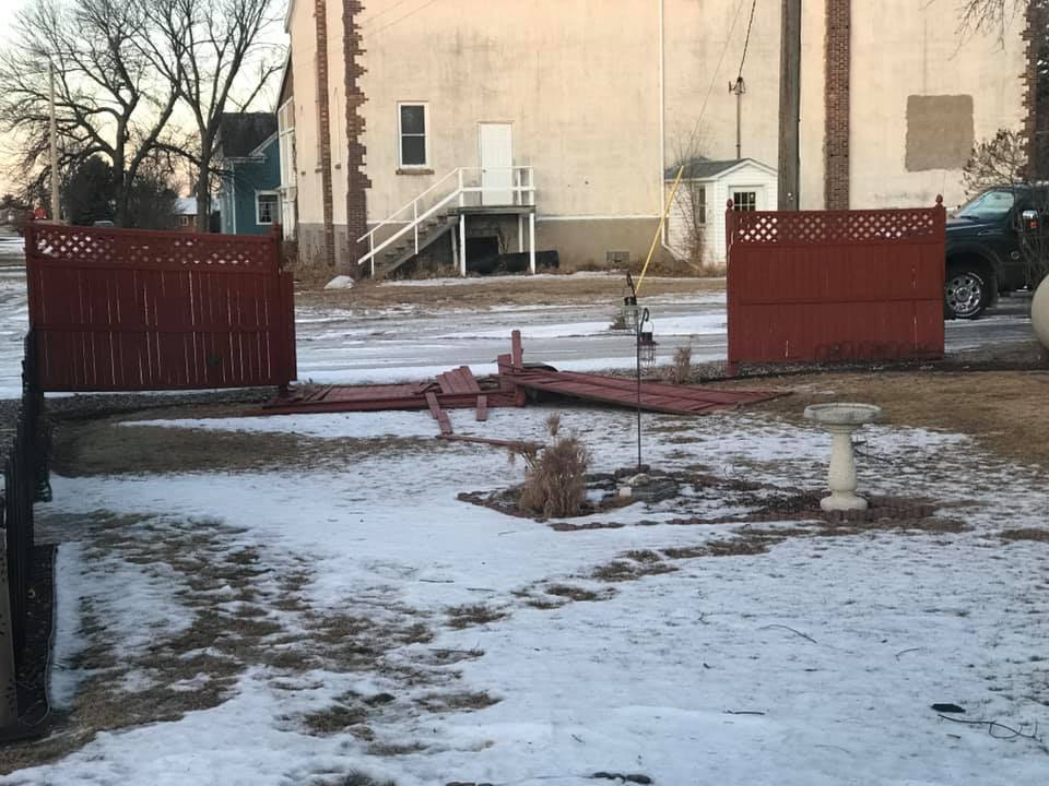
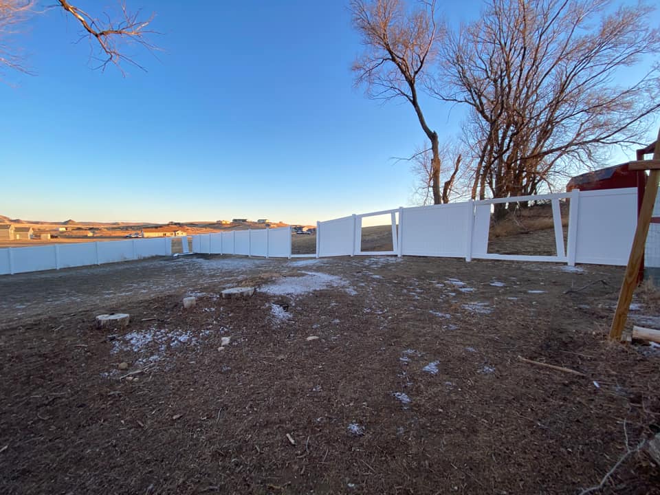
Damage to a fence in Mohall (Nancy Ferguson) |
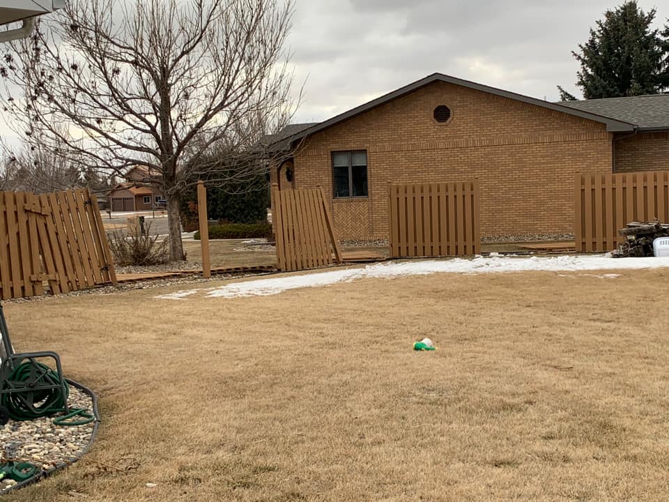
Fence damage in northwest Minot (Kay Eaton) |
A sideways semitrailer 10 miles west of Steele (North Dakota Highway Patrol) |
 |
 |
 |
 |
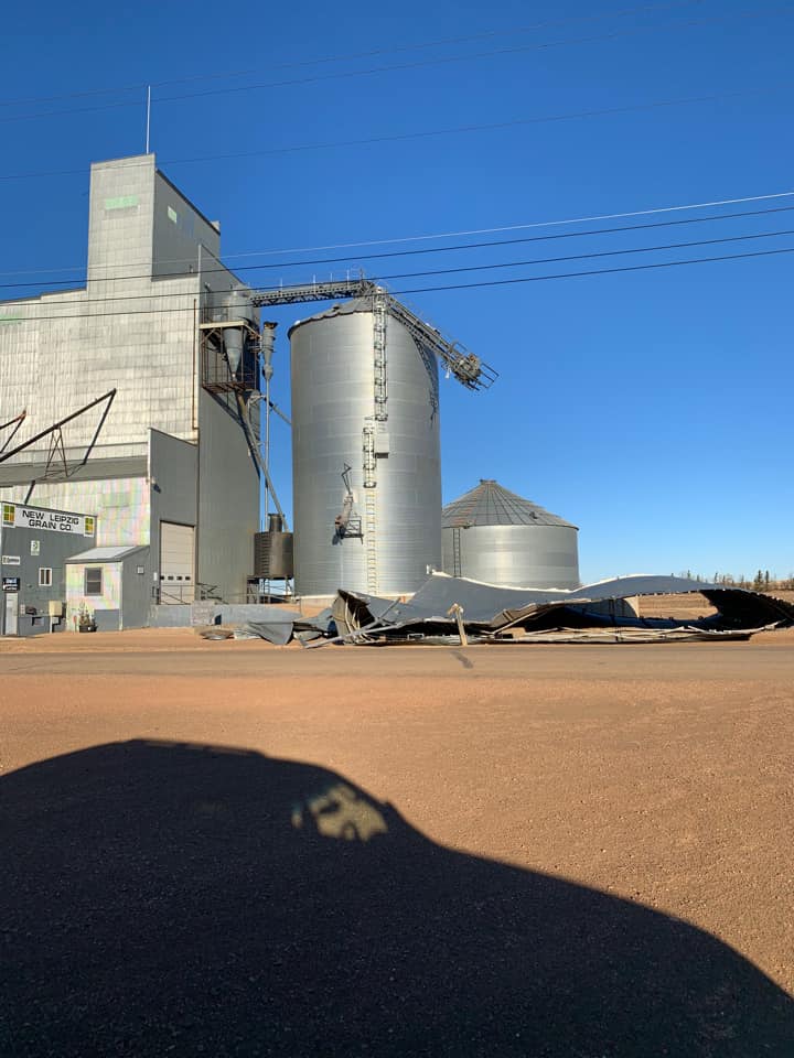
| A grain elevator in New Leipzig was damaged (Grant County Emergency Services) |
A horse trailer roof was lost north of Buffalo, SD (Jordan Milo Dyke) |
Damage to an elevated deer blind near Hebron (Jordan Milo Dyke) |
Bent road sign on Highway 2 near Stanley (North Dakota Highway Patrol) |
 |
 |
 |
 |
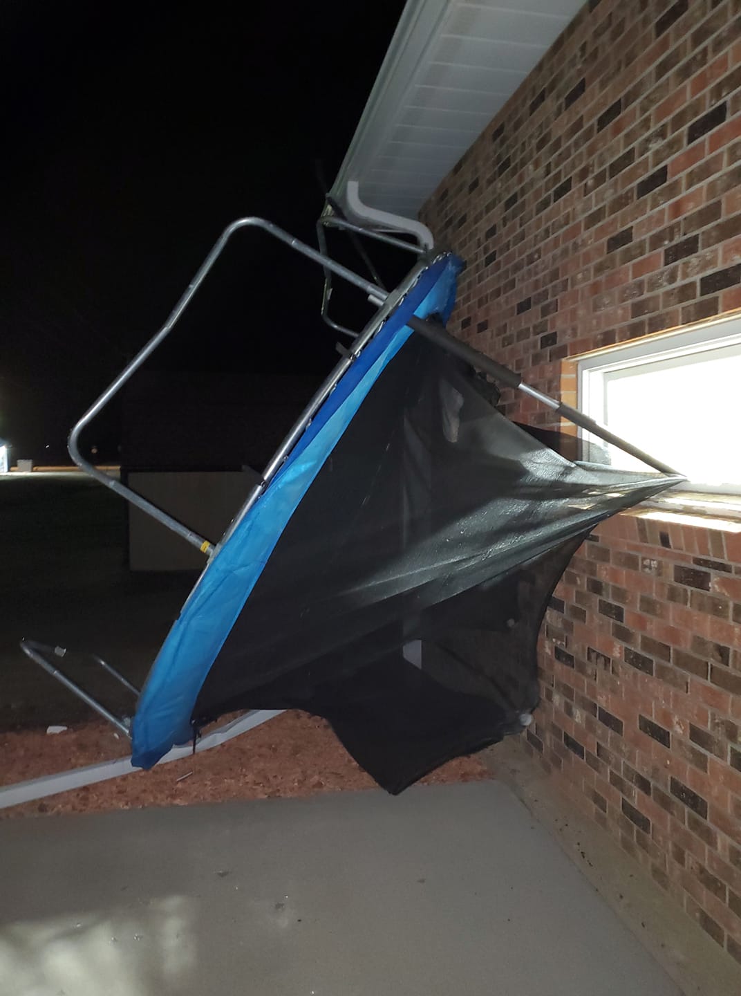
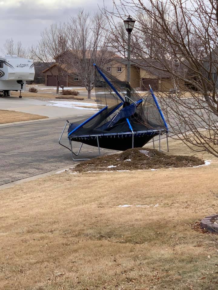
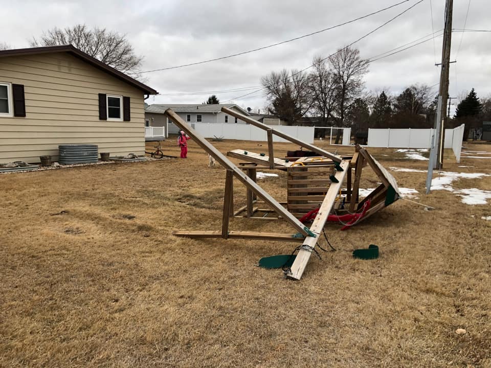
| A twisted trampoline in northwest Minot (Kay Eaton) |
A damaged playset in Surrey (Kristi Piburn Hauge) |
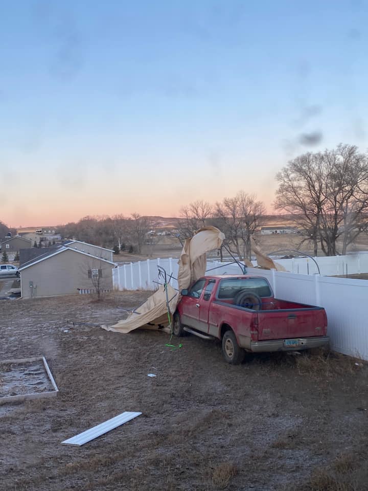
Damage in north Minot (Crystal Cree) |
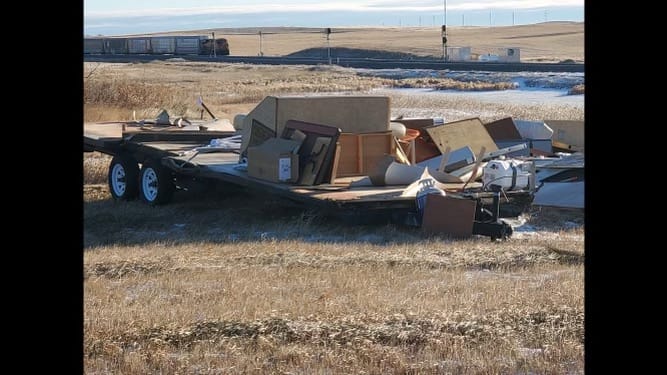
A heavily damaged trailer from Berthold (Dillon Lee) |
 |
 |
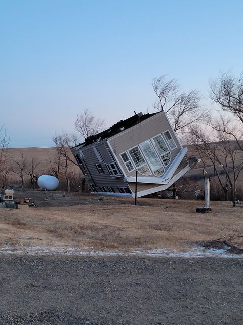
| Damage from Watford City (Devin Killpack) |
Damage from Watford City (Devin Killpack) |
Storm Reports
Storm reports from NWS Bismarck
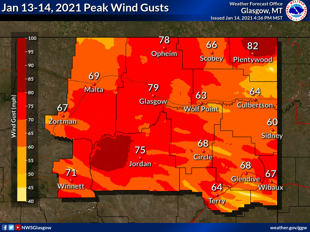 Storm reports from NWS Glasgow for northeast Montana
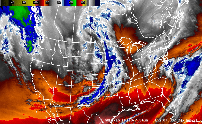
Satellite Imagery
Meteorology
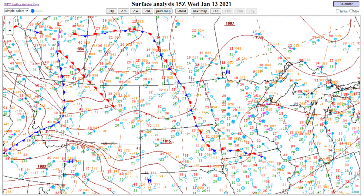
There were several factors that came together to produce a wind event of this magnitude. As can be seen in the surface analysis loop below, there was a very tight pressure gradient (solid brown lines packed close together) that moved over western and central North Dakota behind a cold front, with low pressure to the east and high pressure to the west.
Furthermore, a weather balloon launched near the Bismarck Airport around 5 AM CST on January 14 measured winds greater than 90 mph around 7,000 to 8,000 ft above the surface!
 While strong surface pressure gradients can produce strong winds on their own, another mechanism was needed for these winds to "mix down" to the surface. In this event, we had an unstable atmosphere with warmer temperatures at the surface than above (inferred by the negative slope of the red line). This type of temperature profile is very unusual for an early morning in January. Typically at this time of day and year, we observe what is called a temperature inversion, with colder temperatures at the surface than above (the red line would have a positive slope instead). If this had been the case, the atmosphere would have been stable, and the very strong winds aloft would have had a much more difficult time reaching the surface.
 |
Media use of NWS Web News Stories is encouraged! Please acknowledge the NWS as the source of any news information accessed from this site. |
|

