
Numerous severe thunderstorms are expected across a broad region from the Ohio Valley to the Mid-Atlantic and Northeast States today into tonight. Swaths of damaging wind gusts are expected and some tornadoes are possible. Bertha is expected to bring tropical storm conditions to portions of the Gulf Coast from the Florida Panhandle westward to southeastern Louisiana later today and Wednesday. Read More >
Overview: Severe Thunderstorms Friday June 9, 2017 Through Early Saturday AM June 10, 2017
|
Two rounds of severe thunderstorms impacted western and central North Dakota beginning Friday afternoon June 9, 2017, through the early morning hours of Saturday June 10, 2017. A peak instantaneous wind of 104 mph was measured by a storm chaser near Rugby, ND. Multiple hail reports were received across the area, the largest being baseball size near Richardton, ND and tennis ball size near Ypsilanti, ND. The first round of storms developed near a triple point of the intersection of an occluded front, stationary front and a cold front. Additional storms formed along a dry line across central ND beginning around 4 pm CDT Friday afternoon. A second round of severe storms developed late in the night beginning around midnight CDT with a strong mid level jet.
***See the tabs below for Wind and Hail photos, GOES16 Satellite imagery, Radar, Storm Reports and a Environment Overview***
Click on any image to expand! |
 1 minute GOES16 visible imagery of supercells across central North Dakota Friday evening (Preliminary Non-operational Data) |
 |
 |
 |
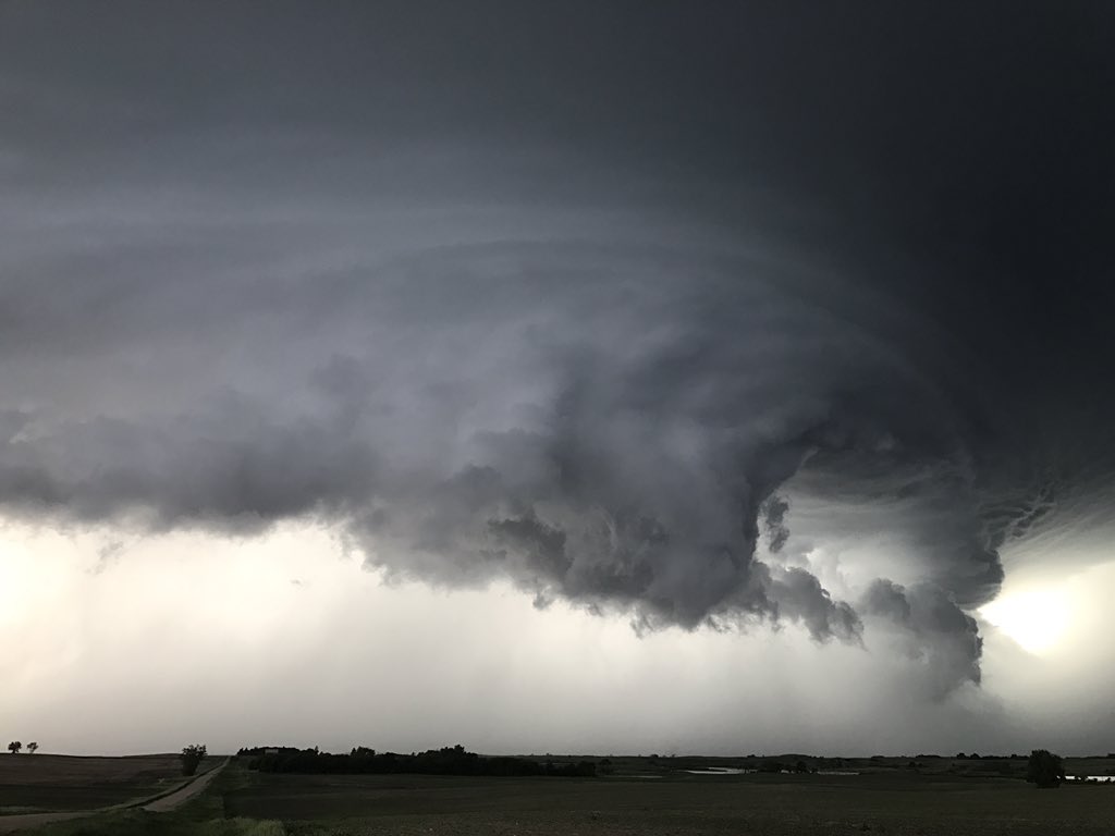 |
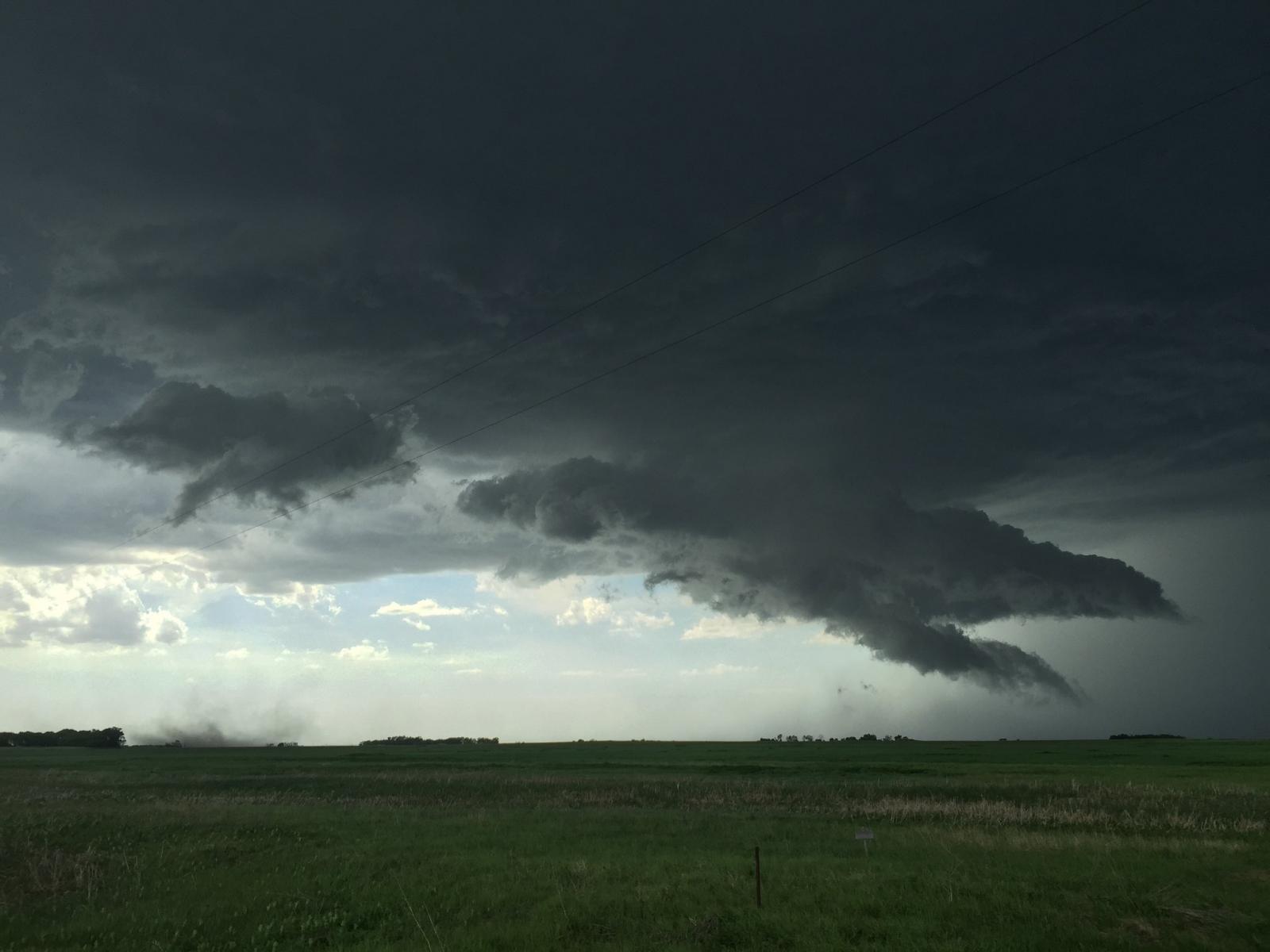
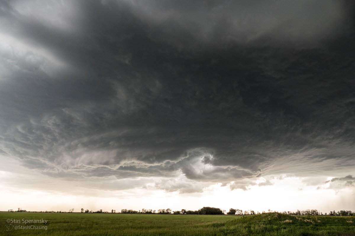
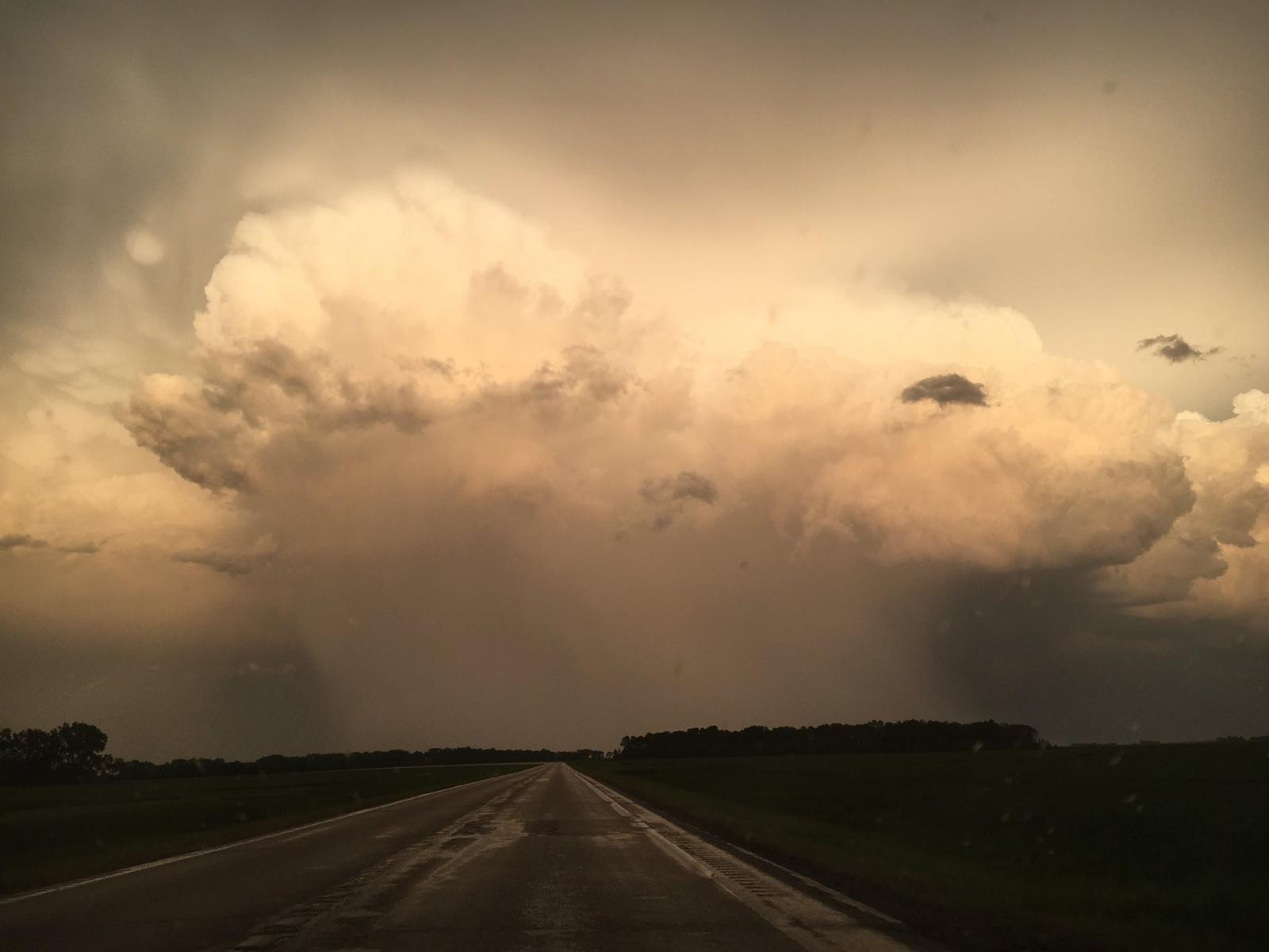
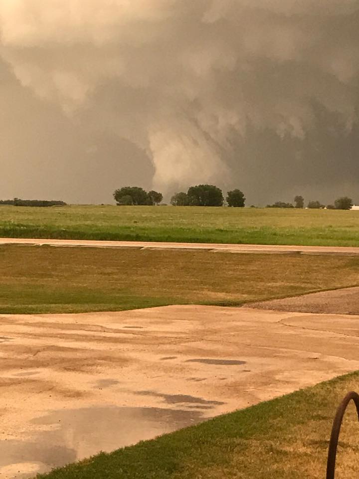
| Near Granville, ND Credit: Misheyla Iwasiuk | Near Rugby, ND Credit: Josh Eckl | Near Towner, ND Credit: Stas Speransky | Near Harlow, ND Credit: Alex Goldstein |
 |
 |
 |
 |
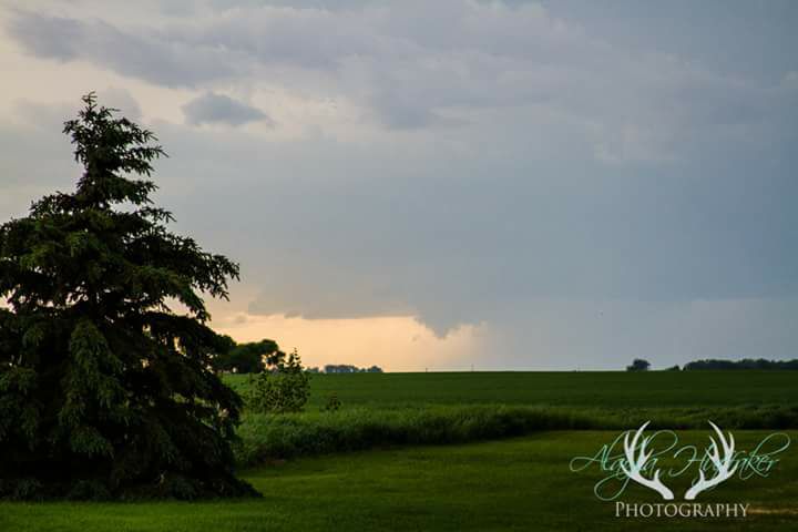
| Near Carrington, ND Credit: Jack Parkin | Near Cando, ND Credit: Alayla Huffaker | Jamestown, ND Credit: Nick Rowley | Near Wimbeldon, ND Credit: Chad Rudolph |
Wind & Hail:
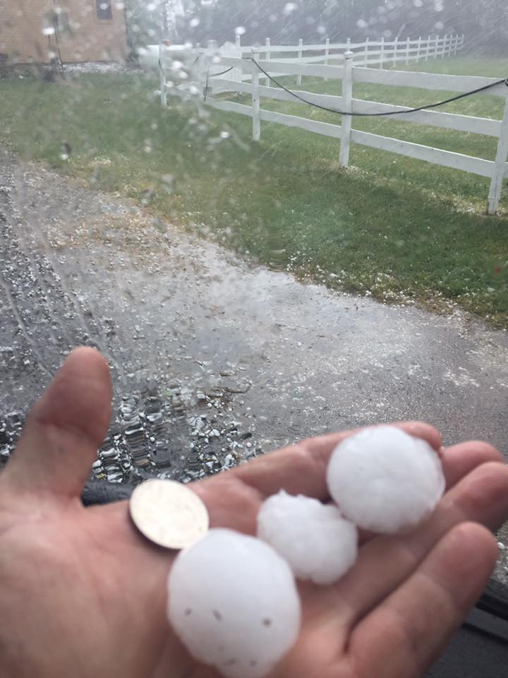
Hail
 |
 |
 |
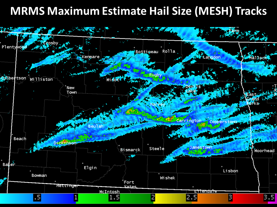 |
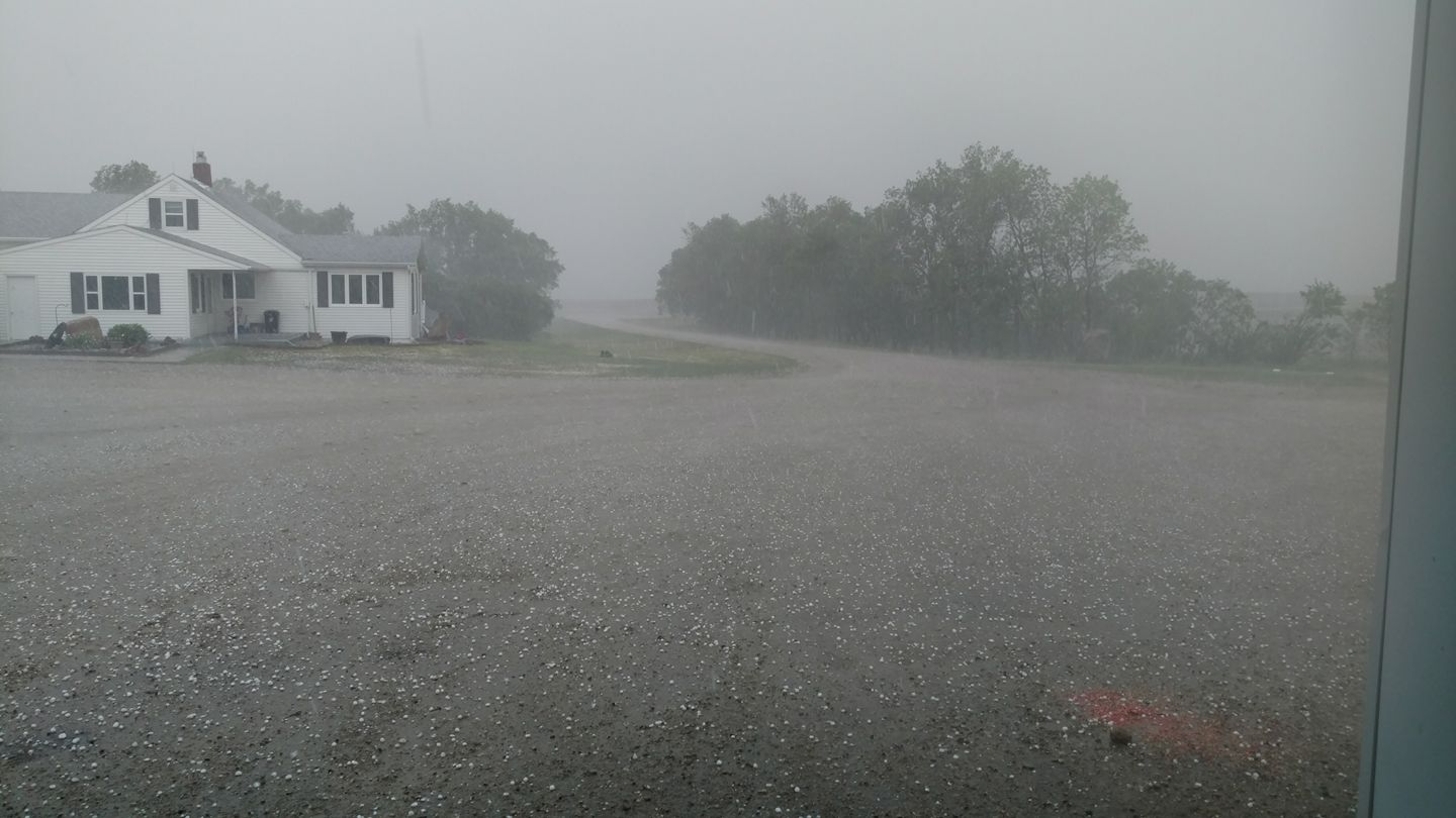
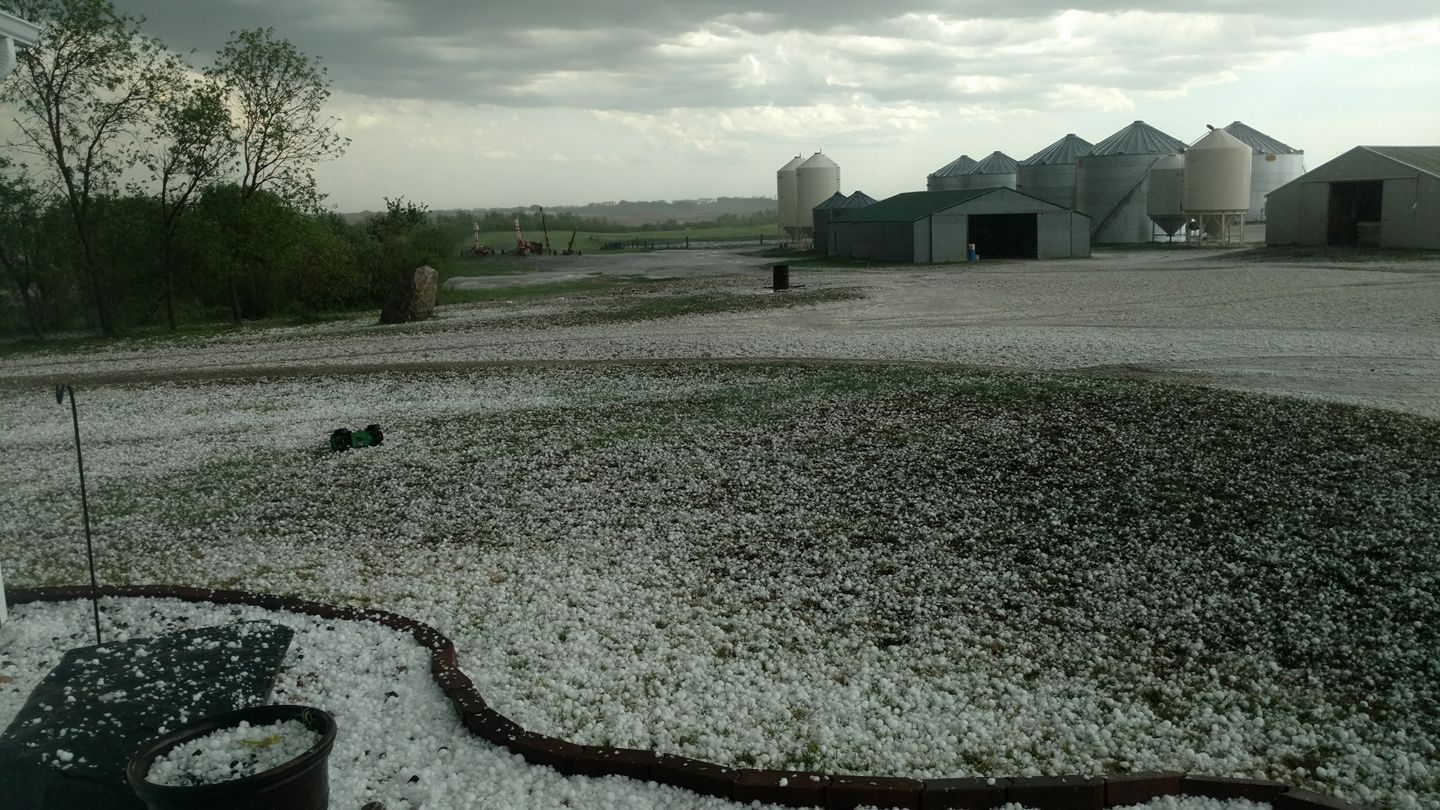
| Ypsilanti, ND Credit: Dustin R. | 10NW MClusky, ND Credit: Kim S. | 10NW McClusky, ND Credit: Kim S. | MRMS Maximum Estimated Hail Size (MESH) Tracks |
 |
 |
 |
 |
| Near Goodrich, ND Credit Kirby S. | Deering, ND Credit: Michael K. | Turtle Lake, ND Credit: Rochelle P. | Carrington, ND Credit: Myra M. |
Wind
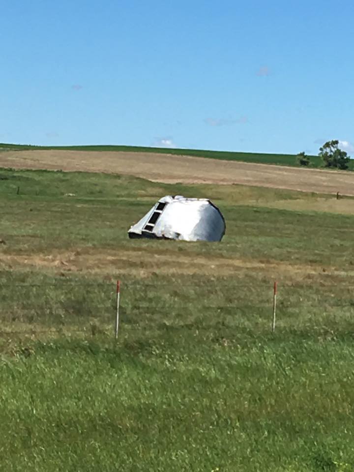 |
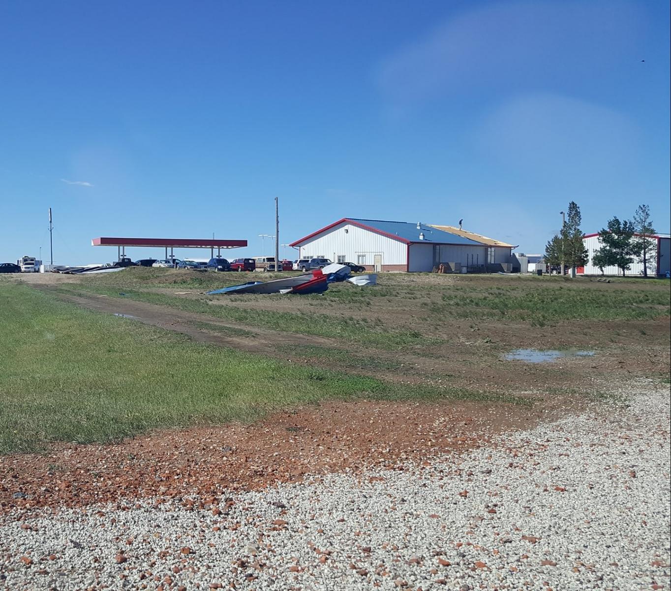 |
| Near Hanover, ND Credit: Codi D. | Richardton, ND Credit: Angela N. |
Satellite GOES16 (Preliminary-Non Operational Data)
 |
 |
| 1 minute visible imagery of thunderstorms initiating around 4 pm CDT Friday afternoon. Note the "orhpan anvil" from 2100-2115Z across central Burleigh county. This initial updraft failed to maintain itself. However, other updrafts were quickly able to form and sustain themselves thereafter. Note increasing mid/upper level forcing with an increasing jet across western North Dakota as manifested by the presence of a zone of cirrus. | 1 minute Day Cloud Phase RGB from 2050-2019 UTC Friday afternoon showing the glaciation (green shading) of cloud tops as cumulus with liquid water tops (white shading) transition to towering cumulus (TCU) and cumulonimbus (CB) with ice cloud tops. This signals the potential for cloud electrification and lightning. |
 |
 |
| 2316-2345 UTC GOES16 Clean IR 1 minute imagery of supercells across central North Dakota. A warm wake pattern is clearly visible downstream of the overshooting tops | Overshooting tops at sunset. |
Radar:
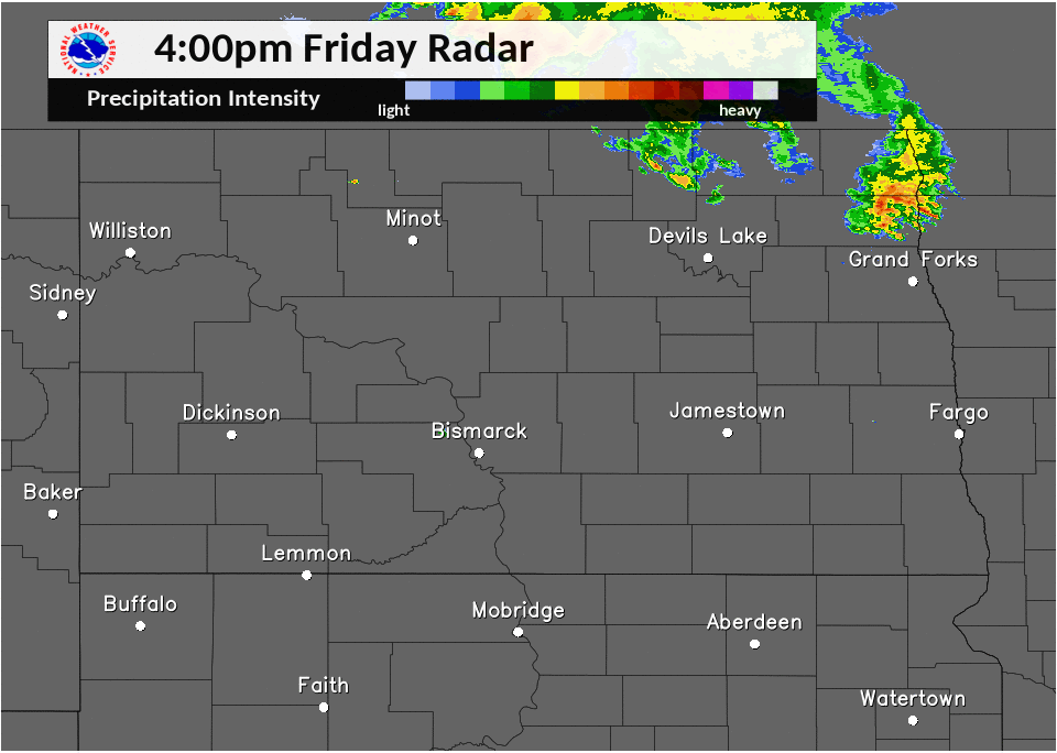 |
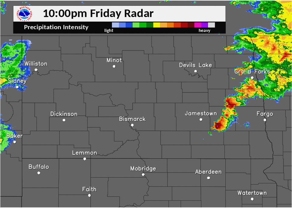 |
| Round 1: Friday Afternoon And Evening | Round 2: Late Friday Night and early Saturday Morning |
Storm Reports
...June 9 and 10 2017 Storm Reports...

Wind Reports...

Location                     Speed     Time/Date
3 W Rugby                    104 MPH   0640 PM 06/09
3 W Rugby                    104 MPH   0640 PM 06/09
3 E Towner                   85 MPH    0627 PM 06/09
3 E Towner                   85 MPH    0627 PM 06/09
6 W Rugby                    83 MPH    0637 PM 06/09
6 W Rugby                    83 MPH    0637 PM 06/09
Rugby                        80 MPH    0700 PM 06/09
Rugby                        80 MPH    0700 PM 06/09
1 NNW Washburn               73 MPH    0354 AM 06/10
Rugby                        70 MPH    0645 PM 06/09
Rugby                        70 MPH    0645 PM 06/09
2 NW Sweet Briar Lake        60 MPH    0145 AM 06/10
1 SSW Rugby                  70 MPH    0653 PM 06/09
1 S Rugby                    70 MPH    0653 PM 06/09
1 SW Hannover                60 MPH    0340 AM 06/10
2 NE Towner                  60 MPH    0630 PM 06/09
2 NE Towner                  60 MPH    0630 PM 06/09
Hannover                     60 MPH    0340 AM 06/10
2 NE Bowdon                  58 MPH    0450 AM 06/10

Hail Reports...

Location                     Size      Time/Date
6 ESE Richardton             2.75 in   0111 AM 06/10
2 SE Richardton              2.75 in   1245 AM 06/10
Ypsilanti                    2.50 in   0924 PM 06/09
Chaseley                     2.50 in   0700 PM 06/09
10 NW New Salem              2.00 in   0130 AM 06/10
5 N Denhoff                  2.00 in   0617 PM 06/09
5 N Denhoff                  2.00 in   0617 PM 06/09
Carrington                   1.75 in   0805 PM 06/09
Deering                      1.75 in   0525 PM 06/09
4 SE Ypsilanti               1.75 in   0930 PM 06/09
Turtle Lake                  1.75 in   0442 PM 06/09
Deering                      1.75 in   0525 PM 06/09
Hebron                       1.75 in   0103 AM 06/10
Turtle Lake                  1.75 in   0442 PM 06/09
2 W Carrington               1.75 in   0800 PM 06/09
2 W Carrington               1.75 in   0800 PM 06/09
Carrington                   1.75 in   0805 PM 06/09
Carrington                   1.75 in   0805 PM 06/09
Carrington                   1.50 in   0810 PM 06/09
Turtle Lake                  1.50 in   0455 PM 06/09
Carrington                   1.50 in   0835 PM 06/09
Bowdon                       1.50 in   0720 PM 06/09
Bowdon                       1.50 in   0720 PM 06/09
Carrington                   1.50 in   0810 PM 06/09
Turtle Lake                  1.50 in   0455 PM 06/09
6 ESE Mercer                 1.50 in   0512 PM 06/09
6 ESE Mercer                 1.50 in   0512 PM 06/09
4 W Hurdsfield               1.25 in   0637 PM 06/09
4 W Hurdsfield               1.25 in   0637 PM 06/09
4 S Taylor                   1.00 in   1240 AM 06/10
1 W Hebron                   1.00 in   0106 AM 06/10
Center                       1.00 in   0148 AM 06/10
Jamestown                    1.00 in   0838 PM 06/09
Jamestown                    1.00 in   0838 PM 06/09
1 SW Hannover                1.00 in   0140 AM 06/10
Turtle Lake                  1.00 in   0445 PM 06/09
Turtle Lake                  1.00 in   0445 PM 06/09
10 N Glen Ullin              1.00 in   0110 AM 06/10
Courtenay                    1.00 in   0901 PM 06/09

Observations are collected from a variety of sources with varying
equipment and exposures. We thank all volunteer weather observers
for their dedication. Not all data listed are considered official.
Environment
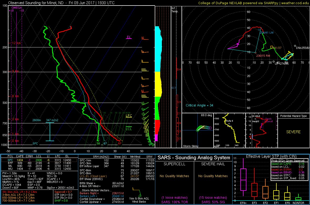 |
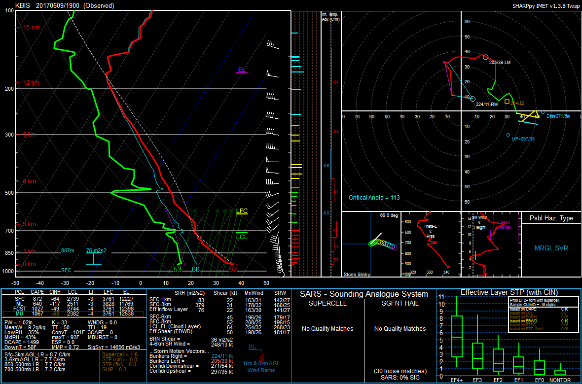 |
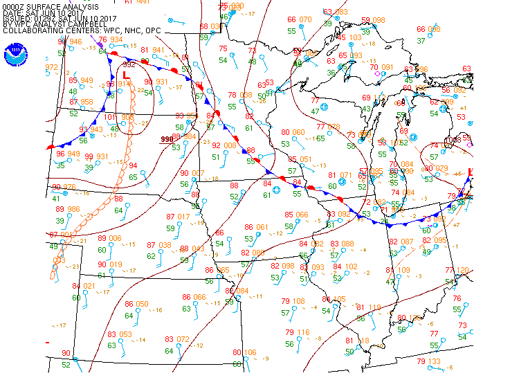 |
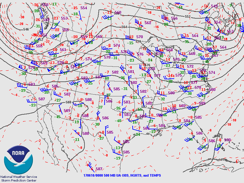 |
| College of Dupage 1930 UTC mobile sounding at Minot, ND Credit: Victor G. | NWS Bismarck 19 UTC sounding at Bismarck, ND | June 10, 2017 00 UTC surface analysis showing surface features associated with the first round of severe storms. | June 10, 2017 00 UTC 500 mb analysis showing a strong 500 mb jet across the northern CONUS Rockies approaching the the Northern Plains as a forcing mechanism for the second round of strongly sheared severe storms. |
The SPC SSEO Updraft Helicity (UH) forecasts both in 24 hr (12-12 UTC) maximum tracks, and neighborhood probability for UH greater than 100 m2/s2 highlighted the potential for a significant severe event across North Dakota when compared to the climatological distribution of UH values the SSEO has forecasted for the area since 2014.
 |
 |
 |
 |
| June 9, 2017 00 UTC SSEO Max 24 Hour UH Tracks (12-12UTC) | June 9, 2017 00 UTC SSEO Neighborhood Probability of UH > 100 m2/s2 (12-12UTC) | June 9, 2017 12 UTC SSEO Max 24 Hour UH Tracks (12-12UTC) | June 9, 2017 12 UTC SSEO Neighborhood Probability of UH > 100 m2/s2 (12-12UTC) |
 |
Media use of NWS Web News Stories is encouraged! Please acknowledge the NWS as the source of any news information accessed from this site. |
|

