
A significant heat wave continues for the Rockies, Northern Plains, and Great Lakes into the Mid-Atlantic, peaking in intensity through midweek and lingering across parts of the Northern Plains and Midwest until this weekend. Excessive rainfall my bring life-threatening and locally catastrophic flash and urban flooding across portions of southwestern Texas through early Friday. Read More >
Overview
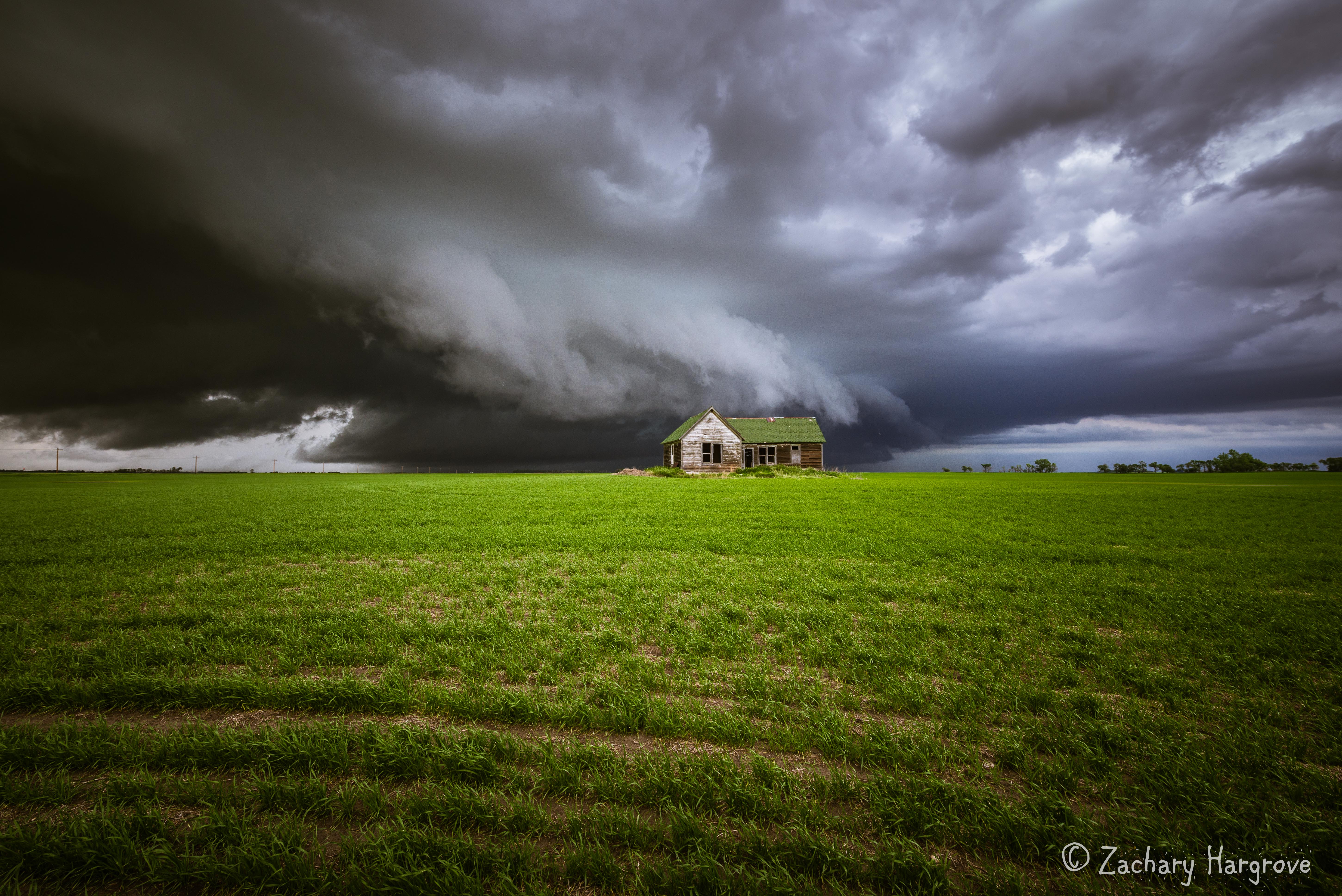
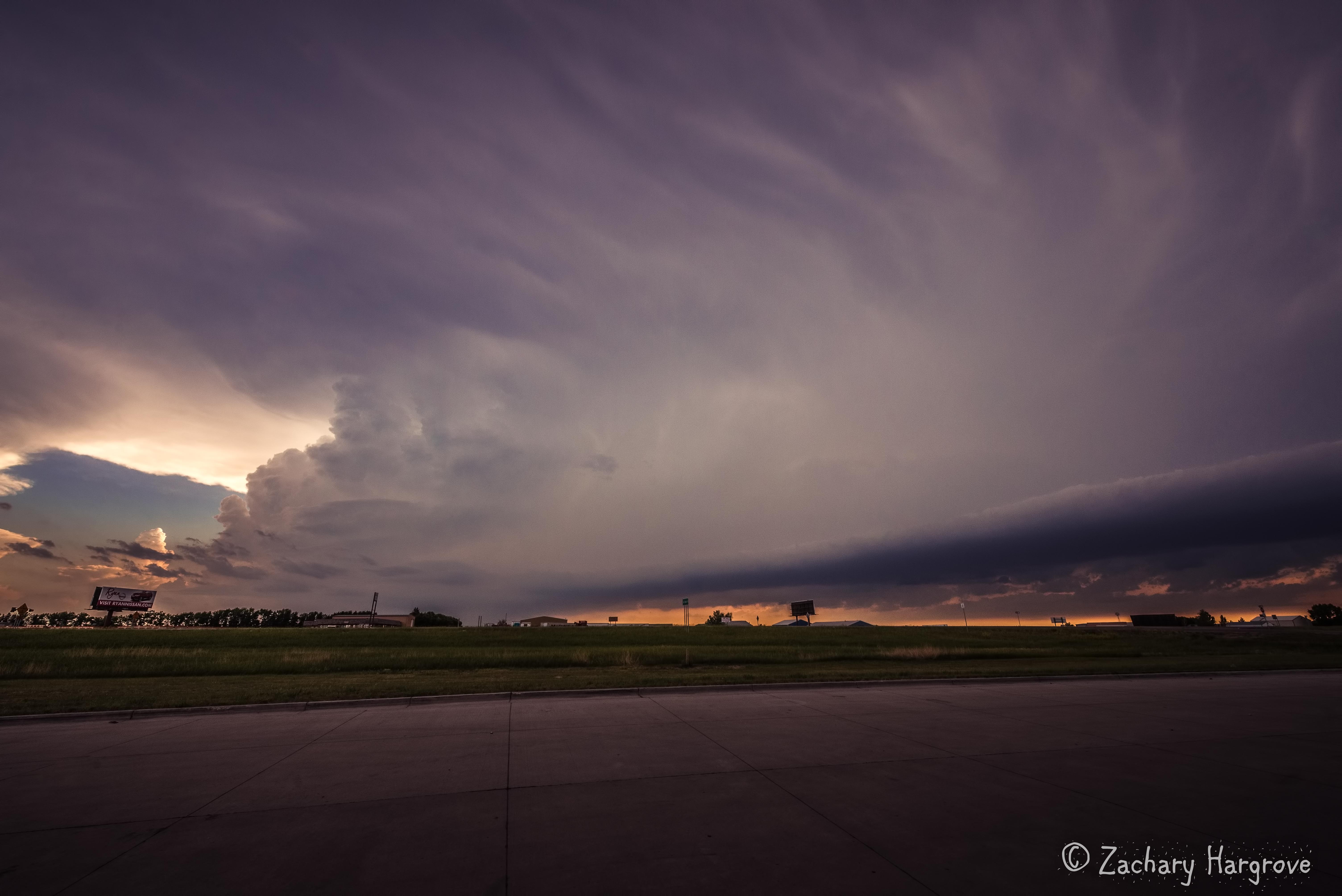
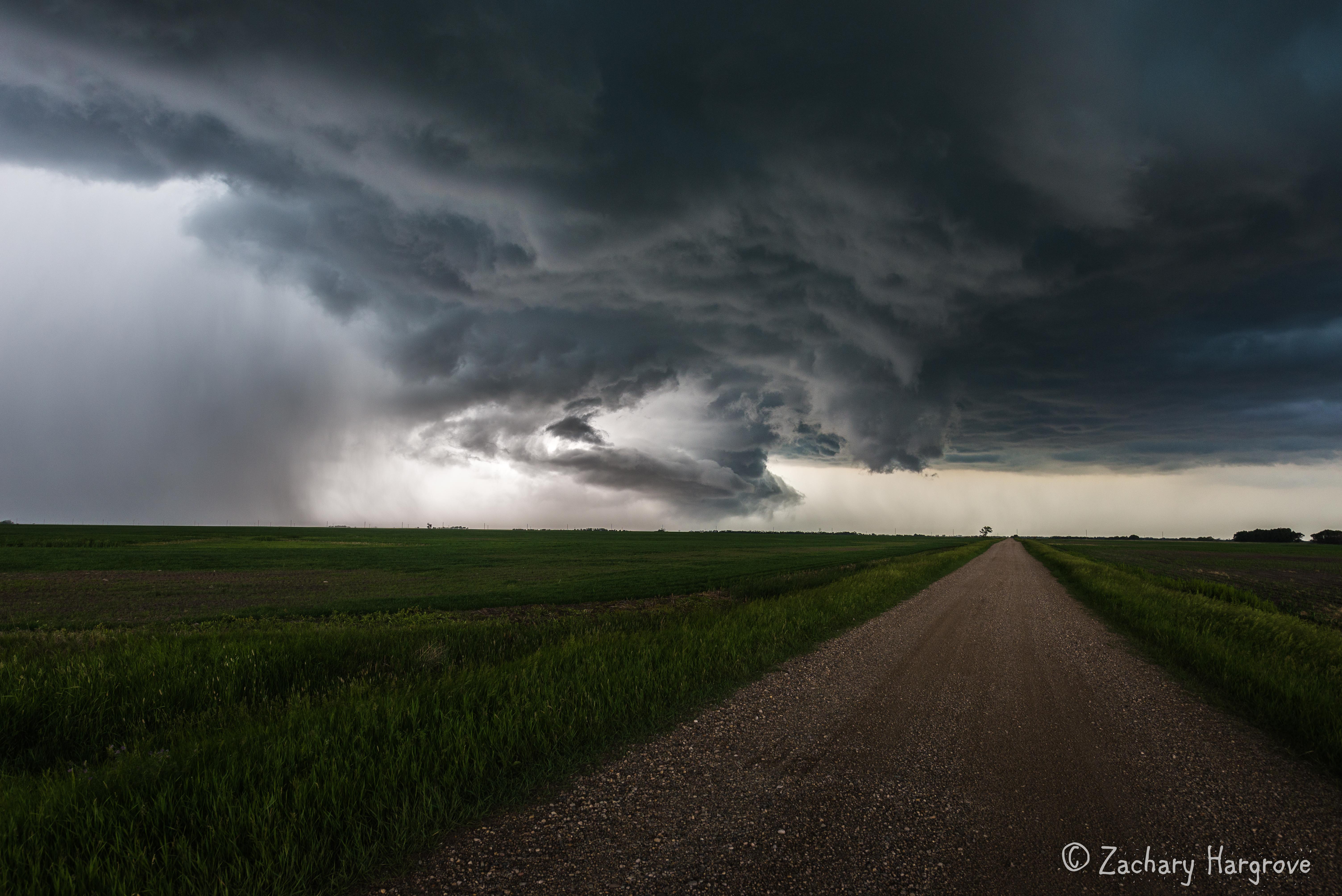
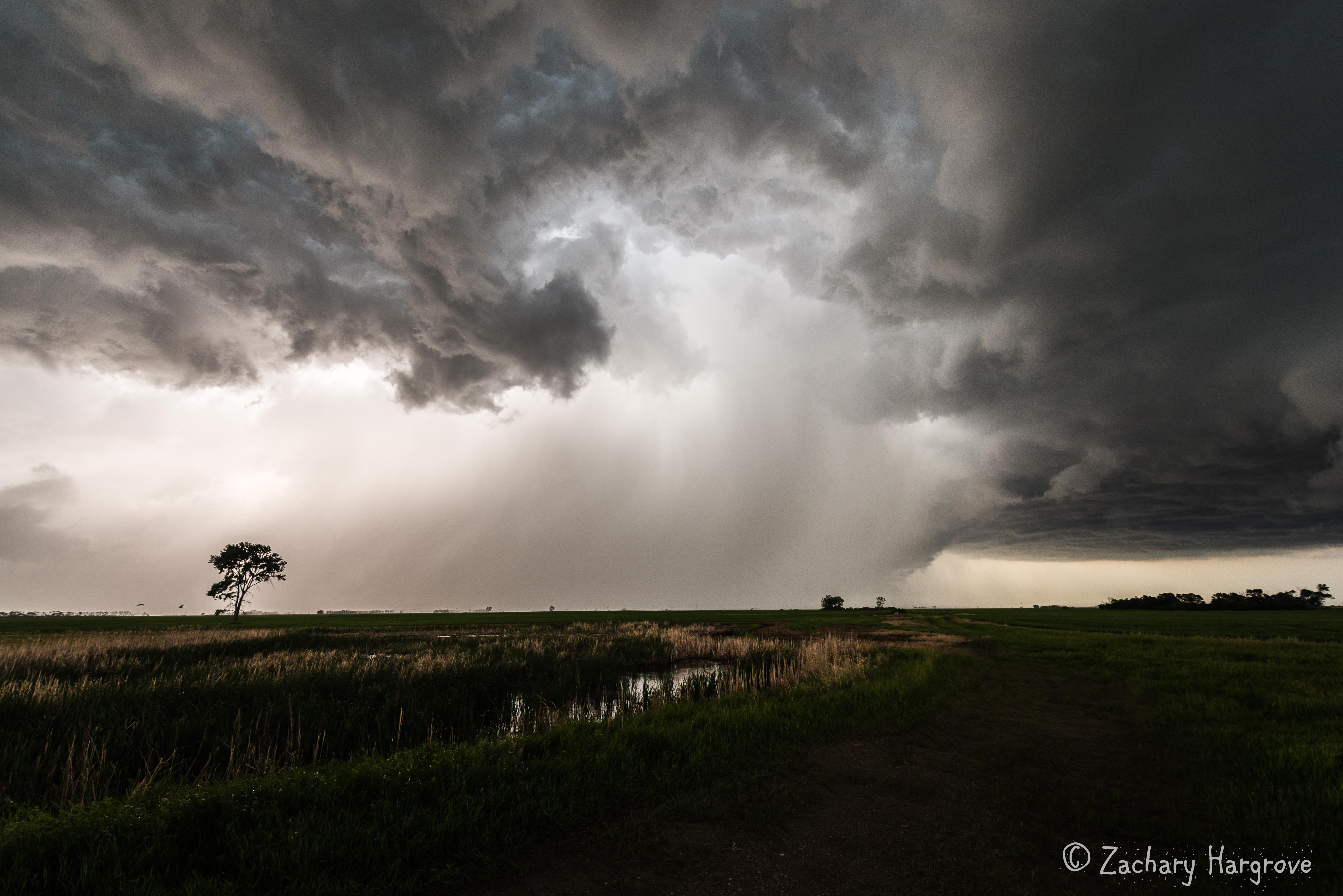
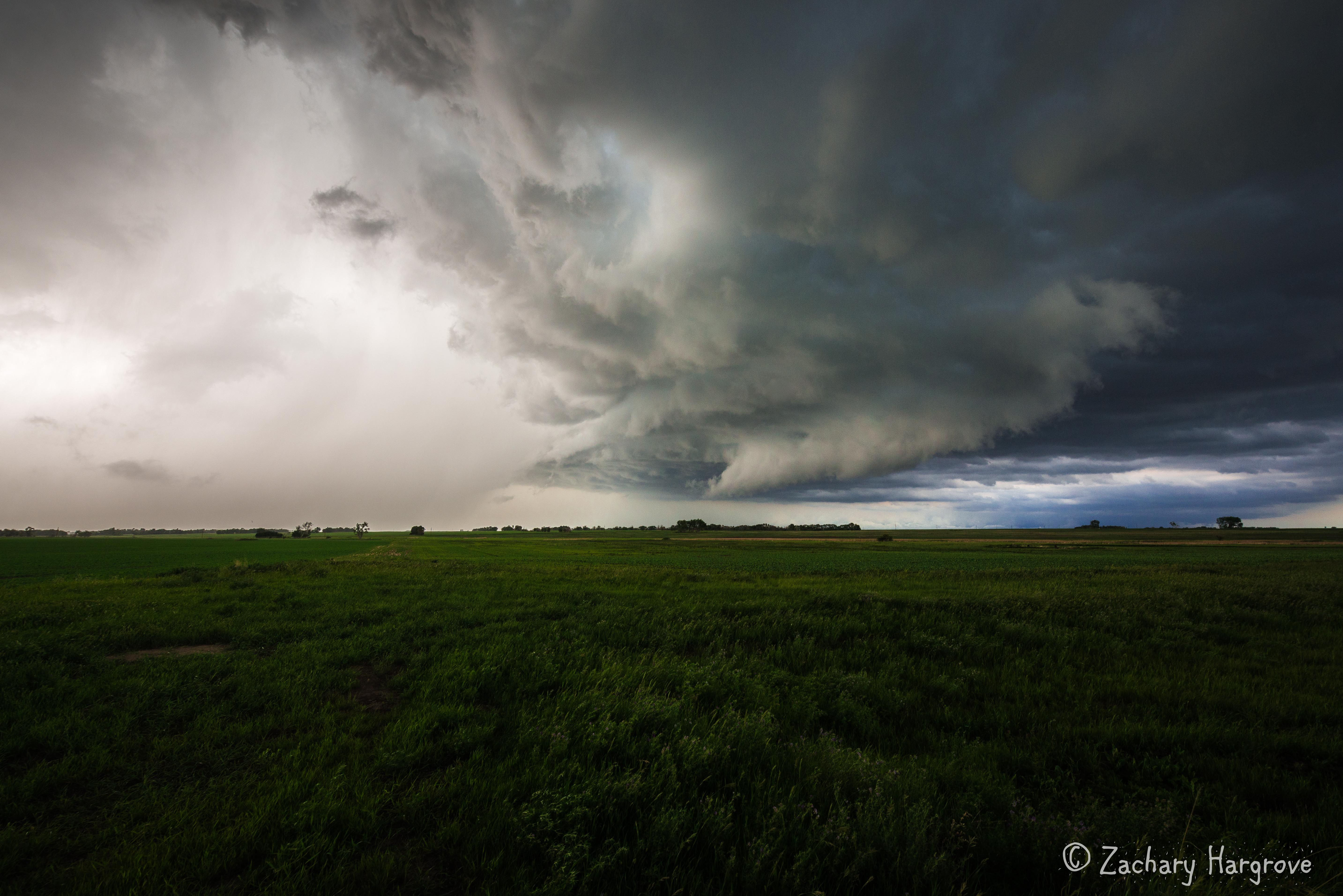
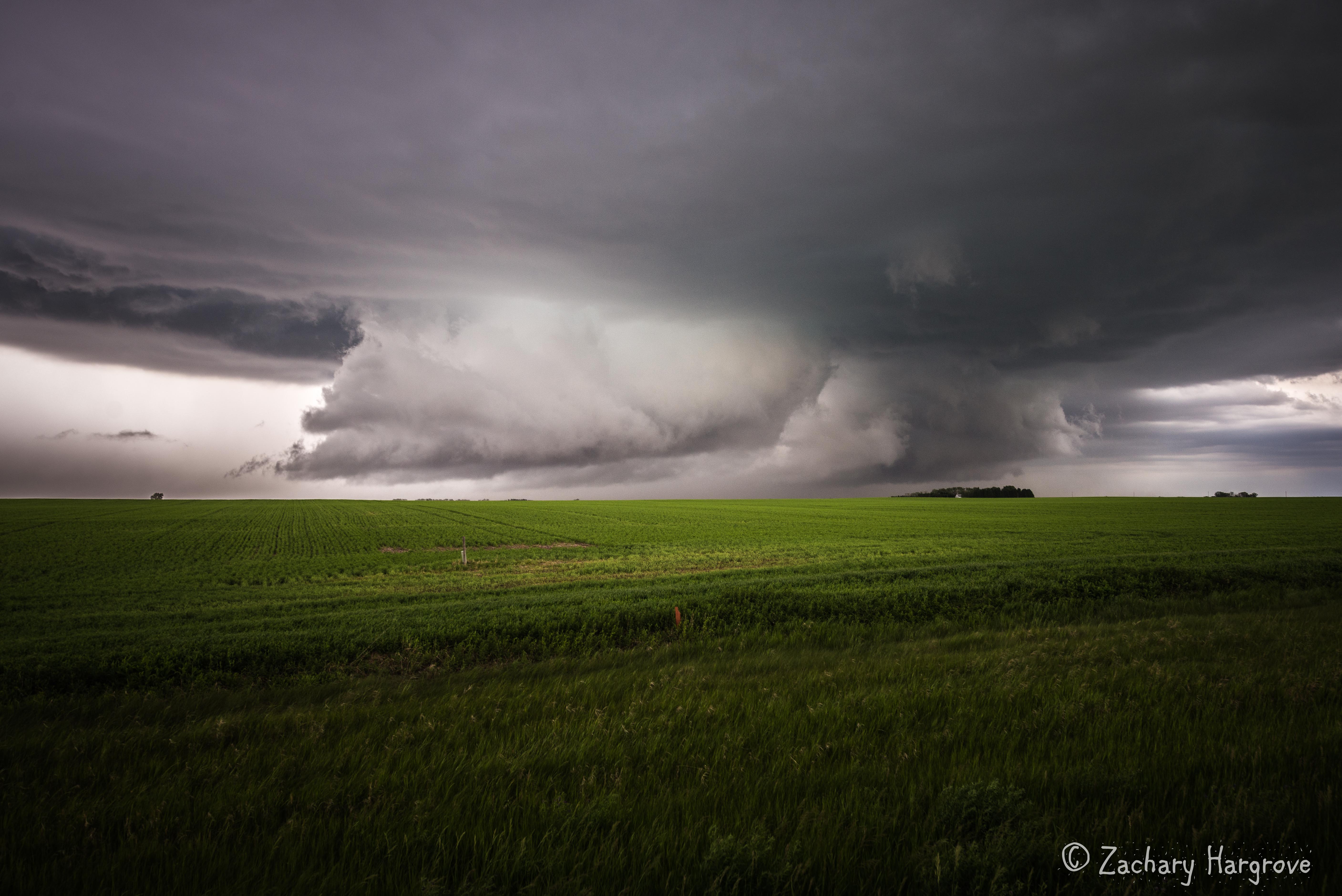
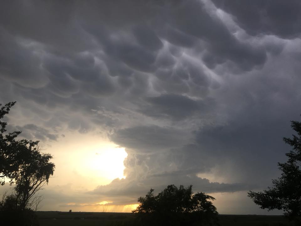
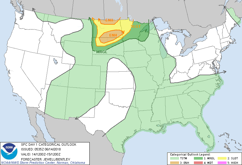
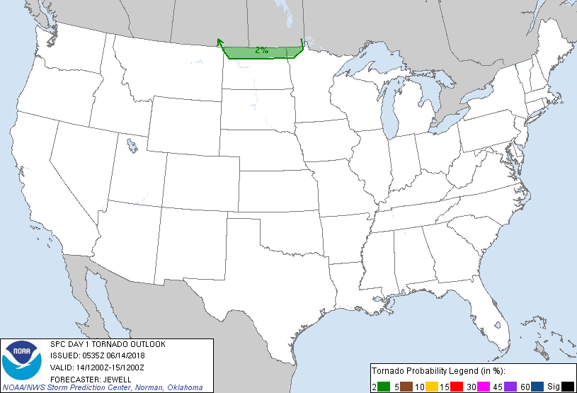
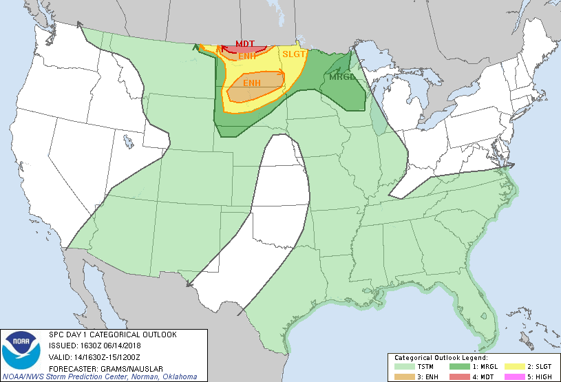
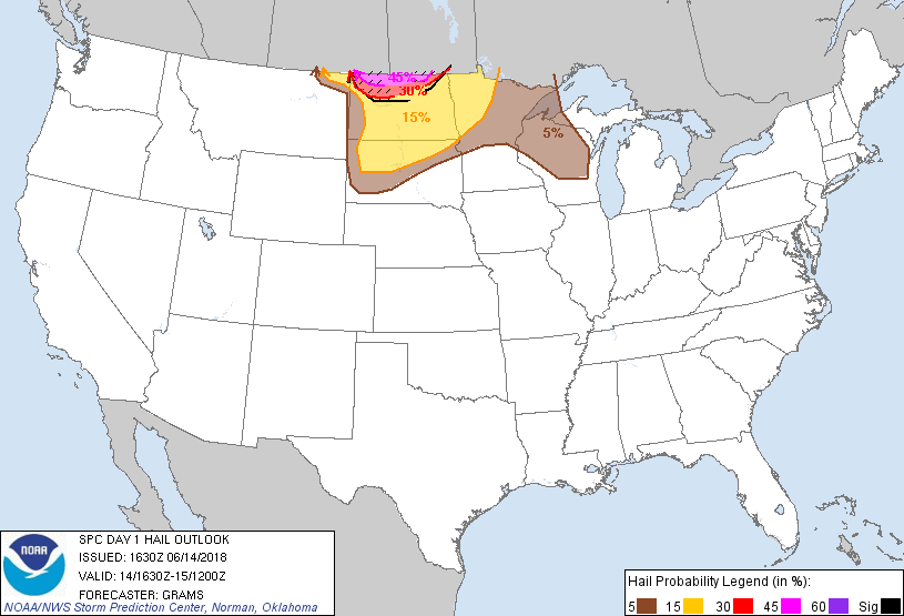
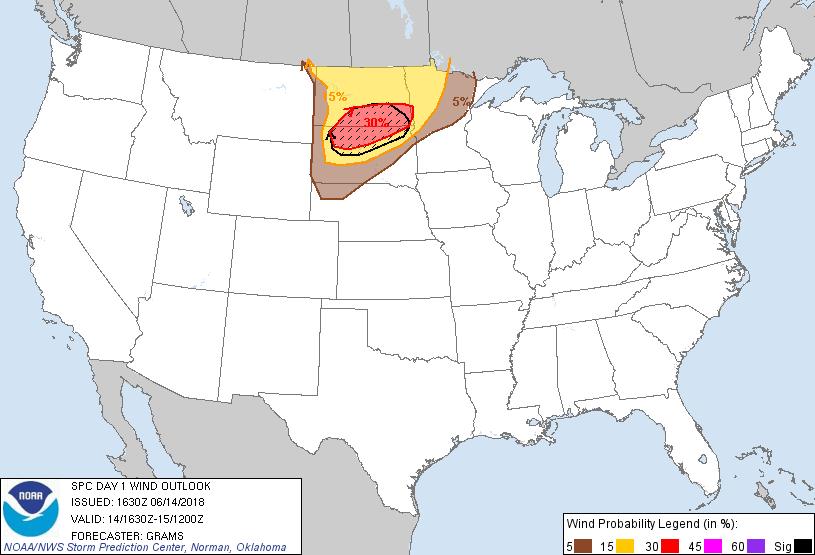
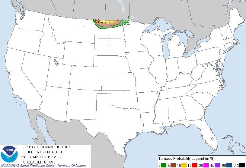
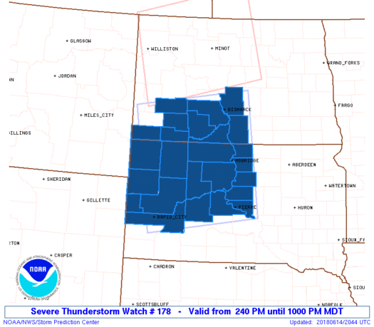
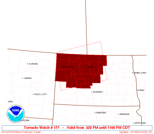
A prolonged severe weather event impacted western and central North Dakota on Thursday, June 14, 2018. The first warning was issued at 1056 AM CDT for a severe thunderstorm entering far northwest North Dakota from Montana. A big thanks to NWS Grand Forks who backed up NWS Bismarck and issued warnings through the morning and into the early afternoon during a communications outage. This was a significant collaboration effort between the two offices. After a lull during the mid afternoon, thunderstorm activity began to increase once again around 300-400 pm CDT across northern North Dakota and into southern Canada. Capping, or warm air aloft, suppressed thunderstorm development across southern North Dakota ahead of an advancing warm front during the afternoon. During the late morning the Storm Prediction Center (SPC), upgraded northwest and north central North Dakota to a Moderate Risk for severe thunderstorms with the potential for very large hail and a few tornadoes. Multiple supercells did impact northwest and north central North Dakota. The largest hailstone of three inches in diameter fell near Gardena (Bottineau county). One brief tornado did occur just east of Rolla in the late evening. Thunderstorms did increase through the evening further south and generally east of US Highway 85 during the evening as capping lessened, with the arrival of greater upper level lift and an occluding surface front.Event Photos:
 |
 |
 |
 |
| Perella (East of Flaxton) Z. Hargrove | Minot Z. Hargrove | 6 NE Kenmare Z. Hargrove | Near Kenmare Z. Hargrove |
 |
 |
 |
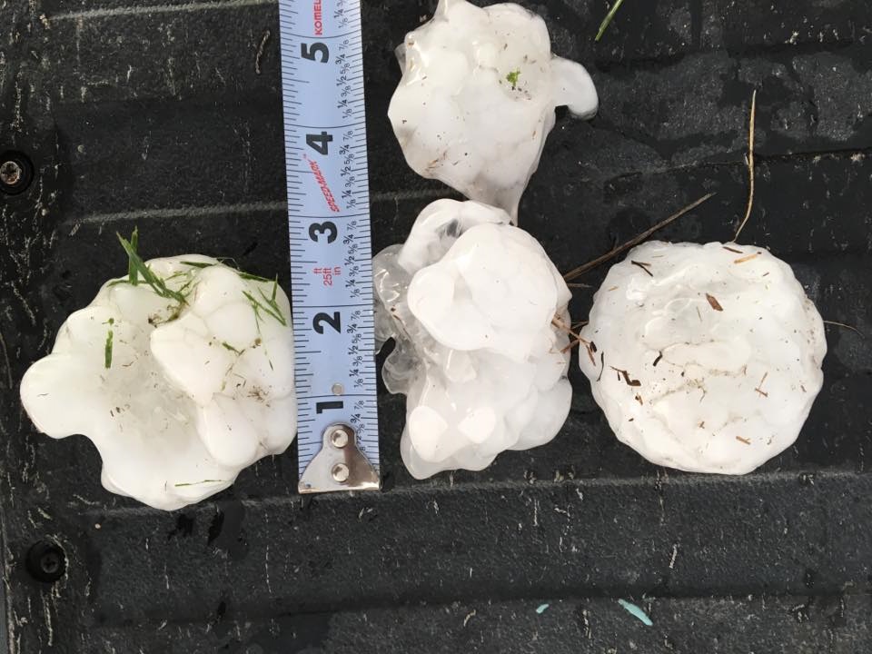 |
| Near Kenmare Z. Hargrove | Near Flaxton Z. Hargrove | Garrison C. Calhoun | Gardena B. Patterson |
June 14, 2018
Radar and Satellite:
 |
 |
| Event Radar and Warning Summary | GOESEast Visible: 932 AM to 137 PM CDT |
 |
 |
| GOESEast Visible: 137 PM to 547 PM CDT | GOESEast Visible: 547 PM to 932 PM CDT |
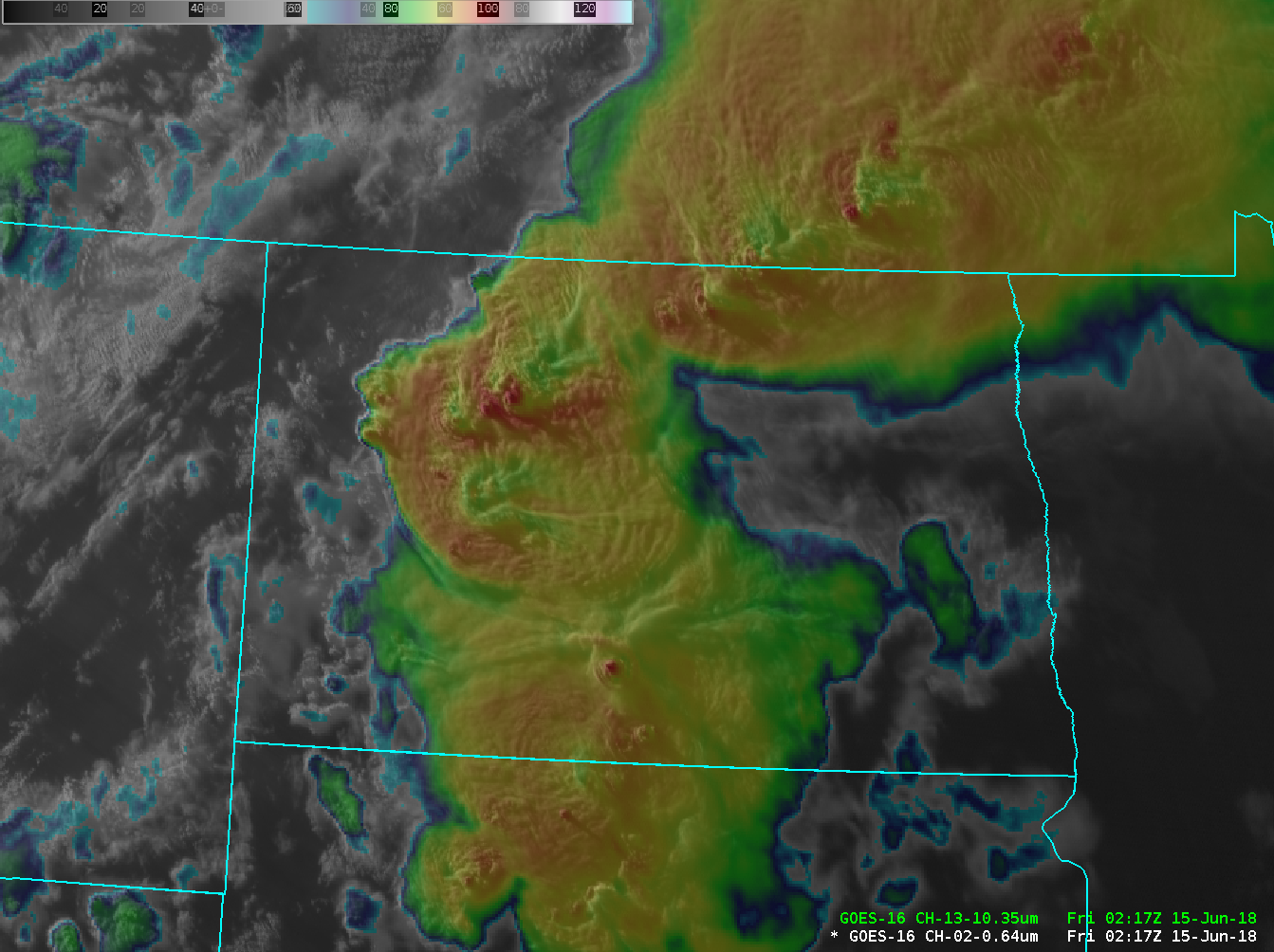 |
| GOESEast 917 PM CDT "Sandwhich Product" (Clean IR transparent over visible). Multiple significant overshooting tops (dark red spots) and warm wake signatures (yellow/green in the wake of the overshooting tops) indicative of very intense thunderstorm updrafts and potential storm severity. |
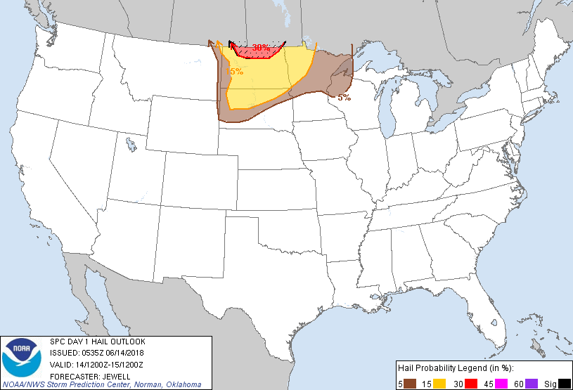
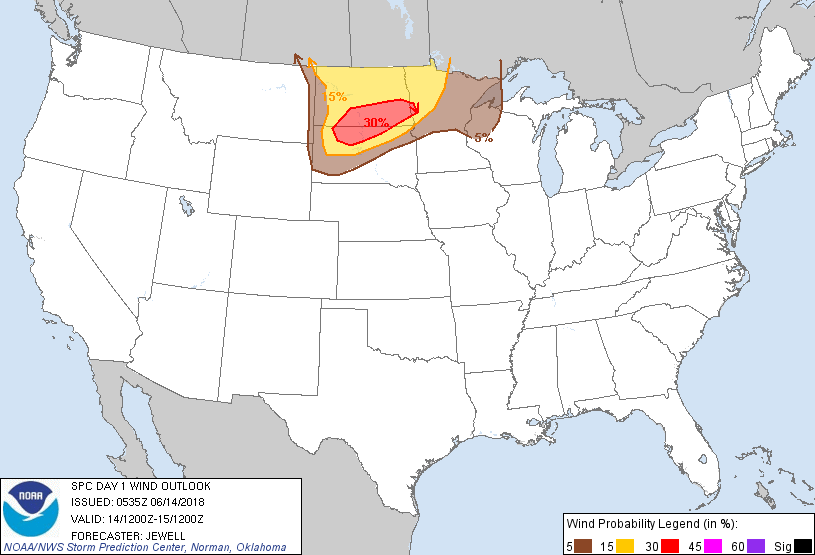
Storm Reports
HAIL

Location                     Size      Time/Date
1 N Gardena                  3.00 in   0816 PM 06/14
4 NE Douglas                 2.75 in   0936 PM 06/14
Portal                       2.75 in   0515 PM 06/14
Kramer                       2.50 in   0750 PM 06/14
5 N Kramer                   2.50 in   0756 PM 06/14
4 S Mylo                     2.00 in   0436 PM 06/14
4 SW Nanson                  1.75 in   0410 PM 06/14
Rice Lake                    1.75 in   0910 PM 06/14
7 S Blaisdell                1.75 in   0742 PM 06/14
2 S Dodge                    1.75 in   0850 PM 06/14
8 WSW Logan                  1.75 in   0935 PM 06/14
Green Lake                   1.50 in   1033 PM 06/14
Saint John                   1.50 in   0839 PM 06/14
4 S Sherwood                 1.50 in   0650 PM 06/14
Minot Air Force Base         1.50 in   1034 PM 06/14
9 E Northgate                1.25 in   0550 PM 06/14
Mandaree                     1.00 in   0950 PM 06/14
6 S Westhope                 1.00 in   0740 PM 06/14
4 S Blaisdell                1.00 in   0736 PM 06/14
Halliday                     1.00 in   0829 PM 06/14
4 ESE Bucyrus                1.00 in   0735 PM 06/14
9 N Ray                      1.00 in   1202 PM 06/14
Reeder                       1.00 in   0715 PM 06/14
4 NNW Omemee                 1.00 in   0825 PM 06/14
2 NE Mylo                    1.00 in   0418 PM 06/14
8 SSW Grenora                1.00 in   1105 AM 06/14
6 SE Regent                  0.88 in   0552 PM 06/14
2 N Hettinger                0.88 in   0725 PM 06/14
Hazelton                     0.88 in   0944 PM 06/14
5 N Crosby                   0.88 in   0435 PM 06/14
4 SW Niobe                   0.88 in   1255 PM 06/14
2 N Hettinger                0.88 in   0725 PM 06/14
4 SW Niobe                   0.88 in   1255 PM 06/14
4 SSE Mcgregor               0.75 in   1208 PM 06/14
Kenmare                      0.75 in   0105 PM 06/14

WIND

Location                     Speed     Time/Date
2 SSE Temvik                 71 MPH    0931 PM 06/14
10 N Beulah                  65 MPH    0923 PM 06/14

TORNADO

0.5 E Rolla    Brief touchdown        0914 PM 06/14
RAINFALL

Location                     Amount    Time/Date
6 SW Sawyer                  2.80 in   1114 PM 06/14
8 SW Logan                   2.65 in   1110 PM 06/14
1 S Minot                    2.00 in   0641 AM 06/15
7 NW Rice Lake               1.80 in   1110 PM 06/14
Ryder                        1.70 in   1055 PM 06/14
Velva                        1.40 in   1100 PM 06/14
Plaza                        1.35 in   1107 PM 06/14
Environment
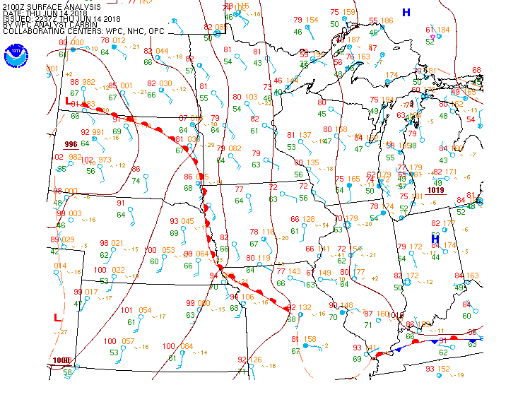
Surface Analysis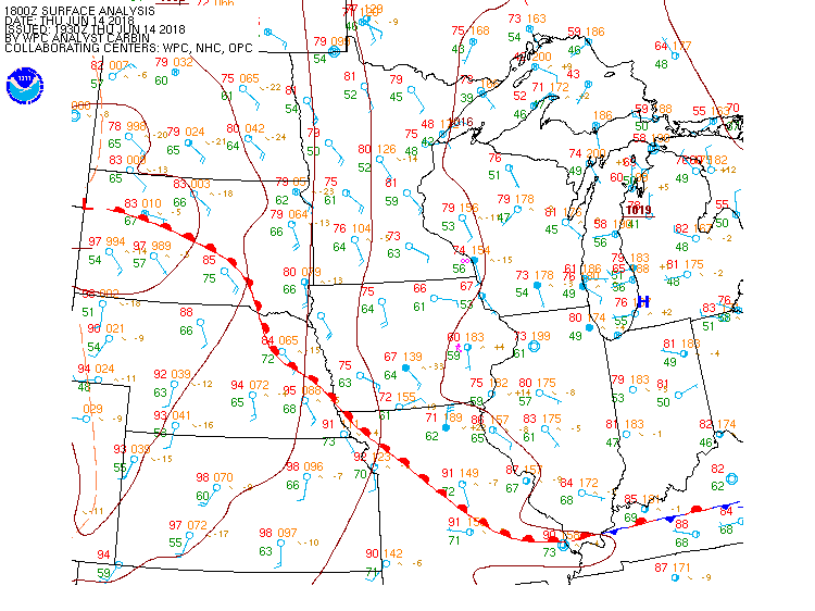 |
 |
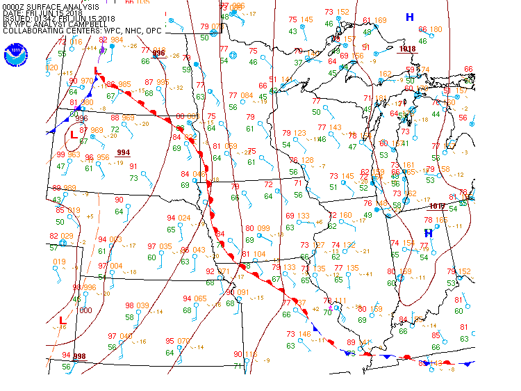 |
| 1 PM CDT Surface Front Analysis | 4 PM CDT Surface Front Analysis | 7 PM CDT Surface Front Analysis |
 |
 |
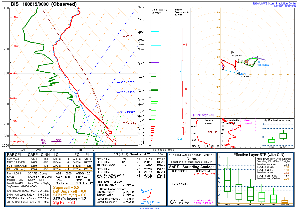 |
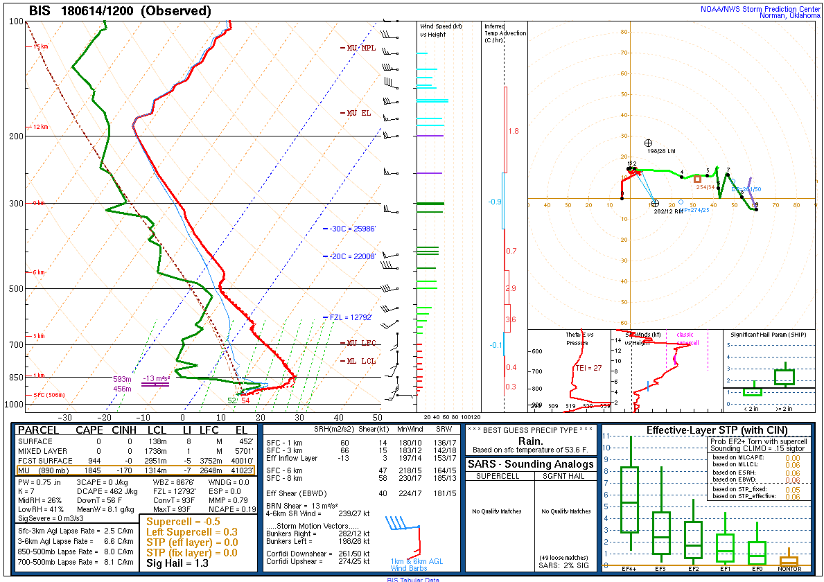
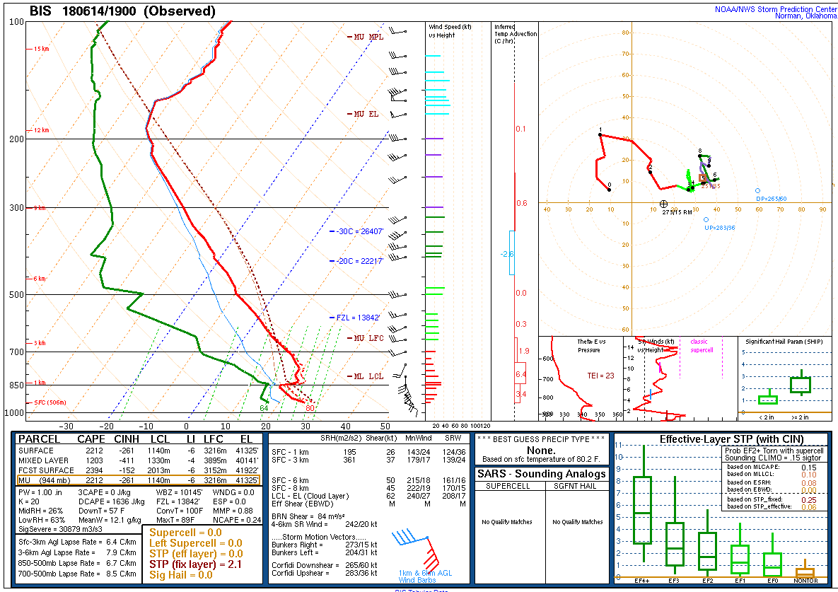
| Bismarck 12Z Sounding | Bismarck 19Z Sounding | Bismarck 00Z Sounding |
SPC Outlooks and Watches
736 AM CDT Outlooks
| Categorical Outlook | Hail Outlook | Wind Outlook | Tornado Outlook |
 |
 |
 |
 |
1130 AM CDT Outlooks
| Categorical Outlook | Hail Outlook | Wind Outlook | Tornado Outlook |
 |
 |
 |
 |
| Severe Thunderstorm Watch Issued At 240 PM CDT | Tornado Watch Issued At 325 PM CDT |
 |
 |
 |
Media use of NWS Web News Stories is encouraged! Please acknowledge the NWS as the source of any news information accessed from this site. |
|

