
Numerous severe thunderstorms are expected across a broad region from the Ohio Valley to the Mid-Atlantic and Northeast States today into tonight. Swaths of damaging wind gusts are expected and some tornadoes are possible. Bertha is expected to bring tropical storm conditions to portions of the Gulf Coast from the Florida Panhandle westward to southeastern Louisiana later today and Wednesday. Read More >
Bismarck, ND
Weather Forecast Office
Overview
|
An anomalously strong Alberta Clipper swept across the state from the northwest to southeast on Sunday, 1/27/2019. High wind warnings were issued for western and central North Dakota, while winter weather advisories and blizzard warnings were issued for parts of central and eastern North Dakota for light freezing rain accumulations and accumulating, blowing, and drifting snow. Late in the afternoon and into Monday morning, widespread wind gusts over 60 mph were reported, with the highest observed gust recorded at Sterling, ND of 66 mph. Sterling also recorded the highest sustained winds of the day, topping out at 52 mph. Numerous power outages were reported across the forecast area. Ahead of the Clipper, a warm layer near the surface created the conditions favorable for light freezing rain across parts of the west and central. Light ice accumulations caused hazardous travel and slippery road conditions. Snow accumulations along and east of the Missouri River Valley generally ranged from 1 to 6 inches with the highest total 5.5 inches reported 5 miles northwest of Streeter, ND. |
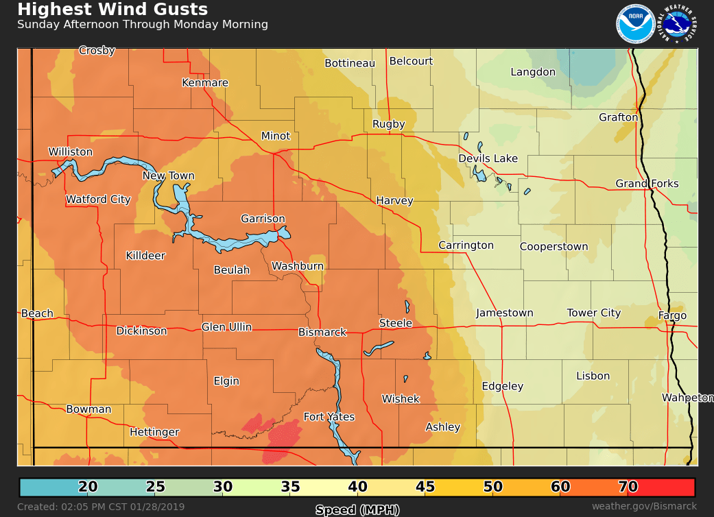 Highest Wind Gusts Sunday Afternoon Through Monday Morning |
 |
Media use of NWS Web News Stories is encouraged! Please acknowledge the NWS as the source of any news information accessed from this site. |
|
US Dept of Commerce
National Oceanic and Atmospheric Administration
National Weather Service
Bismarck, ND
2301 University Drive, Building 27
Bismarck, ND 58504
701-250-4224
Comments? Questions? Please Contact Us.

