
Scattered thunderstorms with severe gusts, hail and a tornado risk are possible near a cold front from the Ohio Valley to the Mid-Atlantic tonight. Tropical Storm Bertha is expected to bring tropical storm conditions to portions of the Gulf Coast from the panhandle of Florida into Louisiana through Wednesday. Read More >
Overview
|
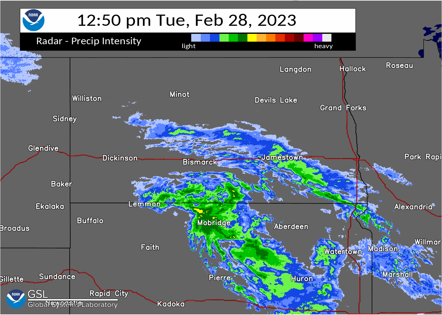
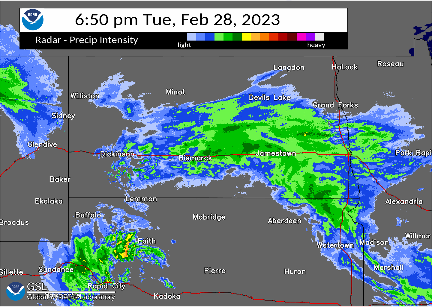
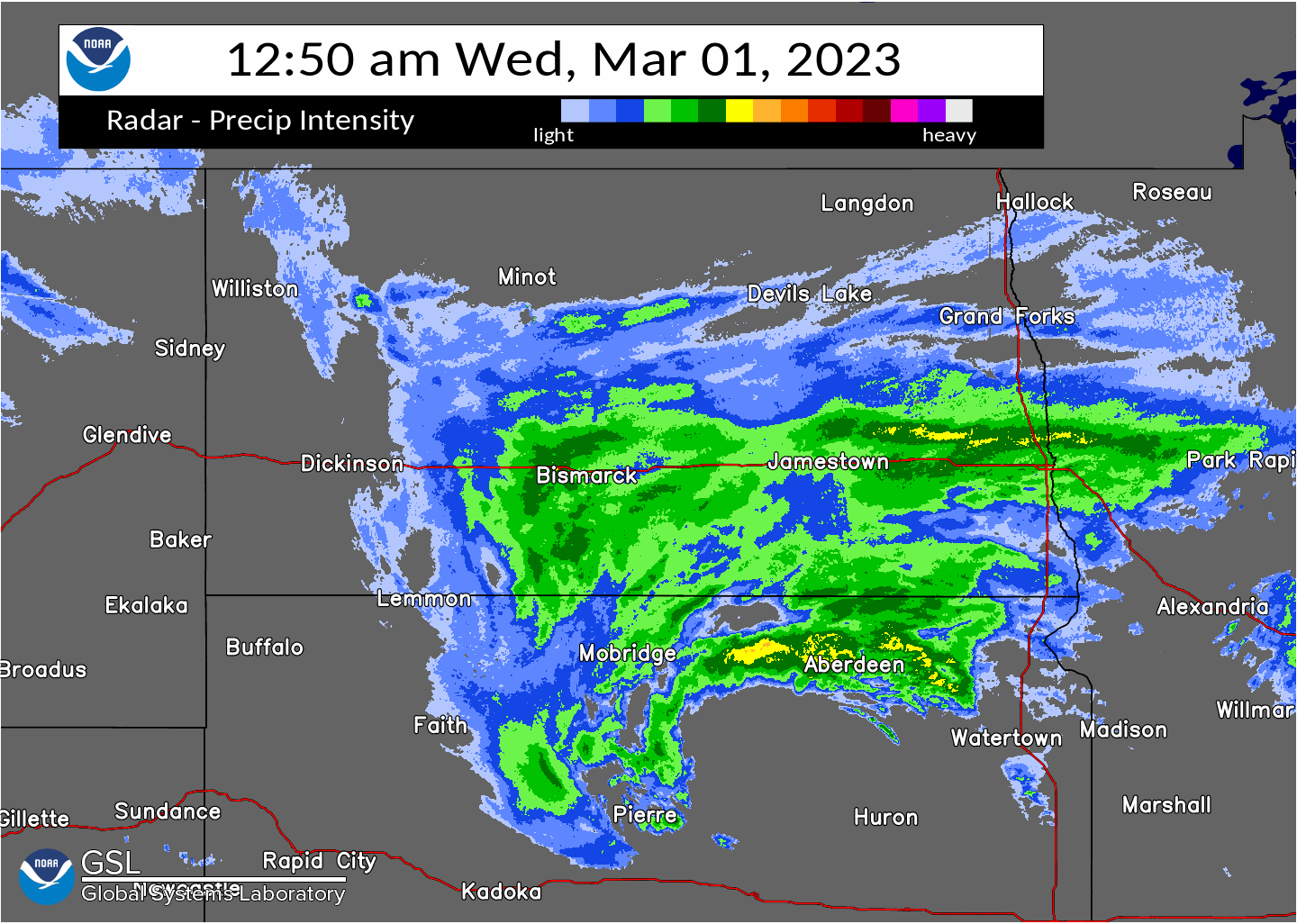
A winter storm brought multiple bands of snow through south-central and southeast North Dakota beginning in the early afternoon of Tuesday, February 28th, and continuing through the morning of Wednesday, March 1st. Intense snow rates of up to 1 inch per hour fell across the Bismarck/Mandan area and other parts of the south-central Tuesday, quickly leading to snow-covered roads and hazardous travel. As snow continued to spread across the area, Interstate 94 was closed from Bismarck to Jamestown Tuesday evening, and a few hours later was closed from Jamestown to Fargo as well. Hazardous travel continued through the overnight hours and into Wednesday morning, with significant drifting of snow over roadways. Strong northeast winds persisted through the night, especially in the James River Valley, before conditions began improving during the day Wednesday as the storm moved away from North Dakota. Highest snow totals were along Interstate 94 from Bismarck to Fargo, where the heaviest snow bands ended up, with lower amounts to the north, south, and west. |
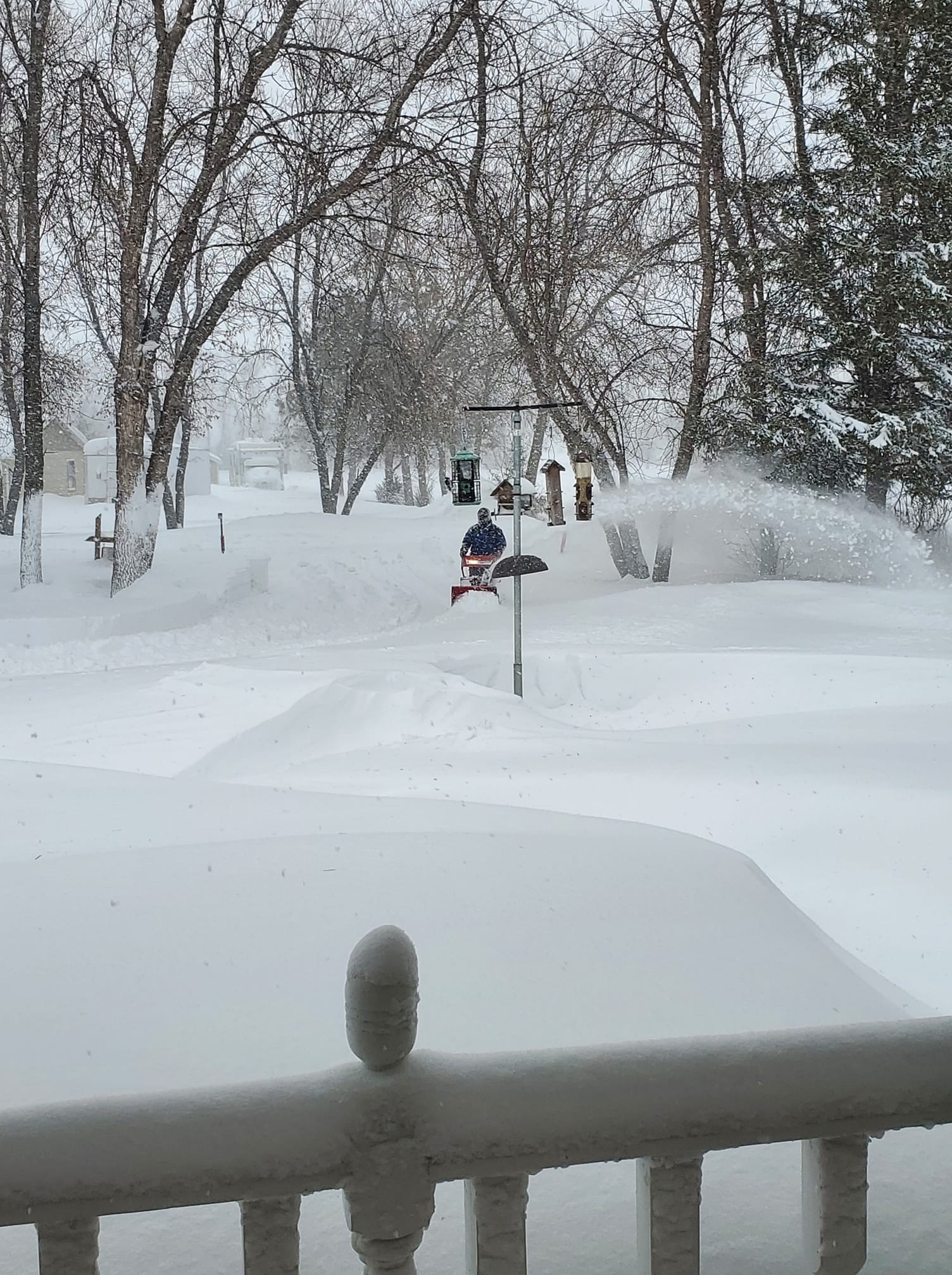 Snow blowing in Jamestown, North Dakota. Photo courtesy of Nicole Nowatzki. |
Photos & Video
 |
 |
 |
 |
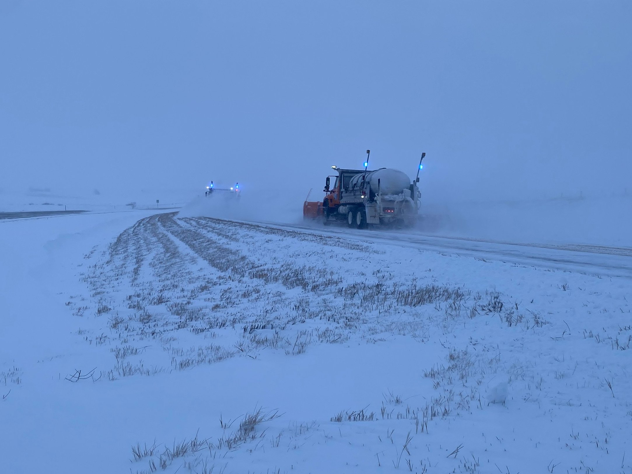
| Snow plows working near Gladstone, ND. (NDDOT) |
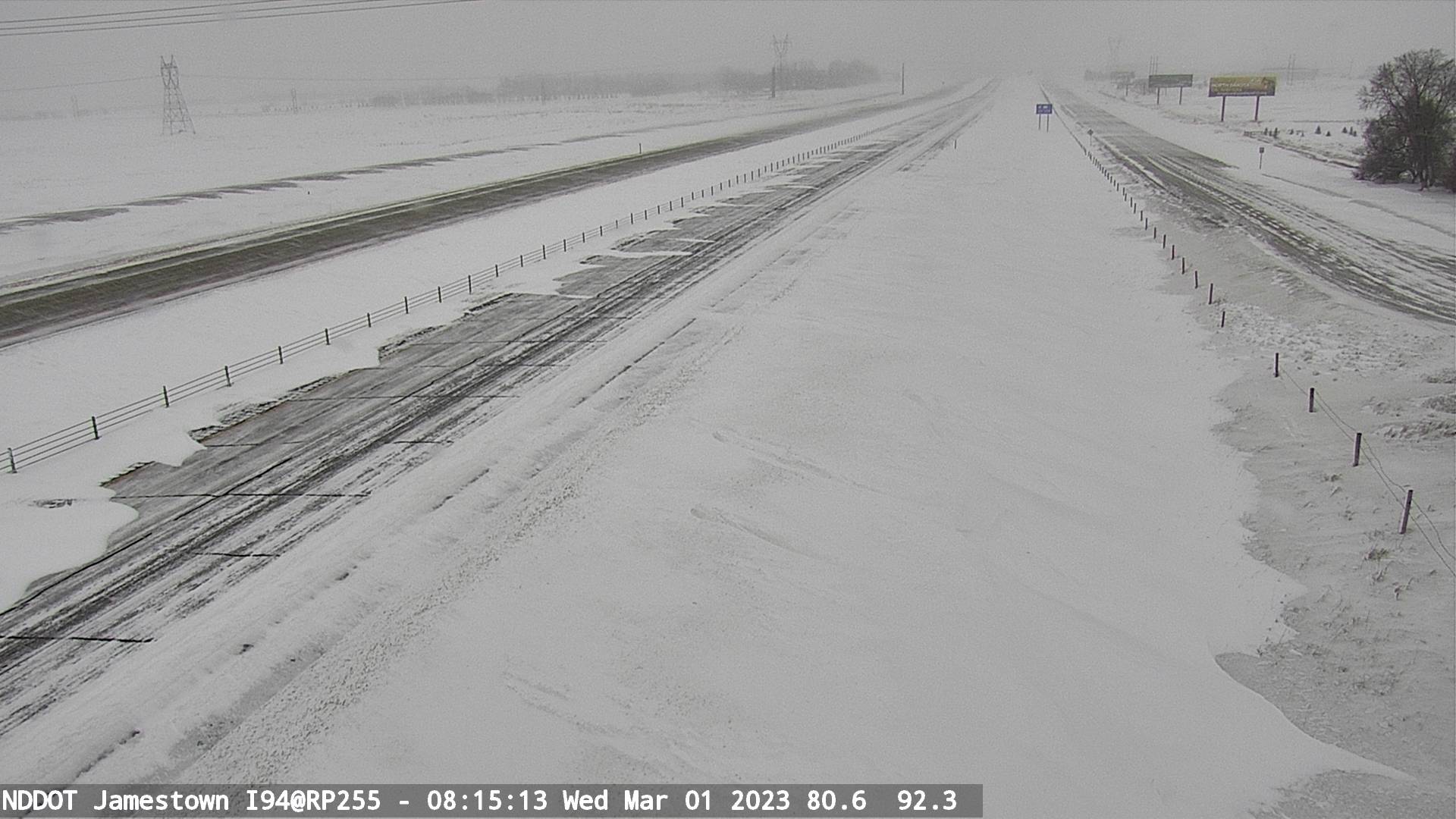
Travel camera footage of Jamestown, ND. (NDDOT) |
Snow plow footage from near Carrington, ND. (NDDOT) |
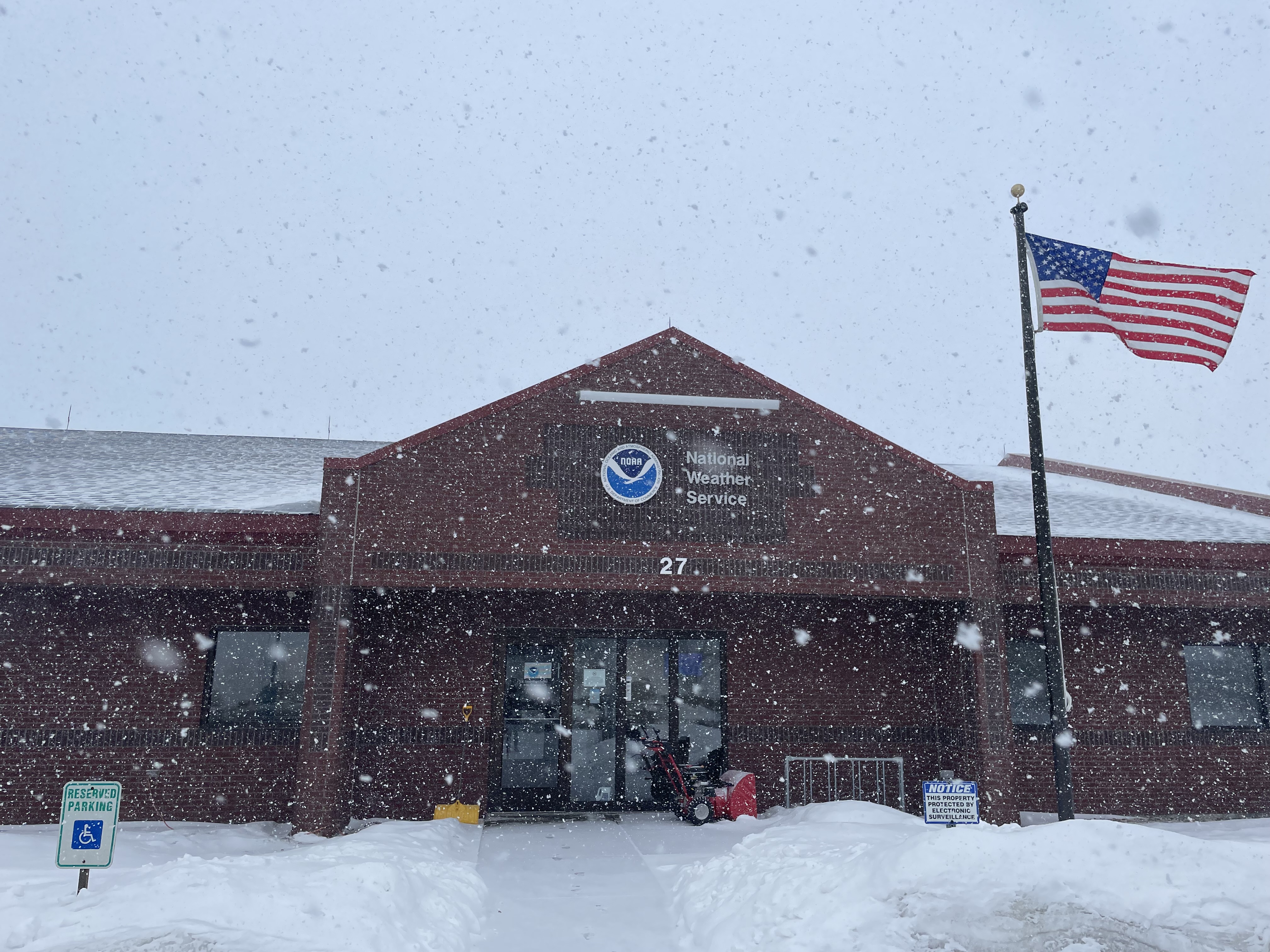
Snow beginning to fall at the start of the winter storm at the NWS Bismarck office. (NWS Bismarck) |
Radar
MRMS Radar Data
 |
 |
 |
|
MRMS Radar Data 2/28/2023 1250pm CST - 650pm CST |
MRMS Radar Data 2/28/2023 - 3/1/2023 650pm CST - 1250am CST |
MRMS Radar Data 3/1/2023 1250am CST - 650am CST |
Storm Reports
...FEBRUARY 28TH TO MARCH 1ST SNOWFALL REPORTS...

LOCATION                     AMOUNT    TIME/DATE       PROVIDER
JAMESTOWN STATE HOSPITAL     14.0 IN   0600 AM 03/01   COOP
STEELE                       12.5 IN   0924 AM 03/01   PUBLIC
3 SSE BISMARCK               12.3 IN   1029 AM 03/01   OFFICIAL NWS OBS
5 WNW HUFF                   12.0 IN   0222 PM 03/01   TRAINED SPOTTER
MANDAN 1.7 SSE               10.8 IN   0745 AM 03/01   COCORAHS
PINGREE 5.4 NW               9.5 IN    0600 AM 03/01   COCORAHS
MONTPELIER                   9.0 IN    0900 AM 03/01   COOP
EDGELEY 5.2 NW               8.2 IN    0800 AM 03/01   COCORAHS
HAZEN                        7.4 IN    0600 AM 03/01   COCORAHS
LA MOURE 4.6 ESE             5.8 IN    0700 AM 03/01   COCORAHS
ELLENDALE 7.3 NW             5.5 IN    0700 AM 03/01   COCORAHS
GLEN ULLIN                   4.8 IN    0900 AM 03/01   PUBLIC
DICKINSON                    4.5 IN    1051 AM 03/01   PUBLIC
NEW ENGLAND                  4.1 IN    0913 AM 03/01   PUBLIC
ASHLEY                       3.7 IN    0800 AM 03/01   COOP
UNDERWOOD                    3.5 IN    0800 AM 03/01   COOP
KILLDEER                     3.5 IN    0915 AM 03/01   COOP
CATHAY 6.5 N                 3.0 IN    0700 AM 03/01   COCORAHS
HARVEY                       2.5 IN    0723 AM 03/01   BROADCAST MEDIA
4 SE MARTIN                  2.5 IN    1237 PM 03/01   PUBLIC
GRASSY BUTTE                 2.4 IN    1130 AM 03/01   CO-OP OBSERVER
RHAME                        2.0 IN    1247 PM 03/01   PUBLIC

OBSERVATIONS ARE COLLECTED FROM A VARIETY OF SOURCES WITH VARYING
EQUIPMENT AND EXPOSURES. WE THANK ALL VOLUNTEER WEATHER OBSERVERS
FOR THEIR DEDICATION. NOT ALL DATA LISTED ARE CONSIDERED OFFICIAL.
 |
Media use of NWS Web News Stories is encouraged! Please acknowledge the NWS as the source of any news information accessed from this site. |
|

