
Dangerous heat will expand from the Gulf Coast into the Southern Plains and Desert Southwest through week's end. Additional extreme heat impacting the Pacific Northwest will shift to the northern Plains by the weekend. Tropical Storm Bertha is expected to continue to impact portions of the northern Gulf Coast from the western Florida Panhandle to southeastern Louisiana through tonight. Read More >
Overview
|
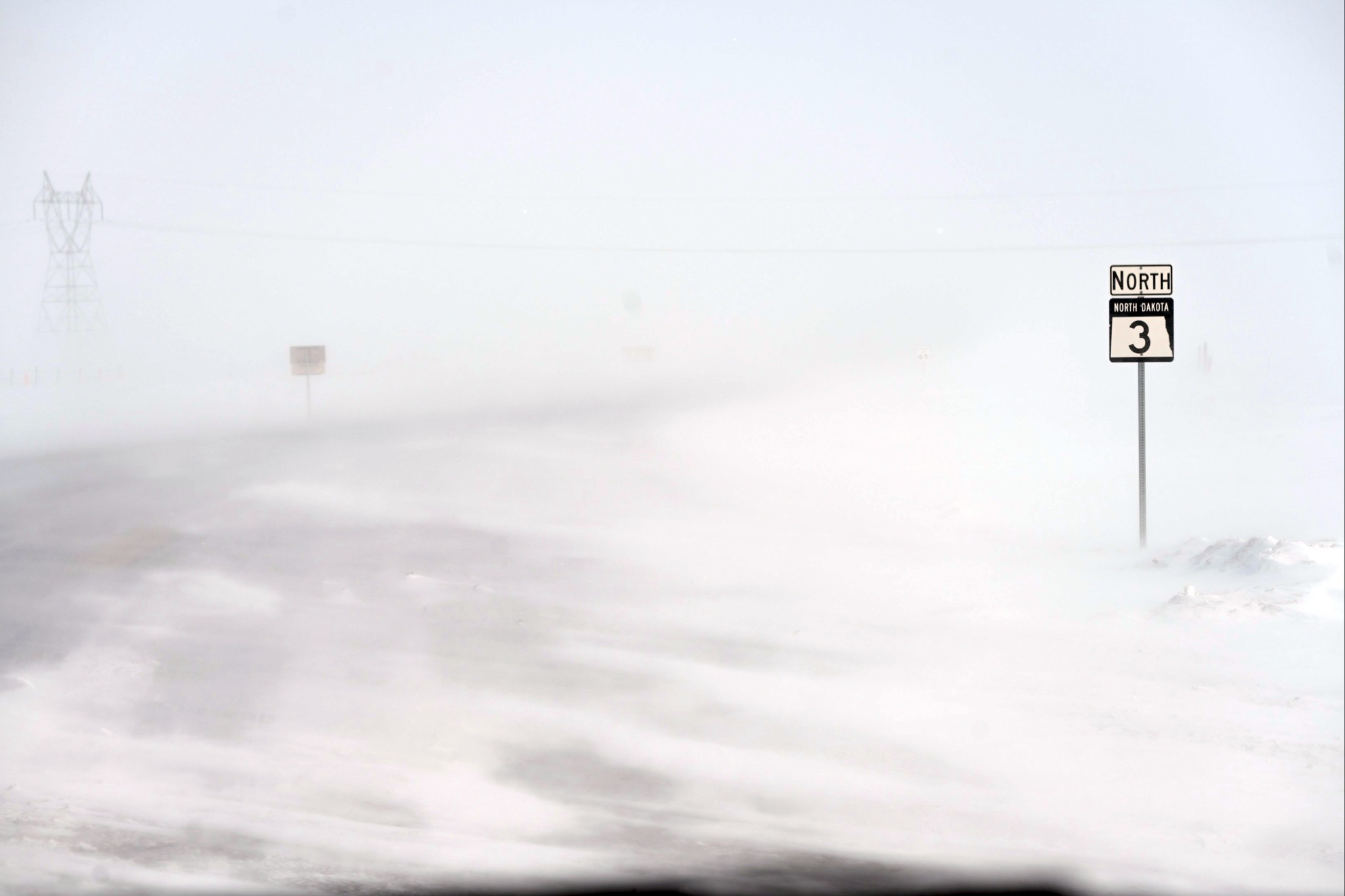
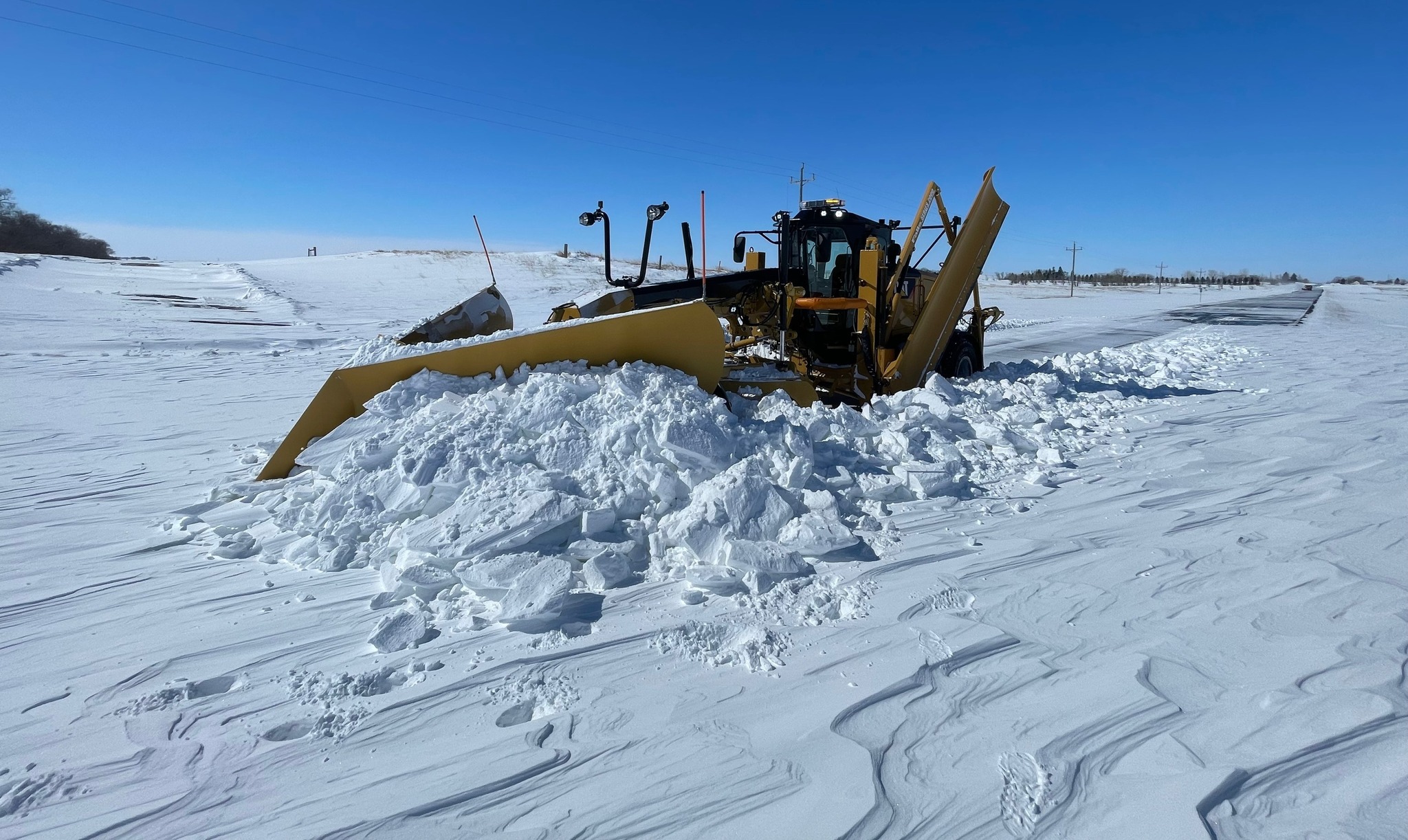
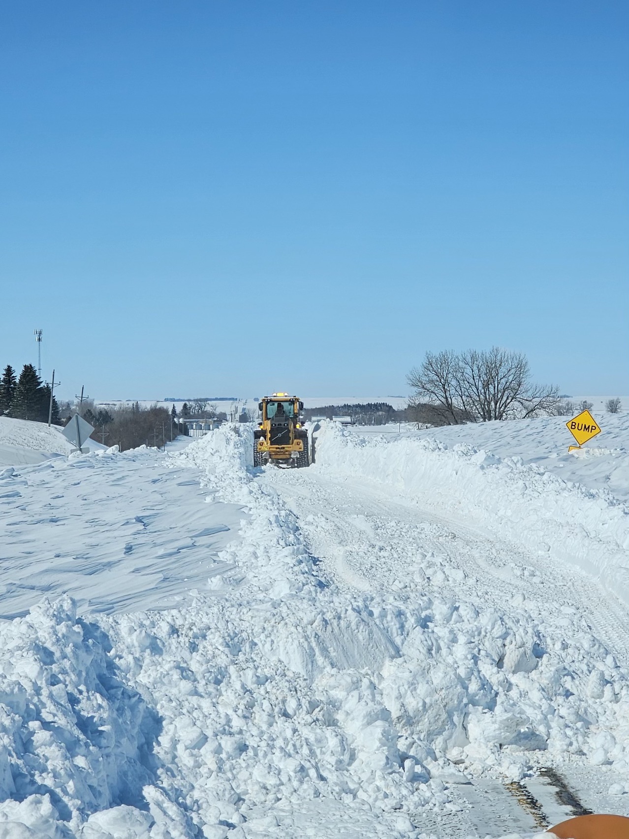
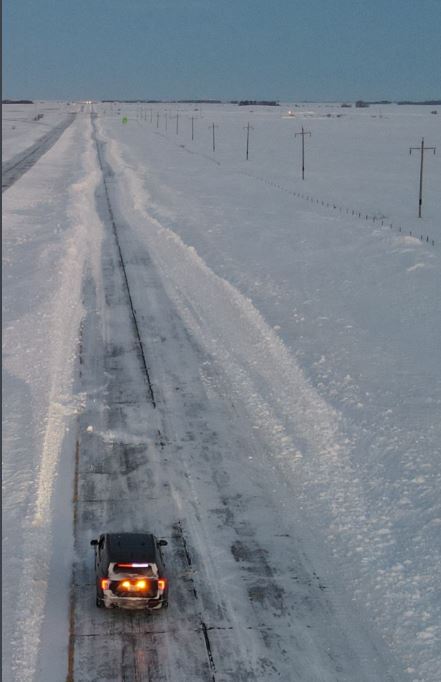
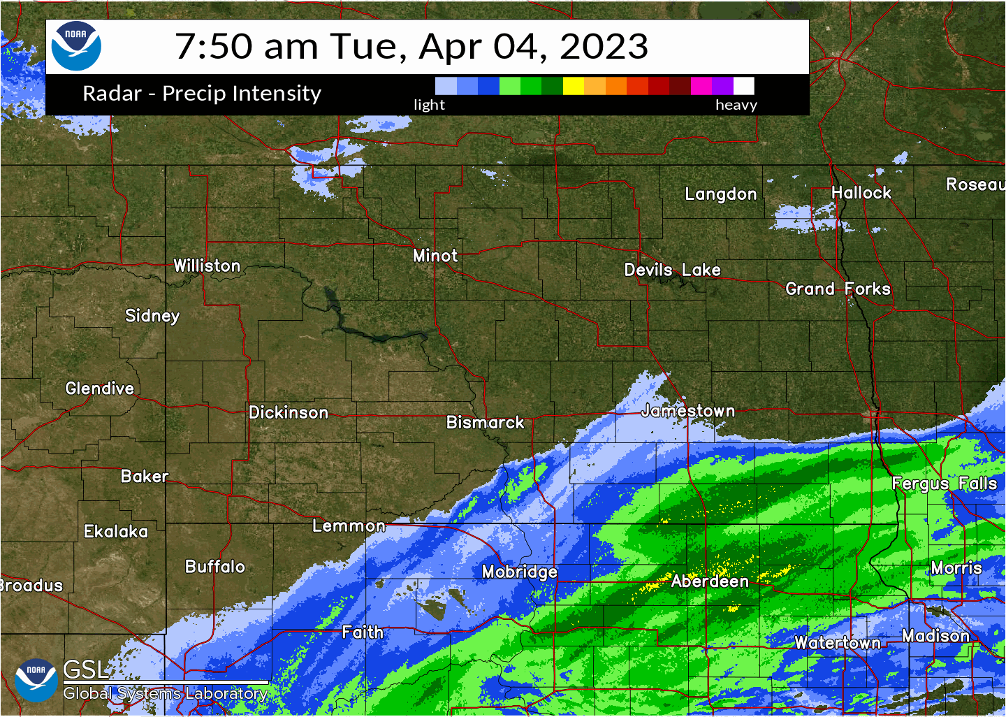
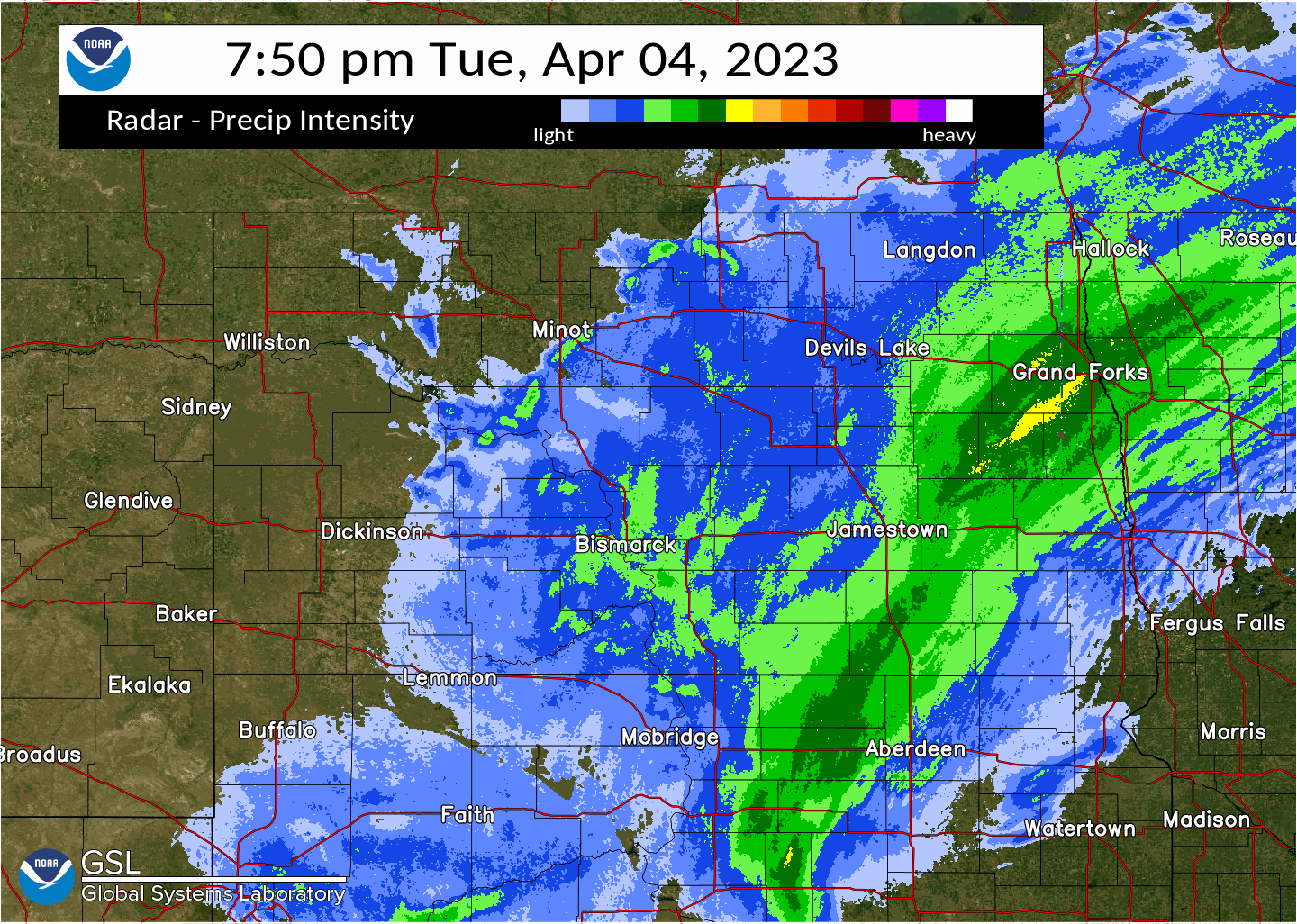
A powerful spring storm moved up into the Northern Plains on Tuesday, April 4th, causing bands of moderate to heavy snow to rotate from South Dakota into south central and southeastern North Dakota through the day. Moderate to heavy snow lasted into the early morning hours of Wednesday, April 5th, with the highest totals generally east of the Highway 83 corridor and into the James River Valley. Winds then increased during the late morning and afternoon hours on Wednesday, which promoted widespread blizzard conditions. Widespread wind gusts in the 40 to 60 mph range were observed through the afternoon. Many of the major routes across the eastern half of the state (including Interstate 94) were closed due to widespread blowing and drifting snow, with many sites seeing visibility values dropping to a quarter mile or less at times. Blizzard conditions then began to gradually subside from west to east during the evening of Thursday, April 6th. |
Highway Patrol Facebook Post the morning of April 5th "The westbound lane on I-94 between from mile markers 272 to 275, east of Jamestown, is proving to be difficult. North Dakota Department of Transportation is working to make a path through several large snow drifts in this area. #patience #ndwx #NDRoads" |
Photos & Video
 |
 |
 |
 |
| Conditions in the Bismarck Area (NDDOT) |
ND Highway 3 and 36 near Tuttle (NDDOT) |
ND Highway 36 (NDDOT) |
ND Highway 46 near Gackle (NDDOT) |
 |
 |
 |
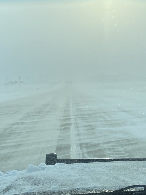 |
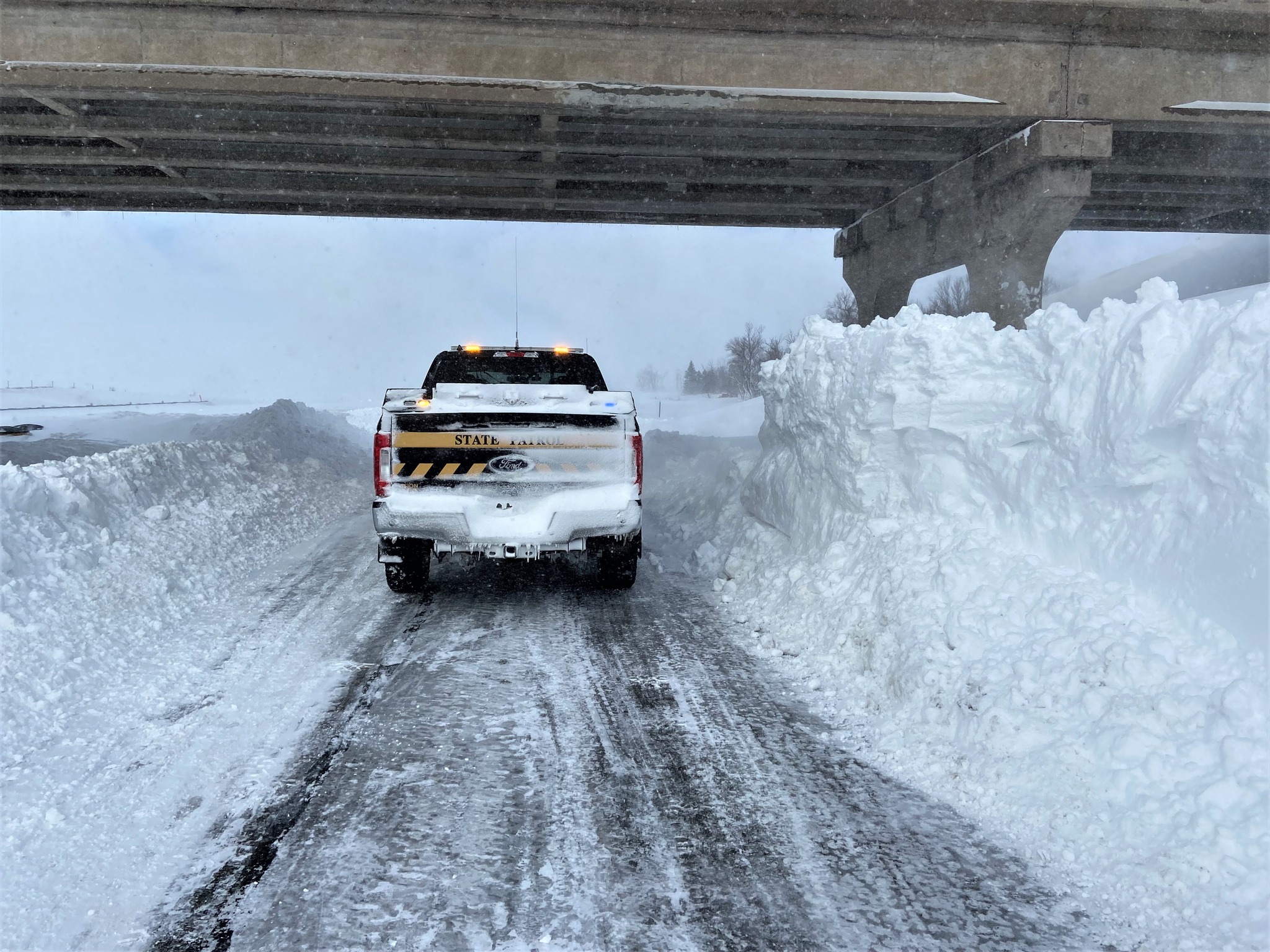
| I-94 West bound between Valley City and Jamestown (NDDOT) |
I-94 West bound between Valley City and Jamestown (NDDOT) |
I-94 Westbound Between Valley City and Jamestown (ND Highway Patrol) |
Conditions near New Salem on I-94 (ND Highway Patrol) |
Radar
 |
 |
 |
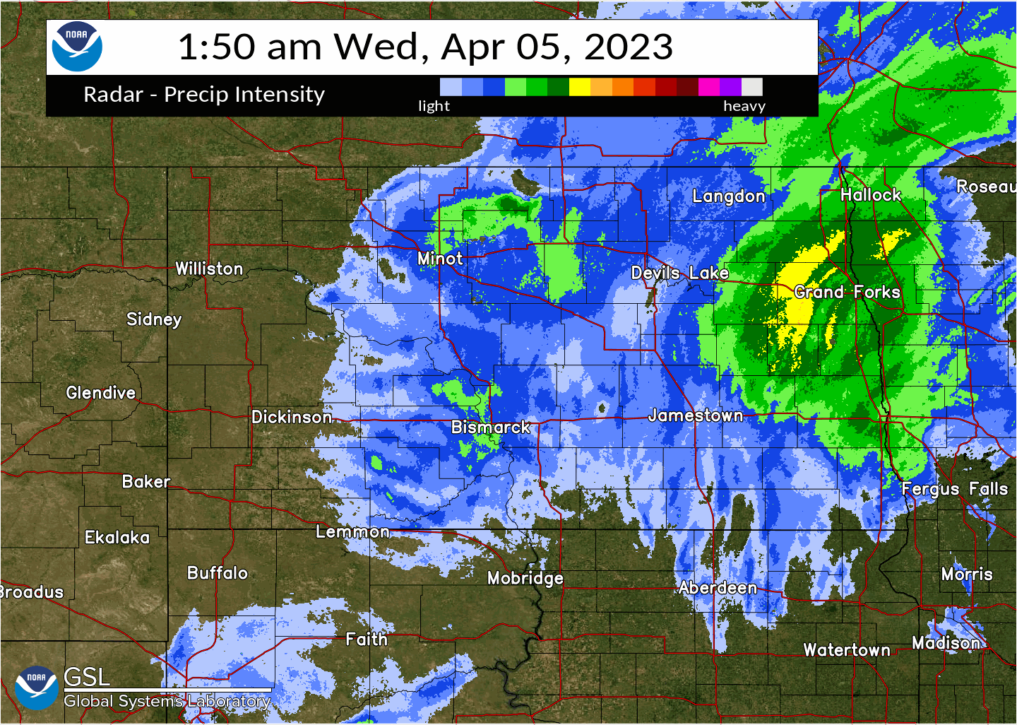 |
| Radar from 7:50 AM to 1:50 PM on Tuesday, April 4th | Radar from 1:50 PM to 7:50 PM on Tuesday, April 4th | Radar from 7:50 PM on Tuesday April 4th to 1:50 AM on Wednesday, April 5th | Radar from 1:50 AM to 7:50 AM on Wednesday, April 5th |
Storm Reports
LOCATION                     AMOUNT    TIME/DATE       PROVIDER
ASHLEY                       14.5 IN   0800 AM 04/05   COOP
MONTPELIER 3.3 ESE           13.3 IN   0700 AM 04/05   COCORAHS
7 NW BERLIN                  13.0 IN   0822 AM 04/05   PUBLIC
JAMESTOWN STATE HOSPITAL     12.1 IN   0600 AM 04/06   COOP
5 ESE JAMESTOWN              12.0 IN   1018 AM 04/05   PUBLIC
LA MOURE 4.6 ESE             12.0 IN   0700 AM 04/05   COCORAHS
EDGELEY 5.2 NW               10.3 IN   0800 AM 04/05   COCORAHS
ELLENDALE 7.3 NW             10.0 IN   0700 AM 04/05   COCORAHS
5 NE ASHLEY                  9.0 IN    0715 AM 04/05   COCORAHS
KULM 4.0 NNE                 8.3 IN    0800 AM 04/05   COCORAHS
PINGREE 5.4 NW               8.3 IN    0600 AM 04/05   COCORAHS
4 NW HAZELTON                6.3 IN    0747 AM 04/05   CO-OP OBSERVER
HARVEY                       6.0 IN    0626 AM 04/05   BROADCAST MEDIA
STEELE                       6.0 IN    0900 AM 04/05   PUBLIC
HUFF                         4.8 IN    1119 AM 04/05   PUBLIC
BISMARCK 3 SSE               4.4 IN    0100 PM 04/05   OFFICIAL NWS OBS
CATHAY 6.5 N                 4.0 IN    0700 AM 04/05   COCORAHS
BEULAH 0.4 S                 3.0 IN    0700 AM 04/05   COCORAHS
VELVA 3 NE                   2.9 IN    0800 AM 04/05   COOP
HAZEN                        2.7 IN    0600 AM 04/05   COCORAHS
LAKE TSCHIDA                 2.3 IN    0800 AM 04/05   HADS
2 NNW MINOT                  2.0 IN    0229 PM 04/05   PUBLIC
4.9 NW NEW SALEM             1.7 IN    0900 AM 04/05   COOP
BOWMAN                       1.5 IN    0800 AM 04/05   COOP
6 SSE LANDA                  1.5 IN    0900 AM 04/05   PUBLIC
GLEN ULLIN                   1.4 IN    0749 AM 04/05   PUBLIC
3.2 N WILLOW CITY            1.1 IN    0520 AM 04/05   COOP
UNDERWOOD                    1.0 IN    0800 AM 04/05   COOP
MAX                          1.0 IN    0800 AM 04/05   COOP

OBSERVATIONS ARE COLLECTED FROM A VARIETY OF SOURCES WITH VARYING
EQUIPMENT AND EXPOSURES. WE THANK ALL VOLUNTEER WEATHER OBSERVERS
FOR THEIR DEDICATION. NOT ALL DATA LISTED ARE CONSIDERED OFFICIAL.
 |
Media use of NWS Web News Stories is encouraged! Please acknowledge the NWS as the source of any news information accessed from this site. |
|

