
A significant heat wave continues for the Rockies, Northern Plains, and Great Lakes into the Mid-Atlantic, peaking in intensity through midweek and lingering across parts of the Northern Plains and Midwest until this weekend. Excessive rainfall my bring life-threatening and locally catastrophic flash and urban flooding across portions of southwestern Texas through early Friday. Read More >
Overview
|
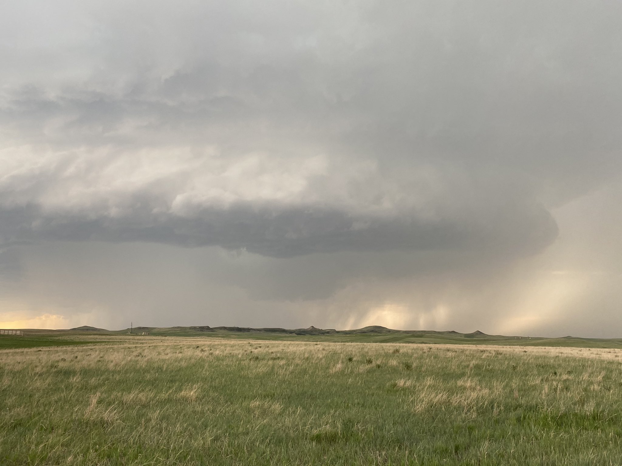
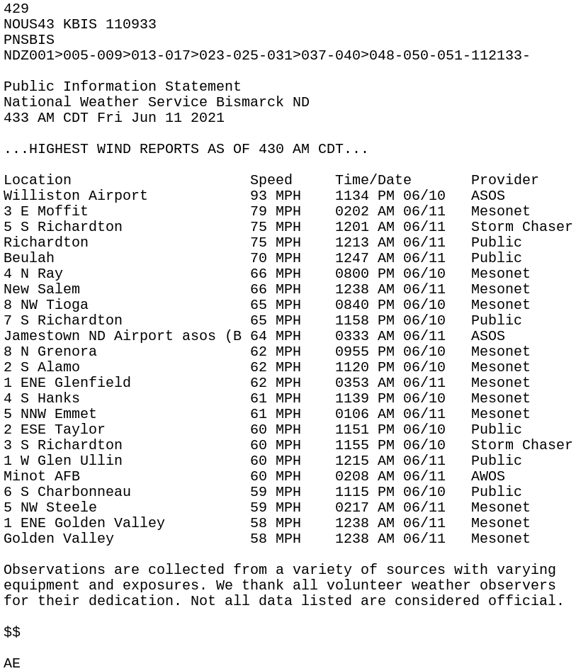
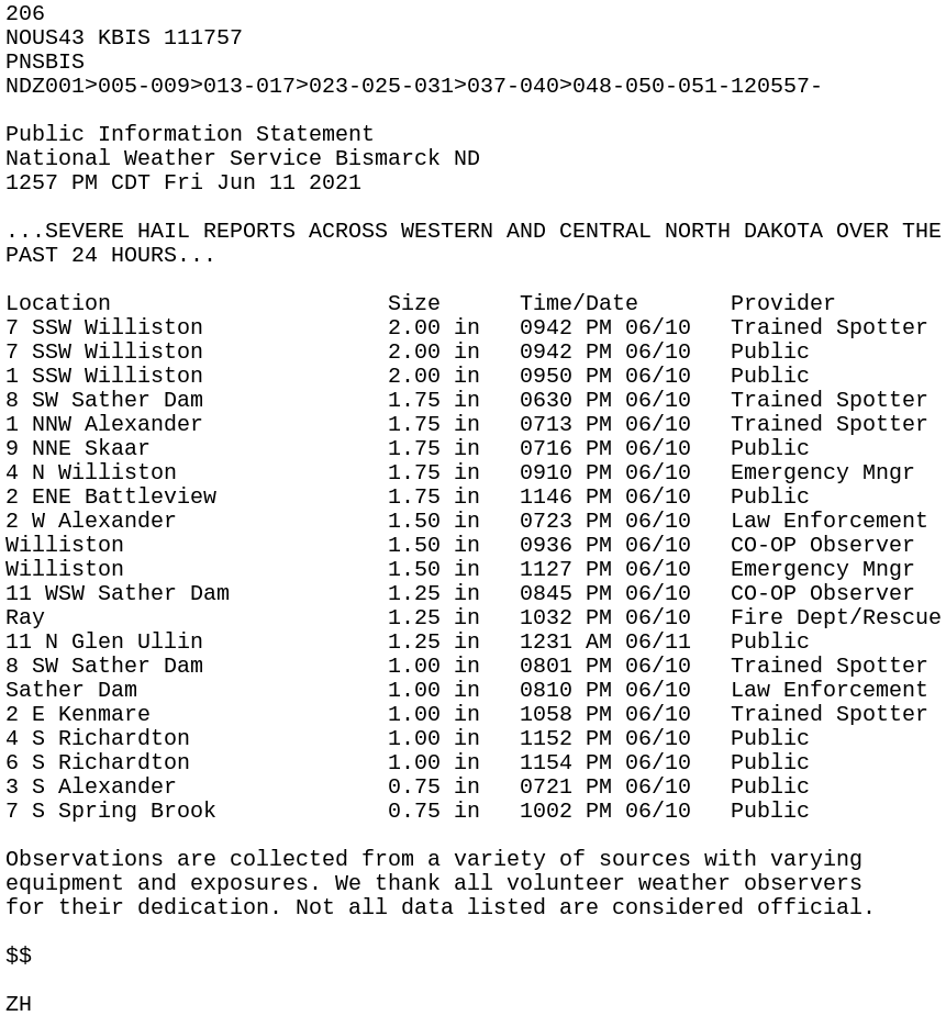
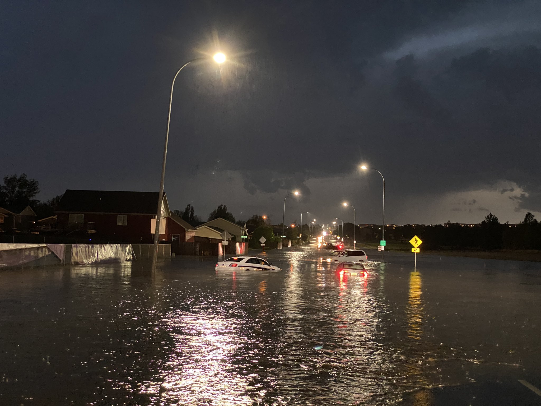
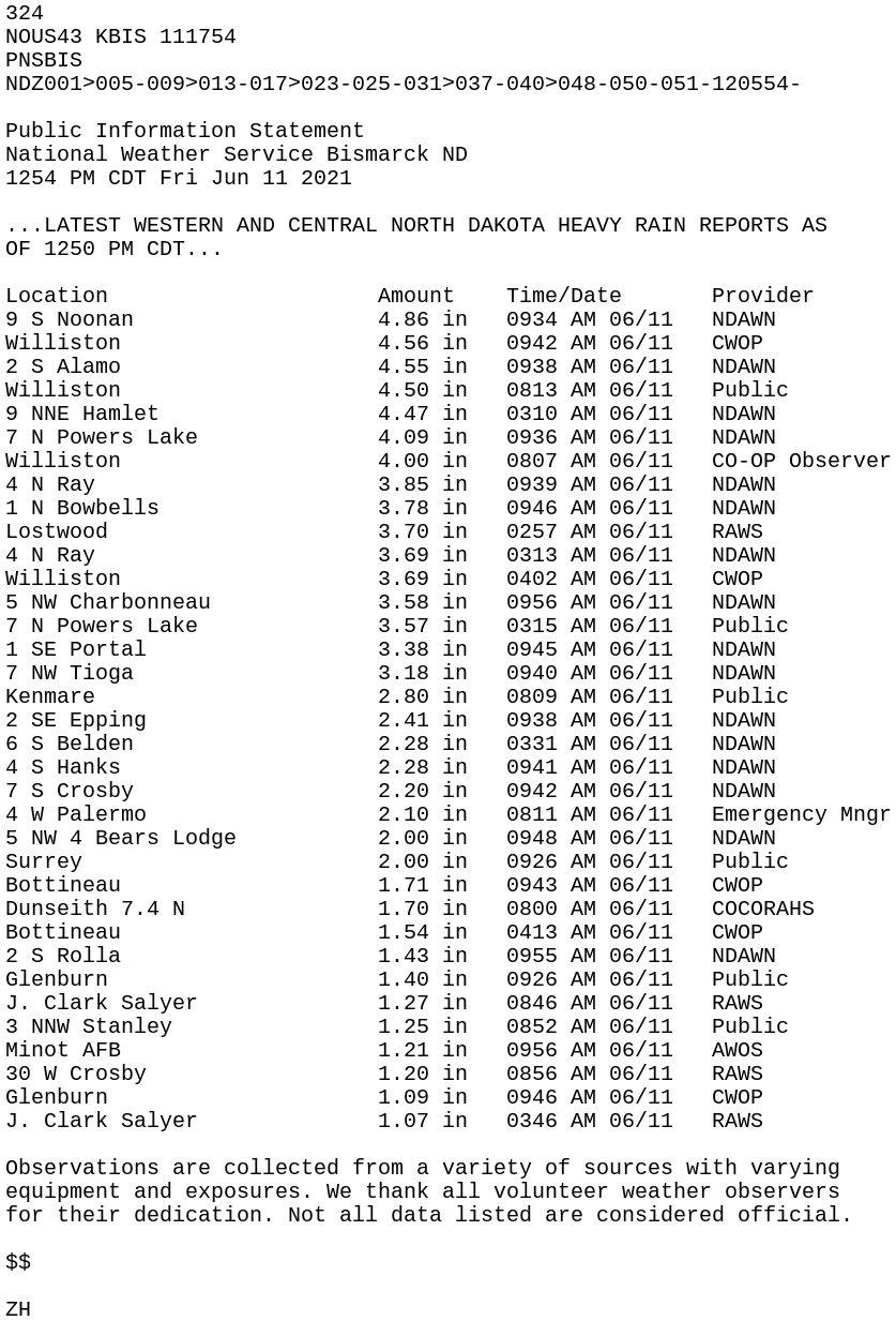
On Thursday, June 10, 2021, much of western and central North Dakota was under a Moderate Risk for severe weather. Initial storms moved into west central North Dakota in the late afternoon and produced multiple tornadoes southwest of Alexander. There were numerous reports of large hail up to the size of golf balls as storms expanded into northwest North Dakota in the evening. An especially strong thunderstorm moved through Williston around 9:30 PM, with hail of 2 inches in diameter. Heavy rainfall from a few rounds of storms produced flash flooding in Williston, with multiple cars submerged on Highway 2. Many locations in northwest North Dakota received heavy rainfall, with widespread amounts of 3 to 5 inches of rain in parts of Williams, Divide, and Burke Counties. As storms moved east from Montana and northeast from South Dakota, they eventually became more linear as they moved into central North Dakota, where damaging winds were the main hazard. Widespread severe gusts were reported across the south central, with a peak gust of 79 mph at Long Lake. There were many reports from across the area of damage to trees and structures, especially from the Hebron and Glen Ullin areas. |
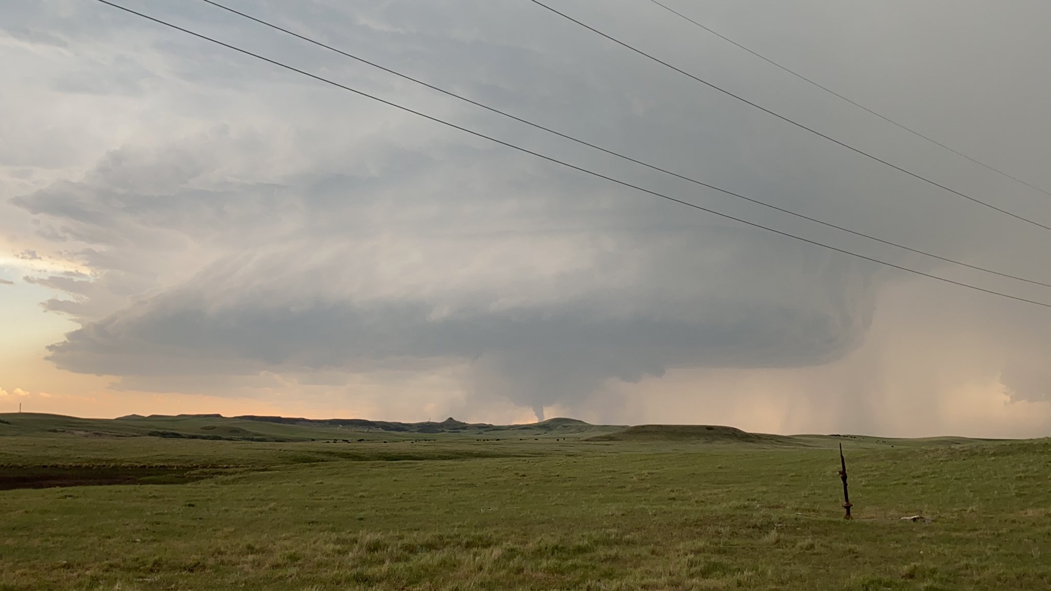
 Tornado near Sather Dam, ND, around 8:30 PM on June 10, 2021. Photo courtesy of Andrew Colantoni. |
Tornado Photos
 |
 |
 |
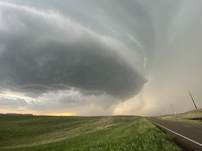 |
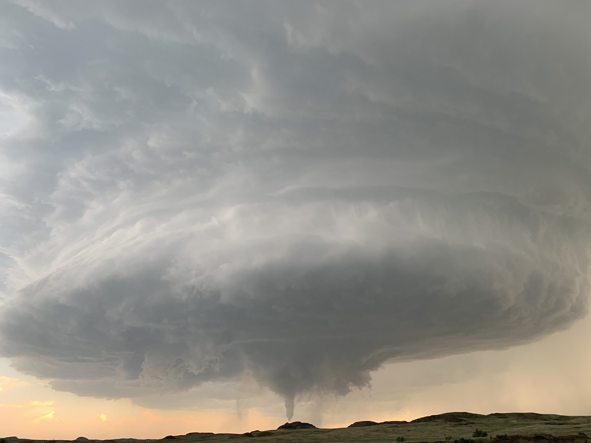
| Mammatus and initial supercell east of Sidney, MT that had a tornado just before the photo was taken, around 6:15 PM CDT (Courtesy of Freddy McKinney) |
Tornado near Sather Dam, ND around 7:50 PM CDT (Courtesy of Freddy McKinney) |
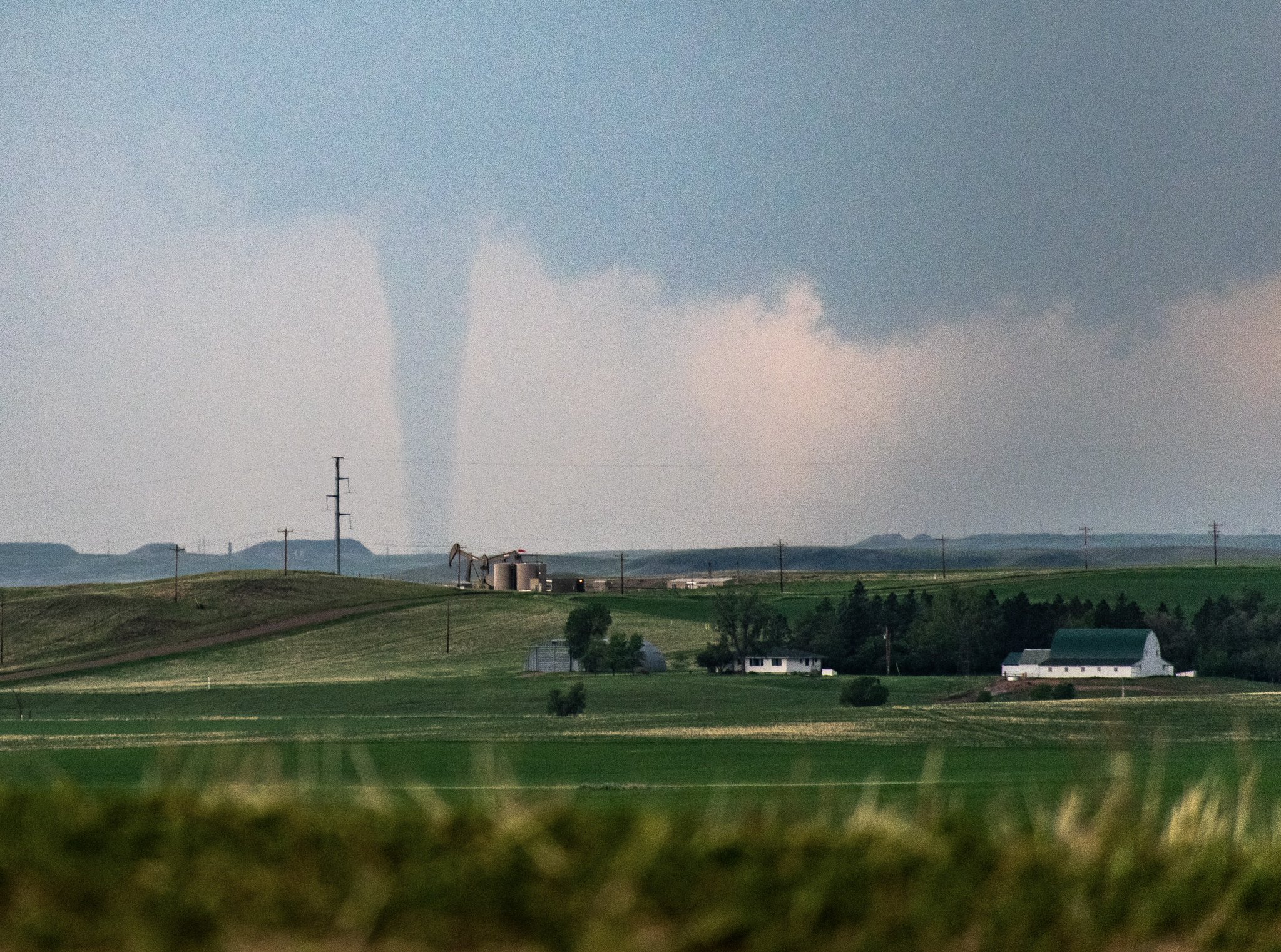
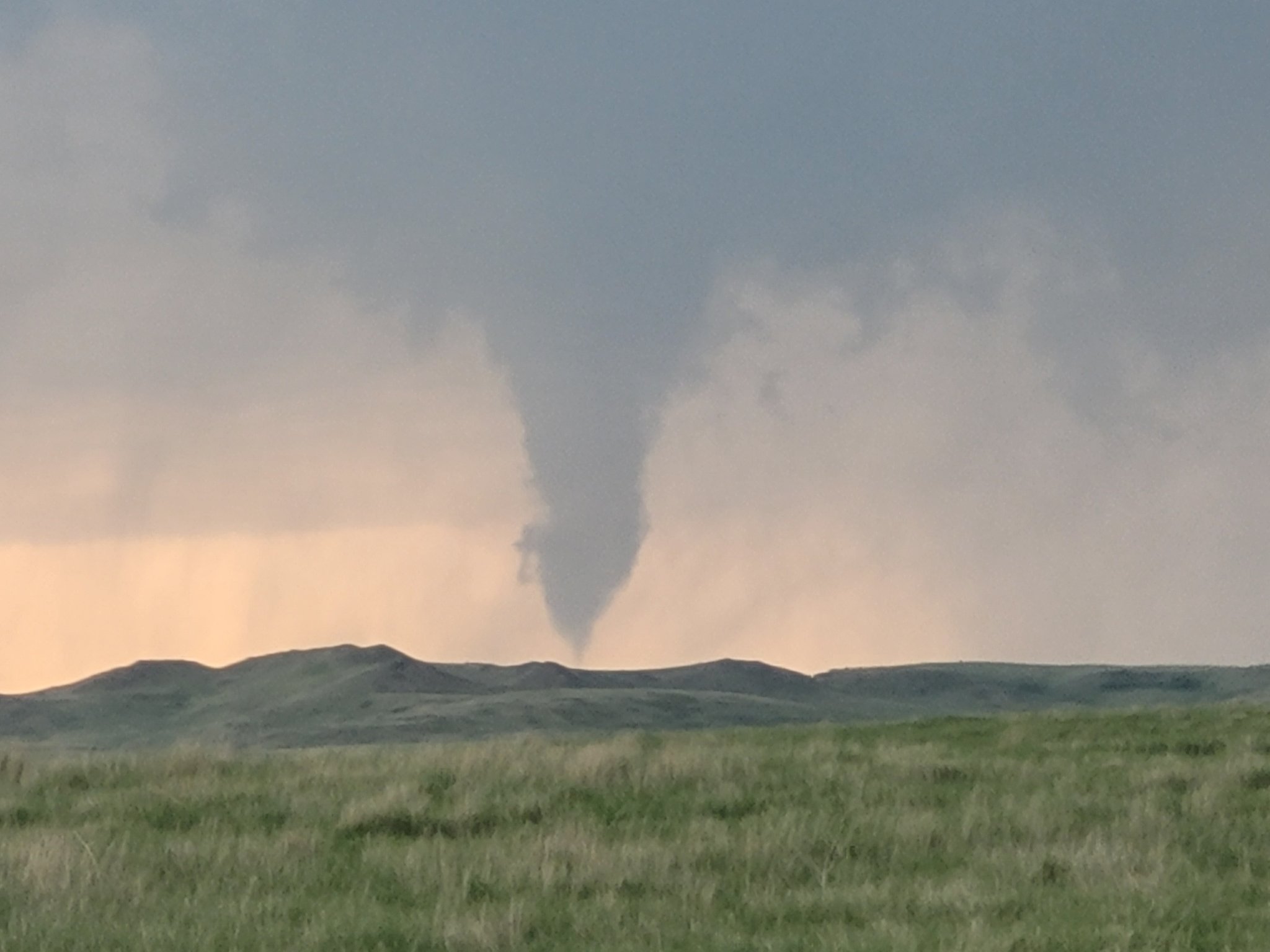
Tornado southwest of Alexander, ND, around 7 PM CDT (Courtesy of Jed Cristoph) |
Storm with funnel cloud southeast of Sidney, MT, around 8:20 PM CDT (Courtesy of Freddy McKinney) |
 |
 |
 |
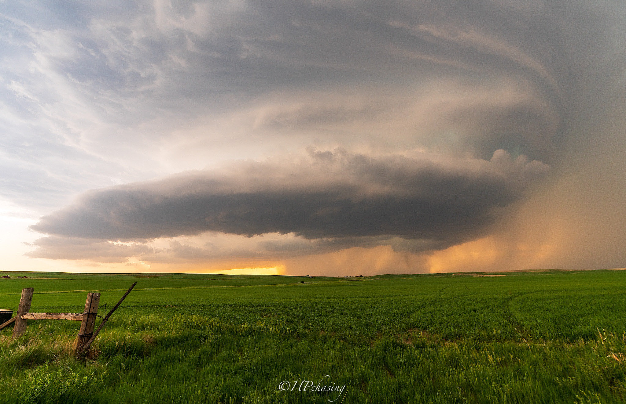 |
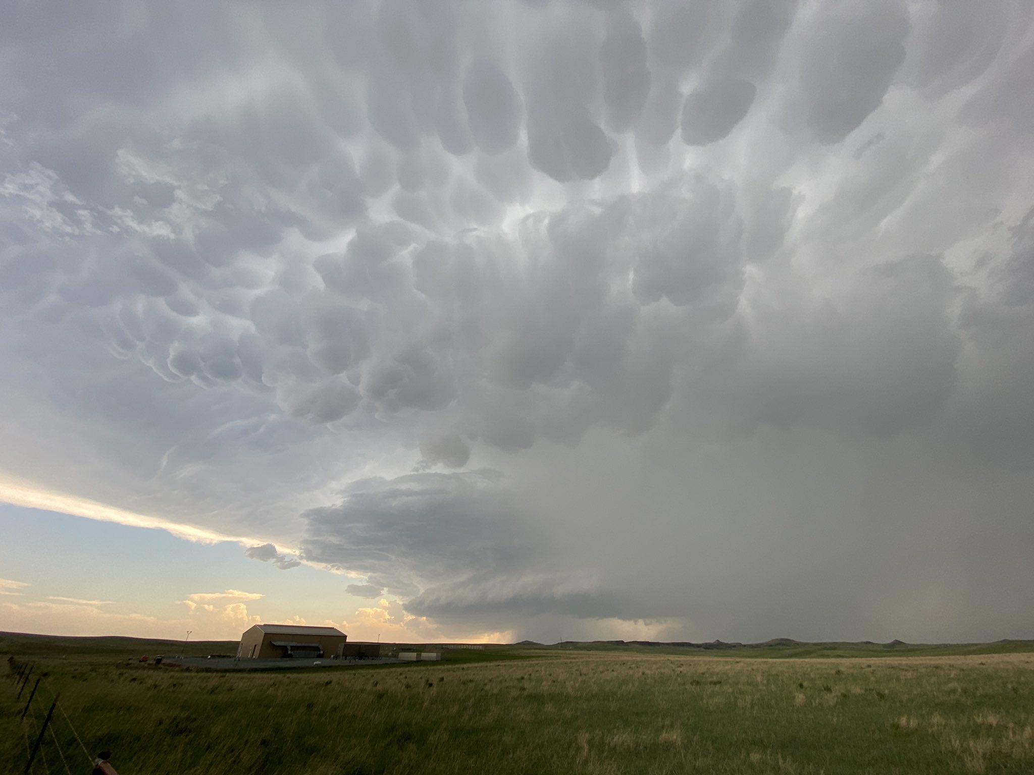
| Large wall cloud on a supercell near Sather Dam, ND around 6:45 PM CDT (Courtesy of Alex Resel) |
Tornado southwest of Alexander, ND, around 8:00 PM CDT (Courtesy of Alex Resel) |
Tornado southwest of Alexander, ND, around 7:55 PM CDT (Courtesy of Josh Brinker) |
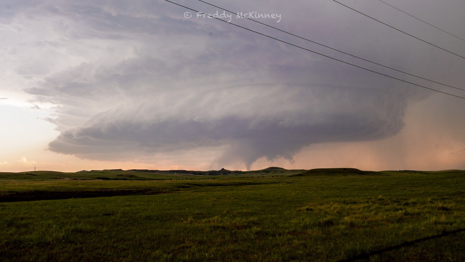
Supercell with a stovepipe tornado in progress around 8:15 PM (Courtesy of Shane Ornelas) |
Wind and Hail Photos
 |
 |
 |
 |
| Tree damage on Main Avenue in Oakes, ND (Courtesy of Dylan Hollingsworth) |
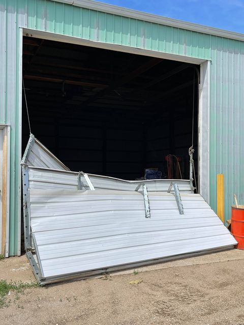
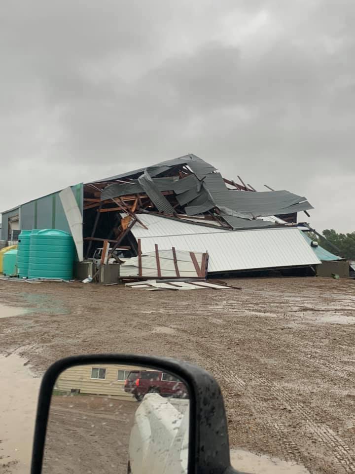
Damage to a shop in Oakes (Courtesy of Dylan Hollingsworth) |
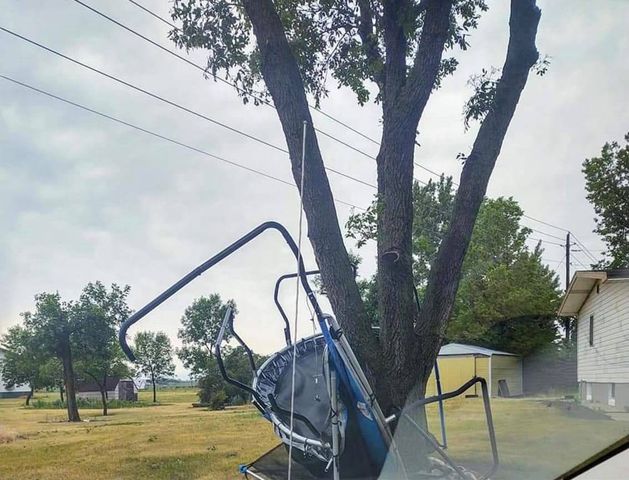
A trampoline wrapped around a tree in Oakes (Courtesy of Dylan Hollingsworth) |
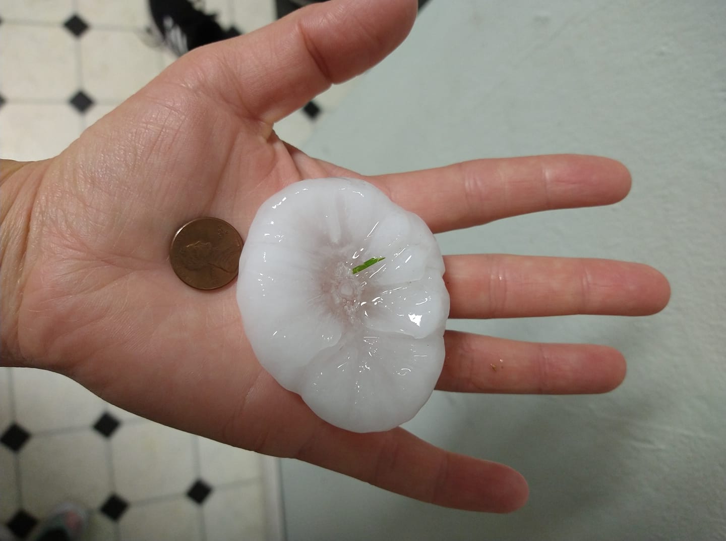
Hail in Williston around 9:50 PM (Courtesy of Jessie Lee) |
 |
 |
 |
 |
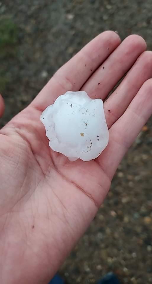
| Hail in the Squaw Gap area (Courtesy of Rebecca Papineau) |
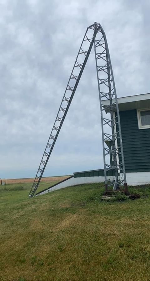
Wind damage in Buford (Courtesy of Jordan Hendrickson) |
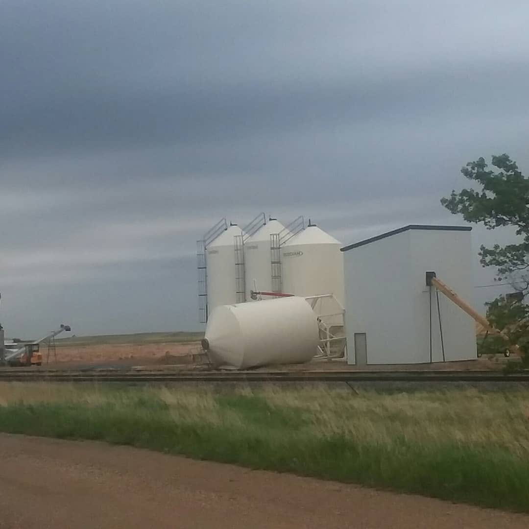
A grain bin blown down in Ryder (Courtesy of Michael Schoffstall) |
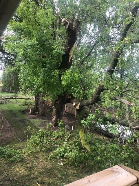
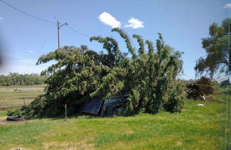
A 40 foot tall, 50 year old evergreen tree knocked down in Verona (Courtesy of Dylan Hollingsworth) |
 |
 |
 |
 |
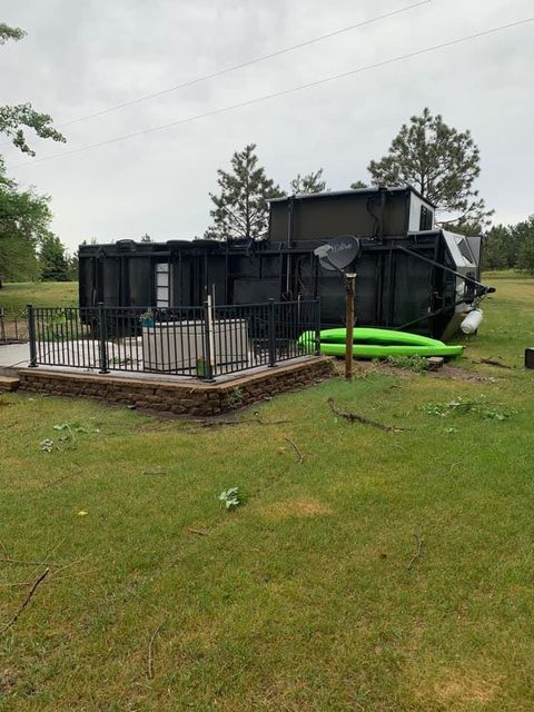
| A camper flipped at Lake LaMoure (Courtesy of Dylan Hollingsworth) |
Hail in Williston (Courtesy of Jamie Lane) |
Damage outside of Oakes (Courtesy of Dylan Hollingsworth) |
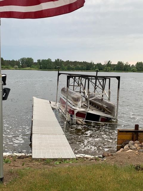
A pontoon flipped at Lake LaMoure (Courtesy of Dylan Hollingsworth) |
Radar
 |
|||
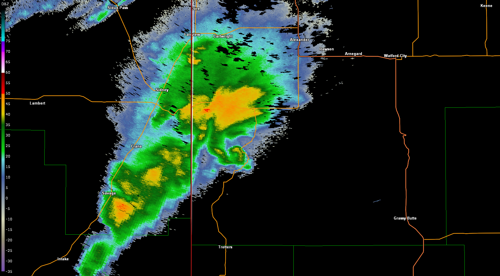
| A hook echo visible on the Williston radar at 7:55 PM CDT, with a tornado reported in the area | Caption | Caption | Caption |
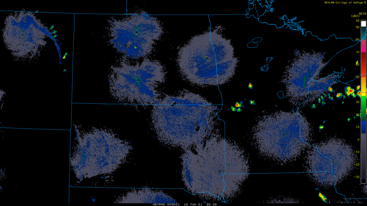
Regional radar loop from 3:30 PM CDT on Thursday, June 10 through 9:00 AM CDT on Friday, June 11.
Storm Reports
Rain Reports
Training thunderstorms and heavy rainfall led to flash flooding in Williston, with reports of multiple cars submerged on Highway 2. Various rainfall reports from northwest North Dakota show a swath of 3 to 5 inches of rainfall received. Photo below of street flooding courtesy of Freddy McKinney.
 |
Media use of NWS Web News Stories is encouraged! Please acknowledge the NWS as the source of any news information accessed from this site. |
|

