
Scattered thunderstorms with severe gusts, hail and a tornado risk are possible near a cold front from the Ohio Valley to the Mid-Atlantic tonight. Tropical Storm Bertha is expected to bring tropical storm conditions to portions of the Gulf Coast from the panhandle of Florida into Louisiana through Wednesday. Read More >
Overview
|
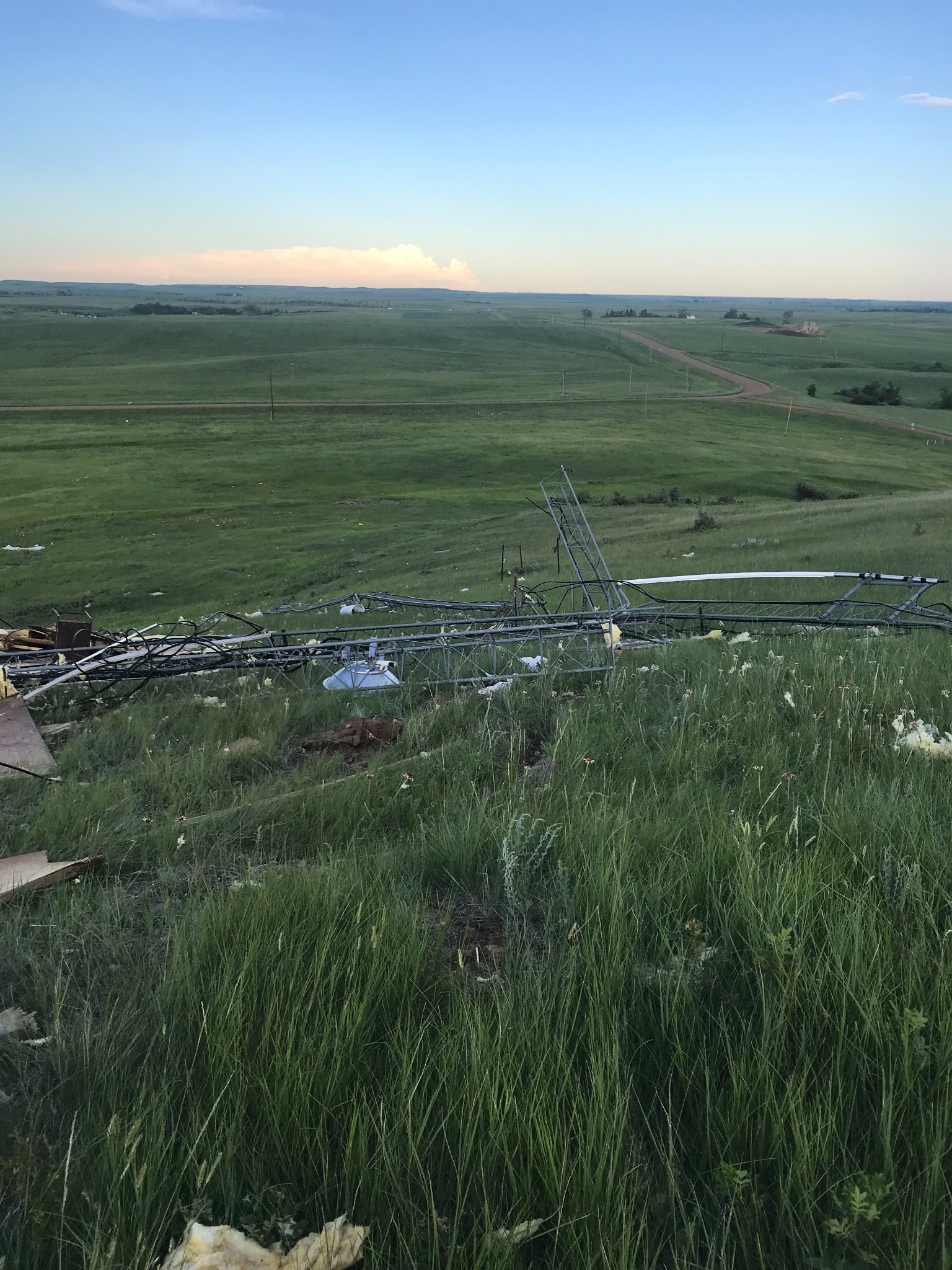
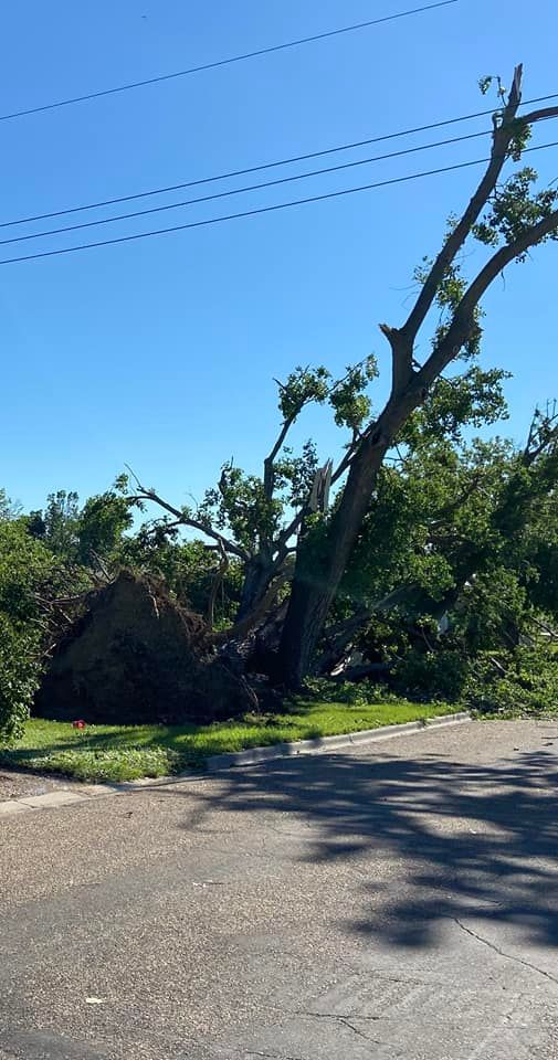
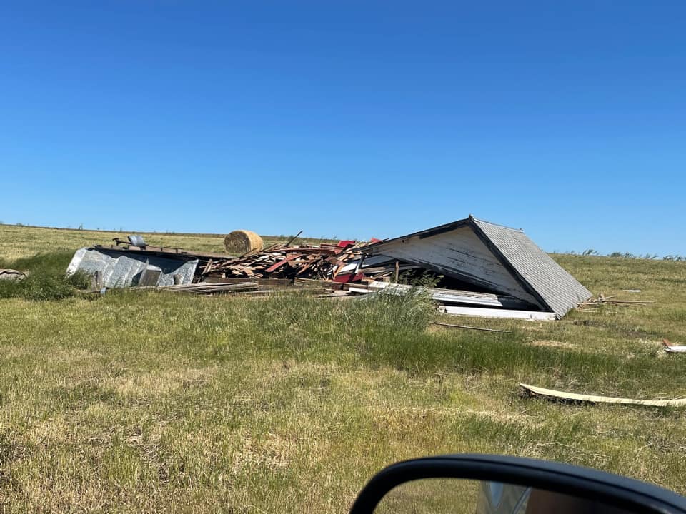
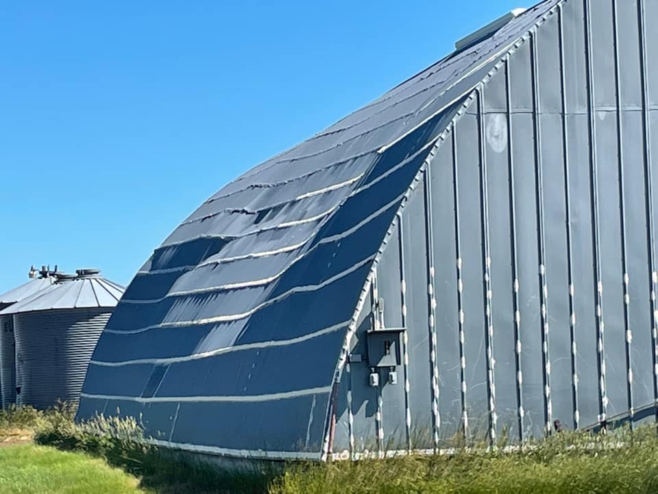
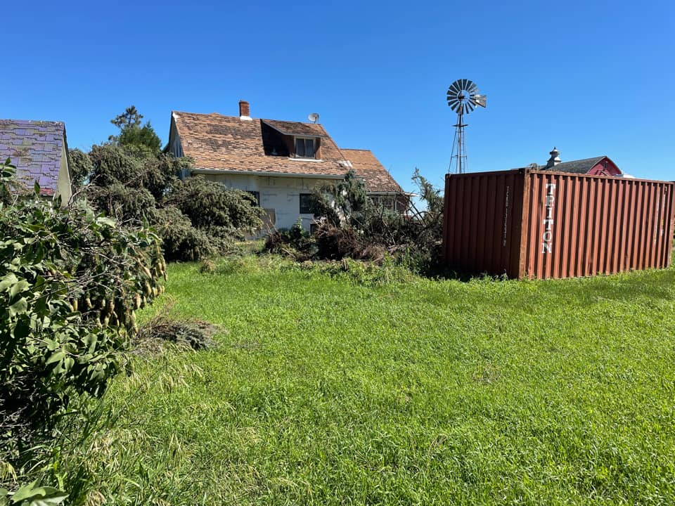
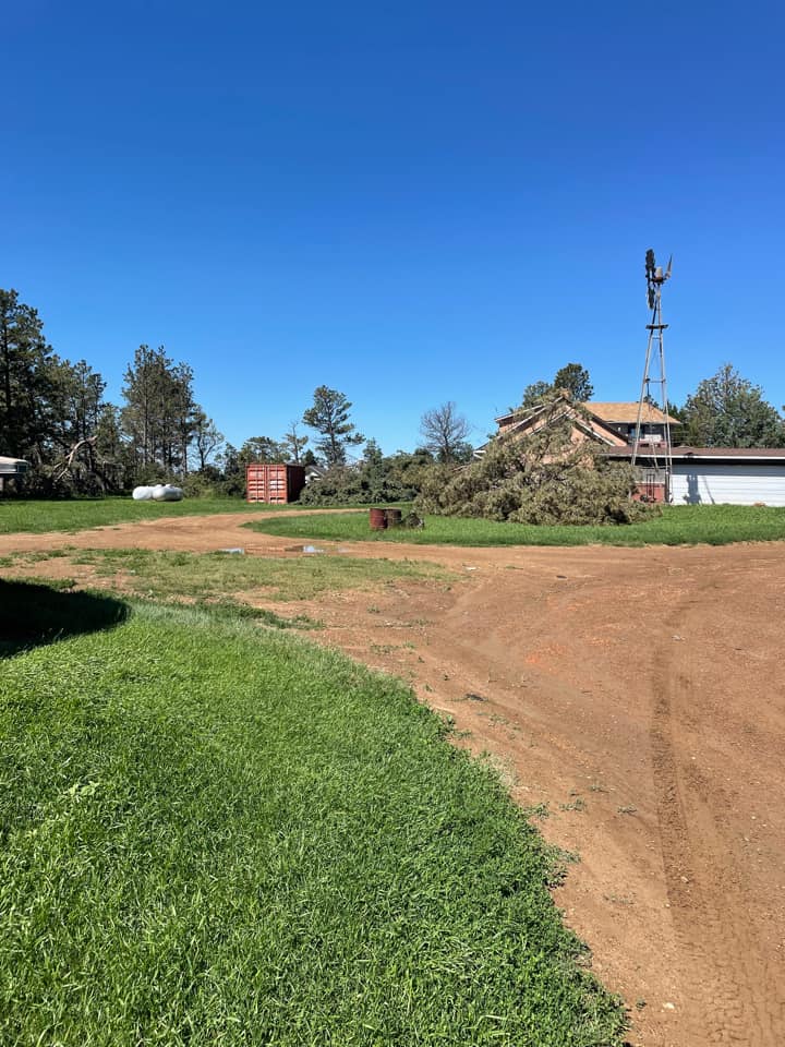
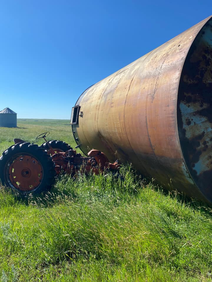
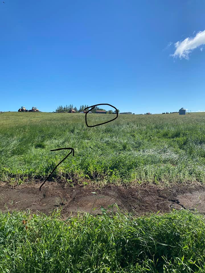
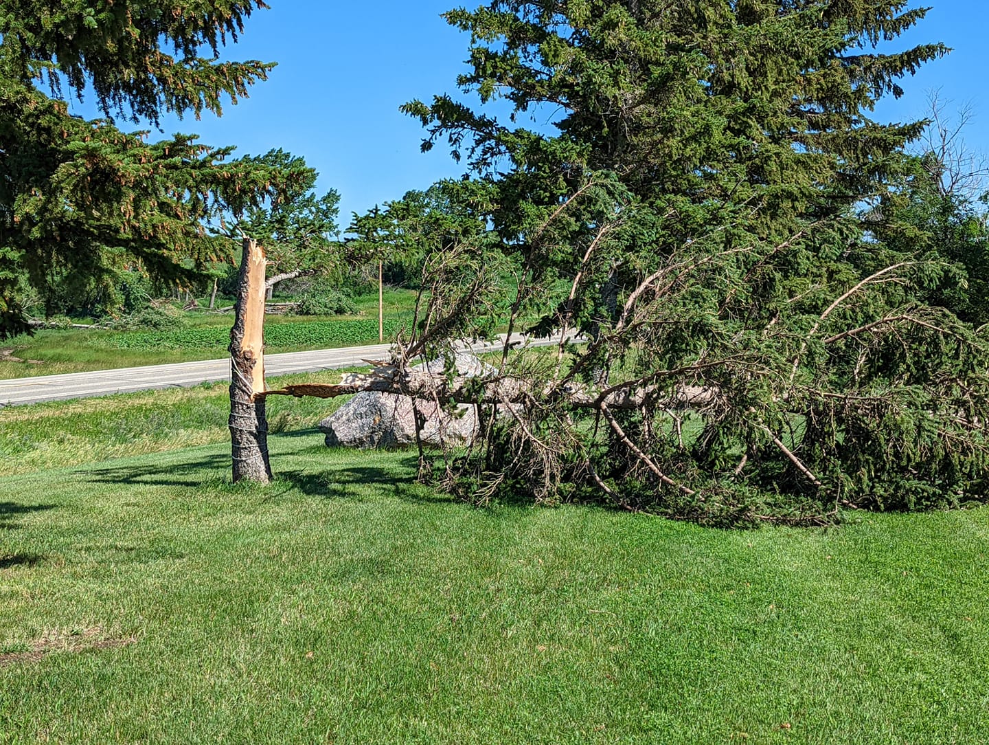
During the early morning hours of July 10, 2022, severe thunderstorms produced intense straight-line winds causing significant damage across Billings and Golden Valley Counties. The area from Beach to Fairfield was particularly hit hard. Wind speeds near Fairfield were estimated to be around 120 mph! Damaging winds also hit Velva, where extensive tree damage was reported. |
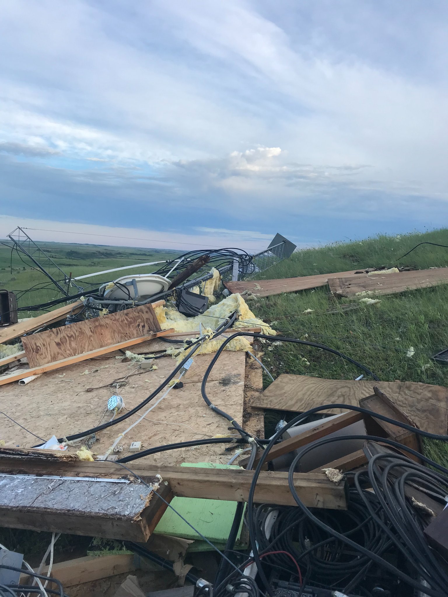 Damage near Fairfield. Image courtesy Billings County Emergency Management |
Photos & Video
|
 |
 |
 |
| Damage near Fairfield (Billings County EM) |
Damage near Fairfield (Billings County EM) |
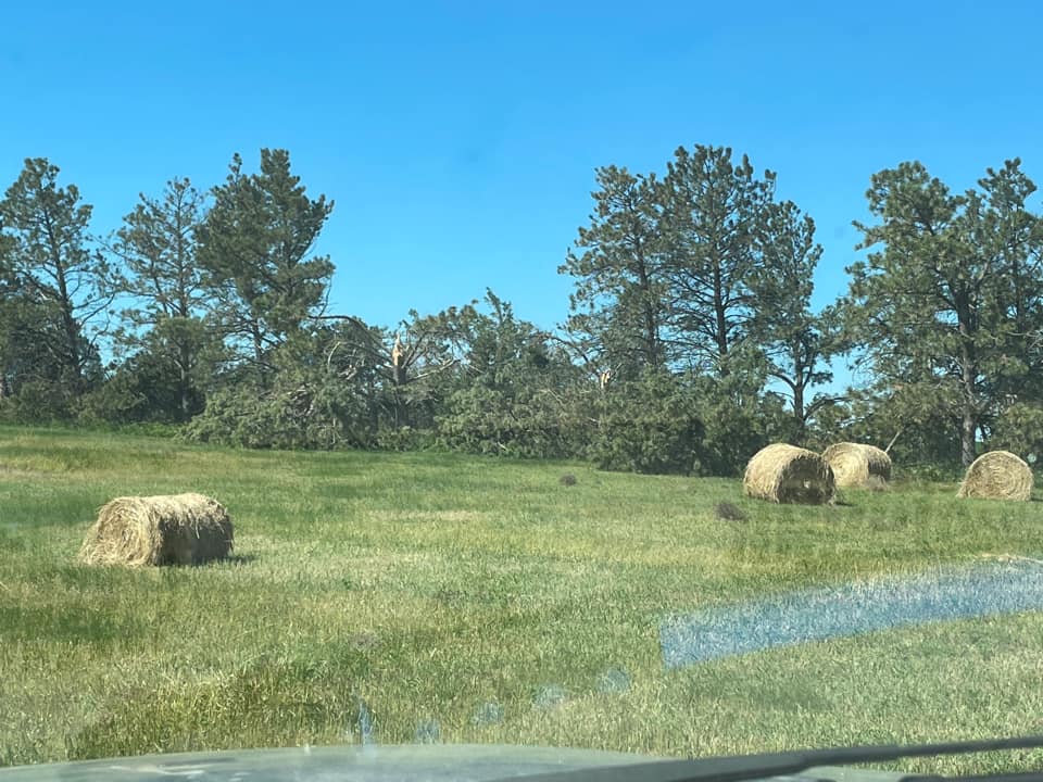
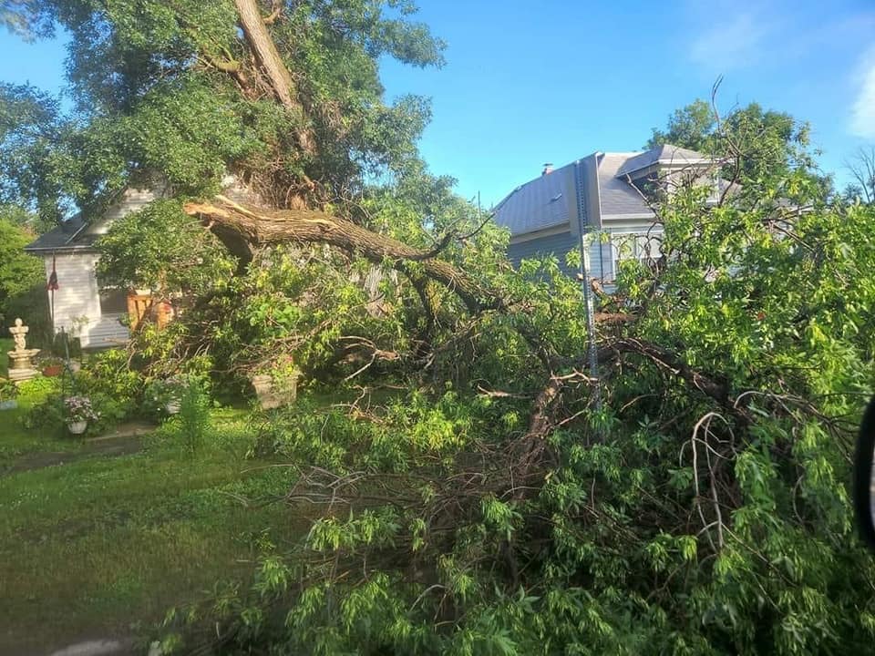
Beach (Brenda Frieze) |
Beach (David Fieldmann) |
 |
 |
 |
 |
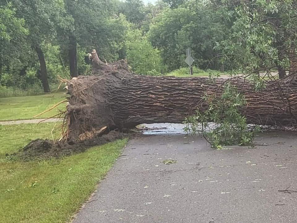
| Beach (David Fieldmann) |
Beach (David Fieldmann) |
Beach (David Fieldmann) |
Beach (David Fieldmann) |
 |
 |
 |
 |
| Beach (David Fieldmann) |
Velva (Maria Thex) |
Velva (Maria Thex) |
Beach (Michele Biellier) |
 |
 |
 |
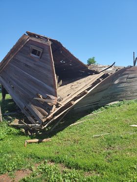 |
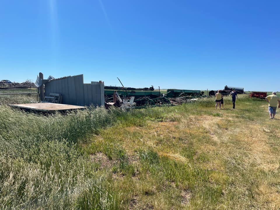
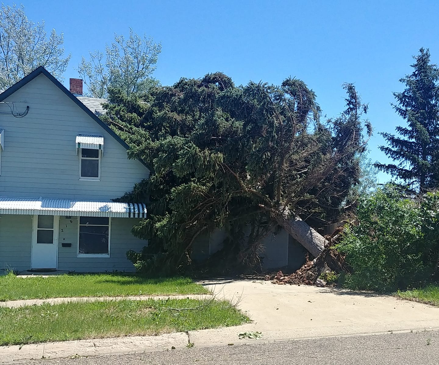
| Fairfield (Mattie Romanyshyn) |
Fairfield (Mattie Romanyshyn) |
Denhoff (Sandy Felchie) |
Fairfield (Verena Fischer) |
Radar
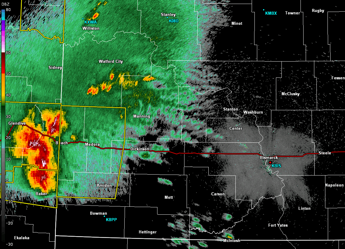 |
|||
| Radar Loop from Bismark Radar 1:45am CDT to 3:38am CDT |
Storm Reports
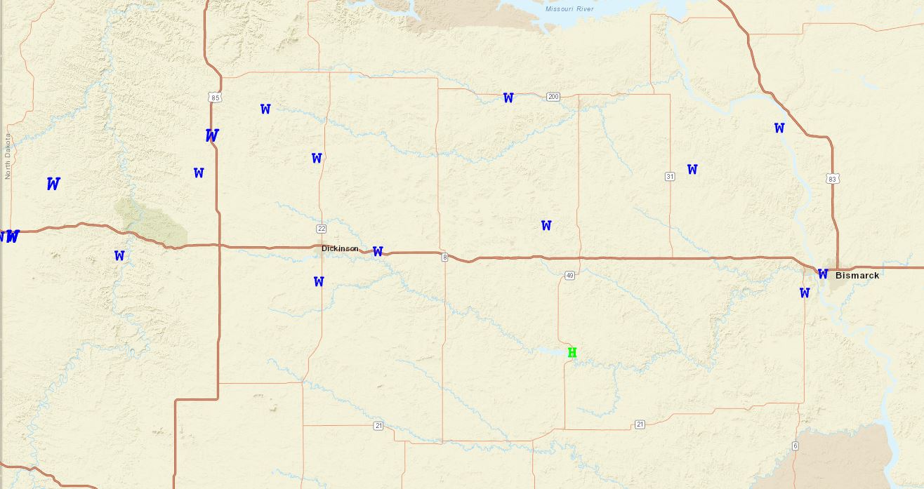 |
|||
| A map of storm reports from the morning of July 10th 2022. For more details see SPC Storm Report Site. |
PRELIMINARY LOCAL STORM REPORT
NATIONAL WEATHER SERVICE BISMARCK ND
218 PM CDT MON JUL 11 2022


0235 AM     TSTM WND GST     FAIRFIELD               47.19N 103.22W
07/10/2022  E120 MPH         BILLINGS           ND   EMERGENCY MNGR

            THIS IS A LATE REPORT FOR THE STORM THAT
            STRUCK THE FAIRFIELD AREA DURING THE VERY
            EARLY MORNING HOURS OF JULY 10. EXTENSIVE
            DAMAGE WAS REPORTED THROUGHOUT THE COMMUNITY
            OF FAIRFIELD AND SURROUNDING AREAS,
            PARTICULARLY TO THE WEST. APPROXIMATELY 100
            POWER POLES WERE SNAPPED THROUGHOUT THE
            AREA. A PAD MOUNTED ELECTRICAL TRANSFORMER
            WEIGHING APPROXIMATELY TWO TONS WAS BLOWN
            OVER ABOUT EIGHT MILES WEST OF FAIRFIELD.
            SIX MILES WEST OF FAIRFIELD, A 120 FOOT
            COMMUNICATIONS TOWER BLEW OVER, AND AN
            ADJACENT SMALL BUILDING WAS DEMOLISHED.
            CLOSER TO AND IN THE COMMUNITY OF FAIRFIELD,
            A QUONSET HUT WAS BLOWN APPROXIMATELY 150
            YARDS, AND A ROOF ON A HOME WAS SEVERELY
            DAMAGED. MULTIPLE TREES IN THE AREA WERE
            UPROOTED OR SNAPPED, AND MULTIPLE STOCK
            TRAILERS WERE FLIPPED OVER. BASED UPON THE
            EXTENSIVE DAMAGE, WIND SPEEDS ARE ESTIMATED
            TO BE AROUND 120 MPH WITH THIS STORM. GREAT
            APPRECIATION IS EXTENDED TO THE BILLINGS
            COUNTY EMERGENCY MANAGEMENT TEAM, THE LOCAL
            POWER COOPERATIVE, AND LOCAL MEMBERS OF THE
            PUBLIC FOR GATHERING AND SHARING INFORMATION
            WITH THE NATIONAL WEATHER SERVICE.
 |
Media use of NWS Web News Stories is encouraged! Please acknowledge the NWS as the source of any news information accessed from this site. |
|

