Dangerous heat will expand from the Gulf Coast into the Southern Plains and Desert Southwest through week's end. Additional extreme heat impacting the Pacific Northwest will shift to the northern Plains by the weekend. Tropical Storm Bertha is expected to continue to impact portions of the northern Gulf Coast from the western Florida Panhandle to southeastern Louisiana through tonight. Read More >
Overview
|
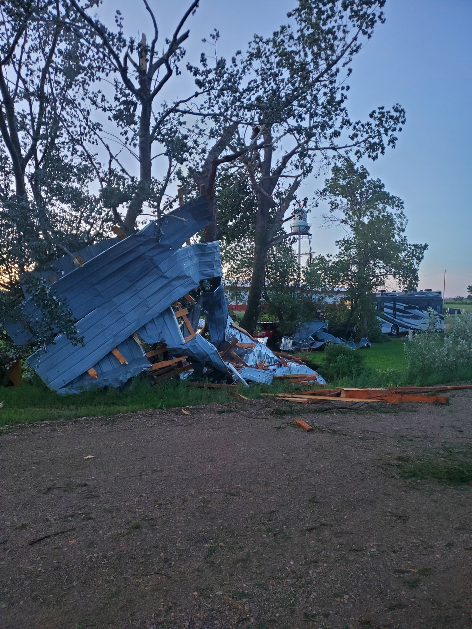
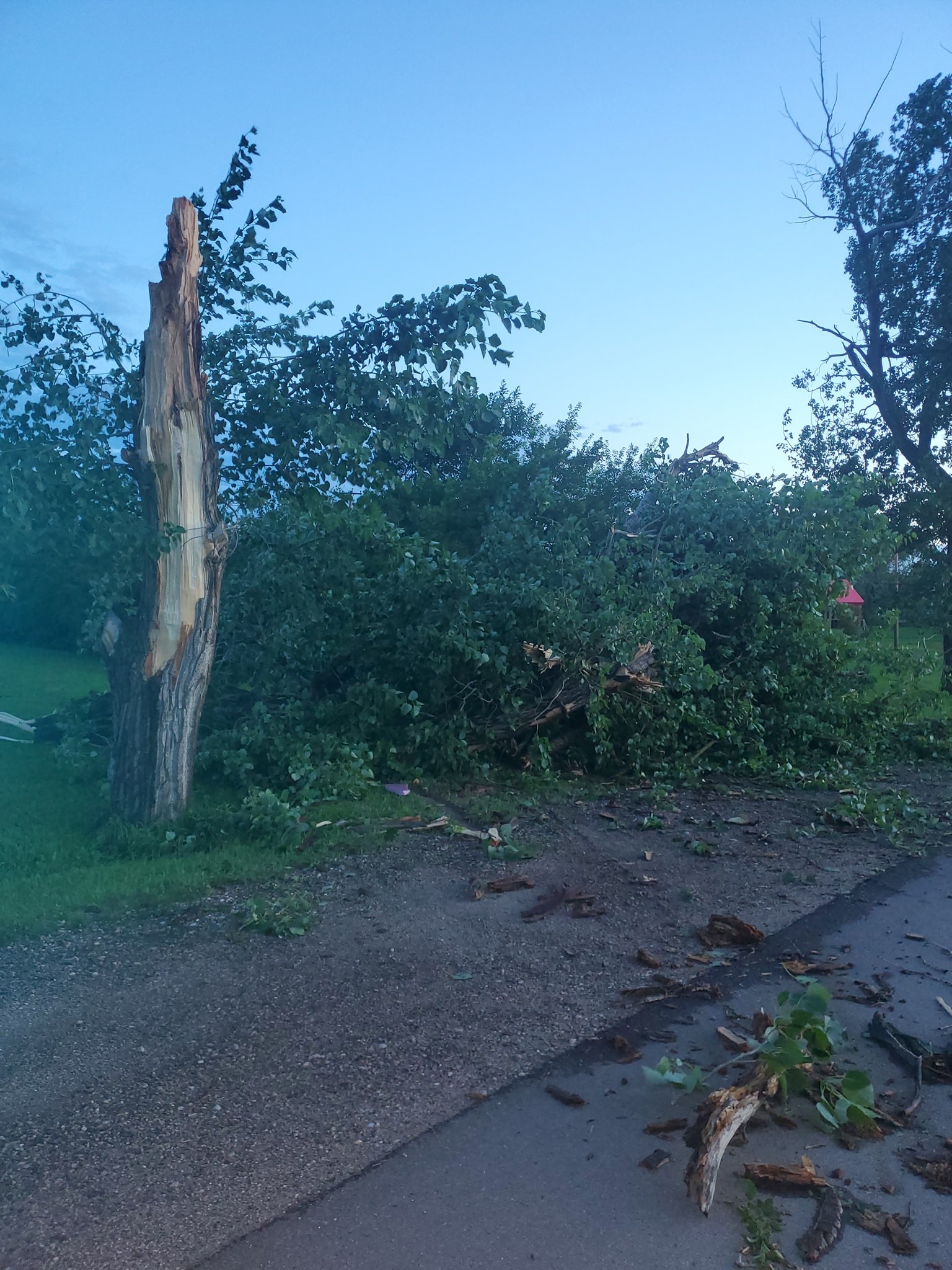
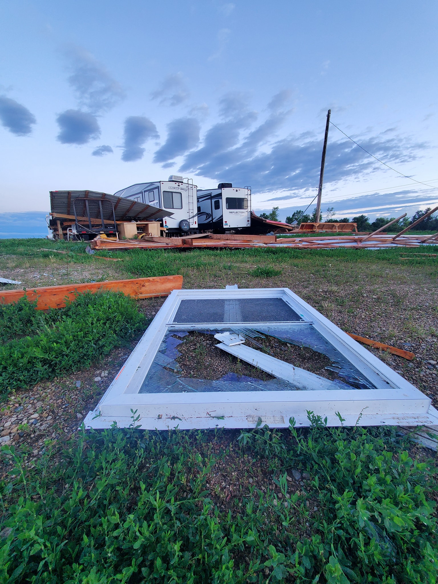
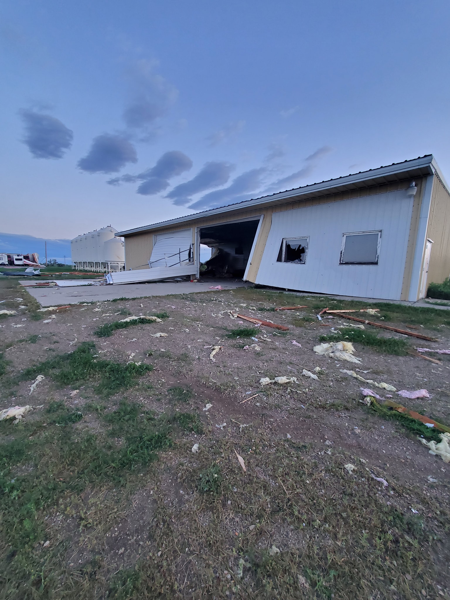
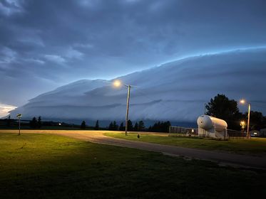
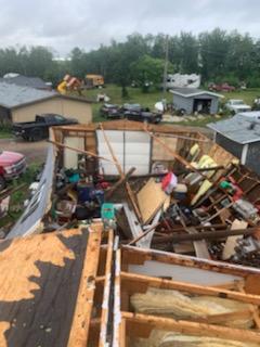
Numerous severe thunderstorms moved through northwest and north central North Dakota from the evening of Monday, July 18th, 2022, through the early morning of Tuesday the 19th. A surface low and cold front moved through eastern Montana and into western North Dakota ahead of a strong upper level disturbance, in an environment with strong instability and wind shear that was supportive of severe thunderstorms. There were a few rounds of thunderstorms as the surface low and cold front moved through, with some locations in the northwest being impacted by multiple thunderstorms through the evening and overnight. A few locations had higher end severe thunderstorms, with very large hail and damaging straight line winds reported. Very large hail fell in the city of Williston late in the evening, with numerous reports of hail from golf ball to tennis ball size (1.75 - 2.5 inches in diameter). There were a few hailstones measured at 3 inches in diameter, which set a new record for the largest hailstone recorded in Williams County. Some of the more significant damage from the Wildrose area included numerous large trees uprooted and some snapped, damage to outbuildings, downed power lines, and sheet metal walls blown into vehicles, campers, and motorhomes. Straight line winds were estimated around 95 mph in this area. Damage just north of Belcourt included partial loss of roof materials on a home, damage to outbuildings and lawn decorations, and broken tree branches. Straight line winds were estimated around 75 mph in this area. WFO Bismarck would like to thank the Williams County and Rolette County emergency managers for their help in collecting damage reports and photos, as well as members of the public who submitted reports and photos through social media. |
Photo credit: Watterud Latoya |
Photos & Video
 |
 |
 |
|
Wildrose damage Photo credit: Watterud LaToya |
Wildrose damage Photo credit: Watterud LaToya |
Wildrose damage Photo credit: Watterud LaToya |
 |
 |
 |
|
Williston hail Photo credit: Kristina Budd |
Storm moving into Wildrose Photo credit: Karla Magnuson |
Belcourt Damage Photo credit: Mike Stewart, Rolette County Emergency Manager |
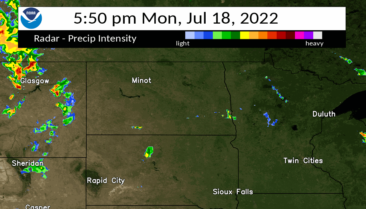
Radar
Full radar loop of severe event
 |
Storm Reports
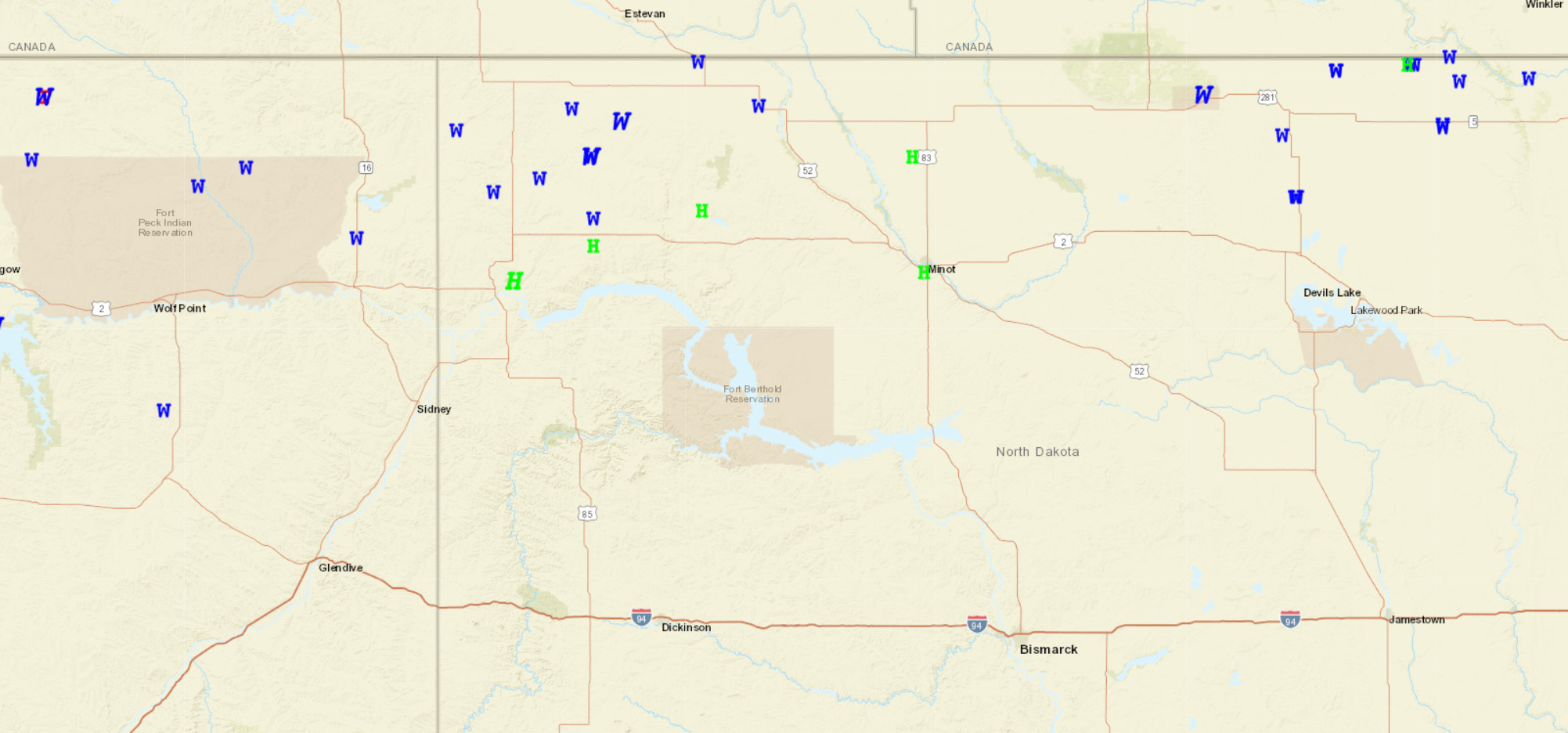
HIGHEST WIND REPORTS

LOCATION                     SPEED     TIME/DATE       PROVIDER
WILDROSE                     95 MPH    1015 PM 07/18   EMERGENCY MNGR
9 S NOONAN                   79 MPH    1033 PM 07/18   MESONET
2 N BELCOURT                 75 MPH    0342 AM 07/19   EMERGENCY MNGR
5 N BLACKTAIL LAKE           73 MPH    0945 PM 07/18   PUBLIC
8 N GRENORA                  67 MPH    0913 PM 07/18   MESONET
4 SW BELCOURT                67 MPH    0338 AM 07/19   RAWS
ROLLA                        64 MPH    0355 AM 07/19   AWOS
3 N RAY (NDAWN)              63 MPH    1205 AM 07/19   NDAWN
7 S CROSBY                   61 MPH    1023 PM 07/18   MESONET
6 N BONETRAIL                60 MPH    0944 PM 07/18   TRAINED SPOTTER
2 S ALAMO                    60 MPH    1007 PM 07/18   MESONET
2 SW PORTAL                  60 MPH    1105 PM 07/18   TRAINED SPOTTER
1 NNE BOWBELLS (NDAWN)       59 MPH    1120 PM 07/18   NDAWN
1 SW BOWBELLS                58 MPH    1109 PM 07/18   MESONET
1 E TIOGA                    57 MPH    1217 AM 07/19   PUBLIC

HAIL REPORTS

LOCATION                     SIZE      TIME/DATE       PROVIDER
1 NE WILLISTON               3.00 IN   1137 PM 07/18   PUBLIC
WILLISTON                    2.75 IN   1140 PM 07/18   PUBLIC
3 S RAY                      1.75 IN   1208 AM 07/19   PUBLIC
WILLISTON                    1.50 IN   1135 PM 07/18   CO-OP OBSERVER
7 WSW LOSTWOOD               1.25 IN   1250 AM 07/19   PUBLIC
2 SSW MINOT                  1.25 IN   0247 AM 07/19
3 WNW WILLISTON              1.00 IN   1135 PM 07/18
LANSFORD                     1.00 IN   0215 AM 07/19   BROADCAST MEDIA

OBSERVATIONS ARE COLLECTED FROM A VARIETY OF SOURCES WITH VARYING
EQUIPMENT AND EXPOSURES. WE THANK ALL VOLUNTEER WEATHER OBSERVERS
FOR THEIR DEDICATION. NOT ALL DATA LISTED ARE CONSIDERED OFFICIAL.
This map shows the location of storm reports from severe wind (blue W) and severe hail (green H). Map courtesy of SPC.
Environment
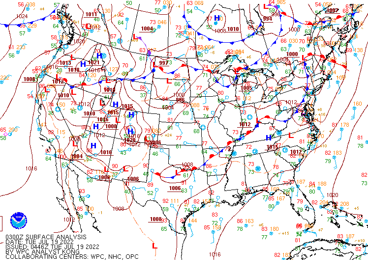
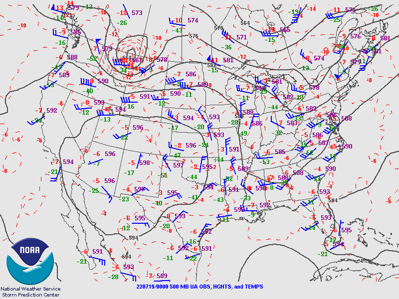
A compact shortwave was approaching North Dakota on the evening of July 18th, with lift ahead of the wave interacting with a surface low and associated warm and cold fronts. An Enhanced Risk (level 3 of 5) was introduced by SPC on the morning of the 18th, with increasing confidence in the potential for severe thunderstorms as these features approached a moisture-rich air mass. Dew points were in the upper 60s to mid 70s which increased the available instability for thunderstorms.
 |
 |
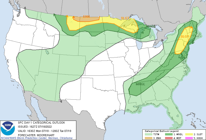 |
| Figure 1: Surface map, valid July 18th 10 PM CDT | Figure 2: 500mb height map, valid July 18th 7 PM CDT | Figure 3: SPC Day 1 Outlook that included an Enhanced Risk (Level 3 of 5) for severe storms over northwest and north central North Dakota. |
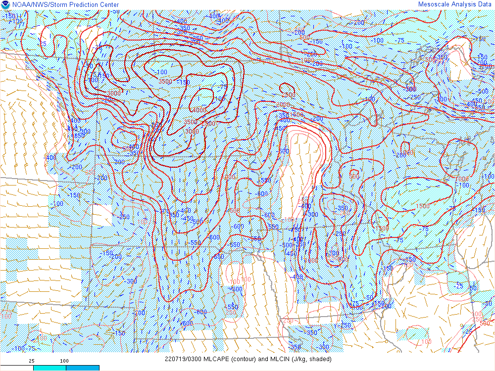
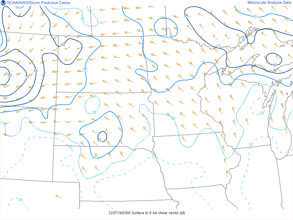
These images help illustrate the near-storm environment at 10 PM CDT, with the highest magnitude severe reports in the 10 PM to midnight timeframe. In northwest North Dakota, MLCAPE was in the 3000-3500 J/kg range, overlapping with 0-6 km shear of 50 knots and mid-level lapse rates of 8.5°C/km. This was an environment very supportive of not just severe thunderstorms but higher-end storms as well, which was proven by the reports of 3 inch hail in Williston, and the estimated 95 mph straight line winds in Wildrose. Images from SPC Mesoanalysis Archive.
 |
 |
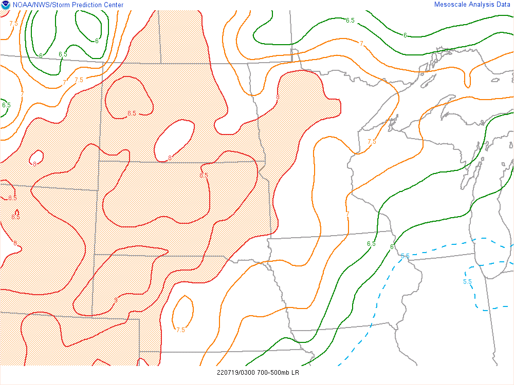 |
| Figure 4: MLCAPE (contour) and MLCIN (shaded), valid July 18th 10 PM CDT | Figure 5: Surface to 6 km bulk shear vector, valid July 18th 10 PM CDT | Figure 6: 700-500mb Lapse Rates, valid July 18th 10 PM CDT |
 |
Media use of NWS Web News Stories is encouraged! Please acknowledge the NWS as the source of any news information accessed from this site. |
|