Numerous severe thunderstorms are expected across a broad region from the Ohio Valley to the Mid-Atlantic and Northeast States today into tonight. Swaths of damaging wind gusts are expected and some tornadoes are possible. Bertha is expected to bring tropical storm conditions to portions of the Gulf Coast from the Florida Panhandle westward to southeastern Louisiana later today and Wednesday. Read More >
Overview
|
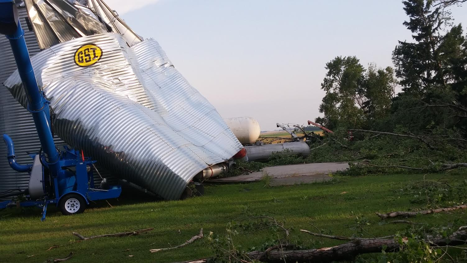
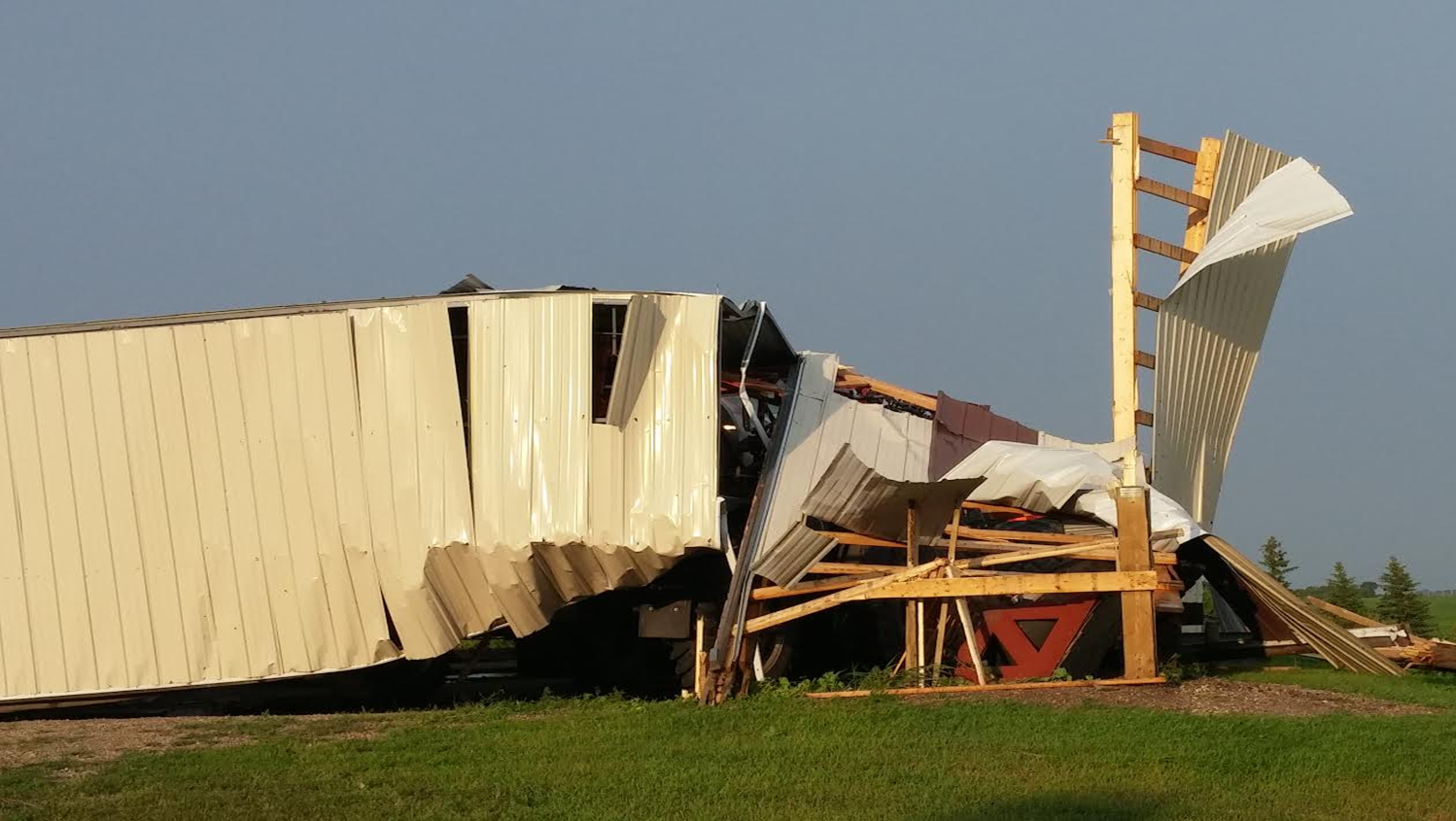
A significant severe weather event struck Rolette County during the late afternoon of Wednesday, August 3rd, 2016. A tornado developed approximately six miles south of Mylo, ND at 528 PM CDT. The tornado traveled northeast and produced extensive damage to two farmsteads, before exiting into Towner County between the town of Agate and Highway 66 at 545 PM CDT. There were no injuries and no fatalities from this tornado. Based on the damage done, the tornado was rated EF2 on the Enhanced Fujita Scale. From that it was determined that tornado winds were around 120 mph. |
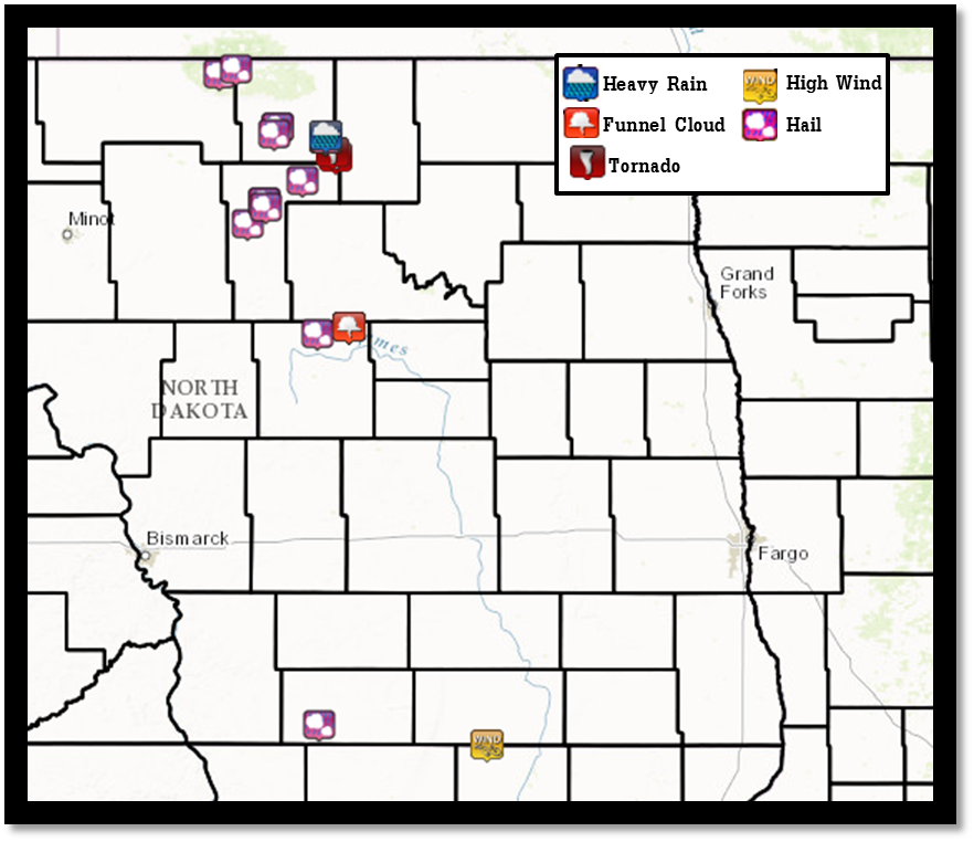 Storm reports for central ND |
Tornadoes:
|
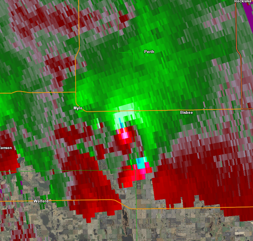
Tornado - LOCATION
Track Map 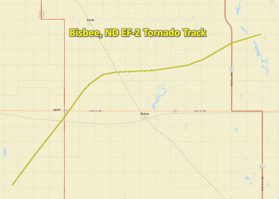 
KML |
||||||||||||||||
|
||||||||||||||||
The Enhanced Fujita (EF) Scale classifies tornadoes into the following categories:
| EF0 Weak 65-85 mph |
EF1 Moderate 86-110 mph |
EF2 Significant 111-135 mph |
EF3 Severe 136-165 mph |
EF4 Extreme 166-200 mph |
EF5 Catastrophic 200+ mph |
 |
|||||
Storm Reports
Public Information Statement
National Weather Service Bismarck ND
248 PM CDT Fri Aug 5 2016

Wind...Hail...and Rainfall Reports for August 3, 2016

...Hail Reports...

Location                     Size      Time/Date
11 NNW Dunseith              3.00 in   0420 PM 08/03
1 SSE Rugby                  2.50 in   0421 PM 08/03
2 NE Mylo                    1.75 in   0550 PM 08/03
Rugby                        1.75 in   0420 PM 08/03
Rugby                        1.75 in   0420 PM 08/03
10 NE Bottineau              1.75 in   0418 PM 08/03
5 WNW Venturia               1.50 in   1000 PM 08/03
8 SW Rugby                   1.25 in   0401 PM 08/03
4 WNW Rolette                1.00 in   0510 PM 08/03
Heimdal                      0.88 in   0741 PM 08/03
3 SW Wolford                 0.75 in   0445 PM 08/03
3 SSE Thorne                 0.75 in   0435 PM 08/03

...Rainfall Reports...

Location                     Amount    Time/Date
2 NE Mylo                    3.60 in   0655 PM 08/03

...Wind Reports...

Location                     Speed     Time/Date
4 S Ellendale                81 MPH    1142 PM 08/03
2 NE Mylo                    60 MPH    0550 PM 08/03

Observations are collected from a variety of sources with varying
equipment and exposures. Not all data listed are considered official.
 |
Media use of NWS Web News Stories is encouraged! Please acknowledge the NWS as the source of any news information accessed from this site. |
|