National Weather Service United States Department of Commerce

Severe Thunderstorms and Possible Flooding in the East; Extreme Heat in the West.

Scattered severe storms with wind damage, large hail, and a few tornadoes will be possible this afternoon and evening across much of the Mid Atlantic and Southeast. Heavy rain may cause instances of flash flooding from eastern Kentucky to southern New York. Out west, dangerous heat will develop through Saturday, with record-breaking temperatures expected. Read More >


Drought Monitor and Outlooks
 
North Dakota Drought Monitor
Drought Monitor
Drought Outlook
Palmer Drought Index
Rain Needed To End Drought
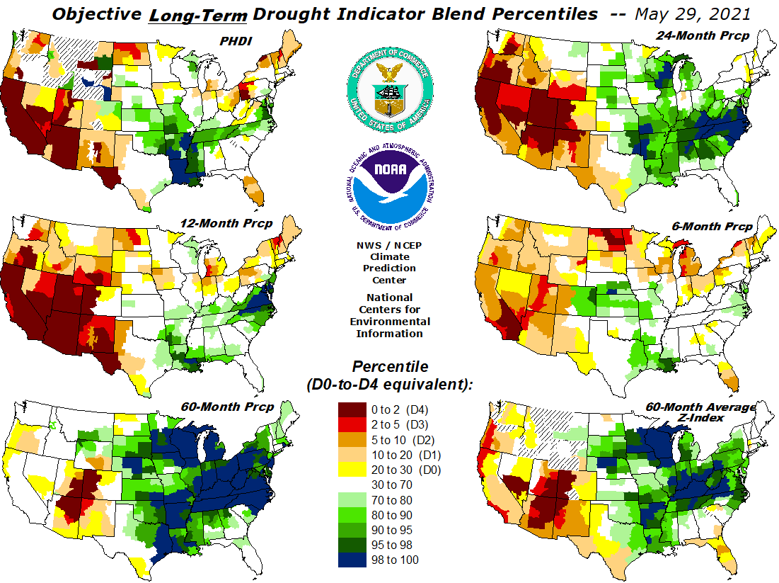
Abnormally Dry (D0) - Going into drought: short-term dryness slowing planting, growth of crops or pastures; fire risk above average. Moderate Drought (D1) - Some damage to crops, pastures; fire risk high; streams, reservoirs, or wells low, some water shortages developing or imminent, Severe Drought (D2) - Crop or pasture losses likely; fire risk very high; water shortages common; water restrictions imposed. Extreme Drought (D3) - Major crop/pasture losses; extreme fire danger; widespread water shortages or restrictions. Exceptional Drought (D4) - Exceptional and widespread crop/pasture losses; exceptional fire risk; shortages of water in reservoirs, streams, and wells, creating water emergencies.

Click images to enlarge

   
Drought Ingredients
 
Crop Moisture
*VegDri
Ensemble 1M Soil Percentile
CPC Soil Moisture Percentile


Short Term Drought Blend
Short Term Components
Long Term Drought Blend
Long Term Components


7 Day Streamflow Ranking
7 Day Streamflow to Drought Rating

 Click images to enlarge