NWS All NOAA
Bismarck, ND
Weather Forecast Office
Select one-CPC Outlooks-------Teleconnections-------Observations-------Drought-------Frost/Freeze/Snow-------Spatial Anomalies
Select One-QPF/Excessive Rainfall-------Fire Weather-------Severe Outlooks-Severe Diagnostics-------Winter Weather-Winter Mesoanalysis-------Aviation-Overview-Aviation-LAMP-------Webcams/Travel-------Space Weather
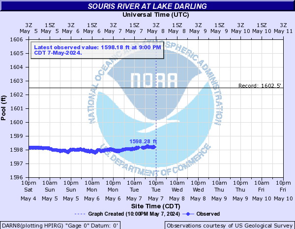
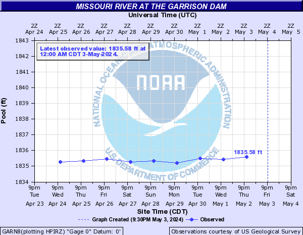
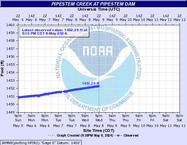
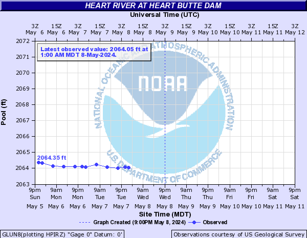
Select One-Hydro Overview-------Snowpack-------Soil Conditions------BIS HSA-------Missouri Basin-James Basin-Souris Basin-Dams------FGF HSA-------Mainstem Red-ND Tributaries-MN Tributaries-Devils Lake
DSS
Select onePartner Briefing Page-------HAZMAT Response-------Briefing Materials
Jamestown Dam
1445.40: Level when USACOE is required to release 1800 CFS
2423.50: Crest of auxillary spillway
2087.00 ft: Glory hole spillway
White Earth Lake