Sudden Stratospheric Warming Events
You may have seen in the news that a Sudden Stratospheric Warming (SSW) event is occurring - what does that mean, and what are the potential impacts for North Dakota?
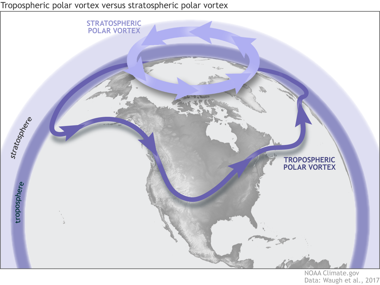
The stratosphere is the layer of the atmosphere extending from ~6 miles to ~31 miles above the surface. The stratospheric polar vortex (we bet you've heard of the polar vortex!) resides in this area, and can significantly influence weather in the mid-latitudes.
Image courtesy of NWS JetStream
The stratospheric polar vortex and tropospheric vortex are two different things. The tropospheric polar vortex is a normal atmospheric feature that affects our weather every winter. For the remainder of this post, we’ll be talking about the stratospheric one.

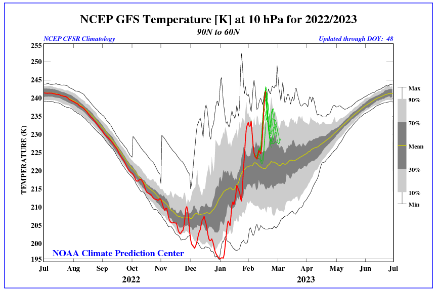
A sudden stratospheric warming is a significant disruption of the stratospheric polar vortex that begins with large-scale atmosphere waves (called Rossby waves) getting pushed higher into the atmosphere. These waves can “break” (like waves in the ocean) on top of the polar vortex and weaken it. If waves are strong enough, the winds of the polar vortex can weaken so much that they can reverse from being westerly to easterly. This leads to cold air descending and warming rapidly, with the red line on the graph showing the sudden jump in temperature.

This can lead to a displacement or splitting of the polar vortex, so instead of cold air being locked above the polar region, it can push further south into the mid-latitudes.
The main uncertainty with these events is we don't know where exactly this cold air will end up across the Northern Hemisphere, so that's what we'll be keeping an eye out for through the month of March, especially with how mild it's been the past few weeks. Past SSW events include January of 2019 and January of 2021, where February temperatures across North Dakota ended up much colder than average. After the SSW event of 2019, our average temp in Bismarck was 18.5 degrees below average! Of course, there is a chance that all the cold air stays east of us, but stay tuned for updates!
Helpful links:
CPC Sudden Stratospheric Warming Monitoring