Charleston, SC
Weather Forecast Office
 |
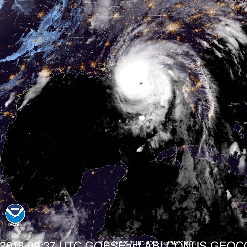 |
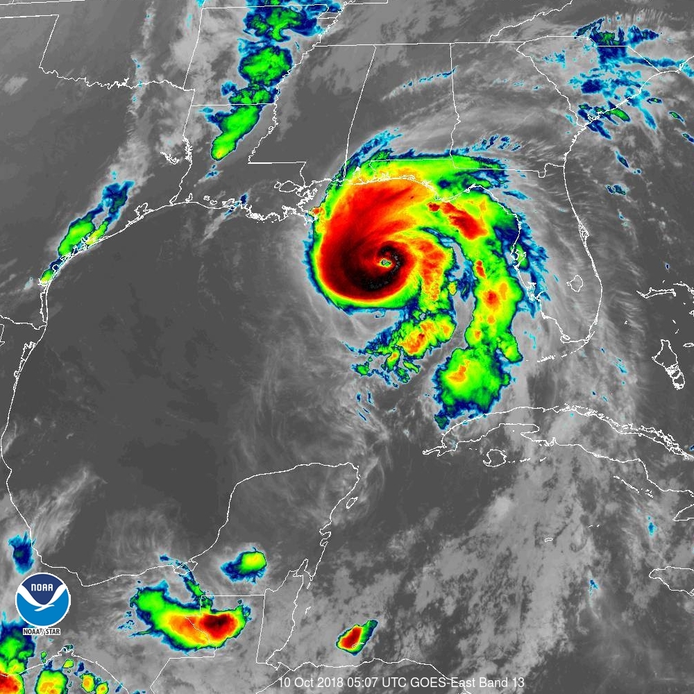
| GOES Infrared Satellite @ 107 AM EDT Oct 10, 2018 | GOES "Geocolor" Satellite @ 537 AM EDT Oct 10, 2018 |
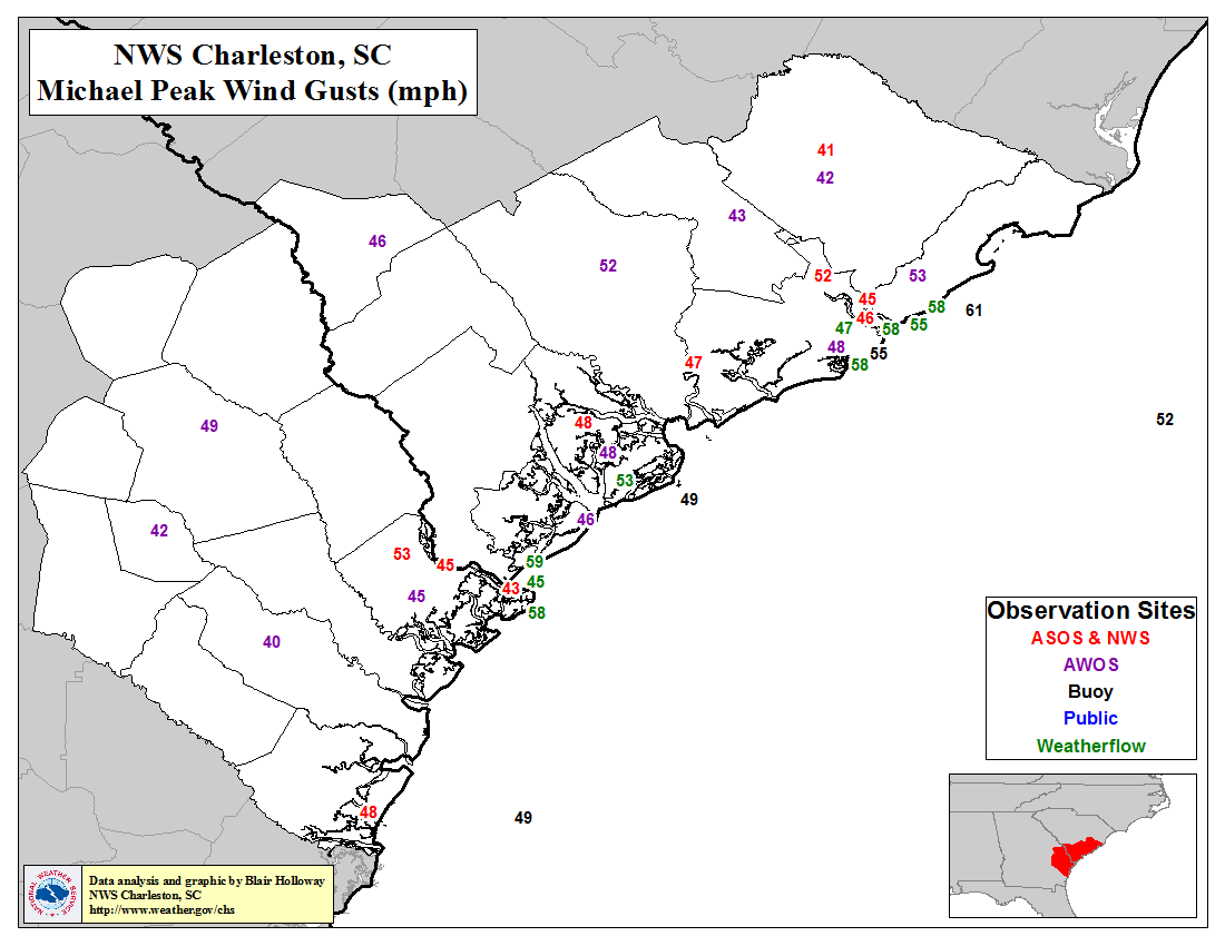
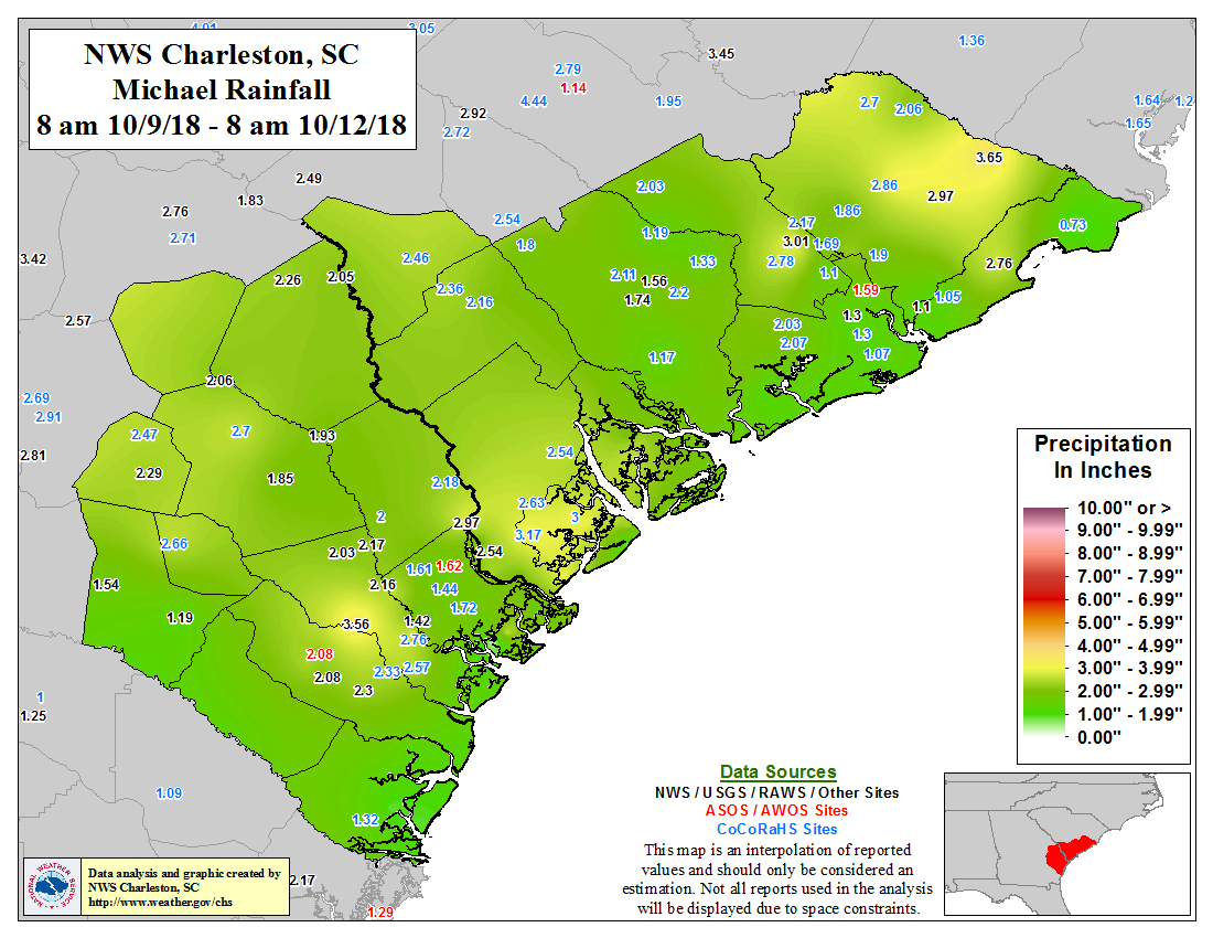
Hurricane Michael made landfall near Mexico Beach, FL on October 10 as a Category 4 hurricane with maximum sustained winds of 155 mph. Michael then moved northeast through southwest GA as a hurricane before weakening to a tropical storm before reaching central SC. Tropical storm force winds and several inches of rainfall occurred across much of southeast SC/GA which led to many fallen trees and some power outages. For more details check out our Post-Storm Report.
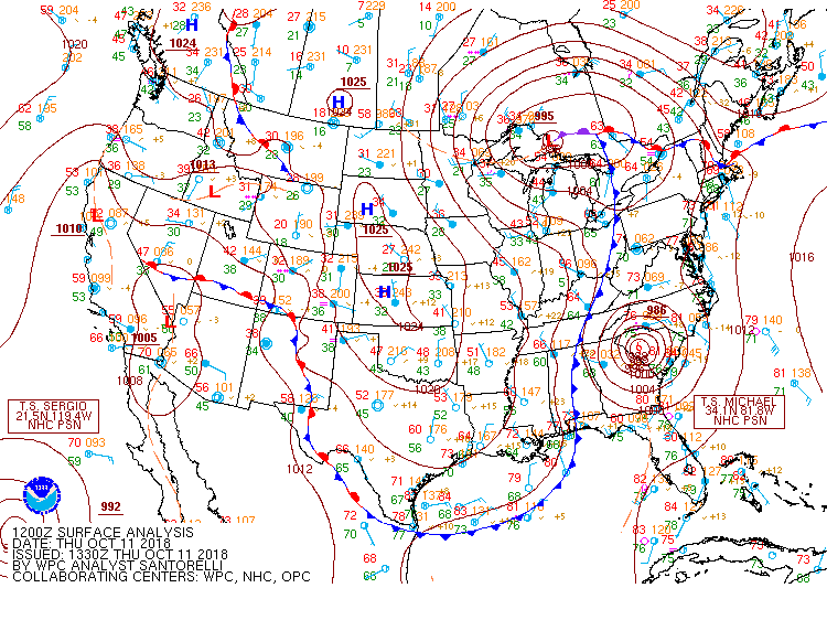
Click here for a surface weather map from the Weather Prediction Center at 12 UTC (8 AM EDT) on October 10 and here for the map at 12 UTC (8 AM EDT) on October 11.
Click on images to enlarge
Click on image to enlarge
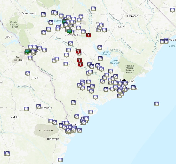
Click on the map above to for a list of storm reports (10/10/2018 - 10/11/2018)
No significant storm surge-related inundation occurred along the southern SC/northern GA coasts from Michael. For NOAA tide level data across the region click here. Water level data collected by the USGS can be found here.
Forecasts
Local Forecasts
Graphical
Weather Activity Planner
Forecaster Discussion
Aviation
Beach
Fire Weather
Lake Moultrie
Marine/Tides
Rivers
Winter
Heat
Past Weather
Observed Weather
Climate Data/Plots
Observed Rainfall
Event Summaries
Today in Weather History
Coastal Flood Event Database
Local Tropical Cyclone History
Tropical Cyclone Reports
US Dept of Commerce
National Oceanic and Atmospheric Administration
National Weather Service
Charleston, SC
5777 South Aviation Avenue
North Charleston, SC 29406-6162
(843) 747-5860
Comments? Questions? Please Contact Us.


 Coastal Flood
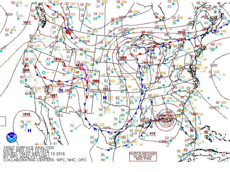